
National Register of Historic Places listings in Alachua County, Florida facts for kids

This article is about the amazing historic places in Alachua County, Florida, United States. These special spots are listed on the National Register of Historic Places.
The National Register of Historic Places is like a special list kept by the United States government. It helps protect buildings, sites, and objects that are important to our country's history. When a place is on this list, it means it's recognized for its unique story and value.
Alachua County has 65 places on this list! Two of them are even more special, called National Historic Landmarks. This means they are super important to the history of the whole country.
| Alachua - Baker - Bay - Bradford - Brevard - Broward - Calhoun - Charlotte - Citrus - Clay - Collier - Columbia - DeSoto - Dixie - Duval - Escambia - Flagler - Franklin - Gadsden - Gilchrist - Glades - Gulf - Hamilton - Hardee - Hendry - Hernando - Highlands - Hillsborough - Holmes - Indian River - Jackson - Jefferson - Lafayette - Lake - Lee - Leon - Levy - Liberty - Madison - Manatee - Marion - Martin - Miami-Dade (Miami) - Monroe - Nassau - Okaloosa - Okeechobee - Orange - Osceola - Palm Beach - Pasco - Pinellas - Polk - Putnam - St. Johns - St. Lucie - Santa Rosa - Sarasota - Seminole - Sumter - Suwannee - Taylor - Union - Volusia - Wakulla - Walton - Washington |
What is the National Register of Historic Places?
The National Register of Historic Places is the official list of places in the United States that are worth saving. These places could be buildings, neighborhoods, archaeological sites, or even objects. They are chosen because they tell us about the past.
Why are places listed?
Places are listed for many reasons. They might be important because of their history, like where a famous event happened. They could also be special because of their architecture, showing how buildings were designed long ago. Sometimes, they are important because of who lived or worked there.
How does it help?
Being on the National Register helps protect these places. It encourages people to preserve them for future generations. It also means these places might get special grants or tax benefits to help with their upkeep. It's all about making sure history isn't forgotten!
Cool Historic Places in Alachua County
Alachua County is full of history, and many of its treasures are on the National Register. Let's explore a few of these fascinating sites.
Dudley Farm Historic State Park

The Dudley Farm is a real working farm from the 1800s. It's located near Newberry. This farm shows what life was like for Florida farmers many years ago. You can see the old farmhouse, barns, and even farm animals. It's like stepping back in time! The farm was added to the National Register in 2002.
Devil's Millhopper Geological State Park

Near Gainesville, you'll find Devil's Millhopper. This isn't a building, but a huge, deep sinkhole! It's like a giant bowl in the ground, about 120 feet deep. It has its own mini-rainforest inside because it's so cool and damp. Scientists have found fossils and shark teeth here. It was added to the National Register in 2017.
Marjorie Kinnan Rawlings House and Farm Yard

This is a very special place in Cross Creek. It was the home of Marjorie Kinnan Rawlings, a famous author. She wrote "The Yearling," a book about a boy and his pet deer. Her house and farm yard are preserved just as they were when she lived there. It's a National Historic Landmark, meaning it's super important to the whole country's history. It was listed in 1970.
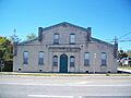
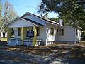
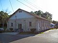
Evinston Community Store and Post Office

In the small town of Evinston, there's a unique old store and post office. It's been serving the community for a very long time. This building is a great example of how small towns used to operate. It was added to the National Register in 1989.
Haile Homestead at Kanapaha Plantation

The Haile Homestead, also known as Kanapaha, is a historic plantation home near Gainesville. What makes it really special are the "talking walls." The family wrote messages and drawings on the walls inside the house. It's a unique way to see their daily lives and thoughts from long ago. This homestead was listed in 1986.
Mission San Francisco de Potano
This site, located off County Road 236 north of High Springs, is an archaeological treasure. It's the remains of an old Spanish mission. Missions were places where Spanish priests lived and taught Native Americans. This site helps us understand the early history of Florida and the interactions between different cultures. It was added to the National Register in 2009.
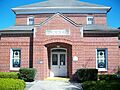
Rochelle School

The Rochelle School is an old schoolhouse located off State Road 234 in Rochelle. This building tells the story of education in rural Florida many years ago. It's a reminder of how communities valued learning. The school was listed on the National Register in 1973.
Historic Districts in Alachua County
Besides single buildings, entire areas can be listed as historic districts. These districts have many buildings that together show the history and character of a place.
City of Alachua Downtown Historic District

The downtown area of Alachua is a historic district. It includes many old buildings that show what the town looked like in its early days. Walking through this district is like taking a trip back in time to see the shops and homes of the past. It was listed in 2000.
High Springs Historic District

High Springs also has a historic downtown area. This district is bounded by Northwest 14th Street, Northwest 6th Avenue, Southeast 7th Street, and Southwest 5th Avenue. It features many buildings that reflect the town's history, especially its past as a railroad hub. This district was added in 1991.
Micanopy Historic District

Micanopy is one of Florida's oldest inland towns. Its historic district, centered around Cholokka Boulevard, has many beautiful old buildings. These buildings show the unique charm and long history of this small town. It became a historic district in 1983.
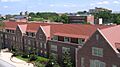
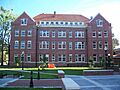
University of Florida Campus Historic District

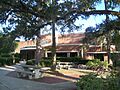
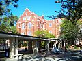
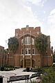
The University of Florida in Gainesville has a large historic district on its campus. Many of its oldest and most beautiful buildings are part of this district. These buildings, like Anderson Hall, Bryan Hall, and Buckman Hall, were built in the early 1900s. They show the grand architecture of the university's beginnings. This district was listed in 1989.
Images for kids
-

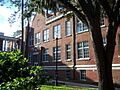
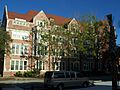
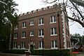
Anderson Hall at the University of Florida.
-
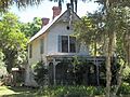
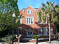
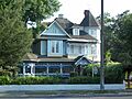
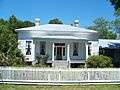
The historic Axline House.
-
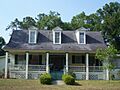
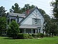
The Maj. James B. Bailey House.
-
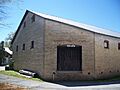
The Baird Hardware Company Warehouse.
-
The Dan Branch House.
-
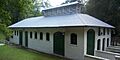
Boulware Springs Water Works.
-
Bryan Hall at the University of Florida.
-
Buckman Hall at the University of Florida.
-
The Cox Furniture Store in Gainesville.
-
The Cox Furniture Warehouse.
-
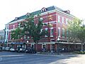
The Seagle Building, once known as the Dixie Hotel.
-
The Engineering Industries Building (Weil Hall) at the University of Florida.
-
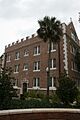
Epworth Hall in Gainesville.
-
Flint Hall at the University of Florida.
-
Floyd Hall at the University of Florida.
-
The historic Hotel Thomas.
-
Hawthorne Cemetery.
-
The Hub building at the University of Florida.
-
Island Grove Masonic Lodge No. 125.
-
The A. Quinn Jones House.
-
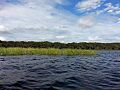
A canoe found at the Lake Pithlachocco Canoe Site.
-
The Liberty Hill Schoolhouse.
-
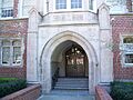
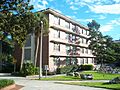
Library East at the University of Florida.
-
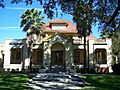
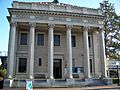
The Masonic Temple in Gainesville.
-
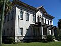
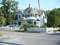
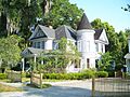
The Matheson House in Gainesville.
-
The Mary Phifer McKenzie House.
-
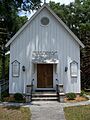
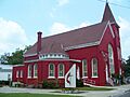
A church in the Melrose Historic District.
-
The Neilson House in Windsor.
-
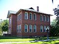
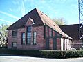
A school building in the Newberry Historic District.
-
Newell Hall at the University of Florida.
-
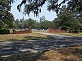
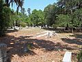
The entrance to Newnansville Cemetery.
-
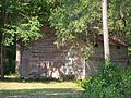
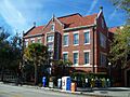
A house in the Northeast Gainesville Residential District.
-
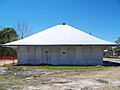
The Old Gainesville Depot.
-
The Old WRUF Radio Station building.
-
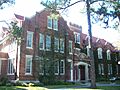
The Old P.K. Yonge Laboratory School (Norman Hall).
-
Peabody Hall at the University of Florida.
-
A church in the Pleasant Street Historic District.
-
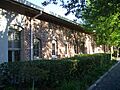
Rolfs Hall at the University of Florida.
-
Shady Grove Primitive Baptist Church.
-
A house in the Southeast Gainesville Residential District.
-
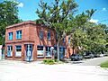
The Star Garage.
-
Thomas Hall at the University of Florida.
-
The U.S. Post Office building, now the Hippodrome State Theatre.
-
A building in the Waldo Historic District.
-
The Weil-Cassisi House.
-
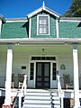
The Winecoff House in Micanopy.
-
Ustler Hall, formerly the Women's Gymnasium.
-
The Yulee-Mallory-Reid Dormitory Complex.


