
National Register of Historic Places listings in Lake County, Florida facts for kids

Have you ever wondered about old buildings or special places in your town? Some places are so important because of their history that they get a special title! This article is about the National Register of Historic Places in Lake County, Florida. It's a list of buildings, areas, and sites that are really important to the history of the United States.
When a place is on this list, it means it's recognized for its special history, architecture, or archeology. It helps protect these places and makes sure people remember their stories. In Lake County, there are 33 places and areas on this list. One place was on the list but has since been removed. You can even see where some of these places are on a map!
| Alachua - Baker - Bay - Bradford - Brevard - Broward - Calhoun - Charlotte - Citrus - Clay - Collier - Columbia - DeSoto - Dixie - Duval - Escambia - Flagler - Franklin - Gadsden - Gilchrist - Glades - Gulf - Hamilton - Hardee - Hendry - Hernando - Highlands - Hillsborough - Holmes - Indian River - Jackson - Jefferson - Lafayette - Lake - Lee - Leon - Levy - Liberty - Madison - Manatee - Marion - Martin - Miami-Dade (Miami) - Monroe - Nassau - Okaloosa - Okeechobee - Orange - Osceola - Palm Beach - Pasco - Pinellas - Polk - Putnam - St. Johns - St. Lucie - Santa Rosa - Sarasota - Seminole - Sumter - Suwannee - Taylor - Union - Volusia - Wakulla - Walton - Washington |
Contents
What is the National Register of Historic Places?
The National Register of Historic Places is like a special club for important historical sites across the United States. It's managed by the National Park Service, which is part of the U.S. government. When a place is added to this list, it means it's been carefully studied and found to be very important to our country's past.
Why are places added to the list?
Places are added for many reasons. Maybe a famous person lived there, or an important event happened there. Sometimes, buildings are added because they show a special style of architecture from a long time ago. Archeological sites, where scientists find old artifacts, can also be listed. The goal is to celebrate and protect these places so future generations can learn from them.
What kinds of places are listed in Lake County?
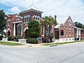
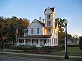
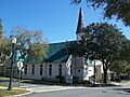
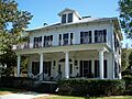
In Lake County, Florida, you'll find all sorts of interesting places on the National Register. Many are old homes, like the Blandford house in Mount Dora or the Campbell House in Okahumpka. These houses show us how people lived many years ago. There are also historic churches, like the Holy Trinity Episcopal Church in Fruitland Park.
Some places are important because they were community gathering spots. The Clermont Woman's Club and the Woman's Club of Eustis are examples of places where people came together. Parks, like Ferran Park in Eustis, are also listed because they have been important public spaces for a long time.
You'll also find old government buildings, like the Lake County Courthouse in Tavares, which tells a story about how the county was run. Even old schools, like Lee School in Leesburg, are on the list, reminding us how education has changed over time.
Historic Districts: A whole neighborhood's story
Sometimes, it's not just one building but a whole area that's special. These are called "historic districts." In Lake County, the Eustis Commercial Historic District and the Mount Dora Historic District are examples. These districts include many buildings that together tell the story of how a town grew and developed. Walking through them is like stepping back in time!
Ancient Sites: Looking back thousands of years
Lake County also has very old archeological sites on the list. These include the Bowers Bluff Middens Archeological District and the Kimball Island Midden Archeological Site near Astor. A "midden" is like an ancient trash heap, where people who lived thousands of years ago left behind shells, tools, and other things. Scientists study these sites to learn about the first people who lived in Florida.
Some notable historic places in Lake County
While there are many amazing places, here are a few examples of the types of historic sites you can find in Lake County:
- Blandford (Mount Dora): A historic home that shows the architectural styles of its time.
- Clermont Woman's Club (Clermont): An important building for community activities and women's history.
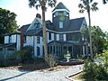
- Donnelly House (Mount Dora): Another beautiful historic home, showing the early days of Mount Dora.
- Howey House (Howey-in-the-Hills): A grand house that belonged to the founder of the town, William J. Howey.
- Lake County Courthouse (Tavares): The old courthouse building, a key part of the county's government history.
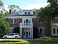
- Lakeside Inn (Mount Dora): A historic hotel that has welcomed visitors for many years.
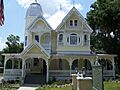
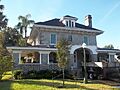
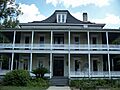
- Mote-Morris House (Leesburg): A very distinctive and well-known historic home in Leesburg.
- Old Mount Dora Atlantic Coast Line Railroad Station (Mount Dora): An old train station, reminding us of how people used to travel and how goods were moved.
- Okahumpka Rosenwald School (Okahumpka): This school is part of a special program that built schools for African American children in the early 20th century.
Former listing
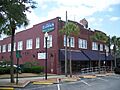
Sometimes, a place might be removed from the National Register. This can happen if the building is changed too much, or if it is destroyed. The Fruitland Park Community Center was once on the list but was later removed.
Images for kids
-
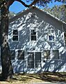
Blandford in Mount Dora
-
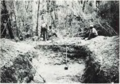
An archeological midden site
-
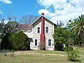
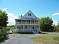
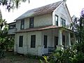
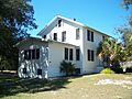
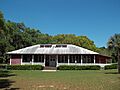
The Campbell House in Okahumpka
-
The Clermont Woman's Club
-
The Clifford House in Eustis
-
The Donnelly House in Mount Dora
-
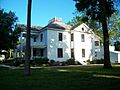
The Harry C. Duncan House in Tavares
-
The Dyches House in Lady Lake
-
The Edge House in Groveland
-
A building in the Eustis Commercial Historic District
-
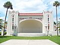
The Alice McClelland Memorial Bandshell at Ferran Park
-
The Edgar L. Ferran House in Eustis
-
The Harper House in Montverde
-
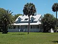
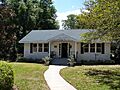
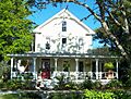
Hill Crest in Fruitland Park
-
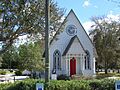
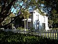
Holy Trinity Episcopal Church in Fruitland Park
-
The Howey House in Howey-in-the-Hills
-

A map of the Kimball Island Midden Archeological Site
-
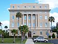
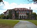
The Old Lake County Courthouse in Tavares
-
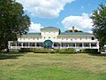
The Lakeside Inn in Mount Dora
-
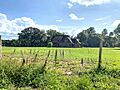
A house in the LaRoe Family Homestead Historic District
-
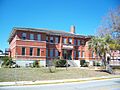
Lee School in Leesburg
-
The First United Methodist Church of Umatilla
-
The Mote-Morris House in Leesburg
-
A church in the Mount Dora Historic District
-
The Gould Hyde Norton House in Eustis
-
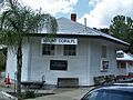
The Old Mount Dora Atlantic Coast Line Railroad Station
-
The William Kimbrough Pendleton House in Eustis
-
The Purdy Villa in Eustis
-
The Moses J. Taylor House in Eustis
-
The Witherspoon Lodge of Free and Accepted Masons, No. 111
-
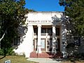
The Woman's Club of Eustis
-
The Fruitland Park Community Center (former listing)


See also
