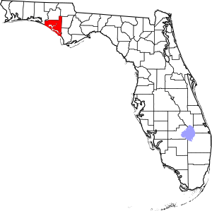
National Register of Historic Places listings in Bay County, Florida facts for kids
Have you ever wondered about old buildings or special places that tell a story about the past? In Bay County, Florida, there are 13 such places that are so important, they're listed on something called the National Register of Historic Places. This is like a special list kept by the United States government. It helps protect and celebrate buildings, objects, and sites that have a big meaning in American history, architecture, archaeology, engineering, or culture.
These special places in Bay County are recognized for their historical value. When a place is on this list, it means it's considered a significant part of our country's heritage. You can even see where some of these places are on a map if their exact location coordinates are shared.
| Alachua - Baker - Bay - Bradford - Brevard - Broward - Calhoun - Charlotte - Citrus - Clay - Collier - Columbia - DeSoto - Dixie - Duval - Escambia - Flagler - Franklin - Gadsden - Gilchrist - Glades - Gulf - Hamilton - Hardee - Hendry - Hernando - Highlands - Hillsborough - Holmes - Indian River - Jackson - Jefferson - Lafayette - Lake - Lee - Leon - Levy - Liberty - Madison - Manatee - Marion - Martin - Miami-Dade (Miami) - Monroe - Nassau - Okaloosa - Okeechobee - Orange - Osceola - Palm Beach - Pasco - Pinellas - Polk - Putnam - St. Johns - St. Lucie - Santa Rosa - Sarasota - Seminole - Sumter - Suwannee - Taylor - Union - Volusia - Wakulla - Walton - Washington |
Exploring Bay County's Historic Treasures
Bay County is home to many interesting sites that have been added to the National Register of Historic Places. Each one has its own unique story and helps us understand the past better.
| Name on the Register | Image | Date listed | Location | City or town | Description | |
|---|---|---|---|---|---|---|
| 1 | Camp Helen Historic District |
(#12000298) |
23937 Panama City Beach Pkwy. 30°16′21″N 85°59′35″W / 30.272374°N 85.993037°W |
Panama City Beach | This historic district is part of a beautiful state park. It includes buildings and areas that show how people lived and vacationed long ago. | |
| 2 | GOVERNOR STONE (schooner) |
(#91002063) |
Bayview Ave. 30°10′03″N 85°42′09″W / 30.167521°N 85.702600°W |
Panama City | The Governor Stone is a historic schooner, a type of sailing ship. It tells us about sea travel and trade from the past. | |
| 3 | Latimer Cabin |
(#04000972) |
Northeast Powell Lake 30°16′45″N 85°59′09″W / 30.279167°N 85.985833°W |
Panama City Beach | This cabin is a great example of early homes in the area. It shows how people lived and built houses many years ago. | |
| 4 | Robert L. McKenzie House |
(#86001728) |
17 East Third Court 30°09′15″N 85°39′38″W / 30.154167°N 85.660556°W |
Panama City | The Robert L. McKenzie House is a notable building in Panama City. It represents the architectural styles of its time. | |
| 5 | A.A. Payne-John Christo, Sr. House |
(#08000671) |
940 West Beach Drive 30°09′39″N 85°40′24″W / 30.160889°N 85.673417°W |
Panama City | This house is named after two important people connected to its history. It's a significant example of local residential architecture. | |
| 6 | St. Andrew School |
(#97000839) |
3001 West 15th Street 30°10′31″N 85°42′06″W / 30.175278°N 85.701667°W |
Panama City | St. Andrew School is recognized for its role in education and its historical design. It has served the community for many years. | |
| 7 | Sapp House |
(#03000991) |
224 Third Court 30°09′13″N 85°39′30″W / 30.153611°N 85.658333°W |
Panama City | The Sapp House is another historic home in Panama City. It shows the style of homes built in the area during its time. | |
| 8 | Schmidt-Godert Farm |
(#02001083) |
100 State Road 2297 30°08′48″N 85°30′02″W / 30.146667°N 85.500556°W |
Panama City | This farm is a historic site that tells us about farming life and practices in the region. It shows how important agriculture was. | |
| 9 | Sherman Arcade |
(#98001155) |
228 Harrison Avenue 30°09′16″N 85°39′39″W / 30.154444°N 85.660833°W |
Panama City | The Sherman Arcade is a historic building that likely served as a place for shops or businesses. It shows how downtown areas developed. | |
| 10 | SS Tarpon (shipwreck) |
(#01000527) |
7.8 nautical miles (14.4 km) offshore Panama City 30°07′24″N 85°56′45″W / 30.123333°N 85.945833°W |
Panama City | The SS Tarpon is a shipwreck located off the coast. Shipwrecks are important because they offer clues about maritime history and past voyages. | |
| 11 | Vamar Shipwreck Site |
(#06000243) |
3.7 miles (6.0 km) offshore Mexico Beach 29°53′53″N 85°27′47″W / 29.898056°N 85.463056°W |
Mexico Beach | The Vamar Shipwreck Site is another underwater historical treasure. It helps us learn about ships and events from long ago that happened at sea. |


