Ridgecrest, California facts for kids
Quick facts for kids
Ridgecrest, California
|
||
|---|---|---|
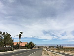
College Heights Blvd., Ridgecrest
|
||
|
||
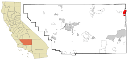
Location in Kern County and the state of California
|
||
| Country | ||
| State | ||
| County | Kern | |
| Incorporated | November 29, 1963 | |
| Area | ||
| • Total | 21.53 sq mi (55.76 km2) | |
| • Land | 20.88 sq mi (54.08 km2) | |
| • Water | 0.65 sq mi (1.69 km2) 3.04% | |
| Elevation | 2,290 ft (698 m) | |
| Population | ||
| • Total | 27,959 | |
| • Density | 1,298.6/sq mi (501.42/km2) | |
| Time zone | UTC−08:00 (Pacific) | |
| • Summer (DST) | UTC−07:00 (PDT) | |
| ZIP Codes |
93555–93556
|
|
| Area codes | 442 and 760 | |
| FIPS code | 06-60704 | |
| GNIS feature IDs | 1652783, 2410944 | |
Ridgecrest is a city in Kern County, California, United States. It is located in the Indian Wells Valley in northeastern Kern County. The city is right next to the Naval Air Weapons Station China Lake (NAWS). Ridgecrest became an official city in 1963. In 2020, about 27,959 people lived there. This makes it the third-largest city in Kern County.
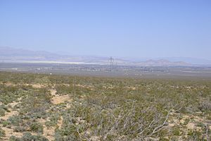
Ridgecrest is surrounded by four mountain ranges. To the west are the Sierra Nevada mountains. The Coso Range is to the north. The Argus Range is on the east. The El Paso Mountains are to the south. It is a bit far from other big cities. It is about 82 miles (132 km) from Lancaster/Palmdale. Bakersfield is about 110 miles (177 km) away. San Bernardino is about 120 miles (193 km) away. You can fly in and out of the city using the Inyokern Airport. This airport is mostly for private planes.
The city has been close to the center of big earthquakes. One happened in 1995. A series of quakes also hit in July 2019.
History of Ridgecrest
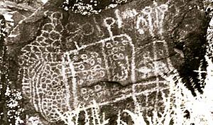
Native American tribes like the Paiute, Shoshone, and Kawaiisu lived in the Indian Wells Valley long ago. The Shoshone tribe left behind amazing petroglyphs. These are rock carvings found in the Coso Range. You can see them in Big and Little Petroglyph Canyons. Their artwork is also shown at the Maturango Museum.
In the mid-1800s, travelers started to pass through the valley. In 1826, beaver trappers led by Jedediah Smith arrived. Later, in 1834, Joseph Walker crossed Walker Pass. Mining booms brought more people to the valley in the late 1800s. Chinese railroad workers also lived here for a short time. They gave China Lake its name.
Before the 1900s, most settlers did not stay permanently. This changed when the Los Angeles Aqueduct was built. It was finished between 1908 and 1913. The arrival of the Southern Pacific Railroad also helped. These things brought lasting settlers to the Indian Wells Valley.
The area that became Ridgecrest started as a farming town in 1912. It was first called Crumville. This name honored local dairymen, James and Robert Crum. The first post office opened in 1941. By 1943, Ridgecrest had 115 homes. The Naval Ordnance Test Station (NOTS) was also set up in 1943. This brought many jobs to the area.
Ridgecrest officially became a city in 1963. The city grew because of the needs of the Naval Air Weapons Station China Lake (NAWS). NAWS tests weapons and guidance systems. Today, Ridgecrest is an important home and business center for NAWS China Lake.
Geography and Earthquakes
Ridgecrest covers about 21.4 square miles (55.4 km2). Most of this is land. About 0.7 square miles (1.8 km2) is water. The city is in the Indian Wells Valley. This valley is part of the Owens Valley. It is also shaped by the volcanic Coso Range.
Earthquakes in 1995
The Ridgecrest area has had many earthquake swarms. These are groups of thousands of smaller quakes. They often do not have one very big main shock. The 1995 Ridgecrest earthquake series started on August 17. A magnitude 5.4 quake hit about 11 miles (18 km) north of Ridgecrest. This caused over 2,500 smaller quakes over five weeks. Then, on September 20, 1995, a magnitude 5.8 quake struck. It was the biggest earthquake in southern California since 1994.
Earthquakes in 2019
Between July 4 and 5, 2019, Ridgecrest had a series of strong earthquakes. The biggest one was a magnitude 7.1 quake. This was the strongest to hit the area in many years. The main earthquake's center was about 10 miles (16 km) northeast of Ridgecrest.
The quakes started on July 4 with a 4.0-magnitude quake. It was about 7 miles (11 km) southwest of Searles Valley. Later that morning, a 6.4-magnitude earthquake hit. This caused over 1,400 smaller quakes in the Ridgecrest and Searles Valley areas. The magnitude 7.1 main earthquake happened on July 5, 2019, at 8:19 P.M. It greatly affected the Ridgecrest area.
Climate and Weather
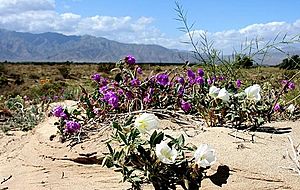
The weather in the Indian Wells Valley is like a high desert. Summers have hot days and cool nights. The air is very dry. The average highest temperature in Ridgecrest is 75°F (24°C). The average lowest temperature is 48°F (9°C). Temperatures can change a lot. They can go from 119°F (48°C) to 1°F (-17°C).
On average, less than 5 inches (127 mm) of rain falls each year. This includes less than 2 inches (5 cm) of snow. The area can also get strong winds, up to 75 mph (121 km/h). December is the coolest month. Its average high is 60°F (16°C) and low is 30°F (-1°C). The coldest temperature ever recorded was 1°F (-17°C). This happened on December 23, 1963, and January 7, 1973.
July is the hottest month. Its average high is 103°F (39°C) and low is 66°F (19°C). The hottest temperature ever recorded was 119°F (48°C). This happened on July 11, 2021, and also in July 1988 and July 1993.
| Climate data for China Lake NAF, California (normals 1981-2010, extremes 1945-2020, precipitation 1944-1973) | |||||||||||||
|---|---|---|---|---|---|---|---|---|---|---|---|---|---|
| Month | Jan | Feb | Mar | Apr | May | Jun | Jul | Aug | Sep | Oct | Nov | Dec | Year |
| Record high °F (°C) | 89 (32) |
91 (33) |
92 (33) |
104 (40) |
109 (43) |
118 (48) |
119 (48) |
119 (48) |
114 (46) |
103 (39) |
93 (34) |
81 (27) |
119 (48) |
| Mean maximum °F (°C) | 72 (22) |
77 (25) |
85 (29) |
94 (34) |
102 (39) |
108 (42) |
113 (45) |
111 (44) |
106 (41) |
96 (36) |
83 (28) |
71 (22) |
113 (45) |
| Mean daily maximum °F (°C) | 60.3 (15.7) |
64.4 (18.0) |
71.1 (21.7) |
77.8 (25.4) |
87.9 (31.1) |
96.9 (36.1) |
103.3 (39.6) |
101.7 (38.7) |
93.9 (34.4) |
81.5 (27.5) |
68.9 (20.5) |
59.0 (15.0) |
80.6 (27.0) |
| Daily mean °F (°C) | 45.2 (7.3) |
49.8 (9.9) |
55.8 (13.2) |
62.1 (16.7) |
71.7 (22.1) |
79.8 (26.6) |
86.2 (30.1) |
84.5 (29.2) |
76.7 (24.8) |
64.7 (18.2) |
52.9 (11.6) |
44.3 (6.8) |
64.5 (18.1) |
| Mean daily minimum °F (°C) | 30.1 (−1.1) |
35.2 (1.8) |
40.6 (4.8) |
46.3 (7.9) |
55.4 (13.0) |
62.7 (17.1) |
69.1 (20.6) |
67.3 (19.6) |
59.5 (15.3) |
47.9 (8.8) |
36.8 (2.7) |
29.6 (−1.3) |
48.4 (9.1) |
| Mean minimum °F (°C) | 20 (−7) |
23 (−5) |
29 (−2) |
34 (1) |
44 (7) |
51 (11) |
60 (16) |
57 (14) |
49 (9) |
37 (3) |
24 (−4) |
19 (−7) |
18 (−8) |
| Record low °F (°C) | 6 (−14) |
12 (−11) |
21 (−6) |
27 (−3) |
35 (2) |
42 (6) |
50 (10) |
51 (11) |
39 (4) |
20 (−7) |
16 (−9) |
8 (−13) |
6 (−14) |
| Average precipitation inches (mm) | 0.45 (11) |
0.62 (16) |
0.20 (5.1) |
0.13 (3.3) |
0.11 (2.8) |
0.01 (0.25) |
0.13 (3.3) |
0.10 (2.5) |
0.22 (5.6) |
0.12 (3.0) |
0.55 (14) |
0.50 (13) |
2.90 (74) |
| Average precipitation days | 2.0 | 2.9 | 1.4 | 1.0 | 0.8 | 0.3 | 0.7 | 0.7 | 0.8 | 0.8 | 2.0 | 2.0 | 15.4 |
| Source: NOAA | |||||||||||||
| Climate data for Naval Air Weapons Station China Lake | |||||||||||||
|---|---|---|---|---|---|---|---|---|---|---|---|---|---|
| Month | Jan | Feb | Mar | Apr | May | Jun | Jul | Aug | Sep | Oct | Nov | Dec | Year |
| Record high °F (°C) | 78 (26) |
89 (32) |
92 (33) |
104 (40) |
108 (42) |
118 (48) |
119 (48) |
114 (46) |
109 (43) |
103 (39) |
89 (32) |
77 (25) |
119 (48) |
| Mean daily maximum °F (°C) | 61.3 (16.3) |
63.7 (17.6) |
74.4 (23.6) |
76.1 (24.5) |
85.9 (29.9) |
98.2 (36.8) |
101.8 (38.8) |
101.9 (38.8) |
94.3 (34.6) |
81.2 (27.3) |
64.3 (17.9) |
58.5 (14.7) |
80.1 (26.7) |
| Mean daily minimum °F (°C) | 30.6 (−0.8) |
34.6 (1.4) |
40.1 (4.5) |
45.6 (7.6) |
52.8 (11.6) |
63.1 (17.3) |
68.4 (20.2) |
67.4 (19.7) |
59.4 (15.2) |
48.3 (9.1) |
33.8 (1.0) |
26.1 (−3.3) |
47.5 (8.6) |
| Record low °F (°C) | 6 (−14) |
12 (−11) |
21 (−6) |
27 (−3) |
38 (3) |
42 (6) |
50 (10) |
51 (11) |
39 (4) |
24 (−4) |
18 (−8) |
8 (−13) |
6 (−14) |
| Average precipitation inches (mm) | 0.88 (22) |
0.79 (20) |
0.78 (20) |
0.13 (3.3) |
0.11 (2.8) |
0.02 (0.51) |
0.09 (2.3) |
0.31 (7.9) |
0.24 (6.1) |
0.18 (4.6) |
0.27 (6.9) |
0.47 (12) |
4.27 (108.41) |
| Average snowfall inches (cm) | 0.8 (2.0) |
0.0 (0.0) |
0.0 (0.0) |
0.0 (0.0) |
0.0 (0.0) |
0.0 (0.0) |
0.0 (0.0) |
0.0 (0.0) |
0.0 (0.0) |
0.0 (0.0) |
0.0 (0.0) |
0.5 (1.3) |
1.3 (3.3) |
| Climate data for Inyokern, California | |||||||||||||
|---|---|---|---|---|---|---|---|---|---|---|---|---|---|
| Month | Jan | Feb | Mar | Apr | May | Jun | Jul | Aug | Sep | Oct | Nov | Dec | Year |
| Record high °F (°C) | 80 (27) |
86 (30) |
93 (34) |
100 (38) |
112 (44) |
114 (46) |
119 (48) |
114 (46) |
110 (43) |
105 (41) |
88 (31) |
84 (29) |
119 (48) |
| Mean daily maximum °F (°C) | 59.6 (15.3) |
64.8 (18.2) |
70.3 (21.3) |
77.7 (25.4) |
87.0 (30.6) |
96.7 (35.9) |
102.7 (39.3) |
101.2 (38.4) |
94.2 (34.6) |
83.2 (28.4) |
69.0 (20.6) |
59.7 (15.4) |
80.5 (27.0) |
| Mean daily minimum °F (°C) | 30.8 (−0.7) |
34.6 (1.4) |
38.7 (3.7) |
44.3 (6.8) |
52.9 (11.6) |
60.5 (15.8) |
66.2 (19.0) |
64.6 (18.1) |
58.1 (14.5) |
48.2 (9.0) |
37.3 (2.9) |
30.2 (−1.0) |
47.2 (8.4) |
| Record low °F (°C) | 1 (−17) |
9 (−13) |
15 (−9) |
21 (−6) |
26 (−3) |
38 (3) |
46 (8) |
45 (7) |
35 (2) |
20 (−7) |
14 (−10) |
5 (−15) |
1 (−17) |
| Average precipitation inches (mm) | 0.74 (19) |
0.95 (24) |
0.55 (14) |
0.17 (4.3) |
0.07 (1.8) |
0.02 (0.51) |
0.16 (4.1) |
0.22 (5.6) |
0.20 (5.1) |
0.10 (2.5) |
0.38 (9.7) |
0.59 (15) |
4.15 (105.61) |
| Average snowfall inches (cm) | 0.3 (0.76) |
0.0 (0.0) |
0.1 (0.25) |
0.0 (0.0) |
0.0 (0.0) |
0.0 (0.0) |
0.0 (0.0) |
0.0 (0.0) |
0.0 (0.0) |
0.0 (0.0) |
0.0 (0.0) |
0.2 (0.51) |
0.6 (1.52) |
People in Ridgecrest
| Historical population | |||
|---|---|---|---|
| Census | Pop. | %± | |
| 1950 | 2,028 | — | |
| 1960 | 5,099 | 151.4% | |
| 1970 | 7,629 | 49.6% | |
| 1980 | 15,929 | 108.8% | |
| 1990 | 27,725 | 74.1% | |
| 2000 | 24,927 | −10.1% | |
| 2010 | 27,616 | 10.8% | |
| 2019 (est.) | 28,973 | 4.9% | |
| U.S. Decennial Census | |||
In 2010, Ridgecrest had 27,616 people. Most people were White (77.4%). About 4.0% were African American. About 4.4% were Asian. People of Hispanic or Latino background made up 17.9% of the population.
Most people (99.3%) lived in homes. About 27.3% of the people were under 18 years old. The average age in Ridgecrest was 33.8 years. For every 100 females, there were about 100.3 males.
Economy and Jobs
The Naval Air Weapons Station China Lake (NAWS China Lake) is very important to Ridgecrest. It is a place where the United States Navy tests weapons. It also provides training. NAWS China Lake is the biggest employer in the city. In 2018, it had almost 8,000 jobs. These jobs include government workers, military staff, and private contractors.
AltaOne Federal Credit Union has its main office in Ridgecrest. The Searles Valley Minerals plant is also nearby. It is located near Trona, California.
Top Employers in Ridgecrest
Here are the main employers in Ridgecrest in 2020:
| Rank | Employer | Employees |
|---|---|---|
| 1 | NAWS China Lake | 7,995 |
| 2 | Ridgecrest Regional Hospital | 840 |
| 3 | Searles Valley Minerals | 700 |
| 4 | Sierra Sands Unified School District | 527 |
| 5 | Walmart | 333 |
| 6 | Albertsons | 173 |
| 7 | Cerro Coso Community College | 152 |
| 8 | Alta One Federal Credit Union | 123 |
| 9 | City of Ridgecrest | 116 |
| 10 | Home Depot | 116 |
Fun Things to Do
One of the most interesting things nearby is the Coso People rock art. You can find it in Big and Little Petroglyph Canyons. The Coso People were great artists. They traded with other tribes. They used tools made from stone.
Other fun activities in the area include:
- Hunting and shooting
- Hiking
- Horseback riding
- Off-roading and dirt biking
- Golf
- Road cycling
- Camping
- Flying and gliding
Maturango Museum
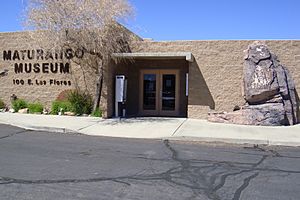
The Maturango Museum is in Ridgecrest. It is famous for its tours to Little Petroglyph Canyon. This canyon is on the China Lake Naval Weapons Station. The museum has displays about the natural and cultural history of the Mojave Desert. You can see exhibits on plants, animals, Native American tools, geology, and local art.
Coso Rock Art District
The Coso Rock Art District is a place with over 20,000 Native American petroglyphs. It is located inside Naval Air Weapons Station China Lake. This is near China Lake and Ridgecrest. The most common carvings are of bighorn sheep, deer, and antelope. Big and Little Petroglyph Canyons were named a National Historic Landmark in 1964. In 2001, they became part of the larger Coso Rock Art District.
Since 2014, Ridgecrest has held an annual Petroglyph Festival. This event celebrates the rock art, native culture, and Ridgecrest as a fun place to visit.
Walker Pass
Walker Pass is a mountain pass in the southern Sierra Nevada mountains. It is about 53 miles (85 km) east-northeast of Bakersfield. It is also about 10 miles (16 km) west-southwest of Ridgecrest. The pass connects the San Joaquin Valley in the west to the Mojave Desert in the east.
Trona Pinnacles
The Trona Pinnacles are unique rock formations. They have been featured in many famous movies. They are located close to Ridgecrest.
Red Rock Canyon State Park
Red Rock Canyon State Park is also very near Ridgecrest. It offers great places for hiking and camping.
Education in Ridgecrest
The Sierra Sands Unified School District serves Ridgecrest and nearby towns like Inyokern. It includes several elementary schools:
- Las Flores Elementary
- Faller Elementary
- Richmond Elementary (currently at Vieweg Elementary)
- Gateway Elementary
- Pierce Elementary
- Inyokern Elementary
For middle school, students go to James Monroe Middle School or Murray Middle School. The main high school is Sherman E Burroughs High School. It serves Ridgecrest, China Lake NAWC, Inyokern, Buttermilk Acres, Red Mountain, and Randsburg. There is also an alternative high school called Mesquite High School.
Ridgecrest Elementary Academy for Language, Music, and Science (REALMS) is a public charter school. It opened in 2019. It teaches children from Transitional Kindergarten to 6th grade.
College Opportunities
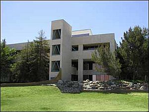
Cerro Coso Community College is part of the Kern Community College District. It started in 1973. About 2,347 full-time students attend. The main campus is in the upper Mojave Desert near Ridgecrest. This campus is the largest of Cerro Coso's locations. It serves about 50,000 people. The college helps students from Ridgecrest, China Lake, Inyokern, and Trona.
Public Library
The Ridgecrest Branch Library is part of the Kern County Library. It serves Ridgecrest, Inyokern, China Lake, Trona, and nearby areas.
Famous People from Ridgecrest
Some well-known people are from Ridgecrest:
- Ted Bachman, a former American football player. He went to Burroughs High.
- Lacy Barnes-Mileham, an Olympic athlete. She competed in discus in the 1996 Atlanta Olympics.
- Mark Hoppus, co-lead singer and bassist of the rock band Blink-182.
- Sabaa Tahir, a famous author.
Media and News
Ridgecrest has one TV station, KZGN-LD. It has 3 channels for the Indian Wells Valley. KZGN provides local news, weather, and sports. It also has a daily interview show called Ridgecrest Talk.
The city has two newspapers: The Daily Independent and the News Review. You can also listen to local radio stations. Some stations from Los Angeles and Bakersfield are also available.
Local radio stations include:
- KRSF 89.3 (Christian radio)
- KZFX 93.7 (classic rock)
- KSSI (FM) 102.7 (rock music, local news)
- KLOA (AM) 1240 (CBS Sports Radio)
- KZIQ 92.7 (adult contemporary music)
- KRAJ The Heat 100.9 FM (hip-hop)
- K296AI 107.1 (KCNV classical music feed)
Getting Around Ridgecrest
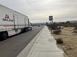
Ridgecrest is where California State Route 178 and U.S. Route 395 meet.
The city has a shuttle bus service called Ridgecrest Transit. It goes to and from Inyokern. From there, you can connect to other buses. The Eastern Sierra Transit Authority bus goes north to Bishop and Mammoth Lakes. It goes south to Lancaster (Metrolink station). This connects to Los Angeles. Kern Transit also connects Ridgecrest to Lake Isabella and Mojave.
See also
 In Spanish: Ridgecrest (California) para niños
 | Leon Lynch |
 | Milton P. Webster |
 | Ferdinand Smith |


