
South Norwood facts for kids
Quick facts for kids South Norwood |
|
|---|---|
 South Norwood Clock tower in 2007 |
|

South Norwood
|
|
| Population | 16,518 (South Norwood ward 2011) |
| OS grid reference | TQ340684 |
| London borough | |
| Ceremonial county | Greater London |
| Region | |
| Country | England |
| Sovereign state | United Kingdom |
| Post town | LONDON |
| Postcode district | SE25 |
| Dialling code | 020 |
| Police | Metropolitan |
| Fire | London |
| Ambulance | London |
| EU Parliament | London |
| UK Parliament |
|
| London Assembly |
|
South Norwood is a lively area in south-east London, England. It's part of the London Borough of Croydon and used to be in the historic county of Surrey. It's about 12.5 kilometers (7.8 miles) south-east of Charing Cross in central London. South Norwood is surrounded by other areas like Woodside, Addiscombe, Selhurst, Thornton Heath, Crystal Palace, Upper Norwood, Anerley, and Penge.
South Norwood and Norwood New Town together form an area called the South Norwood ward. In 2001, this area had over 14,000 people living there.
A large country park covers 125 acres (0.5 square kilometers) on the south-eastern side of the district. It opened in 1989. In the north of the town, you'll find South Norwood Lake. This lake was once a reservoir for the old Croydon Canal. Today, the Croydon Sailing Club uses it, and people enjoy fishing for carp, bream, and perch there.
South Norwood has two secondary schools and a public leisure centre. The main shopping street is part of Selhurst Road. Many people who live here travel to work in Croydon or the City of London. They often use the big railway station to get to their jobs. The postcode for South Norwood and nearby areas is London SE25. It's also the most southern part of the London post town.
Contents
History of South Norwood
The area where South Norwood is now was once covered by a huge natural oak forest called the Great North Wood. This forest stretched for about 6 kilometers (4 miles) across south London. Besides South Norwood, it also covered Upper Norwood, West Norwood (which was called Lower Norwood until 1885), and parts of Woodside and Gipsy Hill.
Records from the 1400s show that people paid rent for a small wooded area called Cholmerden here. By the 1670s, this site had become the grounds of a place called Goat House. Later, Handley's Brickworks had seven tall chimneys that stood out in the landscape. This brickworks is now gone, and the area has been turned into a grassy park with a lake, called Brickfields Meadow.
Canals and Railways Arrive
The Croydon Canal was built in the early 1800s. It ran from New Cross to the area where West Croydon station is now. As the canal passed through South Norwood, pubs started to appear nearby. The Jolly Sailor pub is still standing today at the corner of South Norwood Hill and High Street. Another pub, The Ship, was close to where bricks from a nearby brick field were loaded onto the canal boats. You can still see the passageway where the bricks were moved. The Goat House pub (which is no longer there) was said to be named after an island in the canal where goats were kept.
The Jolly-sailor station opened in 1839. It was part of the London and Croydon Railway. On train lists, it was called Jolly-sailor near Beulah Spa and was renamed 'Norwood' in 1846. This station was right next to a level crossing over Portland Road. To build the world's first railway flyover, a bridge was constructed south of Tennison Road. This bridge carried a new type of railway line (using air pressure) over the regular steam train line below. However, the air pressure system was stopped in 1847.
Growth and Development
In 1848, South Norwood was still a small village. But over the next 10 to 20 years, it grew very quickly. New roads were built, and the Selhurst Park estate was developed. The area got its own church, Holy Innocents, in 1895. Much of this growth was thanks to William Ford Stanley. He built a factory here in 1867 and started a technical school in 1902. This school is now known as the Stanley Arts.
South Norwood continued to grow throughout the 1900s with more houses and public housing projects. Many people from the Caribbean moved here, and the area still has a large black population.
In 1966, a dog named Pickles found the FIFA World Cup Jules Rimet Trophy under a bush in Beulah Hill. The trophy had been stolen from an exhibition.
South Norwood Today
Today, South Norwood's center is where the High Street meets South Norwood Hill and Portland Road. Most of the shops and services are along High Street, Selhurst Road, and Penge Road. There are also shops and restaurants along Portland Road. South Norwood is now unofficially split into two parts: a less busy area in the north-west, which was once a private estate, and a generally busier area in the north-east.
Local Government and Services
Before 1965, South Norwood was part of the County Borough of Croydon. After the London Government Act 1963, it became part of Greater London. Now, the town is part of the wards of South Norwood and Woodside. These wards are managed by the Croydon Council. The council is in charge of services like education, rubbish collection, and tourism.
The South Norwood Ward is part of the Croydon North parliamentary area. This area has many different ethnic groups. The Woodside Ward is part of the Croydon Central parliamentary area. The current Member of Parliament (MP) for Croydon North is Steve Reed from the Labour Party. The MP for Croydon Central is Sarah Jones, also from the Labour Party.
The Metropolitan Police provides policing services from the Croydon Police Station. The London Fire Brigade provides fire services for the area. The closest fire station is at Woodside.
Geography of South Norwood
 |
Upper Norwood | Anerley | Elmers End | |
| Thornton Heath | Woodside | |||
| Croydon | Selhurst | Addiscombe |
South Norwood is next to Anerley to the north, Selhurst to the south, Woodside to the east, and Thornton Heath to the west. The northernmost point of South Norwood is at Beaulieu Heights (also spelled Beulah Heights). This area includes Beulah Heights Park and overlaps with Upper Norwood and New Town. The northern part of the district is on the lower slopes of the hill that forms Upper Norwood.
South Norwood sits on the southern slopes of the Norwood Ridge. This ridge of hills runs for about 5 kilometers (3 miles) and reaches about 110 meters (360 feet) high. It is made of grey, silty clay called London Clay. Because of this, digging for gravel was once an important local business. South Norwood Hill is the most southern part of this ridge. Streams in the area join Chaffinch Brook and the Beck to form the River Pool, which flows into the River Ravensbourne.
Education in South Norwood
South Norwood has several schools for young people.
Primary Schools
There are many primary schools in South Norwood. These include Priory Special School, Heavers Farm Primary School, South Norwood Primary School, Cypress Junior School and Cypress Infant School, St. Chad's Roman Catholic Primary School, St. Mark's Primary School, and Oasis Academy Ryelands.
Secondary Schools
The old Stanley Technical High School, created by local inventor William Stanley, has become an academy. It is now called Harris Academy South Norwood. Another secondary school, Harris City Academy Crystal Palace, is in the north-west of South Norwood. Oasis Academy Arena is also in the area.
Higher Education
South Norwood is home to Spurgeon's College, a famous Baptist college. It has been on South Norwood Hill since 1923 and has about 1,000 students. It is one of only four colleges in the borough that offer higher education.
South Norwood Library

South Norwood Library is sometimes called 'The Brutalist Library'. It is located at the corner of Selhurst Road and Lawrence Road. This public library is part of the Croydon Libraries system. The building was built in 1968 by Croydon architect Hugh Lea. It has five levels that are split across the front and back to make the most of the space.
Sports and Fun Activities
Leisure Centre
South Norwood has a leisure centre managed by Better for Sport Croydon. The South Norwood Leisure Centre is on Portland Road. It reopened in late 2007 after being renovated. It has a 25-meter swimming pool and a gym.
South Norwood Country Park

South Norwood is also home to South Norwood Country Park. This is a 116-acre nature reserve. It used to be a sewage works and a fireworks factory. Over time, it has become a home for many different kinds of plants and animals. Other parks nearby include South Norwood Recreation Ground, Heavers Meadow, Brickfields Meadow, Beaulieu Heights, South Norwood Lake and Grounds, Woodside Green, and Ashburton Park.
South Norwood Community Festival
The South Norwood Community Festival is a yearly event held at South Norwood Recreational Ground. It started in 2011 to benefit the local community. In 2022, over 8,000 people enjoyed live bands, food, crafts, and entertainment for children. Volunteers run the event, and any money made goes to local charities and future festival plans. The last festival was on Sunday, July 2, 2023.
Croydon Sports Arena
Croydon Sports Arena opened in 1953. It is a sports venue in South Norwood used for many activities. The arena is next to South Norwood Country Park. It has an eight-lane 400-meter running track and an area for throwing events. The stadium has lights for night use. In winter, the middle of the field becomes a football pitch, home to Croydon F.C.. In summer, it is mostly used for athletics. Athletics clubs like Striders of Croydon and Croydon Harriers use it. The stands can hold up to 388 people. Since 2018, Greenwich Leisure Limited has managed the arena.
Football in South Norwood
South Norwood F.C. was an amateur football club in the 1870s. They played their home games at Portland Road.
The Premier League club Crystal Palace is based nearby at Selhurst Park. On match days, the pubs on the high street are often busy with fans.
South Norwood Tourist Board
The South Norwood Tourist Board is a group that has organized events like "PicklesFest." They have also called the area the People's Republic of South Norwood. They even renamed the lake in South Norwood Country Park to Lake Conan, after Arthur Conan Doyle who lived in South Norwood.
In 2013, the South Norwood Tourist Board worked with Crystal Palace Transition Town and the community. They turned some unused land near Harris Academy South Norwood into a garden. This area is called Sensible Garden. It is named after Captain Sensible, a musician who went to Stanley Boys School, which was on the same site as the Harris Academy. On July 26, 2014, Captain Sensible himself revealed 'The Sensible Seat' in the garden.
Culture, Music, and Arts

Stanley Arts Centre
Stanley Arts is one of the biggest arts and performance places in the area. It is named after the local inventor and engineer William Stanley, who designed the buildings. Stanley Arts focuses on community arts. It aims to give a platform to artists of color and LGBTQ+ creators in South London. The venue has two theatre spaces, one with 250 seats and another with 60 seats. It also has offices for theatre makers, a coffee shop, and other community activities. Since it first opened in 1903, both professional and amateur performers have used its stages. Famous people like Samuel Coleridge-Taylor and W.Y. Hurlstone performed here. In the 1960s, Shirley Bassey, Matt Munro, and Johnny Dankworth rehearsed here for shows at nearby Fairfield Halls in Croydon.
History of Stanley Arts
The venue was originally called 'Stanley Halls' and is a Grade II listed building. It was first built in 1903. When it was finished, William Stanley invited all the workers to a dinner at the Halls. He said that even if the building wasn't the most beautiful, it was "one of the most substantially built." He hoped the Halls would be a fun place for everyone.
The buildings were completed in stages. The main hall and art gallery opened in 1903. The clock tower and Upper Stanley Hall were added in 1904. The Technical Trade School was built in 1907. The Assembly room, Society Rooms, offices, and the venue secretary’s home were added in 1909. Stanley was an inventor, not a trained architect. He didn't follow one specific style, which made the building a unique mix of styles.
Next to Stanley’s new technical trade school, the Stanley Halls complex was used for both education and culture. It hosted many classes, exhibitions, and political discussions. For example, on March 2, 1912, a "spirited debate on Votes for Women" took place. Alice Abadam, a leader in women's right to vote, spoke there. Later speakers included Harold Wilson and John Smith.
Community and Social Events
During the War Years, first aid courses were held here. The building might have also been used as a temporary shelter for people whose homes were bombed. It was also a place for community celebrations like the Festival of Britain in 1951 and the Coronation of Elizabeth II in 1953. Records from the 1950s show that the Halls hosted many social events. These included birthday parties, antique fairs, jumble sales, weddings, aerobics classes, and even a Psychic Festival. The Halls played a big role in building local community spirit after the war.
Stanley Arts from the 1970s Onwards
As time went on, the halls and rooms became more and more part of the growing Technical School, known as Stanley Tech. Although the buildings were used outside school hours, there was less separate cultural activity. By the early 2000s, the Technical School became part of the Harris Academy chain. A new school complex was built around the back of Stanley Halls. In 2007, the new Harris Academy South Norwood included the old Technical School building and the Upper Stanley Hall & Clocktower. The rest of the historic Stanley Halls complex, including the main Stanley Hall, was separated by a new wall.
For the next five years, the future of the larger, lower part of Stanley Halls was uncertain. The local community worked together to take over these buildings from Croydon Council.
In 2015, the buildings were finally given to the Stanley People’s Initiative. This charity was set up to save this part of the historic Stanley Halls complex. Over the first few years, the new, smaller Stanley Halls found its purpose again. The pandemic of 2020 actually helped people see the buildings as an important place for art, performance, and community.
This new purpose goes back to William Stanley’s original idea. In 1901, he wanted to build a local home for entertainment, art, and culture. Almost 120 years later, his vision was renewed. In early 2021, the trustees launched a new name: Stanley Arts. This name honors the past while looking to a bright future. Stanley Arts aims to be a home for community, arts, and culture in South London for many years to come.
Getting Around South Norwood
Roads
Two main roads, the A215 and the A213, pass through South Norwood. The A213 includes High Street, Penge Road, and Selhurst Road. The A215 includes Portland Road and South Norwood Hill.

Trains
Norwood Junction railway station is in the center of South Norwood, just off High Street. It has 7 platforms, but only 6 are currently in use. Southern and London Overground trains run to London Bridge and Dalston Junction. Fast trains usually take 10 minutes to reach central London, and slower trains take 20 minutes. Trains to London Victoria station take 20 minutes. You can also catch trains to East Croydon and West Croydon stations. There are regular train services to Clapham Junction, Wandsworth Common, Balham, and Streatham. Selhurst station is nearby. From there, you can catch direct trains to Kensington Olympia and Shepherd's Bush via a service to Milton Keynes.
The Thameslink Programme is a big project to expand the Thameslink network. This project costs £3.5 billion. It will increase the number of stations from 51 to 172. The network will spread north to places like Bedford and Cambridge, and south to places like Guildford and Eastbourne. The project includes making platforms longer, updating stations, building new railway structures, and adding more trains. The new Thameslink timetable for Norwood Junction started on May 20, 2018. Norwood Junction now has a Thameslink service all day to Bedford via Blackfriars and St Pancras, with two trains per hour to Epsom via Sutton. Timetables will continue to be updated in 2019.
Transport for London started work on extending the East London line in 2005. This was part of the London Overground. When it was finished in May 2010, trains started running between West Croydon and Dalston Junction through London Docklands.
Trains also make unannounced stops at Selhurst during the night. This allows engineers at Selhurst to get to Gatwick and back. This means you can board a train during the night to South Norwood, even though the train signs might say East Croydon. Trains leave Victoria after 1:00 AM every hour until the official train service starts again.
Trams
Trams do not run directly through the center of South Norwood. The closest stops on the Tramlink network are Harrington Road, Arena, and Woodside. In the mid-2000s, there were plans to extend the tram line to Crystal Palace. This would have added a new tram stop on Penge Road.
Famous People from South Norwood


Many notable people have connections to South Norwood:
- Samuel Coleridge-Taylor (1875–1912) was an English composer and conductor. He was of mixed race (his father was a doctor from Sierra Leone). He was so successful that American musicians called him the "African Mahler" during his tours in the early 1900s. There are two blue plaques honoring him in South Norwood and Croydon.
- Hannah Arterton - an actress who lives in South Norwood.
- Lionel Atwill (1885–1946) - an actor who was born and spent his early childhood in South Norwood.
- Alex Beckett (1982–2018) - an actor who lived and died in South Norwood.
- Captain Sensible - a musician who went to school here.
- Arthur Conan Doyle (1859–1930) - the famous author, lived at 12 Tennison Road in South Norwood from 1891 to 1894. A blue plaque marks his former home. While he lived here, he did not use South Norwood as the main setting for his Sherlock Holmes story "The Adventure of the Norwood Builder". That story mostly takes place in Lower Norwood (now West Norwood). The only link is that Sherlock Holmes's character Jonas Oldacre uses South Norwood's Norwood Junction railway station. The NatWest Bank on South Norwood High Street was once the local police station. It is likely the police station mentioned in the second Sherlock Holmes novel, The Sign of the Four (1890).
- Peter Grant (1935–1995) - a music manager, best known for Led Zeppelin, was born and grew up in South Norwood.
- William Stanley (1829–1909) - an inventor and architect, who built a technical institute and factory in the area.
- Stormzy - a famous rapper who grew up in South Norwood.
- William Walker (1869–1918) - a diver famous for saving Winchester Cathedral from collapsing. He lived at 118 Portland Road, and a plaque remembers him there.
- Ellen E Ciss Wright - an athlete who was the All England 440 yards champion. She lived at 6 Clifford Road, and a plaque on the Portland Road leisure centre honors her.
- Edward Vernon Arnold - an expert in Indian studies and classical scholar, was born in South Norwood in 1857. His father was the Vicar of St. Mark's Church.
Images for kids
-
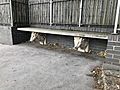
Caprine-themed bench on Goat House Bridge

