A2 road (Northern Ireland) facts for kids
Quick facts for kids
A2 road |
|
|---|---|
| Lua error in Module:Infobox_road/map at line 15: attempt to index field 'wikibase' (a nil value). | |
| Route information | |
| Length | 239 mi (385 km) |
| Major junctions | |
| South end | Newry, County Down |
| A1 in Newry A24 in Clough M3, M2 and A12 Westlink in Belfast M5 near Newtownabbey A26 in Coleraine A5 A40 A515 and A6 in Derry |
|
| North end | At border crossing near Muff, County Donegal and Culmore, County Londonderry and Bridgend, County Donegal. |
| Highway system | |
|
|
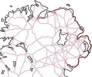
The A2 is a very important road in Northern Ireland. It's special because a lot of it follows the beautiful coastline. People often call a big part of it the Antrim Coast Road. Other sections of the A2 also follow the coast in County Down and County Londonderry.
This road is mostly one lane in each direction. It stretches along most of Northern Ireland's coastline. In many places, it connects to other major roads.
Contents
Exploring the A2 Road Route
The A2 road starts in the city of Newry, which is in County Down. From there, it heads northeast through charming fishing towns like Warrenpoint, Rostrevor, and Kilkeel.
Journey Through Coastal Towns
After passing Dundrum, the road continues through Ardglass to Strangford. If you want to stay on the A2, you can take a ferry from Strangford to Portaferry. From Portaferry, the road meets the Irish Sea coast of the Ards Peninsula. It then follows the coast through towns like Cloughey, Portavogie, Ballyhalbert, Millisle, and Donaghadee.
The road then reaches Bangor, County Down. From Bangor, it becomes a big dual carriageway, which means it has two lanes going in each direction. This part of the road leads directly into Belfast.
Driving Through Belfast
Once in Belfast, the A2 meets the M3. It then goes through the busy Belfast City Centre. This area has a complex system of one-way streets. The A2 crosses the Queen's Bridge and the Queen Elizabeth II Bridge. It passes the Custom House and continues along Corporation Street, eventually joining York Road.
Along this part of the road and further out on the Shore Road, the A2 runs close to the M2 and M5. The M5 motorway ends in Newtownabbey, which is a northern suburb of Belfast.
Heading North from Belfast
After leaving Belfast, the A2 goes through suburban areas like Jordanstown, Greenisland, Carrickfergus, Eden, and Whitehead. Then, the road enters the open countryside on its way to Larne. This is where the most famous part of the road, the Antrim Coast Road, begins.
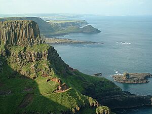
From Larne, the road winds along the eastern coast to Cushendall. It then continues along the north coast to Ballycastle. After Ballycastle, it travels along the famous Giant's Causeway Coast to Portrush. The A2 then goes through Coleraine and Derry.
Near Derry City, the A2 becomes a dual carriageway. This section goes from City of Derry Airport to the Foyle Bridge. The Foyle Bridge is the second longest bridge on the entire island of Ireland! The A2 then reaches the border with the Republic of Ireland. Here, it changes its name to the N13 and continues to Letterkenny in County Donegal. Another part of the A2 ends at Culmore, County Londonderry, and Muff, County Donegal.
The Famous Antrim Coast Road

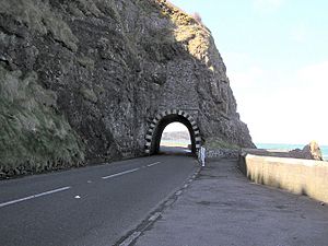
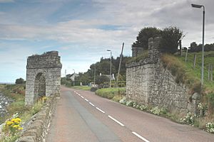
The Antrim Coast Road is known as one of the most amazing tourist routes in the world. It has become very popular, especially when the weather is nice. This part of the road stretches for about 25 miles (40 km). It starts near the Black Arch close to Larne and ends near the Red Arch close to Cushendall. Along the way, it passes through lovely villages like Ballygalley, Glenarm, Carnlough, and Waterfoot. Drivers, cyclists, and walkers should be careful here, as there are no special lanes for bikes and not many footpaths.
Building the Antrim Coast Road
In the early 1800s, it was very hard to travel through the Glens of Antrim. The roads over the mountains were very bad. So, the Commissioners of Public Works in Ireland decided to build the Antrim Coast Road. Their goals were to make it easier for people to travel, help with trade, and give jobs to people who needed them.
The idea for building the road right at the foot of the cliffs came from a clever engineer named William Bald. He worked on this huge project between 1832 and 1842. It was a massive challenge because some of the cliffs were over 330 feet (100 meters) high!
William Bald decided to blast the cliff face. This made the rock fall down onto the shore, creating a strong base for the new road. This was a very new idea at the time. He used a special invention called a "Safety fuse" to make the blasting safer.
The Antrim Coast Road was finished in 1842. It cost about £37,140. For many years, the road stayed mostly the same. However, rocks would often fall from the cliffs because the rock layers were weak and cracked.
Keeping the Road Safe
In 1967, there were two big rockfalls that blocked the road completely. Because the cliffs were so high, the local council decided to build a new part of the road further out into the sea. They built a strong concrete sea wall and used 97,000 tonnes of large rocks to protect it from the waves. This big project was finished in November 1970.
William Bald left an amazing legacy with this road. It's one of the most beautiful tourist routes anywhere. Even though he was so important, no pictures of him have ever been found. There are two memorials to him: a small plaque near Larne and another one in Burntisland, Scotland.
Ian Paisley, a well-known politician from Northern Ireland, once said that the Antrim Coast Road is "one of the most beautiful in the whole of the United Kingdom."
Amazing Tourist Spots Along the A2
Because the A2 road is so long and follows the coast, it passes by many fantastic places to visit in Northern Ireland. Here are some of them:
- The Mourne Mountains: A stunning mountain range perfect for hiking.
- Carrickfergus Castle: A very old Norman castle built way back in 1177.
- The Glens of Antrim: These are beautiful valleys and hills along the coast with incredible views.
- Ballycastle: Home to the 400-year-old Ould Lammas Fair, a traditional market.
- Bushmills: You can visit the Old Bushmills Distillery here, which started making drinks in 1608.
- Dunluce Castle: A dramatic castle from the 13th century, sitting right on the edge of the Atlantic Ocean.
- Carrick-a-Rede Rope Bridge: A fun rope bridge that swings across to a tiny island.
- Portrush: A popular seaside town, close to the famous Giant's Causeway.
- Derry: A historic city known for its amazing Walled City.
 | Jackie Robinson |
 | Jack Johnson |
 | Althea Gibson |
 | Arthur Ashe |
 | Muhammad Ali |


