Deschutes County, Oregon facts for kids
Quick facts for kids
Deschutes County
|
|
|---|---|
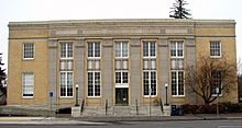
Old U.S. Post Office in Bend, Oregon
|
|
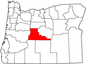
Location within the U.S. state of Oregon
|
|
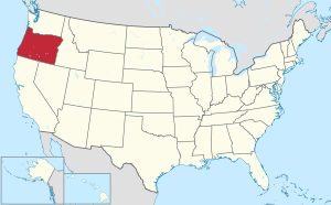 Oregon's location within the U.S. |
|
| Country | |
| State | |
| Founded | December 13, 1916 |
| Named for | Deschutes River |
| Seat | Bend |
| Largest city | Bend |
| Area | |
| • Total | 3,055 sq mi (7,910 km2) |
| • Land | 3,018 sq mi (7,820 km2) |
| • Water | 37 sq mi (100 km2) 1.2%% |
| Population
(2020)
|
|
| • Total | 198,253 |
| • Estimate
(2023)
|
208,513 |
| • Density | 65/sq mi (25/km2) |
| Time zone | UTC−8 (Pacific) |
| • Summer (DST) | UTC−7 (PDT) |
| Congressional districts | 2nd, 5th |
Deschutes County is one of Oregon's 36 counties. It is located in the central part of the state. In 2020, about 198,253 people lived there. The main city and county seat is Bend.
The county was formed in 1916 from a part of Crook County. It got its name from the Deschutes River. This river was named by French-Canadian fur trappers long ago. Deschutes County is a very important place for business and government in Central Oregon. It is also Oregon's newest and fastest-growing county!
Contents
The Story of Deschutes County
How Deschutes County Got Its Name
Long ago, French-Canadian fur trappers explored this area. They worked for the Hudson's Bay Company. They named the local river Rivière des Chutes, which means "River of the Falls" in French. The county later took its name from this river.
When the County Was Formed
Deschutes County was officially created on December 13, 1916. It was made from the southern part of Crook County. Bend has been the county seat since the very beginning. Deschutes was the last county to be formed in Oregon.
Early Industries
In the early days, a big part of the economy was the lumber industry. The Shevlin-Hixon Lumber Company operated in the Bend area. They processed many Ponderosa pine trees.
Exploring Deschutes County's Geography
Size and Water
Deschutes County covers a total area of about 3,055 square miles. Most of this area, about 3,018 square miles, is land. The rest, about 37 square miles, is water. This means about 1.2% of the county is covered by water.
Neighboring Counties
Deschutes County shares its borders with several other counties:
- Linn County (to the northwest)
- Jefferson County (to the north)
- Crook County (to the east)
- Harney County (to the southeast)
- Lake County (to the south)
- Klamath County (to the south)
- Lane County (to the west)
Special Protected Areas
Parts of Deschutes County are protected natural areas. These include:
- Deschutes National Forest
- Newberry National Volcanic Monument
People of Deschutes County
| Historical population | |||
|---|---|---|---|
| Census | Pop. | %± | |
| 1920 | 9,622 | — | |
| 1930 | 14,749 | 53.3% | |
| 1940 | 18,631 | 26.3% | |
| 1950 | 21,812 | 17.1% | |
| 1960 | 23,100 | 5.9% | |
| 1970 | 30,442 | 31.8% | |
| 1980 | 62,142 | 104.1% | |
| 1990 | 74,958 | 20.6% | |
| 2000 | 115,367 | 53.9% | |
| 2010 | 157,733 | 36.7% | |
| 2020 | 198,253 | 25.7% | |
| 2023 (est.) | 208,513 | 32.2% | |
| U.S. Decennial Census 1790–1960 1900–1990 1990–2000 2010–2020 |
|||
Deschutes County has seen a lot of growth in its population. In 2010, there were about 157,733 people living here. By 2020, the population had grown to 198,253. This makes it one of the fastest-growing counties in Oregon.
Most people in the county are white (92.2%). Other groups include Asian, American Indian, and Black or African American people. About 7.4% of the population is of Hispanic or Latino background. Many families live in the county, with about 30.8% of households having children under 18.
Communities in Deschutes County
Deschutes County has several towns and cities, as well as smaller communities.
Cities
Census-Designated Places (CDPs)
These are areas that are like towns but are not officially incorporated as cities.
- Black Butte Ranch
- Deschutes River Woods
- Eagle Crest
- Pronghorn
- Seventh Mountain
- Sunriver
- Terrebonne
- Three Rivers
- Tetherow
- Tumalo
Unincorporated Communities
These are smaller communities that are not part of any city or CDP.
Economy and Jobs in Deschutes County
Deschutes County grew very fast in the 1990s. This was largely because of all the fun outdoor activities available year-round. It is also close to the beautiful Cascade Range mountains.
Besides tourism, important jobs in the county are in lumber, ranching, and farming. Potatoes are a main crop grown here. The Forest Service owns more than half of the land in the county.
Deschutes County is also home to four "destination resorts." These are large resorts that employ many people. Three of the biggest resorts are Sunriver, Eagle Crest, and Pronghorn. They are among the county's largest taxpayers.
The Amazing Geology of Deschutes County
The landscape of Deschutes County is mostly shaped by ancient lava flows. Much of this lava came from Newberry Volcano, which is just south of Bend. Because of this, there are many lava tubes in the area, like the famous Lava River Cave. Deschutes County has over 500 known caves, making it the most cave-rich county in Oregon!
Other lava flows came from the Mount Bachelor Volcanic Chain. This chain includes Mount Bachelor and several smaller volcanoes.
Majestic Volcanoes and Buttes
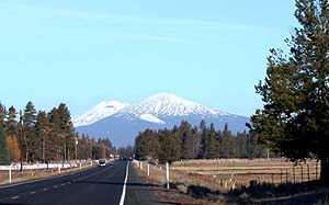
Large volcanoes create a stunning backdrop for the city of Bend. These include the prominent Three Sisters, Mount Washington, Broken Top, Newberry, and Tumalo Mountain.
Scientists have found that Smith Rock State Park is part of a very old "supervolcano." It is called the Crooked River caldera. Its rim was once nearly six times wider than Newberry Volcano's caldera. This ancient supervolcano is now extinct. You can still see parts of its old rim in places like Powell Buttes and Gray Butte.
On the eastern side of the county, you will see large buttes. These are hills that are also of volcanic origin, but much older. Some well-known buttes include Horse Ridge, Pine Mountain, and China Hat.
Types of Lava Flows
There are two main types of lava flows found here. The most common are the pāhoehoe flows. These are smooth and ropey. Over thousands of years, they have been partly covered by volcanic ash and dirt.
The other type is ʻaʻā flows. These are rough and blocky. The most famous ʻaʻā flows are near Lava Butte and the Lava Cast Forest in the Newberry National Volcanic Monument.
See also
 In Spanish: Condado de Deschutes para niños


