Hancock County, Maine facts for kids
Quick facts for kids
Hancock County
|
||
|---|---|---|
|
||
|
||
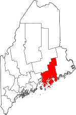
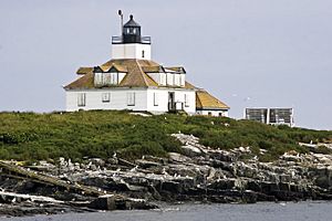
Location within the U.S. state of Maine
|
||
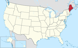 Maine's location within the U.S. |
||
| Country | ||
| State | ||
| Founded | June 25, 1789 | |
| Named for | John Hancock | |
| Seat | Ellsworth | |
| Largest city | Ellsworth | |
| Area | ||
| • Total | 2,345 sq mi (6,070 km2) | |
| • Land | 1,587 sq mi (4,110 km2) | |
| • Water | 758 sq mi (1,960 km2) 32%% | |
| Population
(2020)
|
||
| • Total | 55,478 | |
| • Density | 23.658/sq mi (9.1344/km2) | |
| Time zone | UTC−5 (Eastern) | |
| • Summer (DST) | UTC−4 (EDT) | |
| Congressional district | 2nd | |
Hancock County is a beautiful area located in the state of Maine, United States. It's a place with a rich history and stunning natural beauty. In 2020, about 55,478 people called Hancock County home.
The main town, or county seat, is Ellsworth. Hancock County was officially created on June 25, 1789. It was named after John Hancock, a very important person in American history. He was the first governor of Massachusetts, which Maine was once a part of.
Contents
Exploring Hancock County's Geography
Hancock County covers a large area. It has a total size of about 2,345 square miles. A big part of this, about 758 square miles (32%), is water. The rest, 1,587 square miles, is land.
Mountains and Parks
The highest point in the county is Cadillac Mountain. It stands tall at 1,527 feet. This makes it the highest mountain right on the Atlantic coast of the United States!
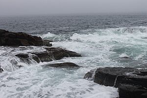
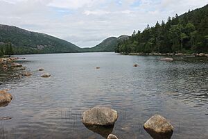
Hancock County is also home to Acadia National Park. This is the only national park in all of New England. The park is mostly on Mount Desert Island, which is Maine's largest island. This island is surrounded by several big bays.
Rivers and Bridges
The county is on the eastern side of Penobscot Bay. It's also near the mouth of the Penobscot River. You can cross this river using the impressive Penobscot Narrows Bridge. Hancock County stretches from the coast far inland. This makes it one of Maine's eight counties that touch the ocean.
Neighboring Counties
Hancock County shares its borders with a few other counties:
- Penobscot County is to the north.
- Washington County is to the northeast.
- Waldo County is to the west.
- Knox County is to the southwest.
Main Roads and Highways
Several important roads run through Hancock County. These highways help people travel around the area. They connect different towns and attractions.
 US 1
US 1 US 1A
US 1A SR 3
SR 3 SR 9
SR 9 SR 15
SR 15 SR 102
 SR 172
 SR 175
 SR 176
 SR 179
 SR 180
 SR 181
 SR 184
 SR 200
People of Hancock County
| Historical population | |||
|---|---|---|---|
| Census | Pop. | %± | |
| 1790 | 9,542 | — | |
| 1800 | 16,358 | 71.4% | |
| 1810 | 30,031 | 83.6% | |
| 1820 | 31,290 | 4.2% | |
| 1830 | 24,336 | −22.2% | |
| 1840 | 28,605 | 17.5% | |
| 1850 | 34,372 | 20.2% | |
| 1860 | 37,757 | 9.8% | |
| 1870 | 36,495 | −3.3% | |
| 1880 | 38,129 | 4.5% | |
| 1890 | 37,312 | −2.1% | |
| 1900 | 37,241 | −0.2% | |
| 1910 | 35,575 | −4.5% | |
| 1920 | 30,361 | −14.7% | |
| 1930 | 30,721 | 1.2% | |
| 1940 | 32,422 | 5.5% | |
| 1950 | 32,105 | −1.0% | |
| 1960 | 32,293 | 0.6% | |
| 1970 | 34,590 | 7.1% | |
| 1980 | 41,781 | 20.8% | |
| 1990 | 46,948 | 12.4% | |
| 2000 | 51,791 | 10.3% | |
| 2010 | 54,418 | 5.1% | |
| 2020 | 55,478 | 1.9% | |
| 2023 (est.) | 56,526 | 3.9% | |
| U.S. Decennial Census 1790–1960 1900–1990 1990–2000 2010–2016 2018 |
|||
How People Live
In 2010, there were 54,418 people living in Hancock County. There were 24,221 households, which are groups of people living together. About 14,834 of these were families.
The average age of people in the county was 46.3 years old. About 24.4% of households had children under 18 living with them. Many people in Hancock County are of English, American, Irish, German, and Scottish backgrounds.
Hancock County's Economy
Hancock County has the longest coastline of any county in Maine. This means it has many miles of shore along the ocean. Because of this, two very important industries here are commercial fishing and tourism.
Fishing and Tourism
Many towns in the county rely on fishing. These include Cranberry Isles, Deer Isle, Frenchboro, Gouldsboro, Southwest Harbor, Stonington, Swans Island, and Tremont (Bass Harbor). Other towns like Bar Harbor and Brooklin also have a lot of fishing activity.
Tourism is also a huge part of the economy. People come from all over to visit Acadia National Park. They also come to see Cadillac Mountain, which is a major attraction.
Other Important Businesses
Hancock County is home to Jackson Laboratory in Bar Harbor. This is a famous place known for its important cancer research.
There are also two colleges in Hancock County:
- Maine Maritime Academy in Castine.
- College of the Atlantic in Bar Harbor.
Air Quality
The American Lung Association checks air quality each year. They gave Hancock County an "F" for ozone pollution. Ozone is a type of air pollution. Hancock County was the only county in Maine to get this low score. This means the air quality for ozone could be better.
Towns and Communities
Hancock County has many different towns and communities.
City
- Ellsworth (This is the county seat, the main town)
Towns
- Amherst
- Aurora
- Bar Harbor
- Blue Hill
- Brooklin
- Brooksville
- Bucksport
- Castine
- Cranberry Isles
- Dedham
- Deer Isle
- Eastbrook
- Franklin
- Frenchboro
- Gouldsboro
- Great Pond
- Hancock
- Lamoine
- Mariaville
- Mount Desert
- Orland
- Osborn
- Otis
- Penobscot
- Sedgwick
- Sorrento
- Southwest Harbor
- Stonington
- Sullivan
- Surry
- Swan's Island
- Tremont
- Trenton
- Verona Island
- Waltham
- Winter Harbor
Unorganized Territories
These are areas that don't have their own local government like towns do.
Census-Designated Places
These are specific areas identified by the U.S. Census Bureau.
Other Villages
These are smaller, unincorporated villages within the county.
- Bass Harbor
- Bernard
- Corea
- East Blue Hill
- East Orland
- Harborside
- Hulls Cove
- Islesford
- Manset
- Minturn
- Northeast Harbor
- Prospect Harbor
- Salisbury Cove
- Sargentville
- Seal Cove
- Seal Harbor
- Somesville
- Enoch's Landing
- Sunset
- Town Hill
Schools in Hancock County
Hancock County has many school districts. These districts help manage the schools for children of all ages, from kindergarten through high school.
K-12 Schools
These districts serve students from kindergarten all the way to 12th grade.
- Airline Community School District
- Blue Hill School District
- Brooklin School District
- Brooksville School District
- Castine School District
- Cranberry Isles School District
- Dedham School District
- Deer Isle-Stonington Community School District
- Ellsworth Public Schools
- Hancock Public Schools
- Frenchboro School District
- Lamoine Public Schools
- Otis School District
- Penobscot School District
- Sedgwick School District
- Surry School District
- Trenton School District
- Regional School Unit 24
- Regional School Unit 25
- School Administrative District 76
- Hancock Unorganized Territory
Secondary Schools
This district focuses on high school students.
- Mount Desert Community School District
Elementary Schools
These districts are for younger students, usually up to 8th grade.
- Bar Harbor School District
- Mount Desert School District
- Southwest Harbor School District
- Tremont School District
See also
In Spanish: Condado de Hancock (Maine) para niños
 | Aurelia Browder |
 | Nannie Helen Burroughs |
 | Michelle Alexander |


