
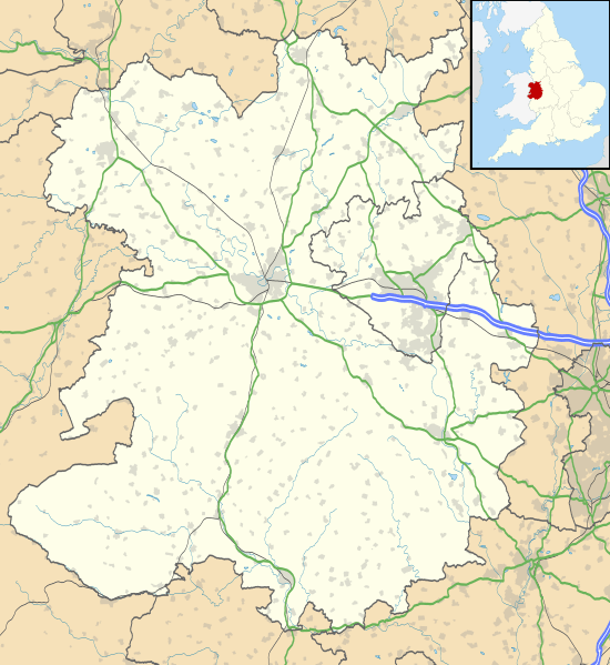
Image: Shropshire UK location map

Description: Map of Shropshire, UK with the following information shown: Administrative borders Coastline, lakes and rivers Roads and railways Urban areas Equirectangular map projection on WGS 84 datum, with N/S stretched 165% Geographic limits: West: 3.25W East: 2.15W North: 53.03N South: 52.27N
Title: Shropshire UK location map
Credit: Ordnance Survey OpenData. Administrative borders and coastline data from Boundary-Line product. All other geographic data from Meridian 2 product. Inset derived from England location map.svg by Spischot.
Author: Nilfanion, created using Ordnance Survey data
Permission: This file is licensed under the Creative Commons Attribution-Share Alike 3.0 Unported license. Attribution: Contains Ordnance Survey data © Crown copyright and database right You are free: to share – to copy, distribute and transmit the work to remix – to adapt the work Under the following conditions: attribution – You must give appropriate credit, provide a link to the license, and indicate if changes were made. You may do so in any reasonable manner, but not in any way that suggests the licensor endorses you or your use. share alike – If you remix, transform, or build upon the material, you must distribute your contributions under the same or compatible license as the original. https://creativecommons.org/licenses/by-sa/3.0 CC BY-SA 3.0 Creative Commons Attribution-Share Alike 3.0 truetrue
Usage Terms: Creative Commons Attribution-Share Alike 3.0
License: CC BY-SA 3.0
License Link: https://creativecommons.org/licenses/by-sa/3.0
Attribution Required?: Yes
Image usage
The following 65 pages link to this image:
- Acton Burnell Castle
- Acton Scott
- Alberbury Castle
- Albrighton, Bridgnorth
- All Saints Church, Claverley
- Apley Castle
- Badger, Shropshire
- Bayston Hill
- Bishop's Castle
- Bridgnorth
- Broadward
- Broseley
- Bryn Amlwg Castle
- Buildwas Abbey
- Bury Walls
- Caus Castle
- Church Stretton
- Cleehill
- Cleobury Mortimer
- Clun
- Clun Castle
- Craven Arms
- Dawley
- Ditherington
- Edgmond
- Ellesmere, Shropshire
- Grindley Brook
- Grinshill
- Hay Inclined Plane
- Hoarstones
- Llanymynech
- Longden Coleham drill hall, Shrewsbury
- Longford, Newport
- Ludlow
- Madeley, Shropshire
- Market Drayton
- Mitchell's Fold
- Moreton Corbet Castle
- Morville Priory
- Much Wenlock
- Newport, Shropshire
- Oakengates
- Old Oswestry
- Oswestry
- Pant, Shropshire
- Pave Lane
- Pimhill
- Richard's Castle
- Shawbury
- Shifnal
- Shrewsbury
- St Andrew's Church, Wroxeter
- St Laurence's Church, Church Stretton
- Stoke on Tern
- Stokesay Castle
- Sundorne
- Telford
- Viroconium Cornoviorum
- Wattlesborough Castle
- Weald Moors
- Wellington, Shropshire
- Wem
- Whitchurch, Shropshire
- White Ladies Priory
- Whittington Castle
