Kaufman County, Texas facts for kids
Quick facts for kids
Kaufman County
|
|
|---|---|

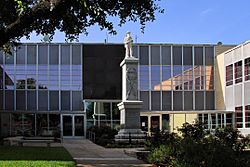
The Kaufman County Courthouse in Kaufman
|
|

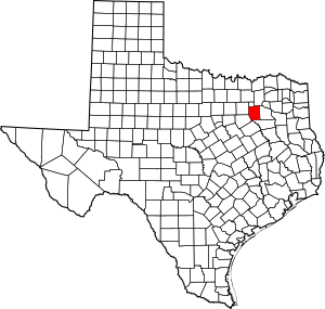
Location within the U.S. state of Texas
|
|
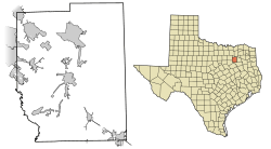
 Texas's location within the U.S. |
|
| Country | |
| State | |
| Founded | February 1848 |
| Named for | David Spangler Kaufman |
| Seat | Kaufman |
| Largest city | Forney |
| Area | |
| • Total | 808 sq mi (2,090 km2) |
| • Land | 781 sq mi (2,020 km2) |
| • Water | 27 sq mi (70 km2) 3.3% |
| Population
(2020)
|
|
| • Total | 145,310 |
| • Density | 180/sq mi (70/km2) |
| Time zone | UTC−6 (Central) |
| • Summer (DST) | UTC−5 (CDT) |
| Congressional district | 5th |
Kaufman County is a place in the northeastern part of Texas, a state in the United States. In 2020, about 145,310 people lived here. The main city and government center is Kaufman.
Both the county and the city of Kaufman got their names from David S. Kaufman. He was a U.S. Representative and a diplomat from Texas. Kaufman County was officially started in 1848. It is also part of a very large area called the Dallas-Fort Worth Metroplex.
A famous Western artist named Frank Reaugh moved to Kaufman County in 1876. He found inspiration here for his paintings, like The Approaching Herd from 1902.
Contents
Exploring Kaufman County's Geography
Kaufman County covers a total area of about 808 square miles (2,093 square kilometers). Most of this area, about 781 square miles (2,023 square kilometers), is land. The remaining 27 square miles (70 square kilometers) are covered by water.
The county is located in the northeast part of Texas. The Trinity River forms its southwestern border. The east fork of this river also flows through the county.
Main Roads in Kaufman County
These are some of the important highways that help people travel through Kaufman County:
 Interstate 20
 U.S. Highway 80
 U.S. Highway 175
 State Highway 34
 State Highway 205
 State Highway 243
 State Highway 274
 Spur 557
Neighboring Counties
Kaufman County shares borders with these other counties:
- Hunt County (to the north)
- Van Zandt County (to the east)
- Henderson County (to the south)
- Ellis County (to the southwest)
- Dallas County (to the west)
- Rockwall County (to the northwest)
Communities in Kaufman County
Kaufman County has many different types of communities, from big cities to small villages.
Cities in Multiple Counties
Some cities are so large that they are located in Kaufman County and also in other nearby counties:
- Combine (also in Dallas County)
- Dallas (mostly in Dallas County, with small parts in other counties including Kaufman)
- Heath (mostly in Rockwall County)
- Mesquite (mostly in Dallas County)
- Poetry (also in Hunt County)
- Seagoville (mostly in Dallas County)
- Seven Points (mostly in Henderson County)
Cities Only in Kaufman County
These cities are located entirely within Kaufman County:
Towns in Kaufman County
Here are some of the towns you can find in Kaufman County:
- Mabank (also partly in Henderson County)
- Oak Grove
- Oak Ridge
- Post Oak Bend City
- Scurry
- Talty
Villages in Kaufman County
The county also has these smaller villages:
Census-Designated Places
These are areas that are like towns but are not officially incorporated as cities or towns:
Unincorporated Communities
These are smaller communities that do not have their own local government:
Ghost Towns
These are places that used to be communities but are now abandoned:
Understanding Kaufman County's Population
The number of people living in Kaufman County has grown a lot over the years. In 2000, there were about 71,313 people. By 2020, this number had jumped to 145,310. The U.S. Census Bureau estimated that in 2023, the population was even higher, around 185,690 people.
People from many different backgrounds live in Kaufman County. In 2020, about 54.11% of the people were non-Hispanic white. About 14.82% were African American, and 24.89% were Hispanic or Latino. There are also smaller groups of Native Americans, Asian Americans, and people of two or more races.
Local Media and News
Kaufman County is part of a large media area that includes Dallas and Fort Worth. This means people in the county can watch many TV channels from that area. Some of these channels include KDFW-TV, KXAS-TV, and WFAA-TV.
The county also has its own local newspapers. These include the Terrell Tribune, the Kaufman Herald, and the Forney Messenger. Forney also has an online news source called inForney.com, which shares breaking news for the county. There's even a magazine called Kaufman County Life that comes out every three months.
Law Enforcement in Kaufman County
The main police force for Kaufman County is the Kaufman County Sheriff's Office. In smaller cities and towns, the Sheriff's Office works with the Texas Highway Patrol to help keep everyone safe.
Education in Kaufman County
Students in Kaufman County attend schools that are part of various school districts. These districts work to provide education for children and teens across the county.
School Districts
Here are the school districts that serve Kaufman County:
- Crandall Independent School District
- Forney Independent School District
- Kaufman Independent School District
- Kemp Independent School District
- Mabank Independent School District
- Quinlan Independent School District
- Rockwall Independent School District
- Scurry-Rosser Independent School District
- Terrell Independent School District
- Wills Point Independent School District
Higher Education
For students who want to continue their education after high school, Kaufman County is in the service area for Trinity Valley Community College.
Images for kids
See also
 In Spanish: Condado de Kaufman para niños
 | William L. Dawson |
 | W. E. B. Du Bois |
 | Harry Belafonte |


