Pemiscot County, Missouri facts for kids
Quick facts for kids
Pemiscot County
|
|
|---|---|

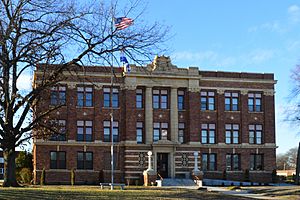
Pemiscot County Courthouse in Caruthersville
|
|

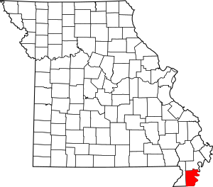
Location within the U.S. state of Missouri
|
|
 Missouri's location within the U.S. |
|
| Country | |
| State | |
| Founded | February 19, 1851 |
| Named for | Fox word meaning "liquid mud" |
| Seat | Caruthersville |
| Largest city | Caruthersville |
| Area | |
| • Total | 513 sq mi (1,330 km2) |
| • Land | 493 sq mi (1,280 km2) |
| • Water | 21 sq mi (50 km2) 4.1% |
| Population
(2020)
|
|
| • Total | 15,661 |
| • Density | 30.528/sq mi (11.787/km2) |
| Time zone | UTC−6 (Central) |
| • Summer (DST) | UTC−5 (CDT) |
| Congressional district | 8th |
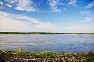
Pemiscot County is a county in the southeastern part of Missouri. It is located in an area called the Bootheel. The mighty Mississippi River forms its eastern border.
In 2020, about 15,661 people lived here. The biggest city and the main government center is Caruthersville. Pemiscot County was officially started on February 19, 1851. Its name comes from a local bayou. The word pem-eskaw means "liquid mud" in the language of the native Meskwaki people. This area has always been important for farming, especially cotton.
The Murphy Mound Archeological Site is in Pemiscot County. It has one of the largest platform mounds in Missouri. This mound was built by the ancient Mississippian culture. They lived throughout the Mississippi River Valley. The site is private and not open to visitors. People might have lived there from around 1200 CE until about 1541.
Contents
History
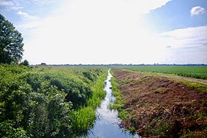
Pemiscot County is right next to the Mississippi River. This made it a good place for farming. In the 1800s and early 1900s, cotton was the main crop. Enslaved African Americans did most of the work on these farms.
Later, many African Americans moved away from the county. This was part of the Great Migration. They went to big cities to find new jobs. Also, new machines made farming easier. This meant fewer workers were needed. Because of these changes, the county's population has gone down since 1940.
Geography

Pemiscot County covers about 513 square miles. Most of this area, about 493 square miles, is land. The other 21 square miles (about 4.1%) is water. Fishing is a popular activity for people living in the area.
Neighboring Counties
- New Madrid County (to the north)
- Lake County, Tennessee (across the Mississippi River to the northeast)
- Dyer County, Tennessee (across the Mississippi River to the southeast)
- Mississippi County, Arkansas (to the south)
- Dunklin County (to the west)
Main Roads
 I-55
I-55 I-155
I-155 US 61
US 61 US 412
 Route 84
 Route 153
 Route 164
Population Facts
| Historical population | |||
|---|---|---|---|
| Census | Pop. | %± | |
| 1860 | 2,962 | — | |
| 1870 | 2,059 | −30.5% | |
| 1880 | 4,299 | 108.8% | |
| 1890 | 5,975 | 39.0% | |
| 1900 | 12,115 | 102.8% | |
| 1910 | 19,559 | 61.4% | |
| 1920 | 26,634 | 36.2% | |
| 1930 | 37,284 | 40.0% | |
| 1940 | 46,857 | 25.7% | |
| 1950 | 45,624 | −2.6% | |
| 1960 | 38,095 | −16.5% | |
| 1970 | 26,373 | −30.8% | |
| 1980 | 24,987 | −5.3% | |
| 1990 | 21,921 | −12.3% | |
| 2000 | 20,047 | −8.5% | |
| 2010 | 18,296 | −8.7% | |
| 2020 | 15,661 | −14.4% | |
| U.S. Decennial Census 1790-1960 1900-1990 1990-2000 2010-2015 |
|||
In 2000, there were about 20,047 people living in Pemiscot County. Most people were White (71.76%) or Black/African American (26.23%). A small number were Native American, Asian, or other races. About 1.57% of the people were Hispanic or Latino.
The average age in the county was 34 years old. About 30% of the population was under 18 years old.
Religion
Pemiscot County is part of the "Bible Belt." This means many people follow evangelical Protestant religions. The most common religions are Southern Baptists, Methodists, and Churches of Christ.
Education
Many adults in Pemiscot County have finished high school. About 58.2% have a high school diploma or higher. About 8.4% have a bachelor's degree or higher.
Public Schools
- Caruthersville School District 18
- Caruthersville Elementary School (Grades PK-5)
- Caruthersville Middle School (Grades 6-8)
- Caruthersville High School (Grades 9-12)
- Cooter R-IV School District
- Cooter Elementary School (Grades K-6)
- Cooter High School (Grades 7-12)
- Deering Delta C-7 School District
- Delta Elementary School (Grades K-6)
- Delta High School (Grades 7-12)
- Hayti R-II School District
- Mathis Elementary School (Grades PK-3)
- Wallace Elementary School (Grades 4-6)
- Hayti High School (Grades 7-12)
- Wardell North Pemiscot County R-I School District
- Ross Elementary School - Portageville - (Grades K-5)
- North Pemiscot County High School - (Grades 6-12)
- Steele South Pemiscot County R-V School District
- South Pemiscot County Elementary School (Grades K-6)
- South Pemiscot County High School (Grades 7-12)
Special and Vocational Schools
- Diagnostic Center - Hayti - (Grades K-12) - For special education
- External Locations - Hayti - (Grades K-12) - For special education
- Oak View Learning Center - Hayti - (Grades K-12) - For special education
- Pemiscot County Vocational School - Hayti - (Grades 11-12) - For job training
Public Libraries
- Caruthersville Public Library
- Conran Memorial Library
- Steele Public Library
Communities
Cities
- Bragg City
- Caruthersville (county seat)
- Cooter
- Cottonwood Point
- Hayti
- Hayti Heights
- Holland
- Homestown
- Portageville (mostly in New Madrid County)
- Steele
- Wardell
Village
Former Village
Census-Designated Place
Other Unincorporated Places
See also
 In Spanish: Condado de Pemiscot para niños
 | Selma Burke |
 | Pauline Powell Burns |
 | Frederick J. Brown |
 | Robert Blackburn |


