
St. Clair County, Illinois facts for kids
Quick facts for kids
St. Clair County
|
|||
|---|---|---|---|

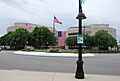
St. Clair County Courthouse in Belleville
|
|||
|
|||

Location within the U.S. state of Illinois
|
|||
 Illinois's location within the U.S. |
|||
| Country | |||
| State | |||
| Founded | 1790 | ||
| Named for | Arthur St. Clair | ||
| Seat | Belleville | ||
| Largest city | Belleville | ||
| Area | |||
| • Total | 674 sq mi (1,750 km2) | ||
| • Land | 658 sq mi (1,700 km2) | ||
| • Water | 16 sq mi (40 km2) 2.4% | ||
| Population
(2020)
|
|||
| • Total | 257,400 | ||
| • Estimate
(2023)
|
251,018 |
||
| • Density | 381.9/sq mi (147.45/km2) | ||
| Time zone | UTC−6 (Central) | ||
| • Summer (DST) | UTC−5 (CDT) | ||
| Congressional districts | 12th, 13th | ||


St. Clair County is a county in Illinois. It is the ninth most populated county in the state. The county is located just east of St. Louis. It is part of the Metro East area, which is a part of the larger Greater St. Louis region in southern Illinois.
In 2020, St. Clair County had about 257,400 people. This makes it the third most populated county in Illinois outside of the Chicago metropolitan area. Belleville is the county’s main city and where the county government is located.
French settlers founded Cahokia Village in 1697. It was a mission to teach Christianity to Native American tribes. St. Clair County was created in 1790 by the government of the Northwest Territory. It was named after its first governor, Arthur St. Clair. In 1809, the county became a key part of the Illinois Territory. It was one of the first two counties in Illinois, along with Randolph County.
Contents
History of St. Clair County
For thousands of years, different groups of Native Americans lived in this area. The first European explorers and settlers were French and French Canadians. They started a mission settlement in 1697, which is now Cahokia Village.
After Great Britain won the French and Indian War in 1763, they took control of the land east of the Mississippi River. British-American settlers then began to move into the area. Many French Catholic families moved west of the river instead of living under British rule.
Founding the County
After the American Revolutionary War, the United States became independent. St. Clair County was the first county created in what is now Illinois. It was formed in 1790 by Arthur St. Clair. He was the first governor of the Northwest Territory and named the county after himself.
The county's first border covered a large area between the Mackinaw River and the Ohio River. Over time, the county's shape and size changed as new territories and counties were formed.
-
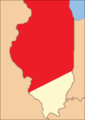
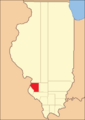
St. Clair County in 1809
-
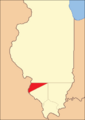
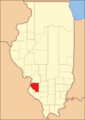
St. Clair County between 1812 and 1813
-
St. Clair County between 1813 and 1816
-
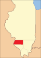
St. Clair County between 1816 and 1818
-
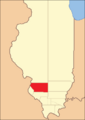
St. Clair County between 1818 and 1825
-
St. Clair County between 1825 and 1827
-
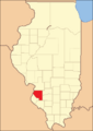
St. Clair County from 1827 to today


Growth of Industry
The St. Clair County area was first used for farming. Later, it became a center for factories and cities, especially around East St. Louis, Illinois. This city grew across the Mississippi River from St. Louis, Missouri. Business leaders from St. Louis, who were originally French fur traders, greatly influenced its growth.
In the 1800s, business owners from St. Louis built coal plants and other large factories in East St. Louis. Coal from southern mines was brought by river to East St. Louis. It was then sent to St. Louis factories. As bridges were built across the river, more industries grew.
In the late 1800s and early 1900s, cities like East St. Louis attracted many new people. These included immigrants from Europe and African Americans moving from the Southern United States. By 1917, the number of African Americans in East St. Louis had doubled. They were moving to escape unfair laws and lack of voting rights in the South.
White workers were usually hired first for better-paying jobs. However, there were still jobs for African Americans. Sometimes, they were hired to replace striking white workers. This caused tension and competition for jobs and housing. The city grew very quickly and struggled to keep up with the new population. The United States was also preparing for World War I.
East St. Louis Riots
In 1917, there were serious problems in East St. Louis. White workers went on strike at a factory. The company hired many African Americans to work instead. White workers complained to the city leaders. The governor sent in the National Guard to help keep peace.
However, from July 1 to July 3, 1917, the East St. Louis riots happened. White groups attacked African Americans and burned their homes. Many African Americans tried to escape by crossing the Eads Bridge to St. Louis. The police eventually closed the bridge. These events caused a lot of damage and sadness.
The riots badly hurt East St. Louis, which had been a growing industrial city. Besides the human cost, there was about $400,000 in property damage. This would be over $8 million today. These riots are known as some of the worst labor and race-related riots in U.S. history.
Rebuilding was hard because many workers were drafted for World War I. When soldiers returned, they found it difficult to find jobs. In the late 1900s, many factories closed down. This caused the city's population to shrink a lot. People who stayed faced high rates of poverty. Today, East St. Louis still has areas of urban decay. Many old, damaged houses have been torn down.
Other cities in St. Clair County are near farms or open land. Unlike the suburbs in Missouri, those in Metro-East are often separated by farms or undeveloped land. The middle part of St. Clair County is on a bluff along the Mississippi River. New homes are being built here, especially in Belleville and its nearby towns. The eastern and southern parts of the county have fewer people. Small towns and new suburban areas are found between large fields of corn and soybeans.
The St. Clair County flag was designed in 1979 by Kent Zimmerman. He was a high school student who won a contest. The flag shows the outline of St. Clair County. It has an orange moon, a stalk of corn, and a pickaxe. The background has three stripes: green, yellow, and green.
Geography and Climate
St. Clair County covers about 674 square miles. Most of this (658 square miles) is land. About 16 square miles (2.4%) is water.
Weather in St. Clair County
| Weather chart for Belleville, Illinois | |||||||||||||||||||||||||||||||||||||||||||||||
|---|---|---|---|---|---|---|---|---|---|---|---|---|---|---|---|---|---|---|---|---|---|---|---|---|---|---|---|---|---|---|---|---|---|---|---|---|---|---|---|---|---|---|---|---|---|---|---|
| J | F | M | A | M | J | J | A | S | O | N | D | ||||||||||||||||||||||||||||||||||||
|
2
40
22
|
2.2
46
27
|
3.5
57
35
|
3.9
68
45
|
4.2
77
54
|
4
86
63
|
3.5
90
67
|
3.3
88
64
|
3
82
56
|
2.9
71
45
|
3.9
56
36
|
3
44
27
|
||||||||||||||||||||||||||||||||||||
| temperatures in °F precipitation totals in inches source: The Weather Channel |
|||||||||||||||||||||||||||||||||||||||||||||||
|
Metric conversion
|
|||||||||||||||||||||||||||||||||||||||||||||||
In Belleville, the average temperatures change throughout the year. In January, the low is about 22°F. In July, the high is about 90°F. The coldest temperature ever recorded was -27°F in January 1977. The hottest was 117°F in July 1954 in East St. Louis.
The amount of rain also changes. January usually gets about 2.02 inches of rain. May gets the most, with about 4.18 inches.
Getting Around St. Clair County
Main Roads
 Interstate 55
 Interstate 64
 Interstate 70
 Interstate 255
 U.S. Highway 40
 U.S. Highway 50
 Illinois Route 3
 Illinois Route 4
 Illinois Route 13
 Illinois Route 15
 Illinois Route 111
 Illinois Route 156
 Illinois Route 157
 Illinois Route 158
 Illinois Route 159
 Illinois Route 161
 Illinois Route 163
 Illinois Route 177
 Illinois Route 203
Public Transport

St. Clair County has 11 stations for the St. Louis MetroLink. This is a train system that helps people travel around the area. The stations are on the Red and Blue lines.
- East Riverfront
- 5th & Missouri
- Emerson Park
- Jackie Joyner-Kersee Center
- Washington Park
- Fairview Heights
- Memorial Hospital
- Swansea
- Belleville
- College
- Shiloh-Scott
The county also has bus services called Metrobus and Madison County Transit.
Neighboring Counties and City
St. Clair County shares borders with several other counties and one major city.
- Madison County (north)
- Clinton County (northeast)
- Washington County (east)
- Randolph County (south)
- Monroe County (southwest)
- St. Louis, Missouri (west)
- St. Louis County, Missouri (west)
People of St. Clair County
| Historical population | |||
|---|---|---|---|
| Census | Pop. | %± | |
| 1820 | 5,253 | — | |
| 1830 | 7,078 | 34.7% | |
| 1840 | 13,631 | 92.6% | |
| 1850 | 20,180 | 48.0% | |
| 1860 | 37,694 | 86.8% | |
| 1870 | 51,068 | 35.5% | |
| 1880 | 61,806 | 21.0% | |
| 1890 | 66,571 | 7.7% | |
| 1900 | 86,685 | 30.2% | |
| 1910 | 119,870 | 38.3% | |
| 1920 | 136,520 | 13.9% | |
| 1930 | 157,775 | 15.6% | |
| 1940 | 166,899 | 5.8% | |
| 1950 | 205,995 | 23.4% | |
| 1960 | 262,509 | 27.4% | |
| 1970 | 285,176 | 8.6% | |
| 1980 | 267,531 | −6.2% | |
| 1990 | 262,852 | −1.7% | |
| 2000 | 256,082 | −2.6% | |
| 2010 | 270,056 | 5.5% | |
| 2020 | 257,400 | −4.7% | |
| 2023 (est.) | 251,018 | −7.0% | |
| US Decennial Census 1790-1960 1900-1990 1990-2000 2010-2019 |
|||
In 2020, the county's population was 257,400 people. Most residents were White (59.6%) or Black/African American (29.7%). Other groups included Asian (1.4%), American Indian (0.3%), and people of two or more races (6.8%). About 4.9% of the population was of Hispanic or Latino background.
In 2010, there were 270,056 people living in the county. The average household had 2.53 people. The average family had 3.09 people. The median age was 36.9 years old.
The median income for a household in the county was $48,562. For a family, it was $61,042. About 15.5% of the population lived below the poverty line. This included 24.7% of those under 18 years old.
Communities in St. Clair County
St. Clair County has many different types of communities.
Cities
- Belleville
- Cahokia Heights
- Collinsville
- Columbia
- East St. Louis
- Fairview Heights
- Lebanon
- Madison
- Mascoutah
- O'Fallon
Villages
Census-Designated Places
These are areas identified by the U.S. Census Bureau for statistical purposes.
Unincorporated Communities
These are places that are not officially part of a city or village.
- Douglas
- Imbs
- North Dupo
- Signal Hill
- State Park Place
- Westview
Townships
Townships are local government areas within the county.
- Canteen
- Caseyville
- Centreville
- East St. Louis
- Engelmann
- Fayetteville
- Freeburg
- Lebanon
- Lenzburg
- Marissa
- Mascoutah
- Millstadt
- New Athens
- O'Fallon
- Prairie du Long
- St. Clair
- Shiloh Valley
- Smithton
- Stites
- Stookey
- Sugarloaf
Islands
Education in St. Clair County
Many school districts serve the students of St. Clair County. Some of these districts may also have parts in other counties.
- Brooklyn Community Unit School District 188
- Cahokia Community Unit School District 187
- Collinsville Community Unit School District 10
- Columbia Community Unit School District 4
- Dupo Community Unit School District 196
- East St. Louis School District 189
- Lebanon Community Unit School District 9
- Marissa Community Unit School District 40
- Mascoutah Community Unit School District 19
- New Athens Community Unit School District 60
- Red Bud Community Unit School District 132
- Waterloo Community Unit School District 5
- Wesclin Community Unit School District 3
- Belleville Township High School District 201
- Freeburg Community High School District 77
- O'Fallon Township High School District 203
- Belle Valley School District 11
- Belleville School District 118
- Central School District 104
- Harmony Emge School District 175
- Freeburg Community Consolidated School District 70
- Grant Community Consolidated School District 110
- High Mount School District 116
- Millstadt Consolidated Community School District 160
- O'Fallon Community Consolidated School District 90
- Pontiac-William Holliday School District 105
- Shiloh Village School District 85
- Signal Hill School District 181
- Smithton Community Consolidated School District 130
- St. Libory Consolidated School District 30
- Whiteside School District 115
- Wolf Branch School District 113
Images for kids
-
St. Clair County Courthouse in Belleville
-

Flag of St. Clair County, Illinois
-
Seal of St. Clair County, Illinois
See also
 In Spanish: Condado de St. Clair (Illinois) para niños
