National Weather Service facts for kids
 |
|
| Agency overview | |
|---|---|
| Formed | February 9, 1870 |
| Preceding agencies |
|
| Jurisdiction | United States federal government |
| Headquarters | Silver Spring, Maryland 38°59′30″N 77°01′48″W / 38.99167°N 77.03000°W |
| Employees | 4,900 |
| Annual budget | US$1.364 billion (FY 2023) |
| Agency executives |
|
| Parent agency | National Oceanic and Atmospheric Administration |
| Key documents |
|
The National Weather Service (NWS) is a special agency of the United States federal government. Its main job is to give weather forecasts and warnings about dangerous weather. They also provide other weather information to help keep people safe. The NWS is part of the National Oceanic and Atmospheric Administration (NOAA). NOAA is a branch of the Department of Commerce. The NWS main office is in Silver Spring, Maryland. This agency was called the United States Weather Bureau from 1891 until 1970. That's when it got its current name.
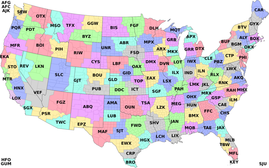
The NWS does its work through many national and local centers. It has 122 local Weather Forecast Offices (WFOs). Since the NWS is a U.S. government agency, most of its weather information is free. Anyone can use it.
Contents
- History of Weather Forecasting
- How the NWS Forecasts Weather
- NWS Offices Around the Country
- How the NWS Gathers Data
- Weather Alerts and Warnings
- How NWS Products are Shared
- Technology Used by NWS
- How the NWS is Organized
- Discussions about Privatization
- How Accurate are NWS Forecasts?
- Leaders of the National Weather Service
- See also
History of Weather Forecasting

How the NWS Started (1870–1899)
People started trying to record weather a long time ago. Joseph Henry from the Smithsonian Institution was one of the first. After a tornado in Illinois in 1855, he asked for more information about the storm. This led to the U.S. Signal Service, which was the first version of the NWS.
In 1869, Cleveland Abbe started giving public weather forecasts. He called them "probabilities." He used weather observations sent by telegraph. Around the same time, Increase A. Lapham worked to create a storm warning service. He saw how powerful storms were in the Great Lakes area.
On February 9, 1870, the first official U.S. weather service began. President Ulysses S. Grant signed a law to create it. Its job was to take weather observations and warn people about storms. The agency was first part of the Department of War. It was called the Division of Telegrams and Reports for the Benefit of Commerce.
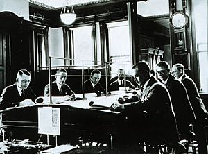
In 1891, the agency became a civilian group. It moved to the Department of Agriculture. Its name officially became the U.S. Weather Bureau. Under this new department, it started giving flood warnings and fire weather forecasts. It also created the first daily national weather maps.
The 20th Century and New Technologies
The first Weather Bureau radiosonde was launched in 1937. A radiosonde is a small device sent into the sky on a balloon to measure weather. This led to using radiosondes instead of airplanes for observations.
For a long time, the Bureau did not use the word "tornado" in its forecasts. They worried it would cause panic. But this meant people didn't get warnings. In 1938, they started giving tornado warnings only to emergency workers. In 1950, the ban on public tornado alerts was lifted.
In 1940, the Bureau moved to the Department of Commerce. In 1952, they started giving experimental public tornado forecasts. In 1957, the Bureau began using radars to forecast local storms. These radars were called WSR-57. A network of these radars was set up across the country.
In 1970, the Weather Bureau became the National Weather Service. This happened when the National Oceanic and Atmospheric Administration (NOAA) was formed. In the 1980s, the NWS still used older radar and communication tools. Between 1988 and 1997, a new radar system called NEXRAD (Next Generation Radar) was put in place. This greatly improved how severe storms were detected.
The 21st Century and Recent Changes
In 2025, the National Weather Service faced some challenges. There were staff layoffs and changes to how it worked with universities. Some offices were without a chief meteorologist, especially as hurricane season began.
How the NWS Forecasts Weather
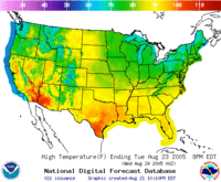
The NWS uses different groups to create forecasts for everyone. In the past, forecasts were mostly text. Now, the NWS uses more digital maps and other modern formats. Each of the 122 Weather Forecast Offices (WFOs) sends its forecasts to a national server. This information is put into the National Digital Forecast Database (NDFD). The NDFD has common weather information like how much rain will fall, temperature, and cloud cover. You can see this data online or download it.
Fire Weather Forecasts
The National Weather Service creates many products about wildfires every day. Local WFOs issue a Fire Weather Forecast daily. This forecast covers up to seven days. It includes important information for firefighters, like wind direction and speed, and rain. This helps crews plan for fires.
NWS meteorologists also create a special fire weather forecast for the United States Forest Service. This data goes into a computer model called the National Fire Danger Rating System (NFDRS). This model tells us the daily fire danger. It has five levels: low, moderate, high, very high, or extreme.
Local Weather Forecast Offices also issue Fire Weather Watches and Red Flag Warnings. These warnings tell people about conditions that could cause extreme fires. The NWS Storm Prediction Center also helps by looking at fire weather conditions for larger areas. This includes "dry thunderstorms" in the western U.S.. These storms have lightning but no rain because the rain evaporates before it hits the ground.
Sometimes, forestry officials ask for a special forecast for a specific location. This is called a "spot forecast." It helps them decide if it's safe to start a prescribed burn (a controlled fire).
The NWS also helps at large wildfires or other disasters. They send Incident Meteorologists (IMETs). IMETs are NWS forecasters who are specially trained to work at disaster sites. They set up a mobile weather center to provide weather support. They use cell phones, laptops, and other equipment to get weather data. IMETs work long hours in tough conditions.
Aviation Weather Support
The NWS helps pilots and the aviation community. Each WFO creates Terminal Aerodrome Forecasts (TAFs) for airports in their area. TAFs are short, coded forecasts for a specific airport. They are issued every six hours and cover 24 hours. TAFs only include weather important for flying, like wind, visibility, and cloud cover.
NWS Offices Around the Country
Weather Forecast Offices (WFOs)
The National Weather Service has 122 local offices called Weather Forecast Offices (WFOs). Each WFO is responsible for a specific area, covering many counties or even multiple states. These local offices create and send out forecasts and weather alerts for their region. Some products only issued by WFOs include severe thunderstorm and tornado warnings, flood warnings, and winter weather warnings. You can find these forecasts on their individual pages on the Weather.gov website.
River Forecast Centers (RFCs)
There are thirteen River Forecast Centers (RFCs). They issue daily river forecasts. These forecasts use information about rainfall, soil, and future rain. Some RFCs also forecast snowpack and river flow in mountainous areas. This information helps farmers, power plants, and water suppliers.
Center Weather Service Units (CWSUs)
Twenty-one NWS Center Weather Service Units (CWSUs) work with the FAA's air traffic control centers. Their main job is to give up-to-date weather information to air traffic controllers. They focus on weather that could be dangerous for planes or slow down air traffic. CWSU meteorologists also issue special warnings for pilots, like the Center Weather Advisory (CWA) for thunderstorms or icing.
National Centers for Environmental Prediction (NCEP)
The NCEP is a group of national centers that provide forecasts for larger areas.
Aviation Weather Center (AWC)
The Aviation Weather Center (AWC) is in Kansas City, Missouri. It helps pilots by issuing two main products:
- AIRMET (Airmen's Meteorological Information): This gives information about icing, turbulence, and strong winds.
- SIGMETs (Significant Meteorological Information): These are issued for important weather that might affect an airport or flight path. This includes large areas of thunderstorms or severe icing.
Storm Prediction Center (SPC)
The Storm Prediction Center (SPC) is in Norman, Oklahoma. It issues severe thunderstorm and tornado watches. These watches mean that dangerous weather is possible. The SPC also collects reports of severe hail, wind, or tornadoes. It provides forecasts for severe weather up to eight days in advance. It also issues fire weather outlooks.
Weather Prediction Center (WPC)
The Weather Prediction Center is in College Park, Maryland. It helps forecast how much rain will fall and where heavy rain is likely. Local NWS offices then issue Flood Watches and Warnings for their areas. These warnings can be for different reasons, like heavy rain or ice jams on rivers.
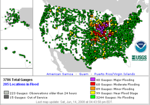
The NWS also has the Advanced Hydrologic Prediction Service (AHPS). This service lets anyone see real-time information about rivers, lakes, and streams. It also provides long-range forecasts for planning.
Ocean Prediction Center (OPC)
The National Weather Service Ocean Prediction Center (OPC) is in College Park, Maryland. It issues weather products for ocean areas near the United States. This includes:
- Coastal Waters Forecast (CWF): Issued by local offices for waters close to the coast.
- Offshore Waters Forecast (OFF): Issued by the OPC for waters farther out in the ocean.
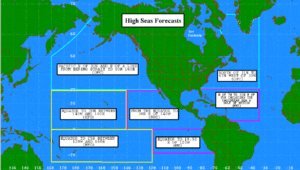
- High Seas Forecast (HSF): Issued by OPC for large ocean areas.
National Hurricane Center (NHC)
The National Hurricane Center (NHC) in Miami, Florida and the Central Pacific Hurricane Center (CPHC) in Honolulu, Hawaii watch for tropical storms and hurricanes. They monitor tropical weather in the Atlantic and Pacific Oceans. They issue advisories and warnings for tropical cyclones. If a hurricane threatens the U.S., local WFOs issue statements about its expected effects.
Climate Prediction Center (CPC)
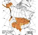
The Climate Prediction Center (CPC) is in College Park, Maryland. It handles all of the NWS's climate forecasts. Their goal is to help people by forecasting short-term climate changes. This includes risks of extreme weather events. Their forecasts cover weeks to seasons ahead. Most of their products cover the U.S. and Alaska.
Local Weather Forecast Offices also issue daily and monthly climate reports. These reports include high and low temperatures and other information for their areas.
Space Weather Prediction Center (SWPC)
The Space Weather Prediction Center (SWPC) is in Boulder, Colorado. It watches and forecasts solar activity. This includes events like coronal mass ejections (CMEs) and solar flares. These events can affect things like electric power transmission, GPS systems, and radio communications.
The SWPC also forecasts the aurora (Northern and Southern Lights).
How the NWS Gathers Data
Surface Observations
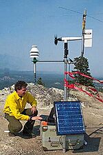
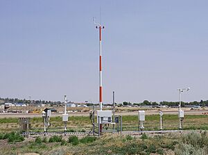
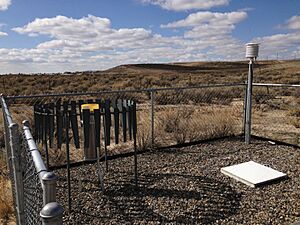
The main way the NWS gets surface weather data is from Automated Surface Observing Systems (ASOS). These stations are a team effort by the NWS, FAA, and Department of Defense. ASOS stations help with forecasts and aviation. They are usually near airport runways. They send hourly observations and special reports when conditions change. They measure sky conditions, visibility, weather, pressure, temperature, wind, and rain.
To get more weather information, the NWS also uses the Cooperative Observer Program (COOP). This is a network of about 11,000 volunteer weather observers. They provide daily maximum and minimum temperatures, snowfall, and 24-hour precipitation totals. This data helps define the climate of the United States. It also helps the NWS with forecasts and warnings.
The NWS also works with private weather networks like the Citizen Weather Observer Program.
Marine Observations
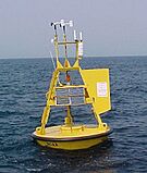
NWS forecasters need good marine observations to prepare forecasts for the ocean. Large bodies of water greatly affect the weather. The NWS's National Data Buoy Center (NDBC) operates about 90 buoys and 60 coastal observing systems. These stations measure wind speed, direction, pressure, and air temperature. Buoys also measure sea surface temperature and wave height. All stations report every hour.
The United States Voluntary Observing Ship (VOS) program also collects weather data. Ships traveling across the ocean take observations. Deck officers on these ships record weather and ocean data. This information is sent to the NWS and used by meteorologists, oceanographers, and fishermen.
Upper Air Observations
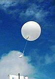
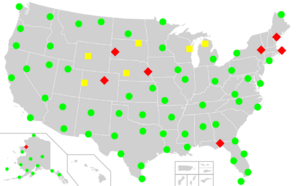
Upper air weather data is very important for forecasting. The NWS has 92 radiosonde locations in North America and ten in the Caribbean. A radiosonde is a small device attached to a balloon. It is released daily. As it rises, sensors measure pressure, temperature, and humidity. By tracking the balloon, they also get wind speed and direction. The balloon can go very high, over 35 kilometers (115,000 feet). When the balloon bursts, a small parachute brings the radiosonde down safely. The data helps meteorologists understand the atmosphere.
Weather Alerts and Warnings
The National Weather Service has different levels of alerts for dangerous weather:
- Outlook – These are issued daily by local Weather Forecast Offices. They talk about possible hazardous weather over the next seven days. This helps people prepare.
- Advisory – An advisory is issued when a hazardous event is happening or likely. Advisories are for less serious conditions than warnings. They can cause problems if people are not careful.
- Watch – A watch means that dangerous weather is possible. Its exact timing or location might still be uncertain. It gives people time to get ready. A watch means hazardous weather is possible, but not happening right now.
- Warning – A warning means that dangerous weather is happening or about to happen. Weather conditions pose a threat to life or property. People in the storm's path need to take action right away.
- Special Weather Statement – This is issued when something unusual is happening. It can be for sudden changes in weather. Sometimes, these statements are warnings for slight weather dangers. Other times, they just give information about a weather system.
Weather Warnings and Advisories
Short-term weather warnings and advisories are issued by local NWS offices. They usually cover small areas. Warnings for severe local storms are issued about an hour before the storm arrives. The NWS also issues warnings for floods, high winds, winter storms, heat, cold, and marine hazards.
A warning means a "hazardous weather or hydrologic event is occurring, is imminent, or has a very high probability of occurring." An advisory "highlights special weather conditions that are less serious than a warning." They tell people to take immediate action or be careful. For example, severe thunderstorm warnings mean strong thunderstorms are happening. Tornado warnings mean a tornado has been seen or is very likely.
The process starts with observations from radar, local reports, or storm spotters. If a warning is needed, the Weather Forecast Office creates a message. This message is sent out through many ways, like the media and the internet.
The message tells you the type of alert, the office that issued it, the areas covered, and when it expires. Some warnings, like for tornadoes, ask for Emergency Alert System activation. This sends alerts to TVs, radios, and phones. The warning also describes the storm's location, hazards, and safety tips.
Sometimes, forecasters use stronger words for very dangerous weather. For example, "Particularly Dangerous Situation" (PDS) is used for tornado watches when a very strong tornado is expected. This helps people understand the high threat.
Since October 1, 2007, the NWS has used "storm-based warnings." This means warnings are shown as polygon shapes on maps. These shapes outline the specific areas the storm will affect. This is more precise than warning entire counties. Warnings can be changed or canceled by NWS offices.
The NWS also uses experimental products for social media. These show maps of warning areas and impacted locations. They can even estimate the population in the warned area.
NOAA Weather Radio All Hazards (NWR) is a special radio system. It broadcasts weather watches, warnings, and forecasts 24 hours a day. It comes directly from a nearby NWS office. This system covers most of the United States. NWR has 1,030 transmitters. You need a special radio receiver to pick up the signal. NWR can also broadcast other emergency alerts, not just weather.
The NOAA Weather Wire Service (NWWS) is a satellite system. It sends weather information to government, businesses, and people. Warnings get the highest priority. NWWS delivers severe weather warnings very quickly, in ten seconds or less.
The Emergency Managers Weather Information Network (EMWIN) helps emergency managers get NWS warnings and forecasts for free. They can get data by radio, internet, or satellite dish.
NOAAPORT is a system that sends NOAA environmental data in real-time. It uses a satellite to broadcast the information.
The NWS's website, Weather.gov, is full of information. It's a portal to hundreds of thousands of web pages. You can find local forecasts by typing in a place name. You can also see maps of active warnings, radar, and climate information. All local NWS offices have their own web pages with specific information for their area.
Technology Used by NWS

The WSR-88D Doppler weather radar system, also called NEXRAD, was developed in the 1980s. It was fully set up across the U.S. by 1997. There are 158 such radar sites. This technology is key to the NWS's severe weather warnings. It has high resolution and can detect motions inside clouds.
NWS meteorologists use an advanced system called the Advance Weather Interactive Processing System (AWIPS). This system helps them view weather information easily. They also use it to create and send out forecasts. The NWS Environmental Modeling Center uses powerful computer models like the Global Forecast System (GFS).
In 2016, the NWS greatly increased the power of its supercomputers. This was to improve the accuracy of its GFS weather model. For example, the GFS model incorrectly predicted Hurricane Sandy would go out to sea. Other models, like the European one, predicted landfall correctly. The new supercomputers made the NWS's computing power much stronger.
How the NWS is Organized
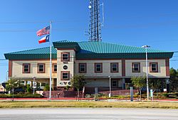
As of 2016, the National Weather Service is organized with different groups:
- Chief Information Officer
- National Centers for Environmental Prediction (NCEP)
- Aviation Weather Center (AWC)
- Climate Prediction Center (CPC)
- Environmental Modeling Center (EMC)
- Weather Prediction Center (WPC)
- Ocean Prediction Center (OPC)
- NCEP Central Operations
- Space Weather Prediction Center (SWPC)
- Storm Prediction Center (SPC)
- National Hurricane Center (NHC)
- Hurricane Specialist Unit (HSU)
- Tropical Analysis and Forecast Branch (TAFB)
- Technical Support Branch (TSB)
- Chief Financial Officer
- Operational Systems
- Hydrologic Development
- Science and Technology
- Programs and Plans
- Meteorological Development Laboratory (MDL)
- Climate, Water and Weather Services
- 6 Regions (Eastern, Central, Southern, Western, Alaska & Pacific)
- 122 Weather Forecast Offices (WFOs)
- 21 Center Weather Service Units (CWSU)
- 13 River Forecast Centers (RFC)
- Pacific Tsunami Warning Center (PTWC)
- National Tsunami Warning Center (NTWC)
- Spaceflight Meteorology Group (SMG)
Discussions about Privatization
The National Weather Service is known as a top weather organization. However, some people have suggested that it competes unfairly with private weather companies. NWS forecasts and data are free to everyone because they are from the government. Sometimes, there are discussions about whether private companies could do some of the NWS's work.
Past Proposals to Change the NWS
In 1983, there was a proposal to sell the NWS's weather satellites to private companies. The idea was to buy weather data back from them. This plan was not popular. Many people, including members of Congress, did not want weather information to be sold for profit. The plan to sell the satellites failed.
In 2005, Senator Rick Santorum introduced a bill. This bill would have stopped the NWS from giving out weather data for free. Many people who use NWS services, like emergency managers, criticized the bill. They said it would threaten safety, especially for air traffic. The bill did not pass.
In 2025, there were some changes that affected the NWS. Some employees were laid off. There were concerns that these changes might lead to more private companies doing government weather work.
How Accurate are NWS Forecasts?
Some experts, like Professor Cliff Mass, have said that NWS forecasts could be more accurate. They believe this has led to less accurate daily forecasts and predictions for extreme weather events like blizzards and hurricanes. In 2016, other weather services, like the British Met Office, were sometimes seen as more accurate.
Reasons suggested for this include:
- Not enough computing power to run better simulations.
- Not using new techniques from research.
- Not using data from all available sources, like from commercial airplanes.
- Older equipment on weather satellites.
- Focusing on too many models instead of a few high-quality ones.
- Problems with how the organization works.
The NWS has a project called the Next Generation Global Prediction System. It aims to fix some of these issues by using a single, high-quality model. In 2016, NOAA announced this project to improve its forecasts.
Leaders of the National Weather Service
Here is a list of the leaders of the National Weather Service and its earlier forms. The first leaders were called Chief Signal Officer. When it became a civilian agency in 1891, the leader was called the chief of the Weather Bureau. Since 1970, the leader has been called the director of the National Weather Service.
| No. | Image | Name | Term start | Term end | Refs |
|---|---|---|---|---|---|
| Started as the U.S. Army Signal Service, Division of Telegrams and Reports for the Benefit of Commerce in 1870 and led by the U.S. Army Chief Signal Officer | |||||
| 1 |  |
Albert J. Myer | February 9, 1870 | August 24, 1880 | |
| acting |  |
Richard C. Drum | August 24, 1880 | December 15, 1880 | |
| 2 |  |
William Babcock Hazen | December 16, 1880 | January 16, 1887 | |
| 3 |  |
Adolphus Greely | March 3, 1887 | June 30, 1891 | |
| Renamed United States Weather Bureau in 1891, moved to the USDA and led by the chief of the Weather Bureau | |||||
| 4 |  |
Mark Walrod Harrington | July 1, 1891 | June 29, 1895 | |
| acting | James R. Cook | July 1, 1895 | July 4, 1895 | ||
| 5 |  |
Willis Luther Moore | July 4, 1895 | April 16, 1913 | |
| acting | Henry E. Williams | April 17, 1913 | August 4, 1913 | ||
| 6 |  |
Charles F. Marvin | August 4, 1913 | January 30, 1934 | |
| 7 |  |
Willis Ray Gregg | January 31, 1934 | September 14, 1938 | |
| acting | Charles C. Clark | September 14, 1938 | December 14, 1938 | ||
| acting |  |
Francis Reichelderfer | December 14, 1938 | January 1, 1939 | |
| 8 | January 1, 1939 | September 30, 1963 | |||
| 9 |  |
Robert M. White | October 1, 1963 | July 13, 1965 | |
| acting |  |
George Cressman | July 13, 1965 | September 1, 1965 | |
| 10 | September 1, 1965 | January 15, 1979 | |||
| Renamed National Weather Service in 1970, moved to NOAA, and led by the director of the National Weather Service. | |||||
| 11 |  |
Richard E. Hallgren | February 12, 1979 | March 27, 1988 | |
| 12 |  |
Elbert W. "Joe" Friday, Jr. | March 28, 1988 | June 27, 1997 | |
| acting | Robert S. Winokur | June 28, 1997 | February 25, 1998 | ||
| 13 |  |
John J. "Jack" Kelly, Jr. | February 26, 1998 | January 8, 2004 | |
| 14 |  |
David L. Johnson | January 9, 2004 | June 30, 2007 | |
| acting |  |
Mary Glackin | July 1, 2007 | September 1, 2007 | |
| 15 |  |
John L. "Jack" Hayes | September 2, 2007 | May 25, 2012 | |
| acting | Laura Furgione | May 29, 2012 | February 9, 2013 | ||
| 16 |  |
Louis Uccellini | February 10, 2013 | January 1, 2022 | |
| acting |  |
Mary C. Erickson | January 2, 2022 | June 6, 2022 | |
| 17 |  |
Ken Graham | June 7, 2022 | present | |
Table notes:
See also
 In Spanish: Servicio Meteorológico Nacional (Estados Unidos) para niños
- Meteorological Service of Canada – Canada's weather forecasting agency, started in 1876
 | DeHart Hubbard |
 | Wilma Rudolph |
 | Jesse Owens |
 | Jackie Joyner-Kersee |
 | Major Taylor |


