Washtenaw County, Michigan facts for kids
Quick facts for kids
Washtenaw County
|
||
|---|---|---|
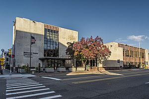
Washtenaw County Courthouse
|
||
|
||
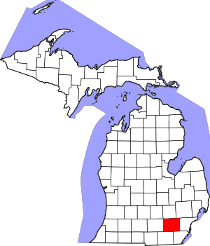
Location within the U.S. state of Michigan
|
||
 Michigan's location within the U.S. |
||
| Country | ||
| State | ||
| Founded | 1822 (created) 1826 (organized) |
|
| Named for | O-wash-ta-nong ("far away water"), Ojibwe name for the Grand River | |
| Seat | Ann Arbor | |
| Largest city | Ann Arbor | |
| Area | ||
| • Total | 722 sq mi (1,870 km2) | |
| • Land | 706 sq mi (1,830 km2) | |
| • Water | 16 sq mi (40 km2) 2.3%% | |
| Population
(2020)
|
||
| • Total | 372,258 | |
| • Density | 527/sq mi (203/km2) | |
| Time zone | UTC−5 (Eastern) | |
| • Summer (DST) | UTC−4 (EDT) | |
| Congressional district | 6th | |
Washtenaw County is a county located in the state of Michigan. In 2020, about 372,258 people lived here. The main city and county seat is Ann Arbor. The county was officially created in 1822 and fully organized in 1826.
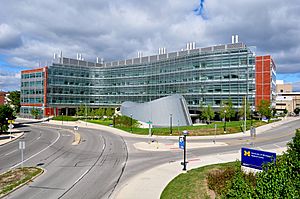
Washtenaw County is part of the larger Ann Arbor area. It is home to several important universities. These include the University of Michigan, Eastern Michigan University, Washtenaw Community College, and Concordia University Ann Arbor.
Contents
History of Washtenaw County
Early Native American People
Long ago, different Native American groups lived in the area that is now Washtenaw County. These groups included the Potawatomi, Chippewa, Ottawa, Wyandotte, and Huron peoples. Other groups like the Miami, Anishinabewaki, Peoria, Meskwaki, and Mississauga also had lands here.
What Does "Washtenaw" Mean?
The name "Washtenaw" comes from the Ojibwe language. The word "Wash-ten-ong" or "Owashtanong" means "far away waters." The Ojibwe people used this name for the Grand River because it is very long. When Washtenaw County was named in 1822, the Grand River's starting point was within the county's original, much larger boundaries.
First Settlements and County Growth
French fur traders were some of the first Europeans in the area. They traded near the Huron River around 1809. The first lasting settlement was built where Ypsilanti is today.
In 1822, the Michigan Territory government named and set the borders for Washtenaw County. For a few years, it was managed by Wayne County. In 1826, Washtenaw became its own self-governing county. Over time, parts of the original Washtenaw County were used to form other counties, like Ingham County.
Early settlers worked to drain swamps to make land ready for farming. Some swampy areas, like those in the Waterloo Recreation Area, still look much like they did back then. As farms grew, so did the local deer population.
In the 1820s and 1830s, people in Michigan were inspired by Greece's fight for independence. This led to buildings being built in the Greek Revival style. Many towns and even children were given Greek names.
Michigan Becomes a State
In 1835, an important meeting called the "frostbitten convention" happened in Ann Arbor. Michigan wanted to become a state, but there was a disagreement with Ohio over a piece of land called the Toledo Strip. This disagreement was known as the Toledo War. Michigan gave up its claim to Toledo. In return, Michigan received most of the Upper Peninsula. After this, Michigan officially became a state on January 26, 1837.
The convention also decided to move Michigan's capital city. It was moved from Detroit to a new city, which became Lansing. The University of Michigan had been founded in Detroit in 1817. It moved to Ann Arbor in 1839. This move was a way to make up for Ann Arbor not becoming the new state capital. Today, the University of Michigan is the largest employer in Washtenaw County.
In 1849, the Michigan State Normal School was founded in Ypsilanti. This school later became Eastern Michigan University. It started as a college around 1891 and became a university in 1959.
Geography of Washtenaw County
Washtenaw County covers about 722 square miles. Most of this area, about 706 square miles, is land. The remaining 16 square miles, or 2.3%, is water.
Neighboring Counties
Washtenaw County shares borders with several other counties:
- Livingston County (to the north)
- Oakland County (to the northeast)
- Wayne County (to the east)
- Monroe County (to the southeast)
- Lenawee County (to the southwest)
- Jackson County (to the west)
- Ingham County (to the northwest)
Main Roads
Many important highways run through Washtenaw County:
 I-94
I-94 BL I-94
 US 12 (Michigan Avenue, Chicago Road)
 Bus. US 12
 US 23
US 23
 Bus. US 23
 M-14
M-14 M-17
M-17 M-52
M-52 M-153 (Ford Road)
People of Washtenaw County
| Historical population | |||
|---|---|---|---|
| Census | Pop. | %± | |
| 1830 | 4,042 | — | |
| 1840 | 23,571 | 483.2% | |
| 1850 | 28,567 | 21.2% | |
| 1860 | 35,686 | 24.9% | |
| 1870 | 41,434 | 16.1% | |
| 1880 | 41,848 | 1.0% | |
| 1890 | 42,210 | 0.9% | |
| 1900 | 47,761 | 13.2% | |
| 1910 | 44,714 | −6.4% | |
| 1920 | 49,520 | 10.7% | |
| 1930 | 65,530 | 32.3% | |
| 1940 | 80,810 | 23.3% | |
| 1950 | 134,606 | 66.6% | |
| 1960 | 172,440 | 28.1% | |
| 1970 | 234,103 | 35.8% | |
| 1980 | 264,748 | 13.1% | |
| 1990 | 282,937 | 6.9% | |
| 2000 | 322,895 | 14.1% | |
| 2010 | 344,791 | 6.8% | |
| 2020 | 372,258 | 8.0% | |
| 2023 (est.) | 365,536 | 6.0% | |
| U.S. Decennial Census 1790–1960 1900–1990 1990–2000 2010–2019 |
|||
In 2020, there were 372,258 people living in Washtenaw County.
- About 69.2% were White.
- About 11.5% were Black or African American.
- About 9.03% were Asian.
- About 0.3% were Native American.
- About 1.9% were of another race.
- About 7.8% were of two or more races.
- About 5% were Hispanic or Latino (of any race).
Most people (83.4%) spoke only English at home. About 3.7% spoke Spanish, and 12.9% spoke other languages.
The median age in the county was 35.5 years old. This means half the people were younger than 35.5, and half were older. About 23.77% of the population was under 19 years old.
Economy and Jobs
Washtenaw County has many different types of jobs. The largest employers in the county, as of July 2020, are:
| # | Employer | # of full-time employees |
|---|---|---|
| 1 | University of Michigan | 35,446 |
| 2 | Trinity Health | 7,435 |
| 3 | United States Federal government | 3,060 |
| 4 | Ann Arbor Public Schools | 2,607 |
| 5 | Toyota Technical Center | 2,295 |
| 6 | Faurecia North America | 2,178 |
| 7 | Eastern Michigan University | 1,559 |
| 8 | IHA Health Services | 1,442 |
| 9 | State of Michigan | 1,409 |
| 10 | Washtenaw County | 1,264 |
| 11 | Thomson Reuters | 1,155 |
| 12 | Domino's Pizza | 812 |
| 13 | City of Ann Arbor | 712 |
| 14 | Ford Motor Company | 700 |
| 15 | NSF International | 693 |
| 16 | US Postal Service | 650 |
| 17 | Washtenaw Community College | 597 |
| 18 | DTE Energy | 568 |
| 19 | Ypsilanti Community Schools | 550 |
Towns and Cities
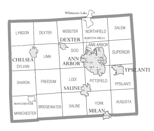
Washtenaw County has several cities, a village, and many townships.
Cities
- Ann Arbor (This is the county seat, where the main county government offices are)
- Chelsea
- Dexter
- Manchester
- Milan (part of this city is in Washtenaw County)
- Saline
- Ypsilanti
Village
Townships
Some townships are called "Charter Townships" and others are "Civil Townships."
- Ann Arbor Charter Township
- Augusta Charter Township
- Pittsfield Charter Township
- Superior Charter Township
- York Charter Township
- Ypsilanti Charter Township
- Bridgewater Township
- Dexter Township
- Freedom Township
- Lima Township
- Lodi Township
- Lyndon Township
- Manchester Township
- Northfield Township
- Salem Township
- Saline Township
- Scio Township
- Sharon Township
- Sylvan Township
- Webster Township
Other Communities
- Whitmore Lake (part of this community is in Washtenaw County)
- Bridgewater
- Dixboro
- Delhi Mills
- Geddes
- Mooreville
- Paint Creek
- Salem
- Stony Creek
- Whittaker
- Willis
Old or "Ghost" Towns
- Rawsonville (part of this old town is in Washtenaw County)
Schools in Washtenaw County
Here are some of the school districts in Washtenaw County:
- Ann Arbor Public Schools
- Columbia School District
- Chelsea School District
- Clinton Community Schools
- Dexter Community School District
- Grass Lake Community Schools
- Lincoln Consolidated School District
- Manchester Community Schools
- Milan Area Schools
- Northville Public Schools
- Pinckney Community Schools
- Plymouth-Canton Community Schools
- Saline Area Schools
- South Lyon Community Schools
- Stockbridge Community Schools
- Van Buren Public Schools
- Whitmore Lake Public Schools
- Ypsilanti Community Schools
Some school districts that used to be here are:
- Ypsilanti Public Schools
- Willow Run Community Schools
See also
 In Spanish: Condado de Washtenaw para niños


