Albury facts for kids
Quick facts for kids AlburyNew South Wales |
|||||||||
|---|---|---|---|---|---|---|---|---|---|
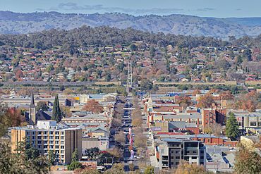
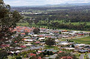
The city of Albury as seen from Monument Hill
|
|||||||||
| Established | 1839 1946 (city) |
||||||||
| Postcode(s) | 2640 (city & suburbs) 2641 (Lavington, Springdale Heights) |
||||||||
| Elevation | 165.0 m (541 ft) | ||||||||
| Time zone | AEST (UTC+10) | ||||||||
| • Summer (DST) | AEDT (UTC+11) | ||||||||
| Location |
|
||||||||
| LGA(s) | City of Albury | ||||||||
| County | Goulburn | ||||||||
| State electorate(s) | Albury | ||||||||
| Federal Division(s) | Farrer | ||||||||
|
|||||||||
Albury is a big city in the Murray region of New South Wales, Australia. It's part of a twin city called Albury-Wodonga. Albury sits on the Hume Highway and the northern side of the Murray River. It is the main town for the City of Albury council area. The city is right on the border between Victoria and New South Wales.
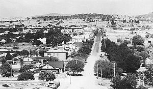
Albury has about 53,677 people living in its urban area. The Murray River separates it from its twin city, Wodonga, in Victoria. Together, these two cities form a larger urban area with almost 98,000 people. Albury is about 554 kilometers (344 miles) from Sydney. It is also 326 kilometers (203 miles) from Melbourne. The city was named after a village in England. It became an important transport link and was officially made a city in 1946.
Contents
History of Albury
The Wiradjuri people were the first known humans to live in the Albury area. They are an Indigenous Australian Aboriginal group. These skilled hunter-gatherers lived in family groups across central New South Wales. Today, many Wiradjuri groups live in towns like Condobolin and Narrandera.
Early European Exploration
Explorers Hume and Hovell reached the Murray River near Albury on November 16, 1824. They called the river the "Hume River." Later, in 1830, Captain Charles Sturt explored the same river further downstream. He named it the Murray River, not knowing it was the same one. Eventually, the name Murray became the official name. The Aboriginal name for the river was Millewa. A place to cross the river became popular near where Hume and Hovell first arrived. In summer, people could often cross the river on foot.
British Settlement Begins
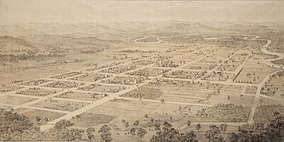
The first European settlers, known as squatters, arrived soon after the explorers. William Wyse and Charles Ebden were among the first to settle. The first buildings were a store and small huts. In 1838, a plan for a town was made. The surveyor suggested the Aboriginal name 'Bungambrawatha'. However, when the plan was approved in 1839, the name was changed to Albury. It is thought Albury was named after a village in Surrey, England. This English village had many mills and industries.
Albury as a Frontier Town
By 1847, Albury had two pubs, some huts, a police station, and a blacksmith. A log punt was set up in 1844 to help people cross the Murray River. The Albury Post Office opened in 1843. It closed briefly but reopened in 1847.
In 1851, Victoria became a separate colony from New South Wales. The Murray River became the border, making Albury a "frontier town." Trade with Melbourne grew, so the first bridge was built in 1860. Albury became a customs post between the two colonies. New South Wales had different trade rules.
Albury started to grow a lot. Many German-speaking immigrants came to grow grapes for wine. By the 1870s, the town had a butter factory, a flour mill, wineries, and local cider and soft drinks.
The railway line from Sydney reached Albury in 1881. A temporary wooden railway bridge connected it to Victoria's train network in 1883. New South Wales and Victoria used different track gauges for their trains. This meant passengers had to change trains at Albury. In 1962, a direct train line from Sydney to Melbourne was finally opened.
A school was running in Albury by 1848. In 1849, the first National School opened with 73 students. A new school was built in 1862. James Fallon, Albury's first mayor, helped fund a High School. Albury High School opened in 1927.
Albury in the 20th Century
In 1903, Albury was suggested as a possible location for Australia's national capital. However, most people in Albury did not support this idea. Eventually, Canberra was chosen as the capital.
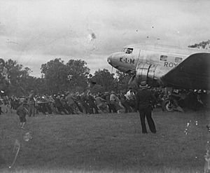
In 1934, a Douglas DC-2 plane called the "Uiver" made an emergency landing in Albury. It was lost during a big air race from London to Melbourne. The people of Albury used the town's lights to signal to the plane. Local residents used their car headlights to light up the racecourse as a runway. The "Uiver" landed safely. The next day, volunteers helped pull the plane out of the mud. It then took off and finished the race, coming in second overall.
Albury and Wodonga played a role in World War II. Military bases were set up nearby. In 1946, Albury became a city. After the war, Australia's first migrant centre opened near Albury in 1947. This centre helped new immigrants settle in Australia.
Since then, there have been efforts to join Albury and Wodonga into one city. In 1973, the government tried to make Albury-Wodonga a major inland city. They bought land and encouraged industries to move there. This led to some population growth.
Population of Albury
| Historical population | ||
|---|---|---|
| Year | Pop. | ±% |
| 1921 | 7,751 | — |
| 1933 | 10,543 | +36.0% |
| 1947 | 14,412 | +36.7% |
| 1954 | 16,726 | +16.1% |
| 1961 | 18,621 | +11.3% |
| 1966 | 23,379 | +25.6% |
| 1971 | 27,403 | +17.2% |
| 1976 | 31,954 | +16.6% |
| 1981 | 35,072 | +9.8% |
| 1986 | 37,164 | +6.0% |
| 1991 | 39,975 | +7.6% |
| 1996 | 41,491 | +3.8% |
| 2001 | 42,005 | +1.2% |
| 2006 | 43,787 | +4.2% |
| 2011 | 45,627 | +4.2% |
| 2016 | 47,974 | +5.1% |
| 2021 | 53,677 | +11.9% |
| Source: Australian Bureau of Statistics data. | ||
The 2021 census showed that 53,677 people lived in Albury.
- About 2.9% of the people were Aboriginal and Torres Strait Islander.
- Most people (81.2%) were born in Australia.
- Other common birthplaces included England (1.9%), India (1.2%), and New Zealand (1.0%).
- English was spoken at home by 86.0% of people.
- Other languages included Nepali (1.1%) and Punjabi (0.6%).
- For religion, 27.7% had no religion. Catholic was 25.4% and Anglican was 16.7%.
Climate and Geography
Albury is located on the flats of the Murray River. It sits at the base of the Great Dividing Range mountains. The city's airport is about 164 meters (538 feet) above sea level.
Albury's Climate
Albury has a mild, temperate climate. Winters are cool and damp, while summers are warm to hot and mostly dry. It has a humid subtropical climate (Cfa). It also has some features of a Mediterranean climate (Csa).
In summer, the average high temperature is 31°C (88°F). It can get hotter, with about 17 days above 35°C (95°F). Winters have average highs of 12°C (54°F) and are the wettest season. Albury has about 20 days a year with temperatures below freezing. Snow is very rare; the last big snowfall was in 1966. The highest temperature ever recorded was 46.1°C (115°F) in January 2020. The lowest was -4.0°C (25°F) in August 1994.
Albury gets about 699.1 mm (27.5 inches) of rain each year. Rain is heaviest in winter, especially in July and August. February is the driest month. The city gets a lot of sunshine, with about 108 clear days each year. Most clear days happen in summer and early autumn.
| Climate data for Albury (Hume Reservoir, 1922–2022, extremes 1965–2022); 184 m AMSL; 36.10° S, 147.03° E | |||||||||||||
|---|---|---|---|---|---|---|---|---|---|---|---|---|---|
| Month | Jan | Feb | Mar | Apr | May | Jun | Jul | Aug | Sep | Oct | Nov | Dec | Year |
| Record high °C (°F) | 45.5 (113.9) |
44.9 (112.8) |
39.2 (102.6) |
34.8 (94.6) |
28.2 (82.8) |
21.6 (70.9) |
21.3 (70.3) |
24.3 (75.7) |
29.8 (85.6) |
35.2 (95.4) |
40.5 (104.9) |
42.1 (107.8) |
45.5 (113.9) |
| Mean daily maximum °C (°F) | 30.9 (87.6) |
30.5 (86.9) |
27.1 (80.8) |
21.8 (71.2) |
16.8 (62.2) |
13.1 (55.6) |
12.3 (54.1) |
14.2 (57.6) |
17.4 (63.3) |
21.1 (70.0) |
25.1 (77.2) |
28.7 (83.7) |
21.6 (70.9) |
| Mean daily minimum °C (°F) | 16.7 (62.1) |
16.6 (61.9) |
13.9 (57.0) |
10.1 (50.2) |
7.0 (44.6) |
4.8 (40.6) |
4.1 (39.4) |
4.9 (40.8) |
6.7 (44.1) |
9.2 (48.6) |
11.8 (53.2) |
14.5 (58.1) |
10.0 (50.1) |
| Record low °C (°F) | 6.8 (44.2) |
6.7 (44.1) |
3.6 (38.5) |
1.1 (34.0) |
−1.7 (28.9) |
−2.7 (27.1) |
−2.8 (27.0) |
−2.3 (27.9) |
−1.8 (28.8) |
1.2 (34.2) |
2.8 (37.0) |
4.4 (39.9) |
−2.8 (27.0) |
| Average precipitation mm (inches) | 50.5 (1.99) |
42.1 (1.66) |
47.2 (1.86) |
51.8 (2.04) |
58.6 (2.31) |
67.5 (2.66) |
75.9 (2.99) |
75.9 (2.99) |
61.5 (2.42) |
67.7 (2.67) |
55.2 (2.17) |
49.3 (1.94) |
699.1 (27.52) |
| Average precipitation days (≥ 0.2 mm) | 5.6 | 5.3 | 5.8 | 7.2 | 10.3 | 12.6 | 14.4 | 13.8 | 11.2 | 10.2 | 8.2 | 6.7 | 111.3 |
| Mean monthly sunshine hours | 313.1 | 282.5 | 272.8 | 228.0 | 161.2 | 120.0 | 127.1 | 173.6 | 207.0 | 260.4 | 276.0 | 288.3 | 2,710 |
| Source 1: Bureau of Meteorology (Hume Reservoir, 1922–2022) | |||||||||||||
| Source 2: Rutherglen Research (sunshine hours, 1975–1998) | |||||||||||||
Albury Airport Weather (1993–2022)
The airport area is more sheltered than the reservoir. It usually has higher maximum temperatures. It also has lower minimum temperatures. The rainfall is generally less there.
| Climate data for Albury Airport AWS (1993–2022); 164 m AMSL; 36.07° S, 146.95° E | |||||||||||||
|---|---|---|---|---|---|---|---|---|---|---|---|---|---|
| Month | Jan | Feb | Mar | Apr | May | Jun | Jul | Aug | Sep | Oct | Nov | Dec | Year |
| Record high °C (°F) | 46.1 (115.0) |
44.8 (112.6) |
38.5 (101.3) |
34.6 (94.3) |
28.8 (83.8) |
21.8 (71.2) |
20.5 (68.9) |
24.3 (75.7) |
29.5 (85.1) |
36.0 (96.8) |
41.8 (107.2) |
43.2 (109.8) |
46.1 (115.0) |
| Mean daily maximum °C (°F) | 32.4 (90.3) |
31.1 (88.0) |
27.7 (81.9) |
22.6 (72.7) |
17.6 (63.7) |
14.0 (57.2) |
13.2 (55.8) |
14.9 (58.8) |
18.0 (64.4) |
21.9 (71.4) |
26.1 (79.0) |
29.5 (85.1) |
22.4 (72.4) |
| Mean daily minimum °C (°F) | 16.8 (62.2) |
16.2 (61.2) |
13.0 (55.4) |
8.5 (47.3) |
5.5 (41.9) |
3.7 (38.7) |
3.1 (37.6) |
3.6 (38.5) |
5.6 (42.1) |
8.2 (46.8) |
11.7 (53.1) |
14.0 (57.2) |
9.2 (48.5) |
| Record low °C (°F) | 6.0 (42.8) |
6.8 (44.2) |
4.3 (39.7) |
0.6 (33.1) |
−2.4 (27.7) |
−3.7 (25.3) |
−3.5 (25.7) |
−4.0 (24.8) |
−1.9 (28.6) |
−0.5 (31.1) |
2.4 (36.3) |
4.5 (40.1) |
−4.0 (24.8) |
| Average precipitation mm (inches) | 54.6 (2.15) |
42.5 (1.67) |
45.3 (1.78) |
40.6 (1.60) |
52.2 (2.06) |
62.0 (2.44) |
65.1 (2.56) |
66.6 (2.62) |
58.2 (2.29) |
52.3 (2.06) |
66.5 (2.62) |
41.9 (1.65) |
643.1 (25.32) |
| Average precipitation days (≥ 0.2 mm) | 6.2 | 5.1 | 5.4 | 6.2 | 9.7 | 14.2 | 16.3 | 14.0 | 10.7 | 8.4 | 8.3 | 6.5 | 111.0 |
| Average afternoon relative humidity (%) | 28 | 33 | 34 | 41 | 54 | 64 | 64 | 57 | 53 | 45 | 39 | 30 | 45 |
| Source: Bureau of Meteorology | |||||||||||||
Lake Hume's Impact
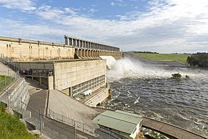
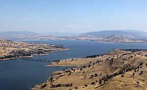
Lake Hume is on the Murray River, about 10 km (6 miles) upstream from Albury. The Hume Dam was built from 1919 to 1936. A power plant there makes 60 MW of electricity. When full, the lake covers 80 square kilometers (31 square miles).
The lake was made to help with irrigation for farms. It changed how the Murray River flows and affected its natural environment. Before the dam, the river flowed low in summer and high in spring. Now, it's often the opposite. Water released from the dam is also much colder than it should be. These changes have harmed native fish like the Murray Cod.
How Albury is Governed
| Mayor of Albury | |
|---|---|
|
Incumbent
Kevin Mack since 14 October 2024 |
|
| Style | Councillor |
| Member of | Albury City Council |
| Formation | 1859 |
| First holder | James T Fallon |
Albury is the biggest city in the area represented by the Farrer in the Australian Parliament. The current representative is Sussan Ley. In New South Wales state politics, Albury is represented by Justin Clancy.
The Albury City Council is in charge of local government. Its area has grown to include new housing estates. Amanda Duncan-Strelec was Albury's first female Mayor in 1995. The current mayor is Kevin Mack.
Albury has a long history with conservative politics. The Liberal Party of Australia held an important meeting in Albury in 1944. They agreed on how the party would be set up.
City Areas and Suburbs
Albury has several different areas and suburbs.
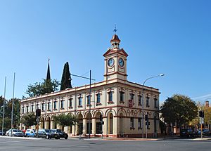
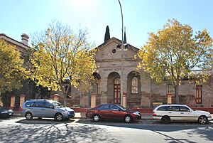
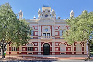
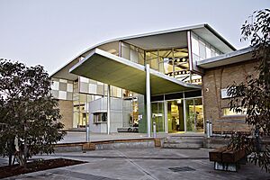
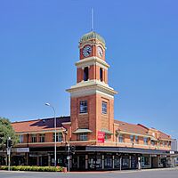
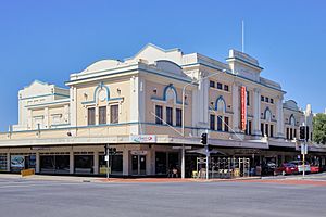
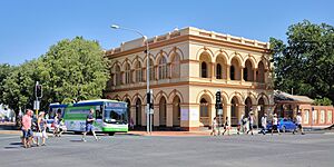
Central Albury is the main business area. It's located between the railway line, the Murray River, and Monument Hill. Dean Street is the main shopping and office street. There's a cultural area around QEII Square. This area includes the Albury Library Museum, Murray Art Museum Albury (MAMA), and the Albury Entertainment Centre. The Post Office, Police Station, and Courthouse are also here.
West Albury is mostly a residential area. It has the First World War Memorial, known as the Monument. The Albury Wodonga Private Hospital is also in West Albury. Part of this area used to be wetlands. Horseshoe Lagoon is a remaining wetland and a Wildlife Refuge.
East Albury is east of the railway line. Houses are on the eastern hill near the Albury Base Hospital. The flat land nearby has parks, houses, and light industries. The city airport is also in East Albury. Mungabareena Reserve is a special Aboriginal cultural site. Mungabareena means "place of plenty talk" in the Wiradjuri language.
South Albury has both homes and industrial areas. The land near the river is still used for farming. Work in the 1990s helped reduce the risk of flooding here.
North Albury used to have orchards and vineyards. After World War II, more houses were built. Waugh Road was extended to the "Five Ways" intersection. This intersection marks the border between North Albury and Lavington. Glenroy is next to North Albury and has public housing.
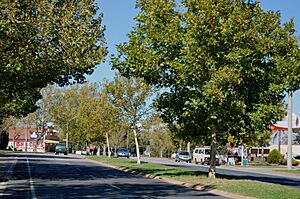
Lavington is Albury's largest suburb. It even has its own postcode (2641). It was first called Black Range. In 1910, it was renamed Lavington. It became part of the City of Albury in the 1950s. Housing and shops have continued to grow there. The Hume Highway used to go through Lavington. Now, a bypass has been built. Lavington includes Springdale Heights, Hamilton Valley, and Norris Park.
Thurgoona, east of Lavington, was built as a new residential suburb in the 1970s. A new campus of Charles Sturt University opened here in the 1990s. There is also a major golf club in Thurgoona.
Other nearby areas include Splitters Creek, Ettamogah (home of the Ettamogah Pub), Bowna, and Table Top. Howlong and Jindera are close towns that serve as places where people live and commute from.
Albury uses a special numbering system for houses. The city center, at Dean and Olive Streets, is number 500. Other houses are numbered based on their distance from this center.
Transportation in Albury
Road Travel
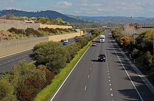
Albury is on the Hume Highway, a major road for travel between states. In 2007, a new section of the Hume Freeway bypassed the Albury city center. This bypass included the new Spirit of Progress Bridge over the Murray River. It was a very expensive road project for rural Australia.
The Hume Highway had to be moved when the Hume Dam was built. This happened between 1915 and 1933. Other important roads connected to Albury include the Riverina Highway and the Olympic Highway.
In 1888, the Smollett Street bridge was built. It is a rare example of a metal arch bridge in New South Wales. It is also the oldest of only two such bridges in the state.
Train Travel
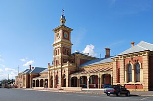
Albury railway station is on the main train line between Sydney and Melbourne. New South Wales and Victoria used to have different track gauges (the width between the train tracks). This meant passengers had to change trains at Albury. To handle this, a very long covered platform was built. It is one of the longest in Australia. Now, the tracks have been changed so trains can go directly from Melbourne to Sydney.
The different track gauges at Albury caused problems during both World Wars. Soldiers and supplies had to be moved from one train to another. Writer Mark Twain even wrote about how strange it was to change trains in Albury in 1895.
During World War II, military storage bases were set up near Albury. The railway station and its yards are important heritage sites.
Air Travel
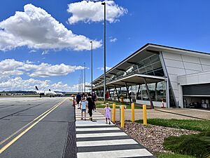
Albury Airport is owned by the City of Albury. It is the second busiest regional airport in New South Wales. About 280,000 passengers use it each year. The airport is 4 km (2.5 miles) east of the city center. It has daily flights to Sydney, Melbourne, and Brisbane. The road to the airport was named Borella Road in honor of war hero Albert Chalmers Borella.
Local Transport and Cycling
Local buses are run by private companies. Most people in Albury use private cars to get around. The Hume Freeway bypass has made traffic flow much better between Albury and Wodonga.
Albury has a good network of bicycle paths. You can ride to Thurgoona and across the border to Wodonga. New bike tracks have been built, including one to the Wonga Wetlands.
Industries in Albury
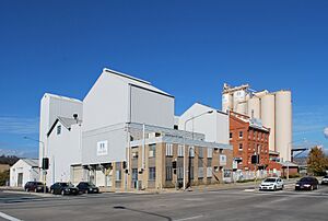
Albury is a center for the farming communities nearby. It is home to the Norske Skog newsprint paper mill. This mill processes pine logs from the eastern mountains. The Australian Taxation Office also has a major center here. Many other smaller industries operate in Albury. Other big employers include The Commercial Club Albury and Hume Bank.
DSI Holdings was once a major employer in Albury. It made gearboxes for car companies like Ford and Holden. At its busiest, it employed over 1,200 people. The company changed owners several times. In 2014, the factory closed, and 142 jobs were lost.
The Australian pizza chain Eagle Boys started in Albury. It stopped operating in 2017.
The Hume Power Station is a hydro-electric power station at the Hume Dam. It uses water to make electricity.
Tourism and Fun Things to Do
The area around Albury has many tourist attractions. You can visit the wine region around Rutherglen. There are also historic goldfield towns like Beechworth. You can go boating, fishing, and canoeing on the rivers and lakes, including Lake Hume. The mountains of the Great Dividing Range are also nearby. Further away are the snowfields of Falls Creek and Mount Hotham.
In Albury itself, Monument Hill is a great place to visit. It has the city's First World War Memorial and offers a good view of the city. Wonga Wetlands is west of the city. It's a special area with lagoons and billabongs. It's home to over 150 types of birds. The Aquatic Environment Education Centre is also there.
The Hume and Hovell Walking Track ends in South Albury. This track follows the route of explorers Hamilton Hume and William Hovell.
Education in Albury
Albury has a campus of Charles Sturt University in Thurgoona. It offers courses in Arts, Business, Education, Medicine, and Science.
The Albury-Wodonga campus of La Trobe University is also a growing school. It has thousands of students. Degrees in Business, Arts, Science, Nursing, and Health are available.
Riverina Institute of TAFE has a campus in Albury. There is also a medical school campus next to the Albury Base Hospital.
Albury has nine public primary schools and three public high schools. There are also several private high schools. The city is home to the NSW Department of Education's regional office.
Culture and Arts
HotHouse Theatre is Albury's only professional theatre company. It started in 1979 and helped create The Flying Fruit Fly Circus. HotHouse Theatre puts on many shows on Gateway Island.
Albury has many amateur theatre groups. They perform plays and musicals in various venues. The oldest is the Albury Wodonga Theatre Company.
Jazz Albury Wodonga hosts national and international jazz artists. Big music acts often perform at the Albury Entertainment Centre. Regent Cinemas on Dean Street have been open since 1929.
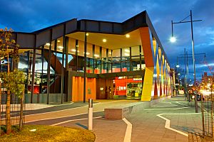
Since 2007, the city has hosted the annual Albury City Short Story Award. In 2015, the Murray Art Museum Albury (MAMA) opened. It has 10 galleries, twice the size of the old art center.
Albury has a sister city relationship with Nanping in China. This partnership started in 2003.
Media in Albury
Newspapers
Albury is a regional media center. The daily newspaper, The Border Mail, is printed in Wodonga. It has offices in both cities.
Television
Albury gets all the major TV networks. These include Seven, WIN Television (which shows Nine Network programs), and Network 10. You can also watch the Australian Broadcasting Corporation (ABC) and the Special Broadcasting Service (SBS).
Seven has a local news bulletin at 6 pm on weekdays. Network 10 shows short local news updates throughout the day. WIN Television broadcasts a regional news bulletin at 5:30 pm on weekdays.
In 2011, analogue television stopped broadcasting in Albury. All TV services now use digital signals.
Radio
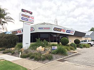
Albury has three commercial radio stations: 2AY (1494 AM), Triple M The Border (105.7 FM), and Hit The Border (104.9 FM). Hit 104.9 The Border broadcasts to many areas in Australia. Triple M 105.7 The Border also broadcasts to other local stations.
Albury and Wodonga share one radio market. This means ads are for both sides of the border. The ABC has local morning radio programs from its studios in Wodonga.
There is also a community radio station called 2REM 107.3 FM. It has many special programs, including shows for older people and different cultural groups. 2GHR 96.7 FM plays classic hits. Other stations include Oak 101.3 FM, KIX 801 AM (country music), and Sky Radio (sports and racing).
SBS Radio and Niche Radio offer multicultural programs. Religious stations like 98.5 The Light, Faith FM, and Vision Christian Radio also broadcast. Raw FM plays dance music on 107.9 FM.
Sports in Albury
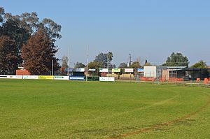
Even though Albury is in New South Wales, Australian rules football is very popular. There are five Australian rules clubs in Albury. The Albury Football Club, Lavington Panthers Football Club, and North Albury Football Club play in the Ovens & Murray Football League. Many players from Albury have gone on to play in the Australian Football League. These include Haydn Bunton Senior, a famous player who won three Brownlow Medals.
Football (soccer) is also very popular. More than 2,500 players are in local clubs. Murray United Football Club plays in the highest level of football in the area. In 2014, Melbourne City played a game against Perth Glory at the Lavington Sports Ground.
Albury has a strong rugby league community. The Albury Thunder team plays in the Group 9 Rugby League competition. Albury has produced many great rugby league players, like Adrian Purtell and Dylan Edwards.
The Albury-Wodonga Steamers are the local rugby union club. They play in the Southern Inland Rugby Union competition.
Cricket is the most popular summer sport. The Lavington Sports Ground hosted Albury's only international cricket match in 1992. Zimbabwe beat England in a big upset. Albury also hosts Big Bash League matches.
The Albury Wodonga Bandits play basketball in the South East Australian Basketball League (SEABL). They play their home games at the Lauren Jackson Sports Centre.
The Albury Gold Cup horse race is a big event in autumn. In 2005, over 18,600 people attended.
Albury is also strong in junior hockey. The town has the Albury Grass Tennis Courts. The Supercars Championship team Brad Jones Racing is based in Albury.
Albury is the birthplace of famous tennis player Margaret Court. She won 62 Grand Slam titles. Other famous athletes from Albury include basketball player Lauren Jackson and cricketer Steve Rixon.
Heritage Buildings
Many buildings and structures in Albury are listed as important heritage sites. This means they are protected because of their historical value.
| Building name | Completed | Heritage register(s) | Notes |
|---|---|---|---|
| ANZ Bank (former) | c. 1907 | (now defunct) Register of the National Estate (RNE) | Designed by G C Inskip; built by Frew & Logan |
| Bellevue Home | c. 1860 | (now defunct) RNE | |
| Bethanga Bridge | 1927–30 | ||
| Bonegilla House (Grace-evelyn Lodge) |
mid-Victorian | New South Wales State Heritage Register | 587 Kiewa Street |
| Burrows House | c. 1860 | (now defunct) RNE | |
| The Carriageway | c. 1860 | New South Wales State Heritage Register | 506–508 Smollet Street |
| CML Building | c. 1925 | (now defunct) RNE | |
| Commercial Hotel and Cottage (formerly Waterstreet Hotel) |
c. 1854 | New South Wales State Heritage Register | 430–436 Smollett Street |
| Court House | 1860 | (now defunct) RNE | Designed by Alexander Dawson |
| Elm Court | c. 1885 | New South Wales State Heritage Register | 435 Townsend Street |
| Headmaster's Cottage | c. 1861 | (now defunct) RNE | Kiewa Street |
| Model Store | Federation | New South Wales State Heritage Register | 582 David Street |
| New Albury Hotel | 1939 | New South Wales State Heritage Register | 491 Kiewa Street |
| Post Office | c. 1880 |
|
570 Dean Street; Designed by James Barnet |
| Public School | c. 1881 | (now defunct) RNE | Designed by W. E. Kemp |
| Albury railway station, Stationmaster's Residence, and associated yards |
1881 |
|
|
| Albury-Wodonga Railway Bridge | 1883–84 | New South Wales State Heritage Register | Designed by John Whitton |
| Reid's Butcher Shop | unknown | New South Wales State Heritage Register | 462 Guinea Street |
| S M Abichair Haberdashery Store | c. 1917 | (now defunct) RNE | |
| Soden's Hotel Australia | c. 1855 | (now defunct) RNE | |
| T&G Building | c. 1935 | (now defunct) RNE | Border Mail 31 January 1939 buildings purchased by anonymous, possibly
T & G. |
| Technical College (formerly Telegraph Office) |
c. 1885 |
|
502 Dean Street |
| Town Hall | c. 1907 | (now defunct) RNE | |
| Turk's Head Museum (formerly Turk's Head Hotel) |
c. 1860–70 | (now defunct) RNE | |
| Uiver Collection | 1934 | New South Wales State Heritage Register | 553 Kiewa Street; a collection of ephemera relating to the flight of the Uiver in the MacRobertson International Centenary Air Race of 1934 |
Notable People from Albury
- Damien Brown (mixed martial artist)
- Haydn Bunton Sr., Australian Football Hall of Fame Legend
- William Carter (actor)
- Margaret Court (tennis player)
- Daniel Cross (Australian rules footbller)
- W.A. Crowle (businessman and philanthropist)
- Ben Doolan (Australian rules footballer)
- Dylan Edwards (rugby league player)
- Alexander England (actor)
- Carly Findlay (writer and activist)
- Dianne Fromholtz (tennis player)
- Reg Gleeson (Australian rules footballer)
- Dick Grimmond (Australian rules footballer)
- Ross Henshaw (Australian rules footballer)
- Zarlie Goldsworthy (Australian rules footballer)
- Lisa Ho (fashion designer)
- Matt Holmes (actor)
- Noel Hodda (actor)
- Lauren Jackson (basketball player)
- Hayley Jensen (singer)
- Brad Jones (racing driver)
- Lee Kernaghan (singer and 2008 Australian of the Year)
- Tania Kernaghan (singer)
- Brett Kirk (Australian rules footballer)
- Maggie Kirkpatrick (actress)
- Jacob Koschitzke (Australian rules footballer)
- Justin Koschitzke (Australian rules footballer)
- Brian Leahy, Australian rules footballer
- Lee'Mon (singer)
- Ken Maynard (cartoonist of Ettamogah Pub)
- Malcolm McEachern (singer)
- Anthony Miles (Australian rules footballer)
- Lisa Mitchell (singer)
- Adam Nable (rugby league player)
- Matt Nable (rugby league player)
- Ellie Pashley (runner)
- Gabriella Pound (Australian rules footballer)
- Adrian Purtell (rugby league player)
- David Reynolds (racing driver)
- Richard Roxburgh (actor)
- Dr 'Paddy' Ryan (priest)
- Will Setterfield (Australian rules footballer)
- Charlie Spargo (Australian rules footballer)
- Geoff Strang (Australian rules footballer)
- Paul Spargo (Australian rules footballer)
- Clementine Stoney (Olympic swimmer)
- Terry Underwood (author)
- Charles Waterstreet (barrister and author)
- Bill Wood (Australian rules footballer)
See also
 In Spanish: Albury para niños
 | Dorothy Vaughan |
 | Charles Henry Turner |
 | Hildrus Poindexter |
 | Henry Cecil McBay |


