Alfreton facts for kids
Quick facts for kids Alfreton |
|
|---|---|
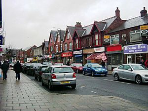 High Street, Alfreton (2007) |
|
| Area | 1.765 sq mi (4.57 km2) |
| Population | 24,302 (2023) |
| • Density | 13,769/sq mi (5,316/km2) |
| OS grid reference | SK414558 |
| • London | 122.5 mi (197.1 km) |
| Civil parish |
|
| District |
|
| Shire county | |
| Region | |
| Country | England |
| Sovereign state | United Kingdom |
| Post town | ALFRETON |
| Postcode district | DE55 |
| Dialling code | 01773 |
| Police | Derbyshire |
| Fire | Derbyshire |
| Ambulance | East Midlands |
| EU Parliament | East Midlands |
| UK Parliament | |
| Website | Alfreton Town Council |
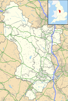
Alfreton is a town in Derbyshire, England. It is located in the Amber Valley area. The town used to be a Norman Manor and later an Urban District. In 2021, about 8,799 people lived in the Alfreton parish. If you include nearby villages like Ironville, Riddings, Somercotes and Swanwick, the population was around 24,476 in 2001.
Contents
History of Alfreton
How Alfreton Got Its Name
People say that Alfreton was started by King Alfred. Its name might come from him. The town's name has been written in different ways over time. For example, it was called 'Elstretune' in the Domesday Book. The oldest record seems to be from the year 1004. It was in the will of Wulfric Spott, who started Burton Abbey. He left 'Aelfredingtune' in his will, which means 'Alfred's farmstead'. This is thought to be Alfreton. But there is no clear proof that this Alfred was the famous king.
Early Settlements and Roman Roads
To the southwest, near Pentrich, there was a Roman fortlet. This fortlet was on a main road called Ryknield Street. Another Roman road, Lilley Street, went from there to the south end of Alfreton. This suggests that people lived in the area many centuries before King Alfred's time.
Growth of the Town Centre
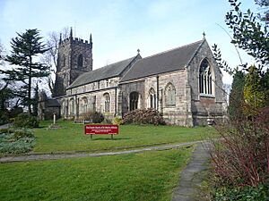
The first settlement was at the top of King Street hill. This is where the original market place grew. There was also an old meeting hall called the 'Moot Hall' on the hilltop until 1914. Many inns opened over the years, and some are still there today. To the west was a manor house. The nearby Church of St. Martin has parts that are from the year 1200.
The Manor of Alfreton
The Alfreton manor covered lands to the south and east. These included the areas of Somercotes, Swanwick, Riddings, and Ironville. The first Lord of the Manor was Earl Roger de Busli. He gave the job to Baron Ralf Ingram. The position was passed down through families, gifts, and sales for centuries. The last Lord of Alfreton was William Palmer-Morewood, who died in 1957.
Mining and Iron Working
In the Middle Ages, farming was the main way people made a living. But there was a lot of coal and ironstone nearby. This meant that mining and iron-working became very important. In some parts of the manor, coal was so close to the surface that farmers would hit it when ploughing. Many small mines started up.
Coal pits grew all over the Manor. Those in Swanwick and Alfreton produced the most coal. Alfreton colliery was to the northeast of the town. Making ropes was also important for this industry. The area became known for its good quality ropes. In the 1700s, Alfreton was the main coal mining centre in Derbyshire. It was also the third-largest town in the county. The mines closed in the late 1960s. Their sites have since been used for other buildings.
Local iron working started in the low-lying land south of the town. A dam was built there to power a water mill. This was a small operation. It wasn't until the 1700s that iron working became a big business. This was mainly in Riddings and Butterley, south and southeast of the manor.
Population Growth and New Industries
These industries helped the area become rich. They brought many workers in the 1800s. This made the local population grow very quickly. The many brick houses you see today were built during this time. Brickmaking and tilemaking were also big local industries. Bootmaking, repairing, and leather tanning also employed many people. This was because of the need for shoes in these heavy industries.
In 1801, about 2,301 people lived in the area. By 1931, this number grew to 21,232. It has stayed around that number ever since. After the mines and Riddings Ironworks closed in the 1960s, jobs changed. People started working in factories, shops, and service jobs. Many of these new businesses are on industrial estates. These estates were built on land where old mines used to be.
Transport Development
Transport in the area improved a lot, just like elsewhere in England. Roads got much better from the late 1700s. Laws were passed to build 'turnpike' roads. These roads had tolls to pay for their upkeep. This gave Alfreton good road links to Derby, Nottingham, Mansfield, Chesterfield, and the High Peak.
The town became a place where stagecoaches stopped. This explains why there were so many inns near the market place. Turnpike companies had to put up milestones. This led to a special cast-iron marker in Alfreton. It is on the town crossroads and says 'Alfreton 0 Miles'.
Around the same time, canals were built. These helped the coal and iron industries. The Cromford Canal, built in 1793, had a very long tunnel. In the 1800s, railways started to take over from coaches and canals. Railways were built east of the town. They also ran along the eastern and southern edges of the old manor.
Rail transport slowed down in the 1960s. Alfreton station closed because of the Beeching cuts. But it reopened in May 1973.
Important Buildings
Alfreton Hall was built around 1750. It was the next manor house after the first one. A new part was added around 1850. Today, it is a place for meetings and a restaurant. Alfreton House, near the High Street, is from about 1650. The Town Council now uses it.
The old George Inn at the top of King Street is from the 1700s. It was used for meetings by the local Turnpike Trust. It was also a place for court hearings. On the west side of the southern entrance to Alfreton is a small, unique stone-roofed building. It is called the 'House of Confinement'. This was built in the 1840s and was the local jail.
There are also several churches. The oldest is St. Martin's at the west end of the town. Parts of it are from the year 1200. Beyond the town, but still in the old Manor, are other important places. These include Carnfield Hall (from the 1400s, now a home and event place), Riddings House (now a nursing home), Swanwick Hall (around 1772, now a school), Swanwick Old Hall (1678, a private home), The Hayes (around 1860, now a conference centre), Newlands House (1800s, now flats), and the Jessop Monument (1854) in Ironville.
Economy of Alfreton
Main Industries
In the past, the main industry in Alfreton was coal mining. But after the mines closed in the 1960s, things changed. Now, the town focuses on light industry, storage, shops, and services. Many jobs in Alfreton are in health, education, and fun activities. Some farming still happens, but it is less common now.
Shopping and Services
Alfreton town centre has many well-known shops. It also has local businesses and charity shops. A large Tesco supermarket is a main feature. There are banks, building societies, and real estate agents. You can find an indoor market, a library, two post offices, and many pubs and places to eat.
Leisure and Recreation
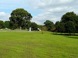
The town has a health centre, a leisure centre, and a swimming pool. There is also a park at the west end of town. A golf course is located just outside the town to the west.
Local Companies
Some famous companies are based in Alfreton. These include the chocolate company Thorntons. The women's fashion company David Nieper is also here. Rock Fall, which makes safety footwear, is another local business.
Transport in Alfreton
Roads and Buses
Alfreton has a busy road network. The main roads are the A61 and A38. The A38 connects to junction 28 of the M1 motorway, which is nearby. The town became a hub for bus transport in the 1900s. It still has many bus services today.
Railway Station
Alfreton's railway station is northeast of the town. It closed in 1967 as part of the Beeching Axe. This was a plan to cut many railway lines. But in 1973, a station opened again on the same site. It was called Alfreton and Mansfield Parkway. This was because the nearby town of Mansfield did not have its own station then. When Mansfield got its own station back in the 1990s, Alfreton's station name went back to just Alfreton.
Since May 2021, the station no longer has direct trains to and from London. However, there is a campaign to bring some back. The Town Council supports this effort. Trains run every hour to Liverpool and Norwich. There are also services between Leeds and Nottingham.
Geography of Alfreton
Alfreton is about 2.45 miles (3.94 km) from the border with Nottinghamshire. It is near the towns of Kirkby-in-Ashfield (5 miles or 8.0 km away), Sutton-in-Ashfield (5.09 miles or 8.19 km away), and Mansfield (8.3 miles or 13.4 km away). The towns of Clay Cross (4.95 miles or 7.97 km away) and Ripley (3.38 miles or 5.44 km away) are also close by. Chesterfield is 9.66 miles (15.55 km) north of Alfreton.
 |
Bakewell | Clay Cross, Chesterfield, Sheffield | Mansfield |  |
| Matlock | South Normanton, Pinxton, Sutton in Ashfield, | |||
| Belper, Derby | Ripley, Derbyshire | Heanor, Nottingham |
Education in Alfreton
Local Schools
The main secondary school in Alfreton is David Nieper Academy. For many years before September 2008, it was known as Mortimer Wilson School. In September 2017, it became David Nieper Academy. This happened after the clothing company David Nieper took it over.
There are two schools for younger children aged 4–6. These are Copthorne Infant School and Croft Infant School. Leys Junior School, on Flowery Leys Lane, and Woodbridge Junior school, on Grange Street, are for children aged 7–11.
There is also a Roman Catholic school called Christ the King on Firs Avenue. It is for children aged 4–11. It also has a nursery for children aged 2–4.
Media in Alfreton
Television and Radio
Local news and TV shows for Alfreton come from BBC East Midlands and BBC Yorkshire on BBC One. They also come from ITV Central and ITV Yorkshire on ITV1. TV signals are received from either the Waltham or Emley Moor TV transmitters.
Local radio stations include BBC Radio Derby, Smooth East Midlands, Capital East Midlands, Greatest Hits Radio Yorkshire (which used to be Peak FM), and Amber Sound FM. Amber Sound FM is a local community radio station.
Newspaper
The local newspaper for the town is the Derbyshire Times.
Sport & Leisure in Alfreton
Football
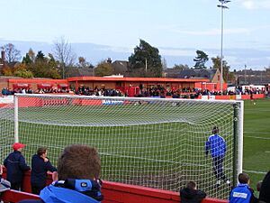
The local football team is Alfreton Town. Their home ground is The Impact Arena on North Street. They play in the National League North. This is the sixth level of English football.
Cricket
Alfreton Cricket Club is an English amateur cricket club. It was started in 1927. The club's ground is in Alfreton Park on Wingfield Road. Alfreton CC has two senior teams that play on Saturdays. They compete in the Derbyshire County Cricket League. There is also a Women's Softball team that plays in the East Midlands Women’s Cricket League. The club has a junior training section too. They play competitive cricket in the Notts & Derby Border Youth Cricket League.
Cycling
Alfreton has an active cycling club. They organize many Audax events. These are long-distance cycling events.
Air Training Corps
Alfreton is home to 1401 (Alfreton and Ripley) Squadron of the Air Training Corps. This is a youth organization for young people interested in aviation.
Wrestling
Professional wrestling shows were often held in Alfreton. Famous British wrestlers like Big Daddy, Jackie Pallo, and Blackjack Mulligan performed here.
Notable residents
- William Carter, born in 1830, started The William Carter Company in Needham Heights, Massachusetts (USA). He moved to Needham in 1854 and built a factory to make children's clothing.
- Benjamin Outram, a civil engineer, was born in Alfreton in 1764.
- Robert Watchorn moved to America through Castle Garden. He worked as the US Commissioner of Immigration at Ellis Island from 1905 to 1909. Later, he was a vice president at the Union Oil Company. He helped Alfreton a lot after the First World War. In 1927, the Watchorn Memorial Primitive Church was built. Later, a school, a house for a minister, and cottages were also built, all to remember his mother. A sports ground and pavilion were given to remember his son. He also had the Lincoln Library built, which is now a Masonic Hall.
- Norman Whitehead (1915–1983) was born in the area. He painted a lot there during the 1930s.
- James Young got a patent to get oil from coal. He did this while working in Alfreton in 1848.
- John Schakspere, a butcher, lived in Alfreton in 1421.
See also
 In Spanish: Alfreton para niños
 | John T. Biggers |
 | Thomas Blackshear |
 | Mark Bradford |
 | Beverly Buchanan |


