Ivory Coast facts for kids
Quick facts for kids
Republic of Côte d'Ivoire
|
|
|---|---|
|
|
|
|
Anthem: L'Abidjanaise
("Song of Abidjan") |
|
 |
|
| Capital | Yamoussoukro 6°51′N 5°18′W / 6.850°N 5.300°W |
| Largest city | Abidjan |
| Official languages | French |
| Vernacular languages |
|
| Ethnic groups
(2021 census)
|
|
| Demonym(s) |
|
| Government | Unitary presidential republic |
| Alassane Ouattara | |
|
• Vice President
|
Tiémoko Meyliet Koné |
| Robert Beugré Mambé | |
| Legislature | Parliament of Ivory Coast |
| Senate | |
| National Assembly | |
| History | |
|
• Republic established
|
4 December 1958 |
|
• Independence from France
|
7 August 1960 |
| Area | |
|
• Total
|
322,462 km2 (124,503 sq mi) (68th) |
|
• Water (%)
|
1.4 |
| Population | |
|
• July 2023 estimate
|
30,900,000 (49th) |
|
• December 2021 census
|
29,389,150 |
|
• Density
|
91.1/km2 (235.9/sq mi) (139th) |
| GDP (PPP) | 2023 estimate |
|
• Total
|
|
|
• Per capita
|
|
| GDP (nominal) | 2023 estimate |
|
• Total
|
|
|
• Per capita
|
|
| Gini (2021) | ▼ 35.3 medium |
| HDI (2022) | low · 166th |
| Currency | West African CFA franc (XOF) |
| Time zone | UTC±00:00 (GMT) |
| Date format | dd/mm/yyyy |
| Driving side | right |
| Calling code | +225 |
| ISO 3166 code | CI |
| Internet TLD | .ci |
|
|
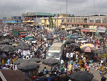
Ivory Coast, also called Côte d'Ivoire (say: KOHT dee-VWAR), is a country in West Africa. It's located on the southern coast. Its capital city is Yamoussoukro, in the center of the country. The biggest city and economic hub is Abidjan, a port city.
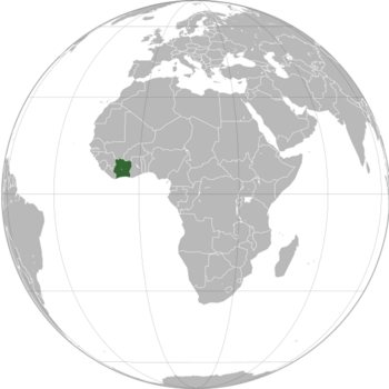
Ivory Coast shares borders with Guinea and Mali to the northwest. It borders Liberia to the west and Burkina Faso to the northeast. To the east is Ghana, and to the south is the Atlantic Ocean. In 2023, about 30.9 million people lived here. This makes it the third-most populated country in West Africa.
The official language is French. Many local languages are also spoken. These include Bété, Baoulé, and Dyula. In total, there are around 78 different languages. The country has many religions. People follow Islam, Christianity, and traditional African faiths.
Ivory Coast is a republic. Its president holds a lot of power. In the 1960s and 1970s, it was a strong economy in West Africa. This was thanks to its coffee and cocoa production. The country faced economic problems in the 1980s. This led to a time of political and social unrest until 2011.
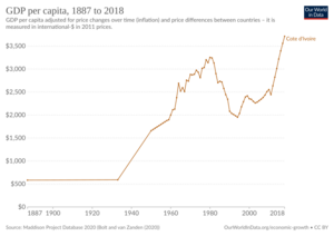
Since 2011, Ivory Coast has seen strong economic growth. From 2012 to 2023, its economy grew by about 7.1% each year. This was one of the fastest growth rates in Africa. In 2023, it had the second-highest GDP per person in West Africa. However, in 2016, nearly half the population (46.1%) still faced multidimensional poverty. In 2020, Ivory Coast was the world's top exporter of cocoa beans. Its economy still relies a lot on farming.
Contents
What's in a Name?
The name "Ivory Coast" comes from a long time ago. In the 15th and 16th centuries, European traders explored West Africa. They divided the coast into different "coasts." These names showed what resources were found there. There was a "Pepper Coast" and a "Gold Coast."
The French called this area Côte d'Ivoire. The Portuguese called it Costa do Marfim. Both names mean "Coast of Ivory." This name came from the main trade happening there: the export of ivory. Ivory is a material from elephant tusks.
Other old names for the area also related to ivory. These included Côte de Dents, meaning "Coast of Teeth." In the 19th century, the name Côte d'Ivoire became common.
The modern country's coastline is not exactly the same as the old "Ivory Coast." That old area stretched further. But the name stuck through French rule and after independence in 1960. In 1986, the government asked that its name, Côte d'Ivoire, not be translated. They wanted it used as is in all international dealings. Still, many English-speaking countries often use "Ivory Coast."
A Look Back: History of Ivory Coast
Early Human Life
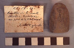
It's hard to find very old human remains in Ivory Coast. This is because the humid climate doesn't preserve them well. But, new discoveries of tools and weapon pieces have been made. These suggest that many people lived here a very long time ago. This could have been during the Upper Paleolithic period (15,000 to 10,000 BC).
The first known people in Ivory Coast left traces all over the land. Historians believe these early groups were either moved or joined with the ancestors of today's people. These ancestors moved south into the area before the 16th century.
Empires and Islam
The first written history comes from North African traders. From ancient Roman times, they traded across the Sahara desert. They exchanged salt, slaves, gold, and other goods. The main trading spots were at the edge of the desert. From there, trade reached as far south as the rainforest.
Important trading cities like Djenné and Timbuctu grew into big centers. Around these centers, large Sudanic empires developed. These empires controlled trade routes with strong armies. They also became places for Islamic learning. Islam spread into the northern parts of what is now Ivory Coast from the 11th century.
The Ghana Empire was the first of these empires. It was powerful between the 4th and 13th centuries. After Ghana, the Mali Empire became a strong Muslim state. Its power was greatest in the early 14th century. The Mali Empire's reach in Ivory Coast was only in the northwest.
Later, the Songhai Empire grew. But it also weakened due to internal problems. These problems caused many people to move south towards the forest. The thick rainforest in the south made it hard for large political groups to form. People lived in small villages. They farmed and hunted for food.
Kingdoms Before Europeans Arrived
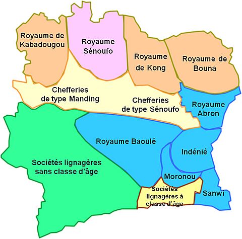
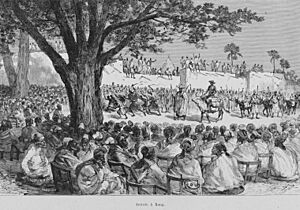
Five important kingdoms existed in Ivory Coast before Europeans arrived. The Muslim Kong Empire was founded in the early 18th century. It became a rich center for farming, trade, and crafts. But different ethnic groups and religious disagreements weakened it. In 1895, Samori Ture conquered Kong.
The Abron kingdom of Gyaaman was set up in the 17th century. The Abron people had moved from the developing Ashanti kingdom in Ghana. Their city, Bondoukou, became a major trading and Islamic center. Its Quranic scholars attracted students from all over West Africa.
In the mid-17th century, other Akan groups formed kingdoms. These included the Baoulé kingdom and two Agni kingdoms. The Baoulé had a strong government. But it later broke into smaller chiefdoms. Even so, the Baoulé strongly fought against French rule.
French Rule Begins
Ivory Coast did not suffer as much from the Atlantic slave trade as other areas. European slave ships preferred other parts of the coast. The first French settlement in West Africa was in Senegal in the mid-17th century. A French mission was set up in 1687 near the border with Ghana.
The French were not firmly established in Ivory Coast until the mid-19th century. In 1843–44, French Admiral Louis Édouard Bouët-Willaumez signed treaties. These made the regions of Grand-Bassam and Assinie French protectorates. French explorers and soldiers slowly expanded French control inland. It took until 1915 to fully bring the area under control.
The French wanted to increase trade. They also wanted to stop the British from gaining too much influence. After France lost a war in 1871, the government pulled back its soldiers. They left the trading posts to merchants. But in 1886, France took direct control again. They started exploring the interior more quickly. By 1887, French explorers had signed treaties. These created French protectorates in Ivory Coast.
French Colonial Era
By the late 1880s, France controlled the coastal areas. In 1889, Britain agreed to French control. In 1893, Ivory Coast became a French colony. Its capital was Grand-Bassam. France wanted to boost exports. So, coffee, cocoa, and palm oil crops were planted. Ivory Coast had many European settlers. They owned a lot of the plantations. They also used a system of forced labor.
African people resisted French control. One strong leader was Samori Ture. He built the Wassoulou Empire in the 1880s and 1890s. His army was large and well-equipped. It could even make and fix its own guns. France fought against Ture. He was captured in 1898, and his empire ended.
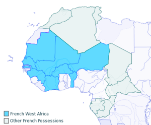
In 1900, France introduced a head tax. This was to pay for public projects. Many Ivorians saw this as unfair. In 1905, France officially ended slavery in most of French West Africa. From 1904 to 1958, Ivory Coast was part of French West Africa. During World War I, Ivorians fought for France.
French colonial policy aimed to make Africans more like the French. This meant spreading the French language, laws, and customs. But it also meant different rules for French people and Africans. Africans were called "subjects" and had no political rights. They were forced to work in mines and on plantations. They also had to serve in the military.
During World War II, France's government changed. After the war, big reforms happened in 1946. All African "subjects" were given French citizenship. They could now form political groups. And forced labor was abolished.
Until 1958, governors from Paris ruled Ivory Coast. They used a direct system. This gave Ivorians little say in decisions. Educated Ivorians hoped to gain equality by becoming more like the French. But they soon realized that true equality and an end to unfair treatment would only come with independence.
Independence and Beyond
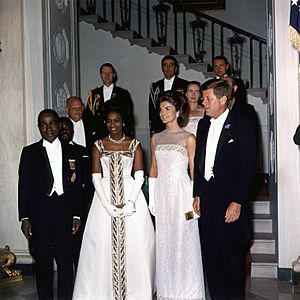
Félix Houphouët-Boigny is known as the father of Ivory Coast's independence. In 1944, he started the first trade union for African cocoa farmers. He was upset that French plantation owners were favored. His union helped farmers work together. Houphouët-Boigny quickly became important. He was elected to the French Parliament. A year later, France ended forced labor.
Houphouët-Boigny built a strong relationship with the French government. He believed Ivory Coast would benefit from this, and it did for many years. France made him a minister, the first African to hold such a position in a European government.
In 1956, a new law gave more power to local governments in French West Africa. On December 4, 1958, Ivory Coast became an independent member of the French Community.
By 1960, Ivory Coast was the richest country in French West Africa. It produced over 40% of the region's total exports. When Houphouët-Boigny became the first president, his government paid farmers good prices for their crops. This encouraged more production. Many workers from nearby countries also moved to Ivory Coast.
Coffee production grew a lot. Ivory Coast became the world's third-largest producer. By 1979, it was the world's top cocoa producer. It also became Africa's top exporter of pineapples and palm oil. French experts helped with this "Ivorian miracle." Unlike other African nations, Europeans moved into Ivory Coast after independence. The French population grew from 30,000 to 60,000 by 1980. Most were teachers, managers, and advisors. For 20 years, the economy grew by almost 10% each year. This was the highest rate among African countries not exporting oil.
Félix Houphouët-Boigny led the country until 1993. Ivory Coast was quite stable compared to its neighbors. It had strong ties with other West African countries and with Western nations, especially France. But its stability was broken by a coup in 1999. Then came two civil wars: from 2002 to 2007 and again from 2010 to 2011. A new constitution was adopted in 2016.
How Ivory Coast is Governed
The government has three main parts: the executive (President), legislative (Parliament), and judicial (courts). The Parliament of Ivory Coast has two parts: the Senate and the National Assembly. Members of the National Assembly are elected for five-year terms.
Since 1983, Yamoussoukro has been the capital city. But Abidjan is still the main administrative center. Most countries keep their embassies in Abidjan.
After fighting mostly ended in 2004, the country was still divided. The north was controlled by a group called the New Forces. A new presidential election was planned for 2005. But it was delayed until November 2010.
The elections finally happened in 2010. The first round was peaceful and seen as fair. In the second round, Laurent Gbagbo ran against former Prime Minister Alassane Ouattara. On December 2, the Electoral Commission announced that Ouattara had won. But the Constitutional Council, which supported Gbagbo, rejected this. The government then closed the country's borders.
President Alassane Ouattara has led the country since 2010. He was re-elected for a third term in November 2020. This election was boycotted by some opposition leaders. The current government has been in power since April 2022.
Regions and Cities
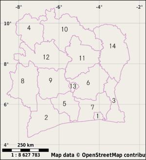
Since 2011, Ivory Coast has been divided into 12 districts. There are also two special autonomous cities that act like districts. These districts are then split into 31 regions. Regions are divided into 108 departments. And departments are divided into 510 sub-prefectures. Some villages are grouped into communes. The autonomous districts have departments, sub-prefectures, and communes, but no regions.
The capital city, Yamoussoukro, is one of the autonomous districts. The largest city, Abidjan, is the other autonomous district.
Largest Cities in Ivory Coast
Template:Largest cities of Ivory Coast
Geography and Nature
Ivory Coast is in western sub-Saharan Africa. It borders Liberia and Guinea to the west. To the north are Mali and Burkina Faso. Ghana is to the east, and the Gulf of Guinea (Atlantic Ocean) is to the south. The country is located between 4° and 11°N latitude and 2° and 9°W longitude.
About 64.8% of the land is used for farming. This includes land for crops, pastures, and permanent crops like fruit trees. One major problem the country faces is water pollution.
Amazing Wildlife and Plants
Ivory Coast is home to over 1,200 animal species. This includes 223 types of mammals, 702 birds, and 161 reptiles. There are also 85 amphibians and 111 kinds of fish. Plus, there are 4,700 plant species. It has the most different types of plants and animals in West Africa. Most of its wildlife lives in the country's rugged interior.
The nation has nine national parks. The biggest is Assagny National Park. It covers about 17,000 hectares (42,000 acres). In 2018, Ivory Coast's forests were ranked 143rd globally for their health.
Economy and Jobs
Ivory Coast has a relatively good income per person for its region. It also plays a key role in trade for nearby countries that don't have a coast. However, in 2016, 46.1% of the population still faced multidimensional poverty. The country has the largest economy in the West African Economic and Monetary Union. It makes up 40% of the union's total economy. Ivory Coast is the fourth-largest exporter of goods in sub-Saharan Africa.
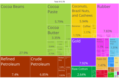
The country is the world's largest exporter of cocoa beans. In 2009, cocoa farmers earned $2.53 billion from exports. Ivory Coast also has many rubber farmers.
Close ties to France since independence in 1960 have helped economic growth. Also, selling many different types of farm products and encouraging foreign investment helped. Recently, Ivory Coast has faced more competition. Prices for its main crops, coffee and cocoa, have fallen. This, along with corruption, makes life hard for farmers and workers. There have been reports of people being forced to work without pay in cocoa and coffee production.
Ivory Coast's economy has grown faster than most other African countries since independence. One reason might be how it taxes exported farm goods. Unlike some other countries, Ivory Coast did not put very high taxes on these exports. This helped its economy do well.
In 2009, about 7.5 million people were part of the workforce. The job market faced problems in the early 2000s. Many companies closed or moved. This was especially true in tourism, transit, and banking. Rising unemployment was a big issue. In 2012, unemployment reached 9.4%. To help, the government encouraged people to start their own small businesses. This policy led to strong growth in self-employment.
People and Culture
| Historical population | ||
|---|---|---|
| Year | Pop. | ±% p.a. |
| 1960 | 3,709,000 | — |
| 1975 | 6,709,600 | +4.08% |
| 1988 | 10,815,694 | +3.78% |
| 1998 | 15,366,672 | +3.32% |
| 2014 | 22,671,331 | +2.56% |
| 2021 | 29,389,150 | +3.48% |
| Source: 1960 UN estimate, 1975–1998 censuses, 2014 census, 2021 census. | ||
In 2021, the population was 29,389,150. This was up from 22,671,331 in 2014. The first national count in 1975 found 6.7 million people. In 2021, women had about 4.3 children on average. This was down from 5.0 children per woman in 2012.
Languages Spoken
About 78 languages are spoken in Ivory Coast. French is the official language. It is taught in schools and used for communication across different groups. A special kind of French, called Nouchi, is spoken by young people in Abidjan. One of the most common local languages is Dyula. It is used for trade in much of the country, especially in the north.
Different Ethnic Groups
Ivory Coast has many different ethnic groups. The largest group is the Akan (42.1%). Other big groups include Voltaiques (17.6%), Northern Mandés (16.5%), and Kru-speaking peoples (11%). About 77% of the people are considered Ivorian.
Because Ivory Coast has been successful, many workers from nearby countries have moved there. About 20% of the population comes from Liberia, Burkina Faso, and Guinea. About 4% of the population is not African. This includes many French, Lebanese, Vietnamese, and Spanish people. In 2004, about 10,000 French and other foreign people left Ivory Coast. This was due to attacks from pro-government youth groups.
Religions in Ivory Coast
Ivory Coast has many different religions. The 2021 census showed that 42.5% of people follow Islam (mostly Sunni). About 39.8% are Christians (mostly Catholic and Evangelical). Another 12.6% said they had no religion. And 2.2% followed traditional African religions, often involving animism.
A 2020 study estimated that Christians make up 44% of the population. Muslims were estimated at 37.2%. About 8.1% had no religion, and 10.5% followed traditional African religions.
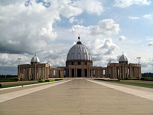
Yamoussoukro is home to the world's largest church building. It is called the Basilica of Our Lady of Peace.
Learning and Education
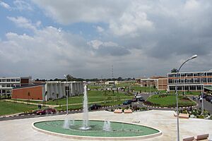
Ivory Coast has one of the highest literacy rates in sub-Saharan Africa. In 2019, about 89.9% of people aged 15 and over could read and write. However, many adults, especially women, cannot read or write. Many children between 6 and 10 years old do not go to school. Most students in high school are boys. After high school, students can take the baccalauréat exam. Universities include Université Félix Houphouët-Boigny in Abidjan.
Science and New Ideas
Ivory Coast spends about 0.13% of its GDP on research and development. Challenges include not enough scientific equipment. Also, research groups are spread out. And they don't always use or protect their research findings well. In 2024, Ivory Coast was ranked 112th in the Global Innovation Index. This was down from 103rd in 2019.
The country's plan for 2012–2015 set aside only a small amount for scientific research. But there are 24 national research programs. These bring together public and private research groups. They focus on common research topics. These topics include health, raw materials, agriculture, and the environment.
Culture and Fun
Each ethnic group in Ivory Coast has its own music styles. Most feature strong singing with many voices. Talking drums are common. Also, polyrhythms, where different rhythms play at the same time, are found throughout the country. Popular music styles include zoblazo, zouglou, and Coupé-Décalé. Some Ivorian artists like Magic Système and Alpha Blondy are famous worldwide.
Sports and Games
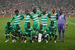
The most popular sport is football (soccer). The men's national team has played in the World Cup three times. They won the Africa Cup of Nations three times, most recently in 2023 when they hosted the event. Ivory Coast has produced many famous footballers like Didier Drogba and Yaya Touré. The women's football team played in the 2015 Women's World Cup.
The country has hosted several big African sports events. These include the 2013 African Basketball Championship. In the past, they hosted the 1984 African Cup of Nations.
Runner Gabriel Tiacoh won a silver medal in the 400 meters at the 1984 Olympics. The country hosted the 8th Jeux de la Francophonie in 2017. Famous athletes include Marie-Josée Ta Lou and Murielle Ahouré.
Rugby union is also popular. The national rugby team played in the 1995 Rugby World Cup. Ivory Coast is also known for Taekwondo. Famous competitors include Cheick Cissé and Ruth Gbagbi.
Delicious Food
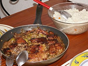
Traditional food is much like that in nearby West African countries. It uses a lot of grains and root vegetables. Cassava and plantains are important parts of Ivorian meals. Attiéké is a popular side dish. It is made from grated cassava, like a vegetable couscous.
A common street food is alloco. This is plantain fried in palm oil, spiced with onions and chili. It's eaten with grilled fish or boiled eggs. Chicken is often eaten. It has a special flavor because it's lean. Seafood like tuna, sardines, and shrimp are also popular. Mafé is a common dish with meat in peanut sauce.
Slow-cooked stews are another common food. Kedjenou is a dish with chicken and vegetables. They are slow-cooked in a sealed pot with little water. This makes the flavors strong and the chicken tender. It's usually cooked in a pottery jar called a canary. Bangui is a local palm wine.
Ivorians have special outdoor restaurants called maquis. These are unique to the region. A maquis usually serves grilled chicken and fish. These are covered in onions and tomatoes. They are served with acheke or kedjenou.
See also
 In Spanish: Costa de Marfil para niños
- Index of Ivory Coast–related articles
- Outline of Ivory Coast
 | James B. Knighten |
 | Azellia White |
 | Willa Brown |


