
County roads in St facts for kids
 
Standard county road markers
|
|
Quick facts for kids Highway names |
|
|---|---|
| Interstates: | Interstate X (I-X) |
| US Routes: | U.S. Highway X (US X) |
| State: | Trunk Highway X (MN X or TH X) |
| County State-Aid Highways: | County State-Aid Highway X (CSAH X) |
| County Roads: | County Road X (CR X) |
| System links | |
| Minnesota State Highways | |
Welcome to the world of county roads in Saint Louis County, Minnesota! These roads are like the veins and arteries of the county, helping people and goods move around. They connect towns, cities, and even natural areas. Think of them as important local highways that help you get where you need to go, whether it's to school, a park, or a friend's house.
This article will tell you about some of the main county roads in Saint Louis County. You'll learn where they start and end, how long they are, and what cool places they pass through.
Contents
County Roads 1–20
County Road 2
County Road 2 is also called West Tischer Road. It starts where West Tischer Road meets Rice Lake Road (which is County Road 4). This road goes east through the city of Rice Lake. It ends when West Tischer Road meets Jean Duluth Road (which is County Road 37). This road is about 5 miles long.
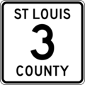
County Road 3
County Road 3 starts in Duluth where Becks Road meets Highway 23. It goes north and west through Midway Township. The road continues past where Becks Road becomes Stenman Road, near the Carlton County line. It ends at the border between Saint Louis and Carlton counties. This road is about 5 miles long.
County Road 3 is known as Becks Road in the Duluth area. It's an important route for trucks. Trucks on this road can carry up to 10 tons (20,000 pounds) on each axle.
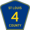
County Road 4
County Road 4 is sometimes called Highway 4. It begins in Duluth where Central Entrance (Highway 194) meets Rice Lake Road. It goes north all the way to Biwabik, which is in the Iron Range area of Minnesota.
This road is known as Rice Lake Road in Duluth, Rice Lake, and Gnesen Township. From Island Lake to Biwabik, it's known as the historic Vermilion Trail. It's also officially named Governor Rudy Perpich Memorial Drive.
County Road 4 is about 60 miles long. It connects Duluth and Biwabik, going through places like:
This road also goes through the Cloquet Valley State Forest.
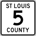
County Road 5

County Road 5 is also called Highway 5. It starts in Arrowhead Township where it meets County Road 8. It goes north and ends near Cook, close to the border of Itasca County. The part of County Road 5 in Ness Township, south of Meadowlands, is a gravel road (not paved).
County Road 5 passes through many communities, including:
- Arrowhead Township
- Ness Township
- Meadowlands
- Elmer Township
- Toivola
- Lavell Township
- Hibbing
- Side Lake
McCarthy Beach State Park is located along this road. County Road 5 also crosses U.S. Highway 169 near Hibbing.
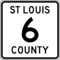
County Road 6

County Road 6 starts in Duluth where U.S. Highway 53 meets Maple Grove Road. It goes west and ends in Brevator Township where Maple Grove Road meets Highway 33. It is about 13 miles long.
County Road 6 is known as Maple Grove Road in the Duluth area. It's an important east-west road that connects several other major roads like U.S. Highway 53, U.S. Highway 2, and Highway 33.
County Road 7

County Road 7 is also called Highway 7. It starts in Grand Lake Township where U.S. Highway 53 meets Industrial Road. It goes north to Mountain Iron in the Mesabi Range area. This road is also known as Industrial Road. It's officially named the Bobby Aro Memorial Highway, named after a famous local entertainer.
County Road 7 is about 52 miles long. It passes through many communities, including:
This road mostly runs north-south. It crosses the Saint Louis River near Forbes and the Cloquet River in Industrial Township.
County Road 8

County Road 8 starts in Floodwood where it meets Highway 73. It goes east and ends in Grand Lake Township near Twig, where it meets U.S. Highway 53. This road is a direct way to get between Floodwood and U.S. Highway 53. Most of this road is a gravel surface (not paved).
County Road 9

County Road 9 starts in Canosia Township (at Pike Lake) where Martin Road meets Midway Road (County Road 13). It goes east and ends in Duluth where Calvary Road meets Woodland Avenue.
County Road 9 is about 11 miles long. It goes through Canosia Township and Rice Lake. It's also known as Martin Road in the Duluth area and is used as a truck route. Trucks on this road can carry up to 9 tons (18,000 pounds) on each axle.
County Road 10
County Road 10 has two parts. The western part starts in Rice Lake where Arnold Road meets Martin Road (County Road 9). It continues east to Jean Duluth Road (County Road 37). This part is about 3.2 miles long.
The eastern part of County Road 10 starts about 1.2 miles north of where the western part ends. It begins where Jean Duluth Road meets West Tischer Road (County Road 2). This part goes east on West Tischer Road for 2 miles, then north on North Tischer Road for 0.5 miles, then east on Strand Road for 1 mile. It ends at Lester River Road (County Road 12).
County Road 11
County Road 11 is about 3.4 miles long. It starts in Midway Township where Midway Road (County Road 13) meets Stark Road. It goes east on Stark Road, then briefly south on Ugstad Road. It then goes east through Proctor on 4th Street, south on 5th Avenue North, and east on 2nd Street. It ends at Boundary Avenue (County Road 14).
County Road 12
County Road 12 starts in the Lakeside – Lester Park neighborhood of Duluth where 60th Avenue East meets East Superior Street. It goes east on East Superior Street to 61st Avenue East, then north on Lester River Road for about 6.45 miles. It then goes east on Roberg Road for 1 mile, then north on Lakewood Road for 0.75 miles. It ends at Lismore Road (County Road 43) in Lakewood Township.
County Road 13

County Road 13 starts in Midway Township where Midway Road meets Becks Road (County Road 3). It goes north and ends in Canosia Township (Pike Lake area) where Midway Road meets Martin Road (County Road 9).
County Road 13 is about 11 miles long. It goes through Midway Township, Hermantown, and Canosia Township. It's known as Midway Road in the Duluth area and is an important truck route. Trucks on this road can carry up to 10 tons (20,000 pounds) on each axle. Midway Road is a key north-south road on the western edge of Duluth.
County Road 14
County Road 14 starts in Midway Township where Midway Road (County Road 13) meets Thompson Hill Road. It goes northeast on Thompson Hill Road and Mountain Drive, running next to Interstate Highway 35. It briefly turns onto Skyline Parkway, then goes north on Boundary Avenue, which is the line between Duluth and Proctor. It then goes west on 5th Street in Proctor and ends where it meets U.S. Highway 2.
County Road 15
County Road 15 has two parts. The southern part starts in Grand Lake Township where Munger Shaw Road meets U.S. Highway 53. It goes north on Munger Shaw Road and ends where Taft Road (County Road 48) meets Munger Shaw Road, just south of Taft.
The northern part of County Road 15 starts where Munger Shaw Road meets Three Lakes Road (County Road 49). It goes north into Shaw and ends where it meets Comstock Lake Road (County Road 52) just east of Whiteface.
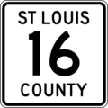
County Road 16

County Road 16 is also called Highway 16. It starts at the border with Itasca County near Bengal, southwest of Hibbing. It goes east and ends at the border with Lake County near Fairbanks.
County Road 16 is about 64 miles long. It goes through communities like Bengal, Forbes, Makinen, and Fairbanks. It's an east-west road that connects Fairbanks and the Hibbing area. It's also known as Townline Road and Wilson Road in different spots.
County Road 17
County Road 17 is a short road that helps people get to the Duluth International Airport and a nearby federal prison camp. It starts where Arrowhead Road (County Road 32) meets Airbase Road. It goes northwest on Airbase Road, then south on Airport Approach Road and Stebner Road. It ends where U.S. Highway 53 meets Stebner Road.
County Road 20
County Road 20 starts where it meets Vermilion Trail (County Road 4), near Bass Lake west of Palo. It goes west and then north into McKinley. It ends where it meets Main Street in McKinley. County Road 20 is also known as Heritage Trail. It is 7 miles long. It crosses Highway 135 in McKinley, between Gilbert and Biwabik.
County Roads 21–40
County Road 21
County Road 21 is also called Highway 21. It's in the northern part of the county. It serves areas like Pike Township, Embarrass, Babbitt, and Ely. The road starts where it meets Highway 169 near the Pike River. It goes east and north for about 40 miles. It enters Ely on Central Avenue and ends where it meets Sheridan Street (Highway 169 / Highway 1).
County Road 22
County Road 22 is also called Highway 22. It's in the northern part of the county and serves places like Bear River and Sherman Corner. The road starts in Bear River, where Itasca County Road 22 becomes Saint Louis County Road 22. It goes east for about 20 miles and ends in Sherman Corner where it meets U.S. Highway 53 and Highway 1.
County Road 23
County Road 23 is in the northern part of the county. It serves Nett Lake, the Nett Lake Indian Reservation, Orr, and Buyck. This road is about 35.7 miles long. It starts on Nett Lake Road in Nett Lake and goes east out of the Indian Reservation to Glendale. It then shares the road with U.S. Highway 53 (Johnson Parkway) into Orr. From Orr, it goes east on Orr–Buyck Road and ends where it meets Crane Lake Road (County Road 24) in Buyck.
County Road 24
County Road 24 is in the northern part of the county. It serves Cook, Buyck, and Crane Lake. This road is about 43.4 miles long. It starts in Cook where U.S. Highway 53 meets 2nd Street Southeast. It goes north on 2nd Street Southeast, briefly east on Vermilion Drive, then continues north on Vermilion Drive. It leaves Cook and generally goes north and east on Vermilion Road, then east on Kallo Road, and north on Crane Lake Road. It ends along Gold Coast Road in Crane Lake. The middle part of this road, from Buyck south towards Wakemup, is an unpaved gravel road.
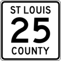
County Road 25

County Road 25 is also called Highway 25. It's in the western part of the county. It serves places like Zim, Cherry, Kinney, and Cook. It also goes through parts of the Superior National Forest. The road starts near Zim where Zim Road (County Road 27) meets Fraser Road. It generally goes north for about 47.3 miles into Cook. It ends on Vermilion Drive where it meets 2nd Street Southeast (County Road 24). County Road 25 also passes near Buhl and Chisholm where it meets U.S. Highway 169.
County Road 26
County Road 26 is in the northern part of the county. It serves Embarrass and Wahlsten. This road is about 11.6 miles long. It starts near Embarrass where County Road 21 meets Wahlsten Road. It generally goes north and west through Wahlsten. It ends where it meets Highway 169. County Road 26 is also known as Wahlsten Road.
County Road 27
County Road 27 is in the northern part of the county. It serves Hibbing and Zim. This road is about 10 miles long. It starts near the southeast corner of Hibbing where County Road 5 meets Zim Road. It generally goes east on Zim Road to Zim. It ends where it meets County Road 7.
County Road 28
County Road 28 is in the southwestern part of the county. It serves Sax. The road starts in Sax where it meets County Road 7. It goes west for about 3.7 miles on Sax Road, then north for 0.5 miles on Dass Road, then west for 2 miles. It ends where it meets Overton Road (County Road 83).
County Road 29
County Road 29 is in the southwestern part of the county. It serves Meadowlands and Kelsey. This road is about 26 miles long. It starts about 1 mile north of Floodwood where it meets Highway 73. It goes east and north through Meadowlands. It ends about 0.5 miles south of Kelsey where it meets County Road 7.
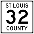
County Road 32

County Road 32 starts in Hermantown where U.S. Highway 53 meets Arrowhead Road. It goes east and ends in Duluth where Arrowhead Road meets Arlington Avenue (County Road 90).
County Road 32 is about 2.5 miles long. It goes through Hermantown and Duluth. It's known as Arrowhead Road in the Duluth area. This road is an important east-west route connecting Hermantown, the Miller Hill area of Duluth, and eastern Duluth.
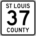
County Road 37

County Road 37 starts in Duluth where Glenwood Street meets Jean Duluth Road. It goes north and ends at Normanna Road (County Road 44) in Normanna Township.
County Road 37 is known as Jean Duluth Road in the Duluth area. It goes through Lakewood Township, Normanna Township, and Duluth. Jean Duluth Road is an important north-south road that connects Glenwood Street, Martin Road (County Road 9/County Road 10), and Normanna Road.
County Roads 41–60
County Road 48

County Road 48 is usually called Lavaque Road in the Duluth area. It's an important north-south road. It is about 15 miles long. It goes through Proctor, Hermantown, Canosia Township, and Fredenberg Township.
The first part of County Road 48 runs from Proctor (where Second Avenue meets U.S. Highway 2) north to Hermantown (where Lavaque Road meets U.S. Highway 53). The second part runs from Hermantown (where Lavaque Bypass Road meets Highway 53) north to Fredenberg Township (where Lavaque Road meets Fish Lake Road). A third part of County 48 is about 4 miles long and follows Fish Lake Road and Taft Road.
The southern end of County Road 48 is in Proctor. The northern end is at Taft in Grand Lake Township, where Taft Road meets County Road 15.
County Road 49

County Road 49 runs from Northland Township (near Canyon) where it meets U.S. Highway 53. It goes east and ends near Island Lake where it meets County Road 4. County Road 49 goes through the Three Lakes Area and Shaw. It's also known as Three Lakes Road. Most of this road is an unpaved gravel road.
County Road 52

County Road 52 runs from Toivola where it meets County Road 5. It goes east and ends near Whiteface and Shaw, where it meets County Road 15.
County Road 52 is known as Arkola Road between Toivola and Cotton (where it meets U.S. Highway 53). It's also known as Comstock Lake Road between Cotton and its eastern end near Shaw.
County Road 56

County Road 56 runs from Duluth where Morris Thomas Road meets Piedmont Avenue. It goes west and ends in Brevator Township where Morris Thomas Road meets Highway 33.
County Road 56 is about 14 miles long. It goes through Duluth, Hermantown, and Solway Township. This road is known as Morris Thomas Road in the Duluth area. It's an important east-west road that connects several other major roads like Piedmont Avenue, U.S. Highway 2, and Highway 33.
County Road 58
County Road 58 runs from Highway 169 near Winton. It goes southeast to the border between Saint Louis and Lake counties. County Road 58 is also known as Kawishiwi Trail.
County Roads 61–80
County Road 61

County Road 61 starts in Duluth near Brighton Beach, where Congdon Boulevard meets the Minnesota 61 Expressway. It follows the North Shore Scenic Drive to Two Harbors.
County Road 61 goes through Duluth Township and Duluth. It's more commonly called North Shore Scenic Drive or Scenic 61. This road was once a major highway (U.S. 61) connecting Duluth and Two Harbors. In the 1960s, the state gave control of the road to Saint Louis and Lake Counties, and they named it County Road 61.
The famous Grandma's Marathon race follows this road every June.
County Roads 81–100
County Road 90

County Road 90 runs from Duluth where U.S. Highway 53 meets Arlington Avenue. It goes north and ends where Arlington Avenue meets Arrowhead Road (County Road 32) in Duluth.
County Road 90 is about 3 miles long. It's an important road in the Duluth Heights neighborhood of Duluth. County 90 is also known as Arlington Avenue.
County Road 91

County Road 91 runs from Duluth where 40th Avenue West meets West 8th Street. It goes north and ends where Haines Road meets Airport Road in Duluth.
County Road 91 is about 6 miles long. It goes through Duluth and Hermantown. For much of its length, it forms the border between these two cities.
County Road 91 is usually called Haines Road in the Duluth area and is an important road. A small part of County Road 91 is known as 40th Avenue West. Haines Road connects West Duluth, Hermantown, and the Miller Hill area of Duluth.
A big project to rebuild part of Haines Road happened from 2012 to 2013. They made the road better, adding wider shoulders and a sidewalk. They also fixed a tricky curve, making it straighter and safer.
County Road 92

County Road 92 runs from the northeast side of Hibbing where it meets U.S. 169 and Highway 73. It goes east and ends in Cherry where it meets County Road 25.
County Road 93

County Road 93 runs from Central Lakes where it meets U.S. Highway 53. It goes east and ends in Makinen where it meets County Road 16.
County 93 is sometimes used as a shortcut between U.S. 53 at Central Lakes and County 16 at Makinen to get to Palo and Aurora (by using County 16 and County Road 100).
County Road 100

County Road 100 runs from near Makinen and Palo where it meets County Road 4. It goes north and ends in Aurora where it meets Highway 135. County 100 goes through Palo. This road is 12 miles long.
County Roads 101 and up
County Road 102

County Road 102 is a road in Mountain Iron. It runs from its southern end at County Road 7 to U.S. Highway 53. It's near the northern end of U.S. Highway 169.
County Road 110
County Road 110 runs from its western end in Aurora where it meets County Road 100. Its eastern end is near Fairbanks where it meets County Road 16. County 110 is 14 miles long. The city of Hoyt Lakes is along this road. County 110 also passes by Bird Lake Recreation Area.
County Road 303
County Road 303 runs from its southern end where it meets Highway 169. It goes through the area of Britt. It's a shortcut to Wuori Township. This "L" shaped road follows Trillium Road, Rice River Road, and Hill Road. It goes through Wuori Township and Sandy Township, and briefly enters Pike Township, where it meets Highway 169 again.
Images for kids
-
County Road 3 shield
-
County Road 4 shield
-
County Road 5 shield
-
County Road 6 shield
-
County Road 7 shield
-
County Road 8 shield
-
County Road 9 shield
-
County Road 13 shield
-
County Road 16 shield
-
County Road 25 shield
-
County Road 32 shield
-
County Road 37 shield
-
County Road 48 shield
-
County Road 49 shield
-
County Road 52 shield
-
County Road 56 shield
-
County Road 61 shield
-
County Road 90 shield
-
County Road 91 shield
-
County Road 92 shield
-
County Road 93 shield
-
County Road 100 shield
-
County Road 102 shield
