Kimberley (Western Australia) facts for kids
Quick facts for kids KimberleyWestern Australia |
|
|---|---|
| Population | 34,364 (2016 census) |
| • Density | 0.0811396/km2 (0.210151/sq mi) |
| Established | 1881 |
| Area | 423,517 km2 (163,520.8 sq mi) |
| LGA(s) |
|
| State electorate(s) | Kimberley |
| Federal Division(s) | Durack |
The Kimberley is a huge and beautiful region in the northern part of Western Australia. It's like a giant puzzle piece, bordered by the Indian Ocean to the west, the Timor Sea to the north, and the Great Sandy and Tanami deserts to the south. To the east, it meets the Northern Territory. This special place was named in 1879 by a government surveyor, Alexander Forrest, after John Wodehouse, 1st Earl of Kimberley, who was a very important person in the British government at the time.
Contents
History of the Kimberley Region
The Kimberley is one of the oldest settled parts of Australia. The first people arrived here about 65,000 years ago. They developed a rich and complex culture over thousands of years. They even started growing yams for food. Amazing rock art in the region suggests that some of the first boomerangs were invented here. The local people also had a deep spiritual connection to the land, often worshipping Wandjina deities.
Early European Exploration
In the 18th century, Dutch explorers gave the Kimberley and nearby Darwin names like "Van Diemen's Land." This was after Anthony van Diemen, a governor for the Dutch East India Company.
In 1837, Lieutenants George Grey and Franklin Lushington, with 12 men, sailed from South Africa. They arrived at Hanover Bay in December 1837. Their exploration inland began in January 1838. The group faced many challenges, including flooded land and conflicts with Aboriginal people. Grey was even injured by a spear but recovered and continued exploring. They named rivers like the Gairdner and Glenelg, and mountains like Mount Lyell.
In 1879, Alexander Forrest, a surveyor from Western Australia, led a group from Beagle Bay to Katherine, Northern Territory. Forrest explored and named many features of the Kimberley. He found good land for farming along the Fitzroy and Ord rivers. He later helped people buy land in the Kimberley.
Settlement and Gold Discovery
In 1881, Philip Saunders and Adam Johns found gold in the Kimberley. This led to more people coming to the area. The first cattle farmers arrived in 1881 and started a station called Yeeda Station. By 1885, more ranchers brought cattle from eastern Australia. When gold was discovered near Halls Creek, many European miners quickly arrived.
In the 1890s, a Bunuba warrior named Jandamarra led a fight against the settlers.
During World War II, a small Japanese team visited the Kimberley in January 1944. They were checking if the Allies were building military bases there. They explored the York Sound area before returning to Timor.
People of the Kimberley
The Kimberley region has a permanent population of about 34,794 people (as of 2011). This number grows a lot during winter when many tourists visit. On a census night in 2011, the population was 50,113. The population is spread out, with only three towns having more than 2,000 people: Broome (12,766), Derby (3,261), and Kununurra (4,573). About 40% of the people living in the Kimberley are of Aboriginal descent.
Main Towns and Communities
| Rank | UCL | LGA | Population | |||||||||
|---|---|---|---|---|---|---|---|---|---|---|---|---|
| 2001 census | Ref. | 2006 census | Ref. | 2011 census | Ref. | 2016 census | Ref. | 2021 census | Ref. | |||
| 1 | Broome | Broome | 15,242 | 11,547 | 12,766 | [1] | 13,984 | [2]Lua error in Module:EditAtWikidata at line 29: attempt to index field 'wikibase' (a nil value).Lua error in Module:WikidataCheck at line 22: attempt to index field 'wikibase' (a nil value). | align="right" |14,660 | [3]Lua error in Module:EditAtWikidata at line 29: attempt to index field 'wikibase' (a nil value).Lua error in Module:WikidataCheck at line 22: attempt to index field 'wikibase' (a nil value). | ||
| 2 | Kununurra | Wyndham–East Kimberley | 5,219 | 3,748 | 4,573 | [4] | 4,341 | [5]Lua error in Module:EditAtWikidata at line 29: attempt to index field 'wikibase' (a nil value).Lua error in Module:WikidataCheck at line 22: attempt to index field 'wikibase' (a nil value). | align="right" |4,515 | [6]Lua error in Module:EditAtWikidata at line 29: attempt to index field 'wikibase' (a nil value).Lua error in Module:WikidataCheck at line 22: attempt to index field 'wikibase' (a nil value). | ||
| 3 | Derby | Derby–West Kimberley | 3,662 | 3,093 | 3,261 | [7] | 3,325 | [8]Lua error in Module:EditAtWikidata at line 29: attempt to index field 'wikibase' (a nil value).Lua error in Module:WikidataCheck at line 22: attempt to index field 'wikibase' (a nil value). | align="right" |3,009 | [9]Lua error in Module:EditAtWikidata at line 29: attempt to index field 'wikibase' (a nil value).Lua error in Module:WikidataCheck at line 22: attempt to index field 'wikibase' (a nil value). | ||
| 4 | Halls Creek | Halls Creek | 1,264 | 1,211 | 1,443 | [10] | 1,546 | [11]Lua error in Module:EditAtWikidata at line 29: attempt to index field 'wikibase' (a nil value).Lua error in Module:WikidataCheck at line 22: attempt to index field 'wikibase' (a nil value). | align="right" |1,605 | [12]Lua error in Module:EditAtWikidata at line 29: attempt to index field 'wikibase' (a nil value).Lua error in Module:WikidataCheck at line 22: attempt to index field 'wikibase' (a nil value). | ||
| 5 | Fitzroy Crossing | Derby–West Kimberley | 1,450 | 928 | 1,144 | [13] | 1,141 | [14]Lua error in Module:EditAtWikidata at line 29: attempt to index field 'wikibase' (a nil value).Lua error in Module:WikidataCheck at line 22: attempt to index field 'wikibase' (a nil value). | align="right" |1,022 | [15]Lua error in Module:EditAtWikidata at line 29: attempt to index field 'wikibase' (a nil value).Lua error in Module:WikidataCheck at line 22: attempt to index field 'wikibase' (a nil value). | ||
| 6 | Wyndham | Wyndham–East Kimberley | 784 | 669 | 787 | [16] | 604 | [17]Lua error in Module:EditAtWikidata at line 29: attempt to index field 'wikibase' (a nil value).Lua error in Module:WikidataCheck at line 22: attempt to index field 'wikibase' (a nil value). | align="right" |745 | [18]Lua error in Module:EditAtWikidata at line 29: attempt to index field 'wikibase' (a nil value).Lua error in Module:WikidataCheck at line 22: attempt to index field 'wikibase' (a nil value). | ||
| 7 | Bidyadanga (La Grange) | Broome | 510 | 425 | 595 | [19] | 617 | [20]Lua error in Module:EditAtWikidata at line 29: attempt to index field 'wikibase' (a nil value).Lua error in Module:WikidataCheck at line 22: attempt to index field 'wikibase' (a nil value). | align="right" |593 | [21]Lua error in Module:EditAtWikidata at line 29: attempt to index field 'wikibase' (a nil value).Lua error in Module:WikidataCheck at line 22: attempt to index field 'wikibase' (a nil value). | ||
| 8 | Balgo | Halls Creek | 456 | 460 | 508 | [22] | 359 | [23]Lua error in Module:EditAtWikidata at line 29: attempt to index field 'wikibase' (a nil value).Lua error in Module:WikidataCheck at line 22: attempt to index field 'wikibase' (a nil value). | align="right" |472 | [24]Lua error in Module:EditAtWikidata at line 29: attempt to index field 'wikibase' (a nil value).Lua error in Module:WikidataCheck at line 22: attempt to index field 'wikibase' (a nil value). | ||
| 9 | Warmun | Halls Creek | 315 | 210 | 297 | [25] | 366 | [26]Lua error in Module:EditAtWikidata at line 29: attempt to index field 'wikibase' (a nil value).Lua error in Module:WikidataCheck at line 22: attempt to index field 'wikibase' (a nil value). | align="right" |457 | [27]Lua error in Module:EditAtWikidata at line 29: attempt to index field 'wikibase' (a nil value).Lua error in Module:WikidataCheck at line 22: attempt to index field 'wikibase' (a nil value). | ||
| 10 | Yungngora | Derby–West Kimberley | 245 | 288 | 283 | [28] | 409 | [29]Lua error in Module:EditAtWikidata at line 29: attempt to index field 'wikibase' (a nil value).Lua error in Module:WikidataCheck at line 22: attempt to index field 'wikibase' (a nil value). | align="right" |434 | [30]Lua error in Module:EditAtWikidata at line 29: attempt to index field 'wikibase' (a nil value).Lua error in Module:WikidataCheck at line 22: attempt to index field 'wikibase' (a nil value). | ||
| 11 | Looma | Derby–West Kimberley | 285 | 393 | 374 | [31] | 531 | [32]Lua error in Module:EditAtWikidata at line 29: attempt to index field 'wikibase' (a nil value).Lua error in Module:WikidataCheck at line 22: attempt to index field 'wikibase' (a nil value). | align="right" |412 | [33]Lua error in Module:EditAtWikidata at line 29: attempt to index field 'wikibase' (a nil value).Lua error in Module:WikidataCheck at line 22: attempt to index field 'wikibase' (a nil value). | ||
| 12 | Kalumburu | Wyndham–East Kimberley | 335 | 413 | 467 | [34] | 412 | [35]Lua error in Module:EditAtWikidata at line 29: attempt to index field 'wikibase' (a nil value).Lua error in Module:WikidataCheck at line 22: attempt to index field 'wikibase' (a nil value). | align="right" |388 | [36]Lua error in Module:EditAtWikidata at line 29: attempt to index field 'wikibase' (a nil value).Lua error in Module:WikidataCheck at line 22: attempt to index field 'wikibase' (a nil value). | ||
| 13 | Bardi (One Arm Point) | Broome | 310 | 214 | 334 | [37] | 365 | [38]Lua error in Module:EditAtWikidata at line 29: attempt to index field 'wikibase' (a nil value).Lua error in Module:WikidataCheck at line 22: attempt to index field 'wikibase' (a nil value). | align="right" |325 | [39]Lua error in Module:EditAtWikidata at line 29: attempt to index field 'wikibase' (a nil value).Lua error in Module:WikidataCheck at line 22: attempt to index field 'wikibase' (a nil value). | ||
| 14 | Bayulu | Derby–West Kimberley | 253 | 259 | 320 | [40] | 322 | [41]Lua error in Module:EditAtWikidata at line 29: attempt to index field 'wikibase' (a nil value).Lua error in Module:WikidataCheck at line 22: attempt to index field 'wikibase' (a nil value). | align="right" |308 | [42]Lua error in Module:EditAtWikidata at line 29: attempt to index field 'wikibase' (a nil value).Lua error in Module:WikidataCheck at line 22: attempt to index field 'wikibase' (a nil value). | ||
| 15 | Beagle Bay | Broome | 293 | 199 | 285 | [43] | 348 | [44]Lua error in Module:EditAtWikidata at line 29: attempt to index field 'wikibase' (a nil value).Lua error in Module:WikidataCheck at line 22: attempt to index field 'wikibase' (a nil value). | align="right" |307 | [45]Lua error in Module:EditAtWikidata at line 29: attempt to index field 'wikibase' (a nil value).Lua error in Module:WikidataCheck at line 22: attempt to index field 'wikibase' (a nil value). | ||
| 16 | Djarindjin–Lombadina | Broome | N/A | N/A | 245 | [46] | 395 | [47]Lua error in Module:EditAtWikidata at line 29: attempt to index field 'wikibase' (a nil value).Lua error in Module:WikidataCheck at line 22: attempt to index field 'wikibase' (a nil value). | align="right" |253 | [48]Lua error in Module:EditAtWikidata at line 29: attempt to index field 'wikibase' (a nil value).Lua error in Module:WikidataCheck at line 22: attempt to index field 'wikibase' (a nil value). | ||
| 17 | Wangkatjungka | Derby–West Kimberley | N/A | N/A | N/A | 254 | [49]Lua error in Module:EditAtWikidata at line 29: attempt to index field 'wikibase' (a nil value).Lua error in Module:WikidataCheck at line 22: attempt to index field 'wikibase' (a nil value). | align="right" |231 | [50]Lua error in Module:EditAtWikidata at line 29: attempt to index field 'wikibase' (a nil value).Lua error in Module:WikidataCheck at line 22: attempt to index field 'wikibase' (a nil value). | |||
| 18 | Mindibungu | Halls Creek | 215 | 144 | 257 | [51] | 150 | [52]Lua error in Module:EditAtWikidata at line 29: attempt to index field 'wikibase' (a nil value).Lua error in Module:WikidataCheck at line 22: attempt to index field 'wikibase' (a nil value). | align="right" |202 | [53]Lua error in Module:EditAtWikidata at line 29: attempt to index field 'wikibase' (a nil value).Lua error in Module:WikidataCheck at line 22: attempt to index field 'wikibase' (a nil value). | ||
Indigenous Languages of the Kimberley
The Kimberley is famous for its many different Aboriginal languages. About 50 to 60 languages were once spoken here. Most of these languages are not part of the larger Pama-Nyungan languages family.
There are four main language families unique to the Kimberley:
- Nyulnyulan languages: Spoken on the Dampier Peninsula and along the Fitzroy River.
- Bunuban languages: Found in the Fitzroy River Basin.
- Worrorran languages: Spoken in the northern Kimberley, from King Sound up to Wyndham.
- Jarrakan languages: Spoken along the Ord River, from Halls Creek to Wyndham and Kununurra.
Today, many of these languages are not spoken daily. People in the Kimberley also speak Australian English, Kriol, and Aboriginal English.
Art and Culture in the Kimberley
The Kimberley region is incredibly rich in art, especially Indigenous rock art. There are tens of thousands of rock art examples from many different cultural groups. This diversity has led to many unique art styles. Some of the most famous are Wandjina and Gwion Gwion.
Artists used various techniques like engraving, painting, scratching, pecking, drawing, and even beeswax. These artworks show how the culture and environment have changed over time.
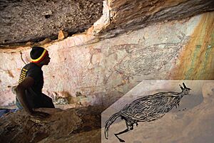
Researchers have studied this art for a long time. Rock shelters are great places for art to be preserved. The oldest known art style is called the Irregular Infill Animal or Naturalistic period. It features life-sized animal pictures. For example, a two-meter-long kangaroo painting on a rock shelter ceiling in northeastern Kimberley is one of the oldest in Australia. Scientists used mud wasp nests found on and under the painting to date it. They found it was between 17,500 and 17,100 years old!
Aboriginal people say that re-touching these artworks is very important. It's like a performance that retells the story behind the art. This helps people connect with their culture and their land. Identity is a big part of understanding the rock art. Different groups in the Kimberley have their own unique styles. However, the Wandjinas are a unifying symbol seen across the region. They are often repainted because Indigenous groups believe in their power.
Geography of the Kimberley
The Kimberley covers a huge area of 423,517 square kilometers (about 163,521 square miles). That's roughly three times the size of England!
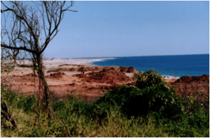
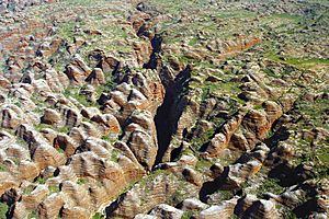
The region has ancient, steep mountains with deep sandstone and limestone gorges. The strong monsoon climate has washed away much of the soil. The southern part of the Kimberley, past the Dampier Peninsula, is flatter. It has dry tropical grasslands used for cattle farming. Some areas, like the valleys of the Ord and Fitzroy River, have fertile soils. The mountains aren't very tall, but the land is so steep that it's hard to travel, especially during the wet season when roads flood. The coast has steep cliffs in the north and flatter areas in the south, with very high tides.
Kimberley's Climate
The Kimberley has a tropical monsoon climate. This means it has a short wet season from November to April. About 90% of the yearly rain falls during this time. Cyclones are common, especially around Broome, and rivers often flood. The northwest gets the most rain, about 1,270 mm (50 inches) per year. The southeast gets less, around 520 mm (20 inches).
The dry season is from May to October. During this time, south-easterly winds bring sunny days and cool nights. Since 1967, the region has seen more rainfall, possibly due to air pollution from Asia.
The Kimberley is one of Australia's hottest places. The average yearly temperature is about 27°C (81°F). Maximum temperatures are almost always above 30°C (86°F), even in July. November, before the rains, is the hottest time. Temperatures can reach over 37°C (99°F) on the coast and over 40°C (104°F) inland.
Aboriginal people in the Kimberley recognize six traditional seasons. These are based on weather patterns and observations of plants and animals.
Geological Features
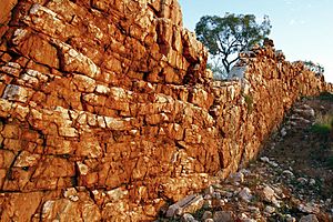
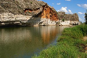
Millions of years ago, during the Devonian period, a huge barrier reef system formed in the Kimberley. This reef was similar to the Great Barrier Reef. Today, you can still see parts of it in the Napier Range and Ningbing Range. Famous spots like Tunnel Creek, Windjana Gorge, and Geikie Gorge are all parts of this ancient reef system.
The Kimberley is also known as the Kimberley Block. It's part of the larger Australian Shield. This area includes the Wunaamin-Miliwundi Range and Durack Range.
Kimberley Coastline
The Kimberley coastline is very isolated. Many parts between Broome and Wyndham can only be reached by boat or helicopter. This makes them popular "wilderness" tourist spots.
Ecology and Wildlife
The Kimberley's unique landscape is home to a special mix of wildlife. The Western Australian Department of Conservation and Land Management has studied this area a lot.
Flora: Plants of the Kimberley
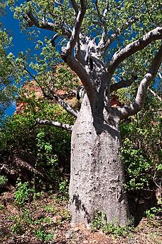
Much of the Kimberley is covered in open savanna woodland. You'll see many low bloodwood and boab trees. In wetter areas, there are Darwin stringybark and Darwin woollybutt eucalyptus trees.
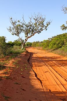
The red sandy soil of the Dampier Peninsula in the south has a special type of wooded grassland called pindan. In more fertile areas, like the Ord Valley, trees grow in grasslands with different types of grasses. The banks of the Ord, Fitzroy River, and other rivers have many different plants.
In the sheltered gorges of the rainy north, there are patches of tropical dry broadleaf forest. These are also called monsoon forests or vine thickets. They were only discovered by scientists in 1965 and are very rich in plant life. You can also find mangroves in river estuaries along the coast.
Fauna: Animals of the Kimberley
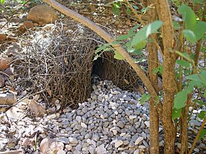
The Kimberley is home to many animals. You can find huge saltwater crocodiles and many different birds. Some birds include the channel-billed cuckoo, Pacific koel, purple-crowned fairywren, and the bowerbird.
The sandstone gorges in north Kimberley are important safe places for many unique species. Some of these animals have disappeared from flatter areas. This includes the purple-crowned fairywren, the endangered Gouldian finch, and many amphibians like the magnificent tree frog.
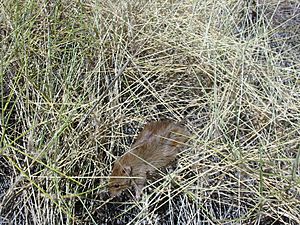
Mammals that have become less common in the flatlands include the bilby, northern quoll, and golden bandicoot. Large bats like black flying foxes and little red flying foxes are common. They help pollinate plants and spread seeds.
A special type of gecko, Gehyra kimberleyi, is named after the Kimberley region.
The gorges in central Kimberley are known for their fossils and large groups of bats. Lake Argyle and other wetlands are important homes for wildlife. The Ord estuary, Eighty-mile Beach, and Roebuck Bay are vital resting spots for shorebirds from all over the world. There are also rocky islands off the north coast where seabirds and turtles live.
Protecting Kimberley's Environment
Most of the Kimberley's natural environment is still in good condition. However, some areas, especially the pasturelands in the south, have been affected by cattle grazing for over 100 years. Other threats include introduced weeds, wild cats, and changes to traditional Aboriginal fire regimes (how grasslands are burned and regrow). The remote sandstone areas in the north still have valuable original habitats that protect much wildlife.
Large protected areas include the Prince Regent National Park and the Drysdale River National Park. There are also similar habitats in the Gregory National Park and Keep River National Park in the Northern Territory.
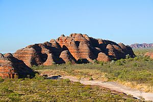
The Kimberley is a popular place for tourists. Famous spots include the Bungle Bungle Range, the Gibb River Road, Lake Argyle, and Cape Leveque. Many areas can be explored with a four-wheel drive vehicle.
Other parks in the region are Geikie Gorge National Park, Mirima National Park, and Wolfe Creek Meteorite Crater National Park. In 2012, the Western Australian government created the Camden Sound Marine Park to protect the ocean.
Visitors should know that controlled burns can happen at any time of year. In 2011, a fire during an ultramarathon injured five people.
Save the Kimberley Campaign
The Wilderness Society has led a campaign to stop a plan to build a gas industrial complex at James Price Point near Broome. Companies like Woodside Energy and BHP wanted to build it. People against the plan believe it would harm the region. Many public figures, including musicians John Butler and Missy Higgins, have supported the campaign.
In 2012 and 2013, large concerts were held in Melbourne and Fremantle to raise awareness and money to protect the Kimberley.
Economy of the Kimberley
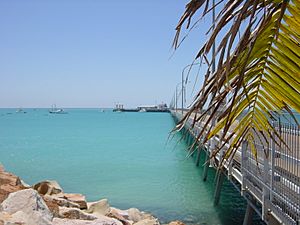
The Kimberley region has a varied economy. Important industries include mining, construction, tourism, retail, agriculture, and pearling.
The town of Broome has a thriving pearling industry. Major pearl farmers operate along the Kimberley coast.
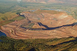
About one-third of the world's yearly diamond production comes from the Argyle and Ellendale diamond mines. Oil is extracted from the Blina oil field. Zinc and lead were once mined near Fitzroy Crossing, and nickel is still mined near Halls Creek. Derby is the main port for shipping these metals.
Historically, the economy relied on pastoral leases, which are large areas of land used for grazing livestock.
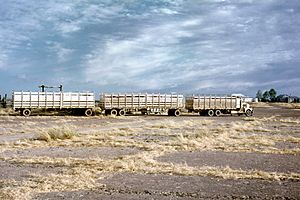
More recently, agriculture has focused on the Ord River Irrigation Area near Kununurra. Beef cattle are raised in the Kimberley and exported live. Wyndham has the last remaining meatworks in the region.
Barramundi fish are bred in Lake Argyle. Broome also has an Aquaculture Park for fish and pearl farming. The Kimberley also has a busy fishing industry.
Many famous Indigenous artists and art centers are in the Kimberley. Artists like Paddy Bedford and Freddie Timms are known internationally. There are Aboriginal-owned art centers that help artists and sell their works.
Tourism is expected to continue growing in the Kimberley. Between 2010 and 2012, about 292,600 people visited the Kimberley each year.
See also
 In Spanish: Kimberley (Australia Occidental) para niños
 | Kyle Baker |
 | Joseph Yoakum |
 | Laura Wheeler Waring |
 | Henry Ossawa Tanner |


