Kingaroy facts for kids
Quick facts for kids KingaroyQueensland |
|||||||||||||||
|---|---|---|---|---|---|---|---|---|---|---|---|---|---|---|---|
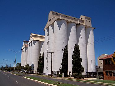
The peanut silos in Haly Street are the town's tallest structures and most visible landmark
|
|||||||||||||||
| Population | 10,266 (2021 census) | ||||||||||||||
| • Density | 149.87/km2 (388.2/sq mi) | ||||||||||||||
| Postcode(s) | 4610 | ||||||||||||||
| Elevation | 441.9 m (1,450 ft) | ||||||||||||||
| Area | 68.5 km2 (26.4 sq mi) | ||||||||||||||
| Time zone | AEST (UTC+10:00) | ||||||||||||||
| Location | |||||||||||||||
| LGA(s) | South Burnett Region | ||||||||||||||
| State electorate(s) | Nanango | ||||||||||||||
| Federal Division(s) | Maranoa | ||||||||||||||
|
|||||||||||||||
|
|||||||||||||||
Kingaroy is a country town and area in the South Burnett Region of Queensland, Australia. It is located where the D'Aguilar Highway and the Bunya Highway meet. Kingaroy is about 218 kilometers (135 miles) north-west of Brisbane, the state capital. In 2021, about 10,266 people lived in Kingaroy.
Kingaroy is the main town of the South Burnett Region. It is known as the "Peanut Capital of Australia." This is because Australia's biggest peanut processing factory is in town. Its tall peanut silos stand out in the skyline. Kingaroy is also famous as the hometown of Sir Joh Bjelke-Petersen, a former leader of Queensland.
Contents
- What is Kingaroy Like?
- Where Did the Name Kingaroy Come From?
- Kingaroy's Past
- How Many People Live in Kingaroy?
- Important Historical Places
- Schools in Kingaroy
- Kingaroy's Economy
- Sports in Kingaroy
- Culture and Fun in Kingaroy
- Important Services in Kingaroy
- Shopping and Community Places
- Fun Events in Kingaroy
- Places to Visit in Kingaroy
- Famous People from Kingaroy
- See also
What is Kingaroy Like?
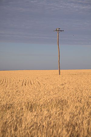
Kingaroy is surrounded by beautiful farms and gentle hills. The Booie Range is just north-east of the town. The Bunya Mountains are about 55 kilometers (34 miles) to the south-west.
The Stuart River flows north on the western edge of Kingaroy. This area is part of the Burnett River system. The land here is very good for farming. It has rich, fertile soils that are important for the region's agriculture.
Kingaroy sits in the Tarong Coal Basin. The town's height above sea level changes from about 415 meters (1,362 feet) to 562 meters (1,844 feet).
Edenvale is a small area within Kingaroy. It got its name from the Edenvale railway station. The land for the station was taken from a farm called "Paradise Farm."
Kingaroy's Weather
Kingaroy has a warm, wet summer and mild, dry winter climate. The average rainfall is about 654.7 millimeters (25.8 inches) per year. Most of the rain falls in summer.
The hottest temperature ever recorded was 41.6°C (106.9°F) in February 2017. The coldest was -6.7°C (19.9°F) in July 1961.
| Climate data for Kingaroy Airport (26º34'12"S, 151º50'24"E, 434 m AMSL) (2001-2024 normals and extremes) | |||||||||||||
|---|---|---|---|---|---|---|---|---|---|---|---|---|---|
| Month | Jan | Feb | Mar | Apr | May | Jun | Jul | Aug | Sep | Oct | Nov | Dec | Year |
| Record high °C (°F) | 41.0 (105.8) |
41.6 (106.9) |
38.2 (100.8) |
35.0 (95.0) |
31.8 (89.2) |
27.7 (81.9) |
27.2 (81.0) |
33.3 (91.9) |
36.7 (98.1) |
39.0 (102.2) |
38.9 (102.0) |
40.5 (104.9) |
41.6 (106.9) |
| Mean daily maximum °C (°F) | 31.0 (87.8) |
29.9 (85.8) |
28.3 (82.9) |
25.8 (78.4) |
22.4 (72.3) |
19.9 (67.8) |
19.7 (67.5) |
21.8 (71.2) |
25.0 (77.0) |
27.4 (81.3) |
29.1 (84.4) |
30.3 (86.5) |
25.9 (78.6) |
| Mean daily minimum °C (°F) | 18.1 (64.6) |
17.7 (63.9) |
16.4 (61.5) |
12.1 (53.8) |
7.6 (45.7) |
5.5 (41.9) |
3.9 (39.0) |
4.3 (39.7) |
8.2 (46.8) |
11.8 (53.2) |
14.5 (58.1) |
16.7 (62.1) |
11.4 (52.5) |
| Record low °C (°F) | 11.0 (51.8) |
11.1 (52.0) |
4.4 (39.9) |
−0.6 (30.9) |
−3.0 (26.6) |
−5.0 (23.0) |
−6.0 (21.2) |
−4.9 (23.2) |
−2.1 (28.2) |
0.3 (32.5) |
2.4 (36.3) |
6.5 (43.7) |
−6.0 (21.2) |
| Average precipitation mm (inches) | 88.3 (3.48) |
89.7 (3.53) |
73.1 (2.88) |
25.2 (0.99) |
37.6 (1.48) |
37.6 (1.48) |
29.4 (1.16) |
25.7 (1.01) |
28.2 (1.11) |
59.6 (2.35) |
66.2 (2.61) |
95.9 (3.78) |
654.7 (25.78) |
| Average precipitation days (≥ 1.0 mm) | 6.1 | 6.5 | 6.5 | 3.8 | 4.2 | 3.7 | 3.4 | 3.0 | 3.2 | 5.9 | 5.3 | 7.4 | 59 |
| Average afternoon relative humidity (%) | 47 | 52 | 48 | 45 | 43 | 49 | 44 | 36 | 35 | 33 | 41 | 43 | 43 |
| Average dew point °C (°F) | 15.6 (60.1) |
16.4 (61.5) |
14.2 (57.6) |
11.3 (52.3) |
6.9 (44.4) |
6.5 (43.7) |
4.8 (40.6) |
3.4 (38.1) |
5.7 (42.3) |
7.5 (45.5) |
11.3 (52.3) |
13.8 (56.8) |
9.8 (49.6) |
| Source: Bureau of Meteorology (2001-2024 normals and extremes) | |||||||||||||
The original weather station in Kingaroy recorded rainfall since 1905 and temperatures since 1947. It closed in 2000. A newer, more modern weather station is now at the town's airport.
| Climate data for Thangool Airport (26º33'00"S, 151º51'00"E, 442 m AMSL) (1947-2001 normals, extremes 1957-2001, rainfall to 1905) | |||||||||||||
|---|---|---|---|---|---|---|---|---|---|---|---|---|---|
| Month | Jan | Feb | Mar | Apr | May | Jun | Jul | Aug | Sep | Oct | Nov | Dec | Year |
| Record high °C (°F) | 41.0 (105.8) |
39.0 (102.2) |
36.0 (96.8) |
33.6 (92.5) |
29.7 (85.5) |
28.4 (83.1) |
27.4 (81.3) |
30.3 (86.5) |
34.0 (93.2) |
37.9 (100.2) |
38.3 (100.9) |
40.8 (105.4) |
41.0 (105.8) |
| Mean daily maximum °C (°F) | 29.5 (85.1) |
28.8 (83.8) |
27.6 (81.7) |
25.1 (77.2) |
21.6 (70.9) |
18.9 (66.0) |
18.5 (65.3) |
20.1 (68.2) |
23.3 (73.9) |
26.0 (78.8) |
28.1 (82.6) |
29.6 (85.3) |
24.8 (76.6) |
| Mean daily minimum °C (°F) | 17.4 (63.3) |
17.5 (63.5) |
15.8 (60.4) |
12.1 (53.8) |
8.6 (47.5) |
5.4 (41.7) |
4.0 (39.2) |
4.8 (40.6) |
7.9 (46.2) |
11.7 (53.1) |
14.4 (57.9) |
16.5 (61.7) |
11.3 (52.4) |
| Record low °C (°F) | 8.8 (47.8) |
6.7 (44.1) |
6.1 (43.0) |
−0.6 (30.9) |
−3.9 (25.0) |
−5.3 (22.5) |
−6.7 (19.9) |
−6.0 (21.2) |
−2.2 (28.0) |
−1.1 (30.0) |
3.5 (38.3) |
6.5 (43.7) |
−6.7 (19.9) |
| Average precipitation mm (inches) | 114.1 (4.49) |
95.5 (3.76) |
77.5 (3.05) |
46.8 (1.84) |
40.2 (1.58) |
42.6 (1.68) |
39.4 (1.55) |
28.6 (1.13) |
37.9 (1.49) |
65.3 (2.57) |
77.2 (3.04) |
110.7 (4.36) |
776.2 (30.56) |
| Average precipitation days (≥ 1.0 mm) | 8.4 | 7.7 | 6.9 | 4.5 | 4.3 | 4.2 | 4.1 | 3.4 | 4.0 | 5.8 | 6.6 | 8.0 | 67.9 |
| Average afternoon relative humidity (%) | 53 | 56 | 54 | 51 | 52 | 51 | 48 | 44 | 42 | 46 | 47 | 49 | 49 |
| Average dew point °C (°F) | 17.6 (63.7) |
17.7 (63.9) |
15.8 (60.4) |
12.7 (54.9) |
10.2 (50.4) |
7.3 (45.1) |
5.9 (42.6) |
6.0 (42.8) |
7.9 (46.2) |
11.4 (52.5) |
14.1 (57.4) |
16.1 (61.0) |
11.9 (53.4) |
| Source: Bureau of Meteorology (1947-2001 normals, extremes 1957-2001, rainfall to 1905) | |||||||||||||
Where Did the Name Kingaroy Come From?
The name Kingaroy is thought to come from the Wakka Wakka Aboriginal language. It means 'Red Ant'. The local Kingaroy Rugby League team is called "the Red Ants." A red ant is also on the old Kingaroy Shire coat of arms.
A Wakka Wakka word list explains it further. It says "king" means a small black ant, and "dhu'roi" means hungry. A local Aboriginal helper suggested the name to surveyor Hector Munro. These ants were a problem at his survey camp. Munro used Wakka Wakka words for different ants when he surveyed nearby towns.
Kingaroy's Past
People started settling in this area around 1843. Henry Stuart Russell was one of the first European explorers here. He saw how good the South Burnett land was. Later, Simon Scott and the Haly brothers brought the first sheep to the area in the late 1850s.
In 1878, the Markwell brothers settled where Kingaroy is now. They chose two areas of land. In 1883, these areas became known as the 'Kingaroy Paddock'. The corner of this paddock is now Haly Street. It is named after the Haly brothers.
A small village grew near Taabinga in the 1890s. But when the railway arrived in 1904, Kingaroy grew quickly. Taabinga became a ghost town after World War I. Today, only the original Taabinga Homestead and a few old buildings remain. The area near Kingaroy Airport is now called "Taabinga Village." It is actually a part of Kingaroy.
The first Kingaroy Post Office opened by 1902. It was renamed Taabinga Village in 1905. Then, when the Kingaroy Railway Station office opened, it was renamed Kingaroy in 1907. The Taabinga Village office closed in 1929.
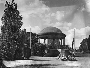
The Kingaroy Soldiers' Memorial Rotunda was started on ANZAC Day, April 25, 1922. It was officially opened on June 29, 1932.
During World War II, the Royal Australian Air Force (RAAF) used Kingaroy Airport. Many squadrons were based there from mid-1942. They used planes like Avro Ansons, CAC Wirraways, and Curtiss P-40E Kittyhawks. The RAAF also had a training school in Kingaroy. The Kingaroy R.A.A.F. Post Office was open from August 1942 to February 1946.
Kingaroy celebrated its 100th birthday in 2004. In 2007, Kingaroy was the first place in Australia to have Level 7 water restrictions. This means people had to save a lot of water. Kingaroy has grown in recent years. In 2006, the population was 7,620.
How Many People Live in Kingaroy?
| Source | Population (urban centre) | Population (locality) | Notes |
|---|---|---|---|
| 2001 census | 7,147 | ||
| 2006 census | 7,620 | ||
| 2011 census | 9,586 | ||
| 2016 census | 10,020 | ||
| 2021 census | 10,266 |
Important Historical Places
Kingaroy has several places listed on the Queensland Heritage Register. These are buildings and sites that are important to the history of Queensland. Some of these include:
- St Michael and All Angels Church, 2–6 Alford Street
- Carroll Cottage, 6 Edward Street
- The old Kingaroy Shire Council Chambers (now the Kingaroy Regional Art Gallery), 126 Haly Street
- Kingaroy Peanut Silos, 117–131 Haly Street
- Burrandowan Station Homestead, Kingaroy Road, Durong
- Taabinga Homestead, 7 Old Taabinga Road, Haly Creek
- Wylarah, South Burrandowan Road, Ironpot
- The old Kingaroy Butter Factory, 67 William Street
The South Burnett Regional Council also lists other important local sites. These include the Kingaroy Showgrounds, which has several old buildings and structures.
Schools in Kingaroy
Kingaroy has several schools for students of all ages:
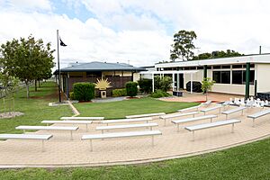
- Kingaroy State School is a government primary school for students from Early Childhood to Year 6. It is located at 61 Alford Street. In 2018, it had 503 students.
- Taabinga State School is another government primary school for students from Prep to Year 6. It is on Rae Street. In 2018, it had 354 students. This school also has a war memorial.
- Saint Mary's Catholic College is a Catholic school for both primary and secondary students (Prep to Year 12). It is at 10 Kent Street. In 2018, it had 480 students.
- St John's Lutheran School is a private school for primary and secondary students (Prep to Year 9). It is at 84-94 Ivy Street. In 2018, it had 432 students.
- Kingaroy State High School is a government secondary school for students from Year 7 to Year 12. It is on Toomey Street. In 2018, it had 999 students.
The Kingaroy campus of TAFE Queensland is a college for vocational training. It is located on the Bunya Highway.
Kingaroy's Economy
Kingaroy has always been important for Australia's peanut and navy bean industries. But since the 1990s, it has also become a center for the growing wine industry in the South Burnett.
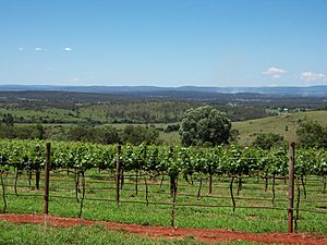
Farmers started growing grapes because of droughts and problems with peanut crops. The rich volcanic soil, hot, dry summers, and cold winters are perfect for growing grapes. Many vineyards were started in the area. The success of these wineries has helped the South Burnett region become a popular place for tourists.
Bean Growers Australia has its main office and processing factory in Kingaroy. They work with farmers who grow many types of beans. These include soybeans, adzuki beans, mung beans, and chickpeas.
Other crops grown in Kingaroy include sorghum, wheat, maize, sunflowers, and citrus fruits. Kingaroy is also a major area for pork production. Since the 1960s, it has had one of Queensland's largest pig processing factories, Swickers Kingaroy Bacon Factory.
Forestry plantations have also become common in the area since the early 2000s. These plantations are expected to create many jobs for local people in the future.
Sports in Kingaroy
Kingaroy has a lively sports scene. Many famous sports people come from Kingaroy. These include rugby league players Chris Sandow and Chris McQueen. Rugby union player Berrick Barnes and cricket players Matthew Hayden and Holly Ferling also grew up here.
Kingaroy has its own golf club and cricket club. The Kingaroy Bowls Club has two grass greens. The Kingaroy & District Tennis Association has eight synthetic grass courts. Kingaroy also has a well-known speedway track.
Rugby League is very popular in Kingaroy. The town's rugby league team is called the Kingaroy Red Ants. They play in the South Burnett Rugby League competition.
Kingaroy also has two soccer teams, Gunners and Wests. They play in the South Burnett's Football competition. The South Burnett Thrashers are a rugby union team based in Kingaroy. In 2013, an Australian Rules Football (AFL) team, the South Burnett Saints, joined a competition. They play at Lyle Vidler Oval in Kingaroy.
The Kingaroy Showgrounds is also home to the Kingaroy Speedway. This is a 400-meter (437-yard) clay oval track. The speedway opened in 1968 and is run by the South Burnett Speedway Club.
Culture and Fun in Kingaroy
Kingaroy has a lively cultural and social life. It has an art gallery and several local craft shops. There are also many well-kept parks. The South Burnett Regional Council runs a public library in Kingaroy.
You can find live entertainment at the Returned Services League club and in several hotels. There are also a few wineries very close to town.
The South Burnett Musical Comedy Society (SBMCS) is based in Kingaroy. They put on a small show in April or May and a big musical production later in the year. The group celebrated its 30th anniversary in 2019.
Important Services in Kingaroy
Kingaroy has many important services for its residents:
- Kingaroy Police Station is at 11-13 Alford Street.
- Kingaroy Fire Station is on the corner of Kent Street and Edward Street.
- Kingaroy SES Facility is at 5 Glendon Street.
- Kingaroy Hospital is a public hospital at 152-176 Youngman Street.
- Lady Bjelke-Petersen Community Hospital (a private hospital) is at 31 Markwell Street.
- Kingaroy Ambulance Station is on the corner of Kent and Edward Street.
The Kingaroy Public Library opened in 1945 and was updated in 2011. Kingaroy also has an aerodrome (small airport) a few kilometers from the town center. There is a bus service between Proston and Caboolture on weekdays.
The Kingaroy Wastewater Treatment Plant is at 7-33 Hodges Road. The South Burnett Regional Council has a depot at 2 Ivins Street.
Shopping and Community Places
- Kingaroy Shoppingworld is a shopping center. It is on the corner of Youngman and Alford Street. It has stores like Woolworths and Big W.
- The Kingaroy branches of the Queensland Country Women's Association meet at the Kingaroy CWA hall at 122-124 Kingaroy Street.
- Kingaroy Showground is at 41-47 Avoca Street.
Parks to Enjoy
Kingaroy has many parks for recreation:
- Adermann Park
- Apex Park
- Belle Street Park
- Bjelke Petersen Recreation Reserve
- Carroll Nature Reserve
- Cowie Drive Park
- Dell Court Park
- Doonkuna Street Park
- Earl Park
- Earle Park Kingaroy
- Fisher Street
- Freemans Nature Park
- Gwalia Court Park
- J A Carroll Park
- Kingaroy Heights Environmental Park
- Memorial Park
- North Street Park
- O'Neill Square
- River Road Park
- Rotary Park
- Sonaree Crescent Park
- Walter Road Park
- Gordonbrook Dam
Fun Events in Kingaroy
Kingaroy hosts several regular events throughout the year:
- Wine and Food in the Park Festival (held every March)
- Kingaroy Show (held every May)
- Burrandowan Picnic Races (held every May since 1922)
- Kingaroy Bacon Fest (held every August since 2018)
- The week-long UAV Outback Challenge (a flying robot competition held every two years in September)
- Christmas Carnival (held every December)
Places to Visit in Kingaroy
The town center is dominated by the tall peanut silos of the Peanut Company of Australia. They are a well-known landmark.
Right across from the peanut silos is the Information, Art, and Heritage Precinct. This complex includes:
- The Kingaroy Regional Art Gallery
- A Visitor Information Centre
- A Heritage Museum
- An area that shows off local industries.
The Heritage Precinct also has:
- Carroll's Cottage (the first building built in Kingaroy)
- The Carrollee Hotel
- The Shire's earliest Council Chambers (built in 1913).
The Kilkivan to Kingaroy Rail Trail follows an old railway line. It is 88 kilometers (55 miles) long. It goes through towns like Goomeri, Murgon, and Wondai. The section from Murgon to Kingaroy is 44 kilometers (27 miles) long and is paved for walkers and cyclists.
Kingaroy has two lookouts:
- Mt Wooroolin Lookout offers 360-degree views. It has picnic tables and barbecues. There is also a 2.4-kilometer (1.5-mile) loop trail for hikers and mountain bikers. You might spot birds like Regent Bowerbirds here.
- Apex Park and Lookout is next to the Carrol Nature Reserve. You can reach the lookout by a walking track. You might see birds like Dollar birds and Eastern whipbird here.
The Kingaroy Observatory moved to its new location at the airport in 2015. It is a popular place for tourists to look at the Universe through powerful telescopes. The sky here is very dark, with little light pollution.
The town is surrounded by amazing scenery, making it great for bushwalking. Several wineries are in or near the town. The Booie Range Distillery, which opened in 2001, is also nearby.
Kingaroy is the biggest town in the South Burnett. It is the main business center for the region. It has hotels, motels, caravan parks, restaurants, and petrol stations. Kingaroy even has its own shopping mall with stores like Woolworths and Big W.
The Big Peanut
The Big Peanut is a large sculpture in Lions Park. It is considered one of Australia's big things. Artist Kane Minogue made it from old farm machinery. It weighs 450 kilograms (992 pounds) and is 3.4 meters (11 feet) tall. It is 1.4 meters (4.6 feet) wide.
The Big Peanut was put in Lions Park in November 2021. It was officially shown to the public in April 2022. This event also celebrated the people who helped make it happen. The idea for a "Big Peanut" had been around for over 30 years. In 2017, a social media campaign called "Kingaroy Needs A Big Peanut" gained a lot of support. Before it was built, The Big Peanut was even shown in an episode of the TV show Bluey in 2020.
Famous People from Kingaroy
- Charles Adermann, politician
- Evan Adermann, politician
- Matt Ballin, rugby league player
- Berrick Barnes, rugby league and rugby union player
- Florence Bjelke-Petersen, politician and writer
- Joh Bjelke-Petersen, 31st Premier of Queensland
- Dave Brown, rugby league player
- Taliqua Clancy, beach volleyball player
- Jim Edwards, politician
- Bill Feldman, policeman and politician
- Holly Ferling, cricket player
- Deb Frecklington, politician
- Matthew Hayden, cricket player
- Ellen Kent Hughes, doctor
- Bob Irwin, naturalist and father of Steve Irwin
- Kelvin Kerkow, lawn bowls player and author
- David Jull, politician
- Don Livingstone, politician
- Brittany Lauga, politician and town planner
- George Logan, politician
- Ian Macfarlane, politician
- Chris McQueen, rugby league player
- Trevor Perrett, politician
- Colin Petersen, musician and music producer
- Carl Rackemann, cricket player
- Chris Sandow, rugby league player
- Brad Tessmann, rugby league player
- Robyn Thorn, swimmer
- Esikeli Tonga, rugby league player
- Willie Tonga, rugby league player
- Warren Truss, politician, 16th Deputy Prime Minister of Australia
- Jack Venman, pastoralist
See also
 In Spanish: Kingaroy para niños
 | Delilah Pierce |
 | Gordon Parks |
 | Augusta Savage |
 | Charles Ethan Porter |


