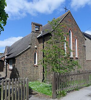
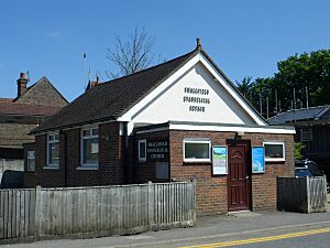
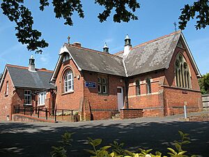
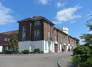
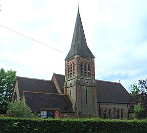
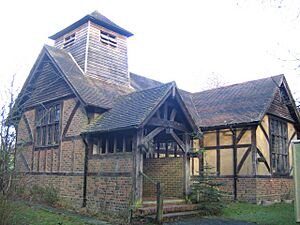
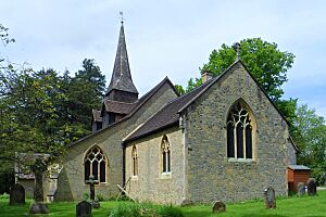
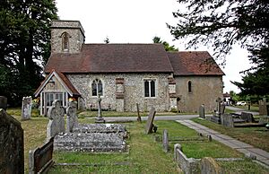
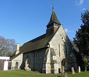
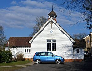
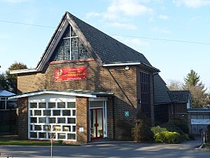
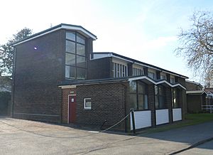
List of places of worship in Tandridge District facts for kids
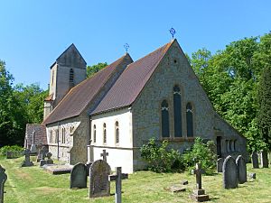
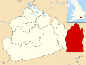
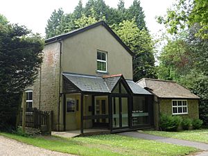
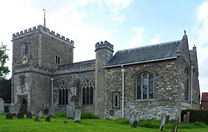
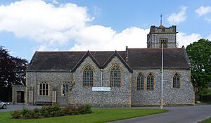
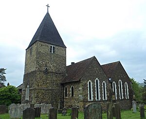
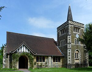
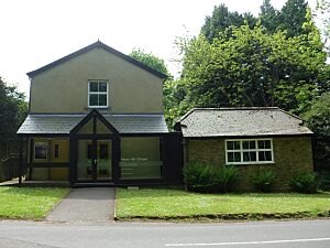
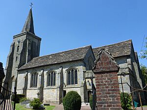
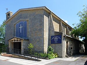
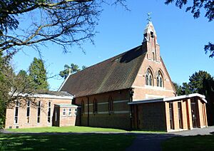
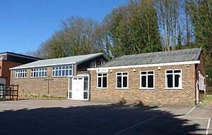
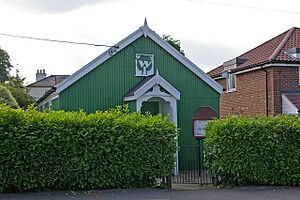
Tandridge is a district in the eastern part of Surrey, England. It has more than 70 places where people have worshipped over the years. These religious buildings range from very old ones built during the Norman era (around 1066) to modern ones. You can find many different styles of buildings here, from large stone churches to smaller wooden or metal chapels. As of 2022, 61 of these places are still used for religious services, and 13 others are now used for different things.
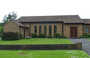
Most people in Tandridge are Christian. The Church of England, which is the official church of the country, has the most churches here. There are also many Roman Catholic, Methodist, Baptist, and United Reformed Church congregations. Other Protestant groups, often called Nonconformists, also have their own chapels. Even Jehovah's Witnesses and the Church of Jesus Christ of Latter-day Saints have important buildings in the district.
Many of these religious buildings are "listed" by English Heritage. This means they are special because of their history or architecture. There are three levels of listing: Grade I (most important), Grade II* (very important), and Grade II (special interest). In 2001, Tandridge had 20 Grade I buildings, 52 Grade II* buildings, and 519 Grade II buildings.
Contents
About the Tandridge District
Tandridge is the easternmost of Surrey's 11 districts. Surrey is a county in southeast England, just south of London. The district covers about 50,440 acres (20,410 hectares) and had about 83,000 people living there in 2011. It shares borders with parts of London, and with other districts in Kent, East Sussex, and West Sussex.
Most of Tandridge is countryside. Caterham is the biggest town, with about 31,000 people. Oxted has about 11,000. More than half of the people live in the northern part of the district, which is closer to London. This area includes towns like Caterham, Oxted, Warlingham, Whyteleafe, and Woldingham. Many small villages in the district have a long history. Each often has its own church, and sometimes other places of worship too.
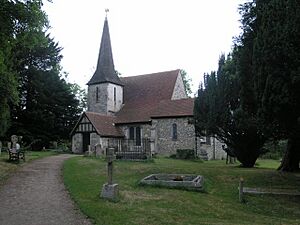
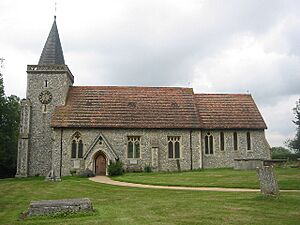
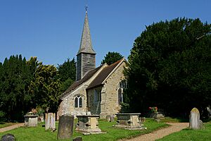
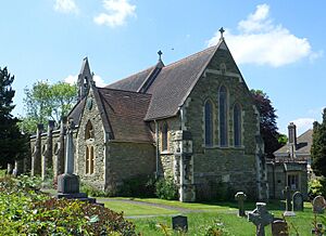
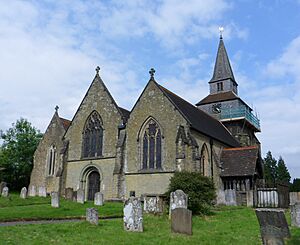
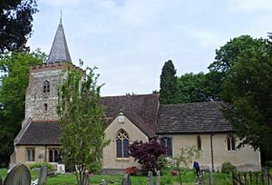
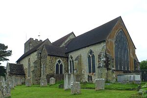
Some Anglican (Church of England) churches in Tandridge are very old, dating back to the 1100s or even earlier. You can find these in places like Bletchingley, Burstow, Chelsham, Horne, and Nutfield. Many have been repaired or changed over time, but their old parts still remain. For example, Caterham's St Lawrence Church is from around 1100 and has a "truly remarkable" old window. It is still used today, even though two newer churches were built in Caterham in the 1800s. Other Anglican churches were built in the Victorian era (1837-1901) and the 1900s as towns and villages grew.
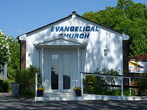
Protestant Nonconformist groups have been active in Tandridge for a long time. Baptists have worshipped in Dormansland since 1792. Their church, built in 1817, helped start other Baptist churches nearby. Pains Hill Chapel near Limpsfield has been around since 1823. After World War II, new Evangelical churches started in Hurst Green and Smallfield.
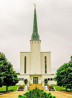
The village of Newchapel is home to the London England Temple, which was the first Latter-day Saints' Temple built outside the United States. Larger towns like Caterham and Oxted have churches for many different groups. These include the Congregational Federation, Open Brethren, Christian Science, Roman Catholic, and United Reformed churches. Oxted's Catholic and United Reformed churches are both Grade II listed. The Catholic church, built in the early 1900s, mixes Gothic Revival and Arts and Crafts styles. The United Reformed church, built in the 1930s, looks like Byzantine buildings.
Methodist churches were recorded in Bletchingley, Caterham, Lingfield, and Warlingham in 1947. Caterham's Methodist chapel is still in use. Warlingham's was replaced by a new building in 1961. Lingfield's is now used for other purposes. The Plymouth Brethren Christian Church has meeting rooms in Whyteleafe.
Religious Groups in Tandridge
The 2011 UK Census showed that about 83,000 people lived in Tandridge.
- About 64.87% said they were Christian.
- About 0.74% were Hindu.
- About 0.72% were Muslim.
- About 0.36% were Buddhist.
- About 0.16% were Jewish.
- About 0.07% were Sikh.
- About 0.32% followed another religion.
- About 25.27% said they had no religion.
- About 7.5% did not say their religion.
The number of Christians in Tandridge was higher than the average for England. However, the numbers of Muslims, Hindus, Jews, Sikhs, and Buddhists were lower than the national average. The number of people with no religion was slightly higher than the national average.
How Churches are Managed
Anglican Churches
All the Anglican (Church of England) churches in Tandridge are part of the Anglican Diocese of Southwark. This diocese is based at Southwark Cathedral in London. The churches in Tandridge belong to two main groups: Caterham Deanery and Godstone Deanery.
- Caterham Deanery includes churches in Caterham, Warlingham, Woldingham, Chaldon, Chelsham, Farleigh, and Whyteleafe.
- Godstone Deanery covers churches in Bletchingley, Blindley Heath, Burstow, Crowhurst, Dormansland, Felbridge, Godstone, Horne, Hurst Green, Limpsfield, Limpsfield Chart, Lingfield, Nutfield, Outwood, Oxted, South Godstone, South Nutfield, Tandridge, and Tatsfield. The church hall in Smallfield is also used for services.
Roman Catholic Churches
There are Roman Catholic churches in Caterham, Lingfield, Oxted, and Warlingham. They are part of the Roman Catholic Diocese of Arundel and Brighton, which has its main church in Arundel in West Sussex. Caterham, Oxted, and Warlingham churches are in the Redhill Deanery. Lingfield's church is in the Crawley Deanery because it shares a parish with East Grinstead.
Other Denominations
- Baptist Churches: Dormansland Baptist Church and Godstone Baptist Church are part of regional Baptist networks.
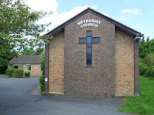
- Methodist Churches: The three Methodist churches in Caterham, Hurst Green, and Warlingham are part of the Purley Methodist Circuit.
- United Reformed Churches: The United Reformed churches in Caterham and Oxted are part of the Southern Synod.
- Evangelical Churches: Smallfield Evangelical Church is part of the Fellowship of Independent Evangelical Churches (FIEC) and Affinity, which are networks for evangelical churches.
- Other Links: Caterham Community Church, Dormansland Baptist Church, Godstone Baptist Church, King's Church at Oxted, Oakhall Church, and Whyteleafe United Free Church are connected to the Evangelical Alliance. Caterham Community Church is also part of the Congregational Federation, a group of independent Congregational churches. Oakhall Church in Caterham is part of Partnership UK, a support network for independent churches.
Current Places of Worship
| Name | Image | Location | Denomination/ Affiliation |
Grade | Notes |
|---|---|---|---|---|---|
| St Mary the Virgin's Church | Bletchingley 51°14′29″N 0°05′58″W / 51.2414°N 0.0995°W |
Anglican | I | This church is in a large churchyard. Its Norman tower was added to in the 1600s and 1910. The nave is from around 1180, and much of the 1200s work remains. An aisle was added in 1856, and J.L. Pearson restored it in 1870. | |
| St Mark's Chapel | Bletchingley 51°13′23″N 0°04′48″W / 51.2231°N 0.0799°W |
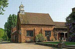
Anglican | II | This private chapel on the South Park estate was a 1600s barn. It was changed into a chapel in 1909, but burned down and was rebuilt in 1912. It is made of red and brown brick and tiles. A decorative cupola with a clock and weathervane sits on the roof. | |
| St John the Evangelist's Church | Blindley Heath 51°11′46″N 0°03′13″W / 51.1962°N 0.0536°W |
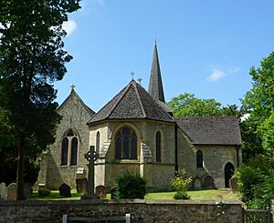
Anglican | II | This church, in the Early English Gothic Revival style, was mostly built by Whichcord & Walker in 1842. Gordon Macdonald Hills added the apse and another aisle in 1886. It has stained glass by Morris & Co.. The walls are made of rubble and ashlar stone. | |
| St Bartholomew's Church | Burstow 51°09′21″N 0°07′29″W / 51.1559°N 0.1248°W |
Anglican | I | The Archbishop of Canterbury may have built the first church here. It has 1100s windows and other Norman features. However, most of the work is from the 1400s. The 1500s tower is covered in weatherboard and has a shingled spire. Astronomer Royal John Flamsteed was a rector here. | |
| St Lawrence's Church | Caterham 51°16′56″N 0°05′10″W / 51.2821°N 0.0860°W |
Anglican | I | This old village church stopped being used in 1866 but reopened in 1927 and is now used regularly. The Norman-era apse is gone, but much of the 1100s and 1200s work remains. The walls still have their original rubble and clunch stone. | |
| St John the Evangelist's Church | Caterham 51°16′56″N 0°05′07″W / 51.2821°N 0.0853°W |
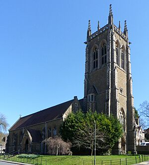
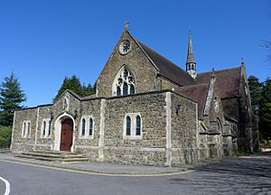
Anglican | II | This large church was built in 1881–82 for the growing Caterham Valley area. William Bassett Smith designed it, and Thomas Graham Jackson later extended it. The east window has Art Nouveau influences. The church is made of Bargate stone in the Decorated Gothic Revival style. | |
| St Mary the Virgin's Church | Caterham 51°16′52″N 0°04′35″W / 51.2811°N 0.0763°W |
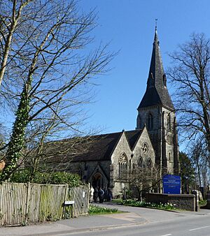
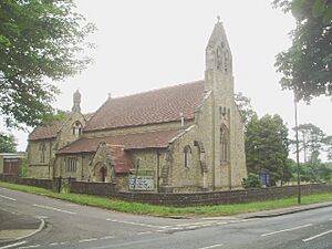
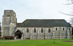
Anglican | II | William and C.A. Bassett Smith designed this new parish church for Caterham, built in 1866–68. It is made of flint and stone in the Early English Gothic Revival style. The tall tower with a broach spire is closest to the road. | |
| Caterham Baptist Chapel | Caterham 51°17′16″N 0°04′37″W / 51.2879°N 0.0769°W |
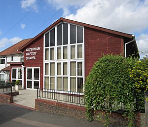
Baptist | – | This chapel opened in 1895, replacing an older building. It was registered in May 1978. Over time, the church changed its beliefs to align with General Baptists. | |
| Caterham Community Church | Caterham 51°17′16″N 0°05′53″W / 51.2878°N 0.0981°W |
Congregational Federation | – | This church was founded in 1876 as Caterham Hill Congregational Church and rebuilt in 1892. It is in the Caterham on the Hill area and holds weekly services. | |
| Caterham Christian Centre | Caterham 51°17′06″N 0°04′44″W / 51.2850°N 0.0788°W |
Evangelical | – | This Evangelical group started in the 1990s. An older Open Brethren place of worship, Bethany Hall, was on this site from 1888. The original timber building was replaced with a brick one in the 1960s. | |
| Caterham Methodist Church | Caterham 51°17′20″N 0°05′56″W / 51.2890°N 0.0989°W |
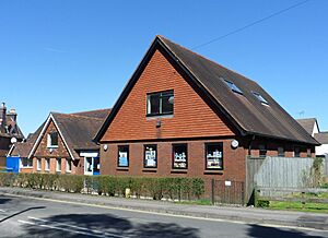
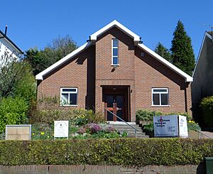
Methodist | – | This chapel was first used by Nonconformist soldiers at the nearby barracks in 1904. It later opened for public Methodist worship. The inside was updated in the 1990s, and it is now used for community events and Sunday school. | |
| Oakhall Church | Caterham 51°17′00″N 0°05′54″W / 51.2834°N 0.0982°W |
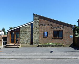
Non-denominational | – | The first Oakhall Church started in 1894. A small building was used until 2019, when the group moved to a much larger building in Caterham. The new church was officially registered in March 2019. | |
| Church of the Sacred Heart | Caterham 51°17′15″N 0°05′11″W / 51.2874°N 0.0864°W |
Roman Catholic | II | This church and a school opened in 1881. Edward Ingress Bell designed the church in a cruciform (cross-shaped) layout, using Bargate stone in the Early English Gothic Revival style. The nave was extended in 1930. The inside is "impressive" and includes Hardman & Co. stained glass. | |
| Caterham United Reformed Church | Caterham 51°16′49″N 0°04′47″W / 51.2803°N 0.0798°W |
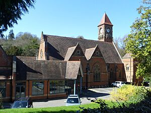
United Reformed Church | – | This church was founded in 1863. A temporary building was replaced by a chapel in 1865. The current large building, with a clock tower, was designed by John Sulman and opened in 1875. | |
| St Peter and St Paul's Church | Chaldon 51°17′07″N 0°07′29″W / 51.2854°N 0.1247°W |
Anglican | I | One window from the 1000s still exists, but the church mostly looks like it did in the late 1100s. It is made of flint, chalk, and local firestone. The Decorated Gothic east window has stained glass from 1869. A mural from around 1200, showing the Purgatorial Ladder, is called "the most interesting ancient wall-painting in England." | |
| St Leonard's Church | Chelsham 51°18′51″N 0°00′32″W / 51.3142°N 0.0089°W |
Anglican | II | Repairs in 1870–71 made the 1200s outside of the church "almost unrecognisable." However, some older parts remain, like herringbone brickwork and a 1100s column inside. The tower is from the 1400s. | |
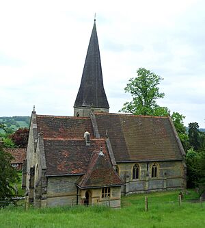
| St George's Church | Crowhurst 51°12′34″N 0°00′38″W / 51.2094°N 0.0106°W |
Anglican | II | This church is mostly from the 1100s, with walls of local stone and some brick. A tall broach spire rises from a weatherboarded turret. The windows are from different periods. Not much repair work has been done, making it "one of the most interesting churches in the district." | |
| St John the Evangelist's Church | Dormansland 51°09′35″N 0°00′19″E / 51.1597°N 0.0053°E |
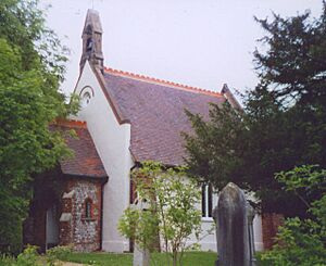
Anglican | – | This church, in the Decorated Gothic Revival style, was designed in 1883 by Arthur Blomfield. It became its own parish two years later. The stone building has a bellcote (a small structure holding a bell). | |
| Dormansland Baptist Church | Dormansland 51°09′48″N 0°00′27″E / 51.1634°N 0.0075°E |
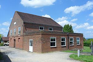
Baptist | – | An earlier chapel from 1786 was replaced in 1817 by this two-storey brick building. It has a plain design with gable ends and a string-course (a horizontal line) between the floors. There are three arched windows on the front. | |
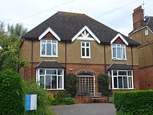
| Claridge House | Dormansland 51°10′01″N 0°00′20″E / 51.1669°N 0.0055°E |
Quaker | – | Claridge House is mainly a Quaker healing and spiritual retreat center. However, public worship meetings are held every Sunday. It is part of a group of eight Quaker meeting houses in Surrey and West Sussex. | |
| St Mary's Church | Farleigh 51°19′24″N 0°01′54″W / 51.3233°N 0.0318°W |
Anglican | I | This small church in a remote village dates from around 1100 and 1250. The nave and original part of the chancel are from the earlier period. In the mid-1200s, 10 feet (3 meters) were added to the chancel, and new windows were put in. The walls are made of flint and Caen stone. | |
| St John the Divine's Church | Felbridge 51°08′29″N 0°02′21″W / 51.1415°N 0.0393°W |
Anglican | – | Felbridge was originally part of Godstone parish. This local stone building by William White dates from 1865. A new parish was created for it. The church has a Decorated Gothic Revival style outside and a "well proportioned" inside. | |
| St Nicholas' Church | Godstone 51°14′47″N 0°03′26″W / 51.2464°N 0.0573°W |
Anglican | I | This church was greatly expanded in 1845 and 1872. It has origins in the 1100s, but most of it is from the 1200s and 1300s. George Gilbert Scott lived in the area and did major work in 1872, including extending the spire. Ward and Hughes designed the stained glass in the east window in 1865. | |
| St Mary's Chapel | Godstone 51°14′48″N 0°03′24″W / 51.2466°N 0.0568°W |
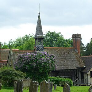
Anglican | II* | George Gilbert Scott also worked on the "very picturesque" almshouses next to the church, built in 1872. This group includes a chapel that is open to the public for Anglican services once a month. The chapel has a small spire and a "domestic-style" interior with timber framing. | |
| Godstone Baptist Church | Godstone 51°15′14″N 0°04′02″W / 51.2538°N 0.0671°W |
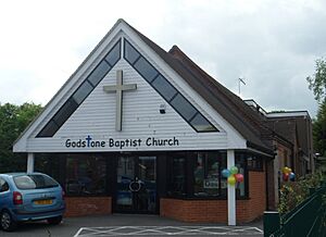
Baptist | – | A Baptist chapel has been in Godstone since 1882. The current building was registered for marriages in 1940. The original building was a tin tabernacle (a church made of corrugated iron) that could hold 250 people. | |
| St Mary the Virgin's Church | Horne 51°10′58″N 0°05′19″W / 51.1827°N 0.0887°W |
Anglican | II* | Horne's 1300s church has only had its own parish since 1705. Gordon Macdonald Hills did a "drastic" restoration in 1880, moving old parts around. These include 1300s and 1400s windows and the south entrance. There is a timber bellcot with a small spire. | |
| St John the Evangelist's Church | Hurst Green 51°14′44″N 0°00′00″W / 51.2456°N 0.0001°W |
Anglican | – | This church was completed in 1912, designed by John Oldrid Scott, to replace an earlier mission hall. It was extended in 1962, and a fire caused serious damage in 1988. | |
| Hurst Green Evangelical Free Church | Hurst Green 51°14′41″N 0°00′18″E / 51.2446°N 0.0051°E |
Evangelical | – | This church replaced an older mission hall on the same site. It was registered for worship and marriages in May 1955. | |
| Hurst Green Methodist Church | Hurst Green 51°14′32″N 0°00′17″E / 51.2422°N 0.0046°E |
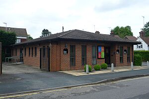
Methodist | – | The congregation meets in a modern building near Hurst Green railway station. It was registered for worship and marriages in October 1961. Various worship and social activities happen here regularly. | |
| St Peter's Church | Limpsfield 51°15′40″N 0°00′44″E / 51.2610°N 0.0123°E |
Anglican | I | The plain, strong tower dates from the 1180s. Some herringbone brickwork (bricks laid in a zigzag pattern) in the west wall is from the same time. The rest of the church is from the 1200s, though parts were added later. Clayton and Bell provided stained glass in 1871. | |
| St Andrew's Church | Limpsfield Chart 51°14′51″N 0°02′34″E / 51.2476°N 0.0429°E |
Anglican | – | Also known as St Andrew's-on-the-Chart, this church was founded in 1895 and finished in 1902 with a spire-topped tower. Reginald Blomfield designed it in a Gothic Revival style. Inside, the reredos (decorated screen behind the altar) has Arts and Crafts features. | |
| Pains Hill Chapel | Limpsfield Chart 51°15′00″N 0°01′25″E / 51.2499°N 0.0237°E |
Evangelical | – | A congregation formed in this isolated area, and a chapel was built in 1823. The first service in the 150-person building was on August 6, 1823. By 1860, it became a Baptist church, and in 1966, it became an independent Evangelical church. | |
| St Peter and St Paul's Church | Lingfield 51°10′35″N 0°00′52″W / 51.1764°N 0.0145°W |
Anglican | I | This became a collegiate church in 1431. Only the 1300s tower remains from before its 1400s rebuilding in the Perpendicular Gothic style. The church is made of sandstone and has a roof tiled with Horsham Stone. | |
| St Bernard's Church | Lingfield 51°10′32″N 0°01′06″W / 51.1755°N 0.0183°W |
Roman Catholic | – | Mass is held every Sunday morning at this church. It is part of the parish of East Grinstead with Lingfield. It was registered for worship in March 1945 and for marriages in April 1945. | |
| London England Temple | Newchapel 51°09′45″N 0°03′08″W / 51.1626°N 0.0522°W |
Latter-day Saint | – | This was the first temple of the Latter-day Saints built outside the United States, in 1958. Edward O. Anderson designed it, and T.P. Bennett and Son built it. It has a large hall with a tall spire-topped tower. | |
| St Peter and St Paul's Church | Nutfield 51°14′31″N 0°07′33″W / 51.2420°N 0.1258°W |
Anglican | II* | The church is in a large churchyard. It has some 1200s features, like the arcade (series of arches) to the north aisle and the chancel arch. W.O. Milne restored and extended it in 1882. The stained glass in the east window, with "deep sultry blues," is by Edward Burne-Jones (1890). | |
| St John the Baptist's Church | Outwood 51°11′54″N 0°06′46″W / 51.1982°N 0.1128°W |
Anglican | II | William Burges designed this chapel in 1869. It did not have a tower until 1876, when W.P. Manning added the "impressive" stuccoed saddleback structure (a roof that looks like a saddle). | |
| St Mary's Church | Oxted 51°15′33″N 0°00′31″W / 51.2591°N 0.0087°W |
Anglican | I | The church slowly developed between the 1100s and 1400s. The Bargate stone tower is the oldest part. The chancel is from the 1200s. Extensive Victorian restoration gave it its current look. It has "richly coloured" stained glass by Edward Burne-Jones. | |
| First Church of Christ, Scientist, Oxted | Oxted 51°15′15″N 0°00′45″W / 51.2543°N 0.0124°W |
Christian Scientist | – | This branch of the Mother Church in Boston, Massachusetts serves Oxted and the surrounding area. It was registered in November 1957. There is also a Christian Science Reading Room in the town. | |
| King's Church | Oxted 51°15′31″N 0°00′06″W / 51.2586°N 0.0017°W |
Evangelical | – | This Evangelical church has its main center and office in the town center. Worship services also take place at a school. | |
| Beadles Lane Gospel Hall | Oxted 51°15′06″N 0°00′59″W / 51.2518°N 0.0165°W |
Open Brethren | – | A "neat little chapel" opened in Oxted in 1811. The current building on Beadles Lane is used by the Open Brethren. | |
| All Saints Church | Oxted 51°15′39″N 0°00′15″W / 51.2609°N 0.0043°W |
Roman Catholic | II | Architect James Leonard Williams, known for house design, started All Saints in 1914. It was not finished until 1928, and a big extension was built in 2001. The outside uses a "sensitive blend of brick, stone and flint." | |
| Church of the Peace of God | Oxted 51°15′36″N 0°00′12″W / 51.2601°N 0.0034°W |
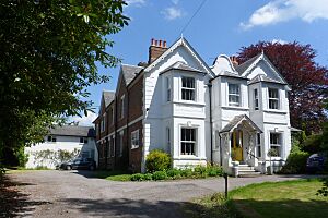
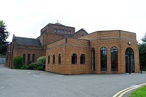
United Reformed Church | II | An older chapel from 1905 was replaced by this building in 1934–35. Frederick Lawrence designed this cross-shaped Byzantine Revival brick and tile building. It has an apsidal (rounded) chancel and a small tower with a cross added in 1959. | |
| Smallfield Church Hall | Smallfield 51°10′18″N 0°06′58″W / 51.1716°N 0.1162°W |
Anglican | – | This building is both a church hall and a chapel of ease (a smaller church for local use) for St Bartholomew's Church at Burstow. It is on Redehall Road in Smallfield village. | |
| Smallfield Evangelical Church | Smallfield 51°10′22″N 0°06′58″W / 51.1729°N 0.1160°W |
Evangelical | – | This church is in the center of Smallfield village. It was a long-established mission hall and was re-registered as an Evangelical church in April 1965. | |
| St Stephen's Church | South Godstone 51°13′11″N 0°02′57″W / 51.2197°N 0.0491°W |
Anglican | – | This church started as a school chapel, a building that served both purposes. It was originally connected to the main parish church at Godstone. | |
| Surrey Assembly Hall | South Godstone 51°11′15″N 0°04′00″W / 51.1874°N 0.0667°W |
Jehovah's Witnesses | – | This is a major regional center for Jehovah's Witnesses. It is in the former Hays Bridge Reformatory School, built in 1938. Its large Neo-Georgian style looks "utterly incongruous" (out of place) in the countryside. It was registered in March 1988. | |
| Christ Church | South Nutfield 51°13′24″N 0°08′11″W / 51.2234°N 0.1364°W |
Anglican | – | This part of Nutfield parish grew quickly after a railway station opened in 1883. Christ Church dates from 1888 and is a red-brick building in the Early English Gothic Revival style. It has a tower with a spire, an aisleless nave, and a lower chancel. | |
| St Silvan's Church | Staffhurst Wood 51°13′14″N 0°01′01″E / 51.2206°N 0.0170°E |
Anglican | – | This small church was originally a mission room for Limpsfield parish. It became a full church in 1930 but is still part of Limpsfield parish. Part of the church was turned into a house in 1976. | |
| St Peter's Church | Tandridge 51°14′35″N 0°01′55″W / 51.2431°N 0.0320°W |
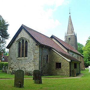
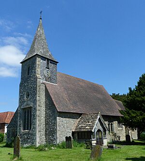
Anglican | I | The 1100s and 1300s nave had no aisles until 1844. Another aisle was added in 1874 by George Gilbert Scott. The church is known for its "timberwork," including the cross bracing that supports the small shingled spire. | |
| St Mary's Church | Tatsfield 51°17′12″N 0°01′52″E / 51.2868°N 0.0310°E |
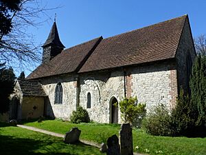
Anglican | II | The name of this isolated hilltop church was unknown in 1911. The old, tall walls are made of flint, chalk, local yellow sandstone, and plaster. Norman parts remain in the nave, which dates to around 1075. The chancel was changed in the 1220s. The Gothic-style tower was added in 1838. | |
| All Saints Church | Warlingham 51°18′49″N 0°03′22″W / 51.3136°N 0.0560°W |
Anglican | II* | Three Victorian restorations (in 1857, 1887, and 1893) changed the look of this 1200s flint church. In the last restoration, an aisle, chancel arch, and vestry were added, and the church was made 27 feet (8 meters) wider. It has a 1400s mural of Saint Christopher. | |
| St Christopher's Church | Warlingham 51°18′28″N 0°02′28″W / 51.3078°N 0.0411°W |
Anglican | – | This was built as a mission church in Warlingham parish in 1907, between Warlingham and Chelsham. J.C. King's "pretty weatherboarded" chapel was not designed in a specific style. An extension was added in 1967. | |
| Warlingham Methodist Church | Warlingham 51°18′31″N 0°03′04″W / 51.3086°N 0.0510°W |
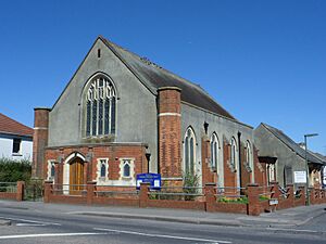
Methodist | – | A Wesleyan chapel existed in the village by 1897. Its license was canceled in March 1961, and the current building was registered in November 1961. | |
| St Ambrose's Church | Warlingham 51°18′28″N 0°03′15″W / 51.3077°N 0.0541°W |
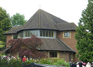
Roman Catholic | – | Many Roman Catholics lived in Warlingham by 1920. Weekly Masses started in a house in 1936. The church became independent in 1942. Bernard Moss designed the current church, built in 1957–58. | |
| St Luke's Church | Whyteleafe 51°18′29″N 0°04′58″W / 51.3080°N 0.0828°W |
Anglican | – | This red-brick church, in a Early English Gothic Revival style, opened in the Whyteleafe suburb in 1886. Its area was created from parts of Caterham, Coulsdon, and Warlingham parishes. | |
| Whyteleafe Free Church | Whyteleafe 51°18′40″N 0°04′45″W / 51.3111°N 0.0791°W |
Evangelical | – | Originally called Whyteleafe United Free Church, this building was certified for marriages in April 1935. | |
| Croydon Road Meeting Room | Whyteleafe 51°17′54″N 0°04′16″W / 51.2982°N 0.0711°W |
Plymouth Brethren Christian Church | – | This building on Croydon Road has been registered for worship by Brethren since March 1995. | |
| Westhall Road Meeting Room | Whyteleafe 51°18′35″N 0°04′41″W / 51.3097°N 0.0780°W |
Plymouth Brethren Christian Church | – | This building is in the former goods yard next to Upper Warlingham railway station. It was registered in April 1989 and is part of a group of meeting rooms. | |
| St Agatha's Church | Woldingham 51°16′38″N 0°02′06″W / 51.2772°N 0.0350°W |
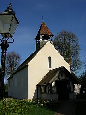
Anglican | – | This is Surrey's smallest parish church, with external dimensions of about 30 feet (9.2 meters) long by 20 feet (6.1 meters) wide. The inside is a single room with just a screen dividing it. The gable-ended roof has a bellcot. The church was restored in 1831–32. | |
| St Paul's Church | Woldingham 51°17′12″N 0°02′13″W / 51.2867°N 0.0370°W |
Anglican | II | The current parish church of Woldingham is in the village center and dates from 1933. Alexander Shaw, 2nd Baron Craigmyle funded it, and Herbert Baker designed the flint building in a neo-Perpendicular style. It has a lot of flushwork (decorative patterns) inside and out, including some with agate. |
Former Places of Worship
These buildings no longer hold religious services but are still standing and used for other purposes.
| Name | Image | Location | Denomination/ Affiliation |
Grade | Notes |
|---|---|---|---|---|---|
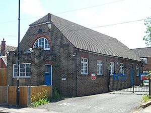
| Caterham Mission Church | Caterham 51°16′53″N 0°04′33″W / 51.2815°N 0.0757°W |
Anglican | – | This red-brick building was built in 1872 as a mission church. It was later moved and became St John's National School. After 1975, it was turned into a theater and day center called the Miller Centre. A blue plaque was put up in 2006 to remember its history. | |
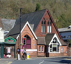
| Oakhall Church | Caterham 51°17′20″N 0°05′50″W / 51.2888°N 0.0973°W |
Non-denominational | – | Oak Hall, a mission hall for 250 people, opened in Caterham on the Hill in 1894. A new building was built on the same site in the 1970s. However, the group grew and moved to a much larger church elsewhere in Caterham. The old building is now rented out. | |
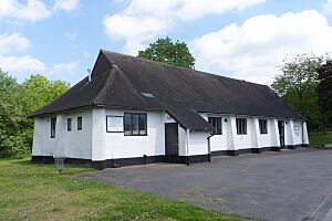
| St Agatha's Mission Hall | Hurst Green 51°14′36″N 0°00′10″E / 51.2434°N 0.0028°E |
Anglican | – | A temporary hut for railway workers was replaced in 1895 by this combined hall and church. When St John the Evangelist's Church was built in 1913, this building became its parish hall. It held services again between 1988 and 1990 after a fire damaged St John's. | |
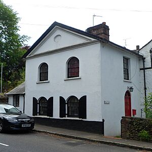
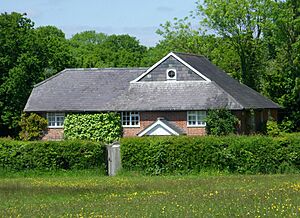
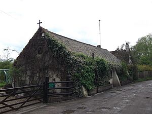
| Chapel | Limpsfield 51°15′26″N 0°00′55″E / 51.2572°N 0.0152°E |
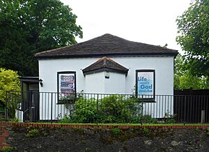
Unknown (Nonconformist) | II | Now called Chapel Cottage, this building was an old Nonconformist chapel from the early 1800s. It is attached to a 1600s house and has timber framing and painted brickwork. The roof is made of slate. The front of the chapel has a pediment (triangular roof part) with an oval shape in its center. | |
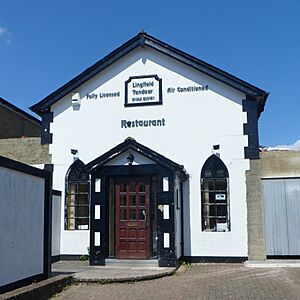
| Salem Chapel | Lingfield 51°10′29″N 0°01′03″W / 51.1746°N 0.0176°W |
Strict Baptist | – | This "neat little" chapel was founded in 1836. It was originally known as Killick's Chapel. The brick building has a stuccoed (plastered) front and a slate roof. The church closed in the late 1900s, and the building is now a restaurant. | |
| Lingfield Methodist Chapel | Lingfield 51°10′27″N 0°00′58″W / 51.1743°N 0.0160°W |
Methodist | – | A Wesleyan Methodist church on Lingfield High Street was registered in April 1912. It was replaced by Wesley Hall in October 1930. This building is also no longer used for religious services and is now a business. | |
| Outwood Baptist Church | Outwood 51°11′41″N 0°06′09″W / 51.1946°N 0.1025°W |
Baptist | – | Baptist ministry started in this village in 1710. A permanent church was built in 1834, costing £225. The church closed in 1979 and was sold. | |
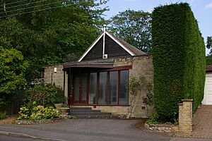
| Friends Meeting House | Oxted 51°15′22″N 0°00′25″W / 51.2562°N 0.0070°W |
Quaker | – | This meeting house was part of a house on East Hill Road. It was bought in 1963 and opened in 1964. It stopped being used around 2011, and the community planned to sell the building in 2015. | |
| Ebenezer Chapel | Smallfield 51°10′37″N 0°06′55″W / 51.1770°N 0.1152°W |
Strict Baptist | – | This chapel, originally called Smallfield Chapel, opened in 1851. Its walls are brick, and the front is stuccoed. The building became a veterinary surgery in the early 2000s. | |
| Tatsfield United Church | Tatsfield 51°17′49″N 0°01′45″E / 51.2970°N 0.0291°E |
United Reformed Church | – | A Baptist chapel was built in the village in 1888. It was later used for different Nonconformist services and then as a gospel hall. It was registered for the United Reformed Church in 1964 but has now closed. | |
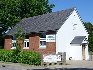
| New Gospel Hall | Tatsfield 51°17′42″N 0°01′38″E / 51.2950°N 0.0271°E |
Open Brethren | – | This tin tabernacle replaced an earlier gospel hall in Tatsfield. It was registered for worship between 1911 and 1964. It is now used by the Women's Institute. | |
| St James's Church | Titsey 51°16′35″N 0°01′08″E / 51.2765°N 0.0189°E |
Anglican | II* | This church, designed by J.L. Pearson in 1861, was the third church for the village. It used sandstone from Limpsfield. It was last used in 1960 and is now considered a "private chapel and monument." | |
| St Andrew's Church | Warwick Wold 51°15′34″N 0°07′20″W / 51.2594°N 0.1222°W |
Anglican | – | A chapel of ease was built in the small area of Warwick Wold in 1912. The first service was on October 6, 1912. It was sold and turned into a house after it stopped being used for religious purposes in the mid-1970s. |
Former Places of Worship Demolished Since 2000
These buildings were once places of worship but have been torn down since the year 2000.
| Name | Image | Location | Denomination/ Affiliation |
Grade | Notes |
|---|---|---|---|---|---|
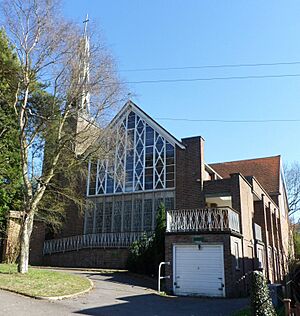
| St Thomas of Canterbury's Church | Whyteleafe 51°18′30″N 0°04′43″W / 51.3083°N 0.0785°W |
Roman Catholic | – | This church was designed in a "modern Gothic" style in 1961. It had a unique aluminum spire and beautiful stained glass by Pierre Fourmaintraux. The church closed in October 2010 due to fewer people attending. It was torn down in 2016 to make way for new homes. |


