Millstone Township, New Jersey facts for kids
Quick facts for kids
Millstone Township, New Jersey
|
||
|---|---|---|
|
Township
|
||
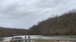
Perrineville Lake in Millstone, at the headwaters for Rocky Brook, in early spring
|
||
|
||
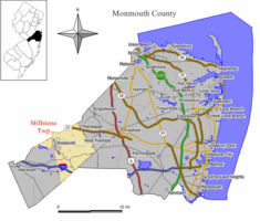
Location of Millstone Township in Monmouth County highlighted in yellow (right). Inset map: Location of Monmouth County in New Jersey highlighted in black (left).
|
||
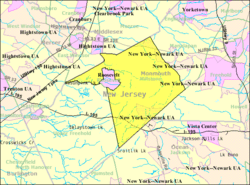
Census Bureau map of Millstone Township, New Jersey
|
||
| Country | ||
| State | ||
| County | Monmouth | |
| Incorporated | February 28, 1844 | |
| Named for | The Millstone River | |
| Government | ||
| • Type | Township | |
| • Body | Township Committee | |
| Area | ||
| • Total | 37.18 sq mi (96.30 km2) | |
| • Land | 36.61 sq mi (94.81 km2) | |
| • Water | 0.58 sq mi (1.49 km2) 1.55% | |
| Area rank | 64th of 565 in state 5th of 53 in county |
|
| Elevation | 223 ft (68 m) | |
| Population
(2020)
|
||
| • Total | 10,376 | |
| • Estimate
(2023)
|
10,320 | |
| • Rank | 237th of 565 in state 18th of 53 in county |
|
| • Density | 283.4/sq mi (109.4/km2) | |
| • Density rank | 481st of 565 in state 52nd of 53 in county |
|
| Time zone | UTC−05:00 (Eastern (EST)) | |
| • Summer (DST) | UTC−04:00 (Eastern (EDT)) | |
| ZIP Codes | ||
| Area code(s) | 732 exchanges: 833, 928 | |
| FIPS code | 3402546560 | |
| GNIS feature ID | 0882115 | |
Millstone Township is a community located in western Monmouth County, New Jersey. It's part of the New York metropolitan area. In 2020, about 10,376 people lived here.
The township gets its name from the Millstone River. The river was named after a story where a millstone (a large stone used in mills to grind grain) was dropped into it. The river actually starts in Millstone Township!
Millstone Township is known for being one of the wealthiest communities in New Jersey. In 2017, the average household income was over $156,000, which was more than double the state average.
Contents
History of Millstone Township
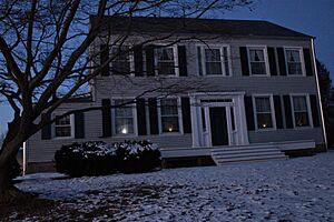
Long ago, the Lenape Native Americans lived in the area that is now Millstone. Later, European settlers arrived. One of the first settlers was an English leather worker named Clark, before the American Revolutionary War.
Millstone Township was once made up of several small villages. Today, Clarksburg still looks a lot like it did in the past. Another area, Perrineville, was named after John Perrine, who bought a large piece of land there.
During the American Revolutionary War, Millstone was important. It had a secret post for the American army. A place called the Rising Sun Tavern, which was the first business in the township, was used by George Washington and later by British General Henry Clinton. Famous people like Benjamin Franklin also visited the tavern.
Millstone Township officially became a township on February 28, 1844. It was created from parts of other nearby townships. Later, in 1937, a small part of Millstone became the borough of Jersey Homesteads, which is now called Roosevelt.
Geography and Nature
Millstone Township covers about 37 square miles (96 square kilometers). Most of this area is land, with a small amount of water.
There are a few small communities within the township. The main ones are Clarksburg (ZIP code 08510) and Perrineville (ZIP code 08535).
Millstone Township shares its borders with several other towns. These include Freehold Township, Manalapan Township, Roosevelt, and Upper Freehold Township in Monmouth County. It also borders towns in Mercer, Middlesex, and Ocean counties.
Rivers and Lakes
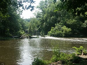
Millstone Township is special because many important rivers and streams in New Jersey start here. It's located on a small hill, which helps these waterways begin their journey.
The township is mostly within the Raritan Valley region. Many of its streams flow into the Raritan River. The Millstone River itself, a major branch of the Raritan River, begins in Millstone Township.
Some parts of the township also drain into the Delaware River. For example, the Assunpink Creek flows through the southern and western areas. You can find the Assunpink Wildlife Preservation Area here, which is a great place to see migratory birds, go mountain biking, or hike.
Another important river that starts near Millstone is the Toms River. This river flows south through the New Jersey Pine Barrens to the Barnegat Bay.
Other notable bodies of water in the township include:
- Assunpink Lake
- Perrineville Lake
- Rising Sun Lake
The area is home to many Oak trees and other Hardwood trees, forming a beautiful forest.
Population in Millstone Township
| Historical population | |||
|---|---|---|---|
| Census | Pop. | %± | |
| 1850 | 1,676 | — | |
| 1860 | 2,356 | 40.6% | |
| 1870 | 2,087 | −11.4% | |
| 1880 | 2,080 | −0.3% | |
| 1890 | 1,782 | −14.3% | |
| 1900 | 1,509 | −15.3% | |
| 1910 | 1,461 | −3.2% | |
| 1920 | 1,405 | −3.8% | |
| 1930 | 1,428 | 1.6% | |
| 1940 | 1,466 | * | 2.7% |
| 1950 | 2,100 | 43.2% | |
| 1960 | 2,550 | 21.4% | |
| 1970 | 2,535 | −0.6% | |
| 1980 | 3,926 | 54.9% | |
| 1990 | 5,069 | 29.1% | |
| 2000 | 8,970 | 77.0% | |
| 2010 | 10,566 | 17.8% | |
| 2020 | 10,376 | −1.8% | |
| 2023 (est.) | 10,320 | −2.3% | |
| Population sources: 1850–1920 1850–1870 1850 1870 1880–1890 1890–1910 1910–1930 1940–2000 2000 2010 2020 *=lost territory in previous decade. |
|||
In 2010, there were 10,566 people living in Millstone Township. This was a big increase from the 8,970 people who lived there in 2000. By 2020, the population was 10,376.
Most households in Millstone Township are families, with many having children under 18. The average household has about 3 people.
How Millstone Township is Governed
Local Government
Millstone Township is run by a group called the Township Committee. This committee has five members who are chosen by the voters. They serve for three years. Each year, one or two seats on the committee are up for election.
The Township Committee makes important decisions for the town. They set rules, approve the budget, and decide on local taxes. They also choose one of their members to be the Mayor and another to be the Deputy Mayor.
As of 2025, the Mayor of Millstone Township is Albert Ferro. The Deputy Mayor is Chris Morris.
Representation in Government
Millstone Township is part of the 3rd Congressional District for the U.S. Congress. It is also part of New Jersey's 12th state legislative district. This means that people from Millstone Township vote for representatives who work in the state and national governments.
Schools in Millstone Township
The Millstone Township Schools educate students from pre-kindergarten all the way through eighth grade. There are three schools in the district:
- Millstone Township Primary School (Pre-K to 2nd grade)
- Millstone Township Elementary School (3rd to 5th grade)
- Millstone Township Middle School (6th to 8th grade)
After eighth grade, students go to Allentown High School in Allentown. They attend this high school along with students from Allentown and Upper Freehold Township.
Important Services
Emergency Services
Millstone Township does not have its own local police department. Instead, the New Jersey State Police patrol the township to keep everyone safe.
The Millstone Township Fire Department provides emergency medical services (EMS) with an ambulance that is staffed 24/7. They also provide fire protection and rescue services. There are career firefighters on duty around the clock, supported by volunteer firefighters.
Transportation
Millstone Township has over 150 miles of roads. Most of these roads are maintained by the township itself.
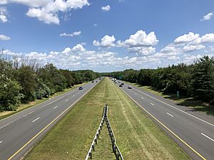
Interstate 195 is the main highway that goes through the southern part of Millstone Township. Other important county roads include CR 524, CR 526, CR 527, CR 537, and CR 571.
The New Jersey Turnpike (also known as Interstate 95) is a major highway nearby. You can get on it from neighboring towns like Robbinsville Township and East Windsor.
Healthcare
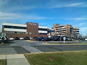
Millstone Township is served by CentraState Healthcare System. This hospital is located in nearby Freehold Township. It works with Atlantic Health System and Rutgers Robert Wood Johnson Medical School. CentraState also has family doctor offices in nearby towns like East Windsor and Monroe Township.
Other hospitals close to Millstone Township include Robert Wood Johnson University Hospital in Hamilton Township and Penn Medicine Princeton Medical Center in Plainsboro Township.
Famous People from Millstone Township
Many interesting people have lived in or are connected to Millstone Township, including:
- Sydney Cummings (born 1999), a soccer player for the Guyana women's national team.
- Dave Gallagher (born 1960), a professional baseball player who played for teams like the New York Mets and Philadelphia Phillies.
- Andy Miller (born 1968) and Julie Miller (born 1972), who are both famous in harness racing.
- RZA (born 1969), a member of the music group Wu-Tang Clan.
- Chris Smith (born 1987) and J. R. Smith (born 1985), who are both professional basketball players.
- Darrin Winston (1966–2008), a professional baseball player for the Philadelphia Phillies.
See also
 In Spanish: Municipio de Millstone (Nueva Jersey) para niños
 | Tommie Smith |
 | Simone Manuel |
 | Shani Davis |
 | Simone Biles |
 | Alice Coachman |


