Ridgefield, Connecticut facts for kids
Quick facts for kids
Ridgefield, Connecticut
|
||
|---|---|---|
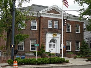
Ridgefield Town Hall
|
||
|
||
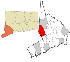 Fairfield County and Connecticut Fairfield County and Connecticut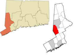 Western Connecticut Planning Region and Connecticut Western Connecticut Planning Region and Connecticut |
||
| Country | ||
| U.S. state | ||
| County | Fairfield | |
| Region | Western CT | |
| Incorporated | 1709 | |
| Villages | Ridgefield Branchville Ridgebury Titicus Farmingville |
|
| Government | ||
| • Type | Selectman-town meeting | |
| Area | ||
| • Total | 35.0 sq mi (90.6 km2) | |
| • Land | 34.4 sq mi (89.2 km2) | |
| • Water | 0.5 sq mi (1.4 km2) | |
| Elevation | 659 ft (201 m) | |
| Population
(2020)
|
||
| • Total | 25,033 | |
| • Density | 727.7/sq mi (281.0/km2) | |
| Time zone | UTC−5 (Eastern) | |
| • Summer (DST) | UTC−4 (Eastern) | |
| ZIP Code |
06877
|
|
| Area code(s) | 203/475 | |
| FIPS code | 09-63970 | |
| GNIS feature ID | 0213496 | |
Ridgefield is a town in Fairfield County, Connecticut, United States. It is located in the foothills of the Berkshire Mountains. The town is also right on the border with New York state. In 2020, Ridgefield had a population of 25,033 people. It is part of the Western Connecticut Planning Region. The main part of town, called the town center, is a special area defined by the U.S. Census Bureau. Ridgefield was settled and became an official town by 1709.
Contents
History of Ridgefield
Ridgefield was first settled by English colonists from Norwalk in 1708. A group of settlers bought land from Chief Catoonah of the Ramapo tribe. The town officially became a town in 1709. Its name, Ridgefield, describes its hilly landscape.
The Battle of Ridgefield
The most important event in Ridgefield's early history was the Battle of Ridgefield. This battle happened on April 27, 1777, during the American Revolutionary War. A small group of colonial soldiers and local militia fought against a larger British force. General David Wooster led the colonial side and sadly died in the battle. Benedict Arnold, another famous figure, also fought there and had his horse shot from under him.
The British army had raided a supply depot in Danbury and was returning to Westport. The battle was a win for the British on that day. However, it was a big win for the colonists in the long run. After this battle, the British never tried to go deep into Connecticut again. Today, soldiers from both sides are buried together in a cemetery on Main Street. A cannonball from the battle is still stuck in the side of the Keeler Tavern, a local inn and museum. Many other Revolutionary War landmarks can be found along Main Street.
In 1781, the French army, led by the Comte de Rochambeau, marched through Connecticut. They camped in the Ridgebury part of town. This is where the first Catholic church service in Ridgefield was held.
From Farms to Estates
For most of its history, Ridgefield was a farming community. In the late 1800s, wealthy people from New York City discovered Ridgefield. They built large estates and huge "summer cottages" in the higher parts of town. This happened because a new railroad connected the town, and the countryside was high above sea level.
Some famous estates included Col. Louis D. Conley's "Outpost Farm," which was almost 2,000 acres (8.1 km²). Part of it is now Bennett's Pond State Park. Seth Low Pierrepont's "Twixthills" was over 600 acres (2.4 km²), and much of it is now Pierrepont State Park.
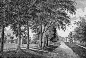
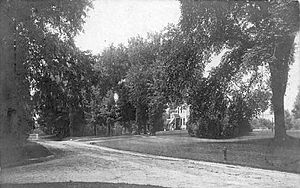
After the Great Depression, these large estates became too expensive to keep. Most were divided up, and many mansions were torn down. In their place, new neighborhoods with one- or two-acre lots were built. This turned Ridgefield into a suburban town in the 1950s, 1960s, and 1970s. However, strict planning rules have helped keep the town's historic look, especially along its famous Main Street.
In 1946, Ridgefield was considered as a possible location for the United Nations Secretariat building. However, it was not chosen because it was too hard to get to.
Geography and Nature
Ridgefield covers about 35.0 square miles (90.6 km²). Most of this is land (34.4 sq mi or 89.2 km²), with a small amount of water (0.5 sq mi or 1.4 km²). Ridgefield shares borders with towns in New York and Connecticut. These include North Salem, Lewisboro, and Southeast in New York. In Connecticut, it borders Danbury, Wilton, and Redding.
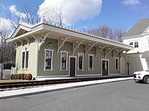
The Metro-North Railroad's Branchville station is in the Branchville part of town. The main town center, called the CDP, covers about 6.4 square miles (16.6 km²). Other areas within Ridgefield include Titicus, Ridgebury, Scotland, Farmingville, Limestone, Flat Rock, and Florida.
Geology: Rocks and Lakes
Ridgefield has many hills and rocks. The highest point is Pine Mountain, at 1,060 feet (323 m) above sea level. The lowest point is Branchville, at 342 feet (104 m). The average height of the village is 725 feet (221 m). The landscape is covered with many rocks left behind by glaciers.
One interesting lake is Round Pond. It was formed in a kettle shape by a glacier about 20,000 years ago. Another lake is Mamanasco Lake, which is 86 acres (35 ha) and near Ridgefield High School.
A special feature is Cameron's Line. This is a fault line formed about 250 million years ago when "Proto North America" and "Proto Africa" collided. Sometimes, small earthquakes are still felt along this line. North of Cameron's Line, Ridgefield has a lot of limestone. This mineral was mined a lot in the past, and you can still see old limekilns. Other minerals like mica, pegmatite, and quartz were also mined here. Even gold and gemstones like garnet and beryl have been found.
Climate
Ridgefield has a climate with warm summers and cold winters. The hottest month is July, with an average high of 85°F (29°C). The coldest month is January, with an average low of 19°F (-7°C). The town gets a good amount of rain throughout the year, with an average of about 53 inches (135 cm) annually.
Population and People
| Historical population | |||
|---|---|---|---|
| Census | Pop. | %± | |
| 1790 | 1,947 | — | |
| 1800 | 2,025 | 4.0% | |
| 1810 | 2,103 | 3.9% | |
| 1820 | 2,310 | 9.8% | |
| 1830 | 2,305 | −0.2% | |
| 1840 | 2,474 | 7.3% | |
| 1850 | 2,337 | −5.5% | |
| 1860 | 2,213 | −5.3% | |
| 1870 | 1,919 | −13.3% | |
| 1880 | 2,028 | 5.7% | |
| 1890 | 2,235 | 10.2% | |
| 1900 | 2,626 | 17.5% | |
| 1910 | 3,118 | 18.7% | |
| 1920 | 2,707 | −13.2% | |
| 1930 | 3,580 | 32.2% | |
| 1940 | 3,900 | 8.9% | |
| 1950 | 4,356 | 11.7% | |
| 1960 | 8,165 | 87.4% | |
| 1970 | 18,188 | 122.8% | |
| 1980 | 20,120 | 10.6% | |
| 1990 | 20,919 | 4.0% | |
| 2000 | 23,643 | 13.0% | |
| 2010 | 24,638 | 4.2% | |
| 2020 | 25,033 | 1.6% | |
| Population 1756–2000 | |||
As of the 2020 census, Ridgefield had a population of 25,033. In 2000, there were 23,643 people living in the town. Most residents were White (96.12%). About 2.08% were Asian, and 0.62% were Black or African American. About 1.97% of the population was Hispanic or Latino.
In 2000, about 43% of households had children under 18 living with them. The median age in town was 39 years old. This means half the people were younger than 39, and half were older. The median income for a family in Ridgefield was $127,981 in 2000.
Arts and Culture
Ridgefield has a lively arts and culture scene.
- The Western Connecticut Youth Orchestra has performed in famous places like Carnegie Hall.
- The Ridgefield Symphony Orchestra started in 1965. Today, it has 75 professional musicians.
- The Keeler Tavern Museum is an old house from the early 1700s. It used to be a tavern and inn. Today, it's a museum where you can take tours and learn about history.
- The Aldrich Contemporary Art Museum shows modern art from around the world. It was updated in 2004 and hosts many special events, including concerts.
- The Ridgefield Playhouse opened in 2000. It's a place for concerts, performances by famous artists, and movies.
- Weir Farm National Historic Site is a special park that was once the farm of J. Alden Weir. He was a painter known for American Impressionism. The site has an art center and gallery. It's one of only two National Park Service sites in Connecticut.
- The Ridgefield Conservatory of Dance teaches different dance styles. They perform The Nutcracker every year at the Ridgefield Playhouse.
- Thrown Stone Theatre Company is a professional theater group that focuses on new plays.
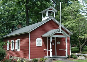
- The Peter Parley Schoolhouse is a one-room schoolhouse from around 1750. It was used until 1913. You can visit it to see old desks and books.
Ridgefield has many public open spaces for outdoor activities. These include Aldrich Park, Bennett's Pond State Park, and Seth Low Pierrepont State Park. About 23% of the town's land is public open space.
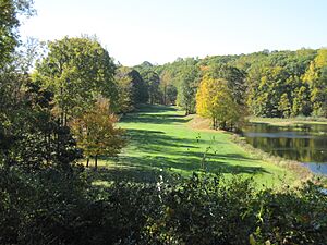
The Ridgefield Golf Course is an 18-hole course owned by the town. It was designed by George Fazio and Tom Fazio and opened in 1974.
The largest business in Ridgefield is Boehringer Ingelheim Pharmaceuticals. Their U.S. headquarters are in the Ridgebury area.
In 2006, the Rockefeller Center Christmas Tree in New York City came from Ridgefield.
The town also has a skatepark for skateboarding and aggressive inline skating. It was rebuilt and made bigger in 2010.
Annual Events
- The Nutmeg Festival is held on Main Street in August. It started in 1906 as a charity event. It is now called Nutmeg and Neighbors and is a fundraising event.
- The Antiques Flea Market happens every June. It's held outdoors at the Veterans Memorial Community Center.
- A local farmers market is held every Thursday during the summer.
Historic Places in Ridgefield
Many places in Ridgefield are listed on the National Register of Historic Places (NRHP). This means they are important historical sites.
- Part of the town center is a historic district.
- The Keeler Tavern is also listed.
- Other listed places include the Frederic Remington House, the Branchville Railroad Tenement, and the Phineas Chapman Lounsbury House.
Government and Politics
Ridgefield has a traditional New England style of government. It uses a Board of Selectmen and Town Meeting system. The town holds an annual meeting in May to discuss the budget and other town matters. The main leader is the First Selectman. Rudy Marconi (D) has been the First Selectman since 1999.
The town also has elected boards and commissions. These include the Board of Education, Planning and Zoning Commission, and Board of Finance.
Education
Ridgefield has nine public schools and two private schools. The public schools are managed by Ridgefield Public Schools.
- There are six public elementary schools: Veterans Park, Branchville, Farmingville, Scotland, Barlow Mountain, and Ridgebury.
- The town has two middle schools: Scotts Ridge Middle School and East Ridge Middle School.
- The high school is Ridgefield High School. Their sports teams are called the Tigers.
Ridgefield also has two Roman Catholic schools: St. Mary (preschool to 8th grade) and St. Padre Pio Academy (kindergarten to 8th grade). Ridgefield Academy is a private school for preschool through 8th grade. There are also various preschools and a Montessori school.
Infrastructure and Services
Ridgefield has several important services and transportation options:
- Electricity: Provided by Eversource Energy.
- Water: Served by Aquarion in central and western parts of town.
- Telephone/Internet: Provided by Frontier Communications and Comcast Cable.
- Local Newspaper: The Ridgefield Press.
- Train Transportation: The Metro-North Railroad's Danbury Branch serves Branchville station. You can take trains north to Danbury station or south to South Norwalk station. Some trains go to Stamford Transportation Center or even Grand Central Terminal in New York City during busy times.
- Bus Transportation: Housatonic Area Regional Transit (HART) operates a bus shuttle. It runs on weekdays between Katonah station and park-and-ride lots in Ridgefield.
Neighborhoods
Ridgefield has 19 main neighborhoods. Some of these include Main Street, Branchville, Titicus, Farmingville, Ridgebury, and West Mountain. It also contains two census-designated places called Lakes East and Lakes West.
Notable People
Many interesting people have lived in Ridgefield. You can find a full list at List of people from Ridgefield, Connecticut.
See also
 In Spanish: Ridgefield (Connecticut) para niños


