Torridon Group facts for kids
Quick facts for kids Torridon GroupStratigraphic range: Mesoproterozoic-Neoproterozoic |
|
|---|---|
| Lithology | |
| Primary | Various |
| Location | |
| Country | Scotland, United Kingdom |
In geology, the Torridonian Group is a collection of very old sedimentary rocks found in the Northwest Highlands of Scotland. These rocks formed between the Mesoproterozoic and Neoproterozoic eras, which was about 1.2 billion to 544 million years ago. They are mostly made of sandstone and shale.
The name "Torridonian" comes from the area around upper Loch Torridon, where these rocks are clearly visible. These rocks lie on top of even older rocks called Lewisian gneiss. You can only find them in a specific geological area called the Hebridean Terrane.
Contents
What are Torridonian Rocks Like?
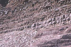
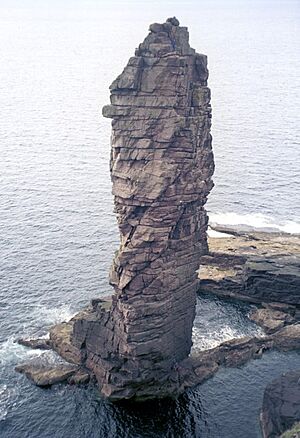
These rocks are mostly red and brown sandstones, along with arkose (a type of sandstone with lots of feldspar) and shale (a fine-grained rock). At the very bottom, you can sometimes find coarse conglomerates, which are rocks made of rounded pebbles and boulders cemented together.
Some of the material in these rocks came from the older Lewisian gneiss they rest on. However, most of the material came from other rocks that are no longer visible today. The Torridonian layers usually lie flat or gently sloped on this ancient, worn-down land surface.
Some mountains, like Beinn Eighe, have white Cambrian quartzite on their tops. This gives them a unique look from far away. Some of this quartzite contains fossilized worm burrows and is called pipe rock. It is about 500 million years old. The Torridon landscape itself has been shaped by glacial (ice) and alluvial (water) action, leaving behind the remains of an ancient, flattened land.
Where Can You Find Torridonian Rocks?
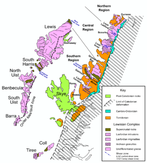
These rocks stretch in a band from Cape Wrath down to the Sleat peninsula on the Isle of Skye. They run through areas like Caithness, Sutherland, Ross and Cromarty, and Skye and Lochalsh.
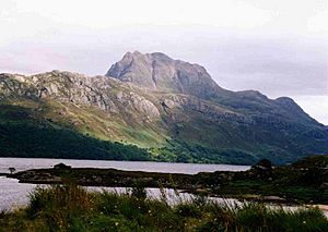
They form famous isolated mountain peaks such as Canisp, Quinag, and Suilven near Loch Assynt. You can also see them in Slioch near Loch Maree. The Torridonian rocks are most developed in the Applecross, Gairloch, and Torridon areas. They also make up most of Scalpay and are found on Rùm, Raasay, Soay, and the Crowlin Islands. These rocks are also hidden beneath much of the Sea of the Hebrides, lying over the Lewisian gneiss.
How Geologists Divide the Torridonian Group
The Torridonian Group is split into two main parts: the older Stoer Group and the younger Sleat and Torridon Groups. There's a big time gap between the Stoer Group and the younger groups. This suggests a long period passed between when they were formed. Scientists believe these rocks were laid down during a time when the Earth's crust was pulling apart, creating rifts.
Stoer Group Rocks
The Stoer Group rocks are found on the Stoer peninsula, near Assynt, Sutherland. This group is divided into three smaller parts.
Clachtoll Formation
At the very bottom, there's often a rock called breccia. It contains large pieces of the older Lewisian gneiss. This shows that the gneiss was weathering away before the breccia formed. Higher up, the breccia turns into pebbly sandstones. These were likely deposited by small alluvial fans (fan-shaped deposits of sediment).
These muddy sandstones often have no clear layers at the bottom. But higher up, they form half-metre thick beds topped with siltstones. These siltstones often show signs of drying out, like mud cracks. In some places, these muddy sandstones are followed by deposits from braided rivers, which are rivers with many small channels.
Bay of Stoer Formation
The lower part of the Bay of Stoer Formation has red sandstones with cross-bedding (slanted layers). These were also laid down by braided rivers.
A special layer, about 10 metres thick, is called the Stac Fada Member. It contains muddy sandstone with many pieces of bubbly volcanic glass. This layer might have been formed by a mudflow. However, some scientists now think it could be material thrown out from an impact crater (like from a meteorite). This idea is supported by finding shocked quartz and biotite (minerals changed by extreme pressure).
Above this, the Poll a' Mhuilt member has thin layers of siltstones and fine sandstones. This suggests they were deposited in a lake environment.
Meall Dearg Formation
The very top of the Stoer Group has sandstones with trough cross-bedding. These are believed to have been deposited by braided rivers, similar to the lower Bay of Stoer Formation.
Sleat Group Rocks
The Sleat Group is found on the Sleat peninsula on Skye. It lies beneath the Torridon Group. Its connection to the Stoer Group is not clear, but it's thought to be younger. These rocks have been changed by heat and pressure (metamorphosed). They are mostly coarse feldspathic sandstones, formed by rivers. There are also some grey shales, likely from a lake environment.
Rubha Guail Formation
The very bottom of the Sleat Group is not visible on Skye. But near Kyle of Lochalsh, you can see breccias made of pieces from the older gneiss. This shows that the land surface was very uneven when these rocks formed.
Most of this formation is made of coarse green sandstones with trough cross-bedding. The green colour comes from minerals like epidote and chlorite. These coarse sandstones are mixed with finer sandstones and siltstones, which become more common higher up. The siltstones show signs of drying out. This formation generally gets finer-grained towards the top.
Loch na Dal Formation
The bottom of this formation has dark-grey siltstones that are often rich in phosphorus. This 200-metre thick layer suggests a large lake existed. The upper part of the formation has coarse, sometimes pebbly, sandstones with trough cross-bedding. These were likely formed as deltas built out into the lake.
Beinn na Seamraig Formation
This formation is made of coarse-grained sandstones with cross-bedding. The layers often look twisted or folded.
Kinloch Formation
This formation is similar to the Beinn na Seamraig Formation. The sandstones here are generally finer-grained and have better ripple marks. The sediments show repeating patterns, with layers getting finer upwards. Each cycle is about 25–35 metres thick, ending with shales.
The top of this group seems to blend into the Torridon Group. This means there might not have been a big time gap or break in deposition.
Torridon Group Rocks
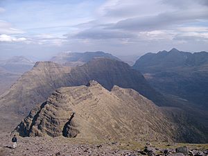
The Torridon Group fills in an uneven ancient land surface, sometimes cutting through the older Stoer Group rocks. In many places, it rests directly on the Lewisian gneiss. Some scientists think there's a significant break within this group, between the Diabaig and Applecross Formations.
Diabaig Formation
The lowest part of this formation has a breccia at its base. This breccia contains pieces from the underlying Lewisian complex. It is thickest in ancient valleys. The breccias gradually change into flat-lying sandstones. These sandstones sometimes have channels and mix with grey shales. The shales have thin layers of fine-grained sandstone with wave ripples. The shales also show mudcracks, preserved when sand filled them.
Higher up, thick layers of massive sandstone appear. Ripple marks on top of the sandstone layers show that currents flowed from the east. This sequence suggests that alluvial fans were building out into temporary lakes, gradually filling the landscape. The more massive beds are thought to be turbidites, which are sediments deposited by underwater currents in a lake.
Applecross Formation
This formation consists of coarse sandstones with both trough and planar cross-bedding. The way the troughs are shaped suggests that ancient currents flowed from the Northwest. These sandstones contain unique pebbles, including jasper (a type of quartz) and porphyry (a type of igneous rock).
Many sandstone beds show signs of soft-sediment deformation. This means the sediments moved and twisted before they fully hardened, possibly due to earthquakes. The very top of this formation has finer-grained sandstones, which gradually change into the Aultbea Formation.
Near Cape Wrath, the bottom of this formation shows that currents spread out like a fan. This suggests it was deposited by a large alluvial fan (about 40 km wide) with its top near the Minch Fault. The area that supplied the sediment for this fan was huge, about 10,000 square kilometres.
Aultbea Formation
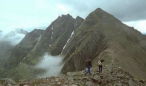
This formation is similar to the Applecross Formation. However, its sandstones are fine to medium-grained, and there are very few pebbles. Almost all of these sandstone beds also show the twisted layers seen in the older formation.
The Applecross and Aultbea Formations together show a pattern where the rocks generally get finer-grained towards the top. This suggests they were deposited in a bajada environment, where many smaller fans merged to form a braided river system.
Cailleach Head Formation
This formation is similar to the Aultbea Formation, but its grains are noticeably finer. It is made up of cycles, each about 22 metres thick. Each cycle starts with an erosion surface (where older rock was worn away). Then come dark grey shales with mudcracks, followed by flat-layered sandstones with wave ripples on top. Finally, there are trough cross-bedded sandstones containing mica.
These cycles are thought to represent deltas repeatedly building out into a lake. The lack of evaporite minerals (like salt) suggests that the lakes had water flowing through them. Tiny microfossils called acritarchs were found here in 1907. These were the first Precambrian fossils found in Britain.
How Old Are These Rocks?
Scientists can figure out the age of these rocks by looking at the rocks above and below them. The Lewisian complex, which the Torridonian rocks sit on, is about 1200–1100 million years old. The lower Cambrian quartzite, which lies on top of the Torridonian, is about 544 million years old.
Using radiometric dating (measuring radioactive elements), scientists found that the Stoer Group is about 1200 million years old. The bottom part of the Torridon Group is about 1000–950 million years old. This means there was a gap of at least 200 million years between the Stoer Group and the Torridon Group.
By studying tiny crystals called zircons in the rocks, scientists can also learn about their age. The Stoer Group and the lower Sleat Group have zircons from older rocks (Scourian and Laxfordian). The upper Sleat Group has many zircons from the Laxfordian age, but almost none from the even older Archaean age.
The Diabaig Formation has zircons around 1100 million years old, which is the age of the Grenville Orogeny (a mountain-building event). The Applecross and Aultbea Formations have even more zircons around 1100 million years old, and some even younger than 1000 million years. This suggests that the Stoer and Sleat Groups formed before the Grenville event (before 1200 million years ago). The Diabaig Formation formed after this event (after about 1090 million years ago), and the rest of the Torridon Group formed after about 1060 million years ago.
A more exact age for the Stac Fada Member (in the Stoer Group) is 1177 ± 5 million years. This age is thought to be when the material from the impact event was laid down.
How the Rocks Formed (Tectonic Setting)
The different thicknesses and types of rocks suggest that both the Stoer and Sleat/Torridon Groups formed in a "rift" setting. This means the Earth's crust was pulling apart. Evidence from seismic data (like an echo sounder for rocks) in the Minch (the sea between mainland Scotland and the Outer Hebrides) shows that the Minch Fault was active while the Torridon Group was forming.
This explains why the Applecross Formation has pebbles that came from the west. It suggests that the source of these sediments was constantly being uplifted in that direction. More recent studies suggest that while the Stoer and Sleat Groups likely formed in a rift, the large size of the Torridon Group (especially the Applecross and Aultbea Formations) might mean it formed in a "molasse" setting. This is where sediments fill a basin next to a mountain range, possibly related to the Grenville Orogeny.
|
 | John T. Biggers |
 | Thomas Blackshear |
 | Mark Bradford |
 | Beverly Buchanan |


