United States Geological Survey facts for kids
Seal of the United States Geological Survey
|
|

Official identifier of the U.S. Geological Survey
|
|
 Flag of the United States Geological Survey |
|
| Agency overview | |
|---|---|
| Formed | March 3, 1879 (as Geological Survey) |
| Jurisdiction | United States |
| Headquarters | John W. Powell National Center Reston, Virginia, U.S. 38°56′49″N 77°22′03″W / 38.9470°N 77.3675°W |
| Employees | 8,670 (2009) |
| Annual budget | $1.497 billion (FY2023) |
| Agency executive |
|
| Parent agency | United States Department of the Interior |
The United States Geological Survey (USGS) is a science agency. It's part of the U.S. Department of the Interior. The USGS studies many things like biology (living things), geography (Earth's features), geology (rocks and Earth's history), and hydrology (water).
It started on March 3, 1879. Its main job was to learn about the U.S. landscape. This included its natural resources (like minerals and water) and natural hazards (like earthquakes and floods). The USGS even helps make maps of other planets and moons! They use information from U.S. space missions.
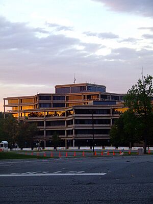
The USGS is the only science agency in its department. It focuses on finding facts and doing research. It does not make rules or laws. Its main office is in Reston, Virginia. Other big offices are near Lakewood, Colorado and in NASA Research Park in California. In 2009, about 8,670 people worked there.
Since August 1997, the USGS motto has been "science for a changing world." Before that, their slogan was "Earth Science in the Public Service."
Contents
How the USGS Works
Since 2012, the USGS has focused its science on "Mission Areas." These areas change and grow over time. The USGS also has different parts like headquarters, regional offices, science programs, and research centers.
USGS Regions
The USGS divides its work into regions across the United States. These regions help them focus on local needs.
- Region 1: North Atlantic-Appalachian
- Region 2: South Atlantic-Gulf
- Region 3: Great Lakes
- Region 4: Mississippi Basin
- Region 5: Missouri Basin
- Region 6: Arkansas-Rio Grande-Texas-Gulf
- Region 7: Upper Colorado Basin
- Region 8: Lower Colorado Basin
- Region 9: Columbia-Pacific Northwest
- Region 10: California-Great Basin
- Region 11: Alaska
- Region 12: Pacific Islands
Science Programs and Centers
The USGS has many special science programs and facilities. They help study different parts of our planet.
Earthquake Monitoring
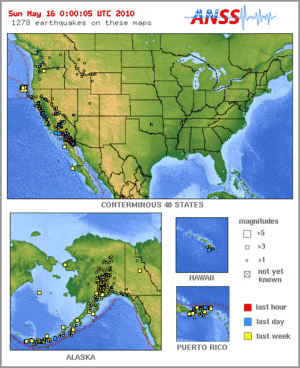
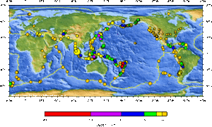
The Earthquake Hazards Program watches for earthquakes all over the world. The National Earthquake Information Center (NEIC) in Golden, Colorado, finds where earthquakes happen and how strong they are. The USGS also supports many regional earthquake networks in the U.S.
The USGS tells officials, emergency teams, and the public about important earthquakes. They also keep old earthquake data for scientists to study. They research long-term seismic hazards, which are dangers from earthquakes. The USGS has also shared the California earthquake forecast.
Volcano Early Warning Systems
The USGS works to create a National Volcano Early Warning System. This system helps improve how they watch the 169 volcanoes in U.S. territory. They also find ways to measure the danger each volcano poses.
The USGS runs five volcano observatories:
- The Alaska Volcano Observatory in Anchorage, Alaska. It covers volcanoes in Alaska and the Northern Mariana Islands.
- The California Volcano Observatory in Menlo Park, California.
- The Cascades Volcano Observatory in Vancouver, Washington. It covers volcanoes in Idaho, Oregon, and Washington.
- The Hawaiian Volcano Observatory in Hilo, Hawaii. It covers volcanoes in Hawaii and American Samoa.
- The Yellowstone Volcano Observatory in Yellowstone National Park, Wyoming. It covers volcanoes in Arizona, Colorado, Montana, New Mexico, Utah, and Wyoming.
The Volcano Disaster Assistance Program helps other countries when volcanoes erupt. They offer help, training, and research.
Coastal and Marine Science
The USGS Coastal and Marine Science Center has three locations. One is for the Atlantic Ocean in Woods Hole, Massachusetts. Another is for the Pacific Ocean in Santa Cruz, California. The third is for the Gulf of Mexico in St. Petersburg, Florida.
This center studies geology, mapping, water, and biology. They look at dangers from floods, hurricanes, and climate change. They map the land and ocean floor. They also find mineral resources and study water resources. They learn how human actions and nature affect water systems.
Earth's Magnetic Field
The USGS National Geomagnetism Program watches the magnetic field of the Earth. They have special observatories that send out magnetic data right away.
North American Environmental Atlas
The USGS works with scientists from Canada and Mexico. Together, they create the North American Environmental Atlas. This atlas shows and tracks environmental issues across North America.
Streamflow Programs
The USGS runs several programs related to water.
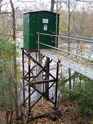
- They have a network of over 7,400 stream gauges in the U.S. These gauges measure how much water is flowing in rivers and streams. You can find this data online in real-time.
- They also have the National Streamflow Information Program.
- The National Water-Quality Assessment Program checks the quality of water. All USGS water data is available to the public.
Water Resources Research
The Water Resources Research Act of 1984 created a Water Resources Research Institute (WRRI) in every state. These institutes, along with those in Washington D.C., Puerto Rico, the U.S. Virgin Islands, and Guam, form the National Institutes for Water Resources (NIWR). They focus on water issues through research, training, and teamwork.
Climate Adaptation Science Centers
The Climate Adaptation Science Centers (CASCs) help fish, wildlife, and lands adapt to climate change. They are a partnership between scientists and resource managers. The National CASC is at USGS headquarters in Reston, Virginia. Nine regional CASCs work with universities across the U.S. to provide science for local needs.
Astrogeology Research
Since 1962, the Astrogeology Research Program has explored and mapped planets and moons. They have been involved in lunar and planetary missions.
Wildlife Health
The USGS also runs the National Wildlife Health Center. Its goal is to provide science and support for wildlife and ecosystem health. They give information, help, research, and leadership on wildlife health issues. They are important for watching for H5N1 avian influenza outbreaks in the U.S. The USGS also has 17 other biological research centers.
ShakeMaps
The USGS is looking into working with Twitter to create ShakeMaps faster. ShakeMaps are interactive tools. They let people see how strong and widespread earthquake shaking was in an area.
Mapping the Land
Topographic Maps
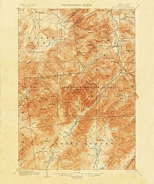
The USGS creates different kinds of topographic maps for the U.S. These maps show the shape and features of the land. The most common maps are the 7.5-minute, 1:24,000 scale maps. Each map covers an area based on 7.5 minutes of latitude and longitude.
Almost 57,000 of these maps cover the 48 states, Hawaii, and parts of Alaska. The size of the area on each map changes depending on how far north or south it is. For example, near 30° north, a map covers about 64 square miles (166 km²). At 49° north, it covers about 49 square miles (127 km²).
The USGS stopped printing paper topographic maps in 2006. They were replaced by The National Map in 2019. Older maps, like the 15-minute series, were used before. These covered a larger area, like four of the 7.5-minute maps.
The 1:250,000 scale topographic series is another type of map. These maps were made in the 1950s. They cover a very large area, about 1 degree of latitude by 2 degrees of longitude.
USGS topographic maps have grid lines. These lines help you find locations using latitude and longitude. You can also use other systems like the Public Land Survey System or Universal Transverse Mercator coordinate system. The USGS also makes special maps for counties and national parks.
Many of these maps are available online for free. The USGS provides digital map images and data sets. In 2015, the USGS launched the topoView website. This site lets you see over 178,000 digitized maps from 1884 to 2006. You can search for an area, view maps in detail, and download them.
The National Map and U.S. Topo
In 2008, the USGS changed how it made topographic maps. They stopped using traditional methods like aerial photography and field checks. Today's U.S. Topo maps are made using computers and automated processes. The information comes from the National GIS Database.
Between 2009 and 2011, the USGS made almost 40,000 maps. This was more than 80 maps per workday. Only about two hours of human work are spent on each map. This includes placing text and a final check. There are almost no field checks to confirm details.
These new digital maps are cheaper to make. However, some people say they are not as accurate or detailed as older maps. Older maps were based on aerial photos and field checks. Some human-made features are often missing from the new digital maps. These include windmills, mines, water tanks, and even railroads. Because of this, some feel the new U.S. Topo maps are not as good as the maps made from 1945 to 1992.
Hydrologic Instrumentation Facility
The Hydrologic Instrumentation Facility (HIF) has four main parts. These include a warehouse, repair shop, and engineering unit. It also has a testing section with labs, and an information technology section.
The HIF is in charge of designing, testing, and repairing water instruments. They also store and give out these instruments. They sell and rent equipment to the USGS and other agencies. The HIF also trains people on how to use the equipment.
The Engineering Group looks for new technology. They design instruments that work better, are more accurate, or cost less. They work with companies to make sure products meet USGS needs. If no company makes what is needed, the HIF designs it themselves. Sometimes, they patent new designs. This helps companies make the instruments at a lower cost for everyone.
USGS Publications
USGS scientists share their findings in many ways. They publish in scientific journals. They also create USGS Report Series. These reports include early results, maps, data, and final results. You can find a full list of all USGS publications online.
History of the USGS
In the mid-1800s, some states started their own geological survey groups. For example, the Kentucky Geological Survey began in 1854.
In 1879, a report from the National Academy of Sciences led Congress to create a federal survey agency. This was partly to map the huge lands added to the U.S. by the Louisiana Purchase in 1803 and the Mexican–American War in 1848. The USGS was officially started on March 3. Its job was to "classify public lands" and "examine the geological structure, mineral resources, and products of the national domain."
Clarence King was the first director of the USGS. He brought together different regional survey groups. After two years, John Wesley Powell took over as director.
USGS Directors
See also
 In Spanish: Servicio Geológico de Estados Unidos para niños
- Alaska Volcano Observatory
- California earthquake forecast
- Cascades Volcano Observatory
- Core Research Center
- Geographic Names Information System
- Hawaiian Volcano Observatory
- List of national mapping agencies
- National Lidar Dataset (United States)
- QuakeSim
- Timeline of environmental history
- Variscale ruler
- Volcano Disaster Assistance Program
- Water Resource Region
Images for kids
 | May Edward Chinn |
 | Rebecca Cole |
 | Alexa Canady |
 | Dorothy Lavinia Brown |


