Weber County, Utah facts for kids
Quick facts for kids
Weber County
|
|
|---|---|

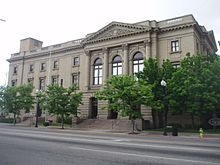
Historic United States Post Office and Courthouse in Ogden, Utah.
|
|

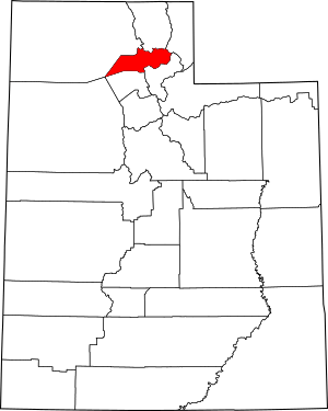
Location within the U.S. state of Utah
|
|
 Utah's location within the U.S. |
|
| Country | |
| State | |
| Founded | January 31, 1850 (created) March 3, 1852 (organized) |
| Named for | John Henry Weber |
| Seat | Ogden |
| Largest city | Ogden |
| Area | |
| • Total | 659 sq mi (1,710 km2) |
| • Land | 576 sq mi (1,490 km2) |
| • Water | 83 sq mi (210 km2) 13% |
| Population
(2020)
|
|
| • Total | 262,223 |
| • Estimate
(2023)
|
271,926 |
| • Density | 472/sq mi (182/km2) |
| Time zone | UTC−7 (Mountain) |
| • Summer (DST) | UTC−6 (MDT) |
| Congressional district | 1st |
Weber County (pronounced WEE-ber) is a county in the state of Utah. In 2020, about 262,223 people lived here. This makes it Utah's fourth-largest county by population.
The main city and county seat is Ogden. This city is also home to Weber State University. The county got its name from a fur trapper named John Weber. Weber County is part of a larger metropolitan area that includes Ogden and Clearfield.
Contents
History of Weber County
Early Explorers and Settlers
The Weber Valley was a popular spot for fur trappers. They came looking for beavers and muskrats along the streams. One of the first trappers arrived in 1824 from Fort Bridger. He reported that the Bear River flowed into a salty bay.
Peter Skene Ogden explored the area in 1826. He worked for the Hudson's Bay Company. He traded furs near what is now North Ogden for several years. Later, in 1843, John C. Frémont explored the Weber Valley. He made maps that encouraged people to move west.
Miles Goodyear, another fur trapper, built a trading post in 1845. It was located on the Weber River. In 1847, he sold it to the first Mormon pioneers arriving in the area. James Brown bought the site and renamed it Brownsville. This place later became known as Ogden.
How Weber County Was Formed
After the Mormon pioneers settled in Utah, they started a government. In 1849, this government was called the State of Deseret. On January 31, 1850, they created six counties. Weber County was one of them, with Ogden as its main city.
The exact borders of the county were set in 1852. These borders changed a few times over the years. In 1862, the creation of Nevada Territory made Weber County much smaller. By 1880, the county's borders were set to what they are today.
Originally, Weber County stretched all the way to California. It also went north to the Oregon boundary. Now, it covers part of the Wasatch Front. It also includes some eastern shores of the Great Salt Lake. And it has a large part of the rugged Wasatch Mountains.
Geography and Nature
Land and Water Features
Weber County stretches from the high Wasatch Range in the east. It reaches into a part of the Great Salt Lake in the west. The Weber River and Ogden rivers flow through its valleys. Many smaller streams also feed into these rivers.
The county is divided into two main areas. These are the "Lower Valley" and the "Upper Valley." A mountain ridge separates them. The Lower Valley is closer to the Great Salt Lake and has more people. The Upper Valley is mostly the Ogden Valley. This area is where the Ogden River gets its water.
The highest point in the county is Willard Peak. It is in the Wasatch Mountains. This peak is about 9,763 ft (2,976 m) above sea level. The county covers 659 square miles (1,710 km2) in total. About 576 square miles (1,490 km2) is land, and 83 square miles (210 km2) (13%) is water. It is one of Utah's smaller counties.
Major Roads and Transportation
Many roads in Weber County follow a special grid system. Road names change by 800 for every mile. This is similar to how roads are named in Salt Lake County. North Ogden was the first city to use this system in 1947. The main north/south line is 1st Street. The main east/west line is Wall Avenue in Ogden.
 I-15
I-15 I-84
I-84 US-89
US-89- SR-37
- SR-39
- SR-79
- SR-97
- SR-108
- SR-126
- SR-134
- SR-158
- SR-162
- SR-167
- SR-203
- SR-204
Neighboring Counties
- Box Elder County - northwest
- Cache County - north
- Rich County - northeast
- Morgan County - southeast
- Davis County - south
- Tooele County - southwest
Parks and Protected Areas
- Cache National Forest (part)
- Ogden Bay Waterfowl Management Area
- Weber Memorial Park
- Willard Bay Upland Game Management Area (part)
Lakes and Ponds
- Beus Pond
- Bluebell Spring
- Box Spring
- Bybee Pond
- Causey Reservoir
- Choke Spring
- Cold Springs
- Cutler Spring
- Deseret Spring
- Front Hollow Spring
- Glassman Pond
- Great Salt Lake (part)
- Green Pond
- Huntsville Reservoir
- Lime Kiln Spring
- Limestone Spring
- Little Monte Springs
- Lower Dry Bread Pond
- Meadow Creek Pond
- Monastery Spring
- Norma Springs
- Pineview Reservoir
- The Horseshoe Bend
- Twenty-First Street Pond
- Utaba Reservoir
People of Weber County (Demographics)
Population Overview (2020)
| Historical population | |||
|---|---|---|---|
| Census | Pop. | %± | |
| 1850 | 1,186 | — | |
| 1860 | 8,675 | 631.5% | |
| 1870 | 7,858 | −9.4% | |
| 1880 | 12,344 | 57.1% | |
| 1890 | 22,723 | 84.1% | |
| 1900 | 25,239 | 11.1% | |
| 1910 | 35,179 | 39.4% | |
| 1920 | 43,663 | 24.1% | |
| 1930 | 52,172 | 19.5% | |
| 1940 | 56,714 | 8.7% | |
| 1950 | 83,319 | 46.9% | |
| 1960 | 110,744 | 32.9% | |
| 1970 | 126,278 | 14.0% | |
| 1980 | 144,616 | 14.5% | |
| 1990 | 158,330 | 9.5% | |
| 2000 | 196,533 | 24.1% | |
| 2010 | 231,236 | 17.7% | |
| 2020 | 262,223 | 13.4% | |
| 2021 (est.) | 267,066 | 15.5% | |
| United States Census Bureau 1790–1960 1900–1990 1990–2000 2010–2020, 2021 |
|||
In 2020, Weber County had 262,223 people. This means there were about 429 people for every square mile. Most people (73.9%) were White. About 18.6% of the people were Hispanic or Latino.
There were slightly more males (50.29%) than females (49.71%). About 27.7% of the population was under 18 years old. The average age in the county was 32.9 years.
Households and Income
There were about 89,595 households in Weber County. The average household had almost three people. Most households (72.0%) were families. About 54.3% of families were married couples.
The average income for a household was $71,275 per year. For families, the average income was $80,961. About 8.6% of the people lived below the poverty line.
Education Levels
Many adults in Weber County have completed high school. Out of people 25 years or older:
- 29.3% had a high school diploma.
- 37.2% had some college or an associate degree.
- 17.5% had a bachelor's degree.
- 7.6% had a graduate or professional degree.
Age Distribution in 2010
| Age Range | Number | Percent |
|---|---|---|
| Under 5 years | 20,837 | 9.0 |
| 5 to 9 years | 19,667 | 8.5 |
| 10 to 14 years | 18,375 | 7.9 |
| 15 to 19 years | 17,261 | 7.5 |
| 20 to 24 years | 17,636 | 7.6 |
| 25 to 29 years | 19,131 | 8.3 |
| 30 to 34 years | 17,469 | 7.6 |
| 35 to 39 years | 14,559 | 6.3 |
| 40 to 44 years | 12,899 | 5.6 |
| 45 to 49 years | 14,160 | 6.1 |
| 50 to 54 years | 14,123 | 6.1 |
| 55 to 59 years | 11,904 | 5.1 |
| 60 to 64 years | 9,824 | 4.2 |
| 65 years and over | 23,388 | 10.1 |
The average age in 2010 was 30.7 years. For every 100 females, there were about 100.7 males.
Ancestry Groups (2017)
In 2017, the largest ancestry groups in Weber County were:
- English (21.6%)
- German (10.5%)
- "American" (7.5%)
- Irish (6.1%)
- Scottish (4.1%)
- Danish (3.9%)
- Italian (3.6%)
- Dutch (3.1%)
- Swedish (3.0%)
- Welsh (1.9%)
- Norwegian (1.9%)
Education in Weber County
Colleges and Universities
Weber County has several places for higher education:
- Weber State University
- Ogden–Weber Technical College
K-12 School Districts
There are two main school districts for younger students:
- Ogden City School District
- Weber School District
There is also a special state-run school:
- Utah Schools for the Deaf and the Blind
Communities in Weber County
Cities
- Farr West
- Harrisville
- Hooper
- Marriott-Slaterville
- North Ogden
- Ogden (county seat)
- Plain City
- Pleasant View
- Riverdale
- Roy
- South Ogden
- Uintah
- Washington Terrace
- West Haven
Towns
Townships
- Reese
- Warren
- Weber
- West Weber
Census-Designated Places (CDPs)
Census County Division
- Ogden Valley
Unincorporated Communities
Famous People from Weber County
- Hal Ashby - film director
- Rodney Bagley - helped create the catalytic converter
- Gilbert Belnap - pioneer and sheriff
- Solon Borglum - sculptor
- Fawn M. Brodie - historian
- John Browning - famous for making firearms
- Bernard DeVoto - historian
- David Eccles - businessman
- Lester Herrick - pioneer and sheriff
- Jefferson Hunt - founded Huntsville
- J. Willard Marriott - businessman
- Herbert B. Maw - former Utah governor
- David O. McKay - a past president of the Church of Jesus Christ of Latter-day Saints
- Olene S. Walker - former Utah governor
See also
 In Spanish: Condado de Weber para niños
 | Stephanie Wilson |
 | Charles Bolden |
 | Ronald McNair |
 | Frederick D. Gregory |

