Greater Glasgow facts for kids
Quick facts for kids Greater Glasgow
|
|
|---|---|
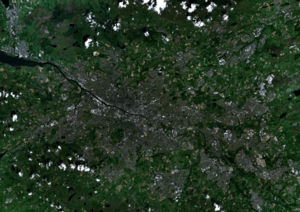
 Satellite image showing the Greater Glasgow Area |
|
| Area | 265 km2 (102 sq mi) |
| Population | 1,028,220 (2020) |
| Language | English, Scots, Gaelic |
| OS grid reference | NS590655 |
| • Edinburgh | 42 mi (68 km) |
| • London | 403 mi (649 km) |
| Country | Scotland |
| Sovereign state | United Kingdom |
| Post town | GLASGOW |
| Postcode district | G1–G84 |
| Post town | PAISLEY |
| Postcode district | PA1–PA19 |
| Post town | MOTHERWELL |
| Postcode district | ML1–ML8 |
| Dialling code | 0141, 01236, 01355, 01360, 01389, 01505, 01698, 01475 |
| EU Parliament | Scotland |
Greater Glasgow is a large urban area in Scotland. It includes the city of Glasgow and all the towns and villages that are physically connected to it. Think of it as one big, continuous built-up area.
This area is defined by National Records of Scotland for counting people and for statistics. It's not about local government boundaries. In 2001, Greater Glasgow had about 1.2 million people. This made it the largest urban area in Scotland. It was also the fifth-largest in the United Kingdom.
However, the way this area is defined can change. In 2016, the population estimate was lower, around 985,290 people. This was because some areas like Motherwell, Coatbridge, and Hamilton were no longer counted as part of it. There were small gaps between their populated areas and Glasgow. Also, new towns like Cumbernauld and East Kilbride were never included. They are separate, even though they are close to Glasgow. By 2020, the population of Greater Glasgow rose to over 1 million again. This was because Barrhead was added back into the count.
A wider idea of Greater Glasgow covers an even bigger area. This can include parts of Ayrshire, Lanarkshire, Dunbartonshire, Renfrewshire, and Inverclyde. Today, the Glasgow City Region includes eight local councils. Together, they have over 1.7 million people. This larger area is often called a metropolitan area.
The city of Glasgow grew a lot in the late 1800s and early 1900s. In 1912, it became the eighth city in Europe to reach one million people. It stayed above a million for 50 years. Since the 1960s, the population of the main Glasgow City council area has gone down. This is due to changes in boundaries and people moving to suburbs and new towns.
Contents
Understanding the Urban Area
After changes to local government in 1996, the Greater Glasgow Settlement Area was created. This was for the 2001 Census. It groups together urban areas that are close to each other. Each group of postcodes must have enough homes and at least 500 residents.
The table below shows the towns and areas that make up Greater Glasgow. It also shows how their populations have changed over the years.
| Locality | Council area | Population
(1991 census) |
Population
(2001 census) |
Population
(2016 estimate) |
Population
(2020 estimate) |
|---|---|---|---|---|---|
| Airdrie | North Lanarkshire | 12,436 | 36,326 | 37,410 | 36,390 |
| Bargeddie | North Lanarkshire | 2,325 | 2,790 | 2,960 | 3,210 |
| Barrhead | East Renfrewshire | 16,703 | 17,443 | 17,610 | 17,890 |
| Bearsden | East Dunbartonshire | 27,707 | 27,967 | 28,120 | 28,470 |
| Bellshill | North Lanarkshire | 20,075 | 20,134 | 20,290 | 19,700 |
| Bishopbriggs | East Dunbartonshire | 23,825 | 23,118 | 23,540 | 23,680 |
| Blantyre | South Lanarkshire | 16,900 | 16,800 | ||
| Bothwell | South Lanarkshire | 6,380 | 6,870 | ||
| Bowling | West Dunbartonshire | 5,500 | 5,500 | 560 | 560 |
| Brookfield | Renfrewshire | 540 | 880 | ||
| Busby | East Renfrewshire | 1,617 | 1,654 | 3,250 | 3,310 |
| Cambuslang | South Lanarkshire | 23,212 | 24,500 | 29,100 | 30,790 |
| Chapelhall | North Lanarkshire | 4,405 | 5,691 | 6,690 | 7,140 |
| Chryston | North Lanarkshire | 3,000 | 3,100 | ||
| Clarkston | East Renfrewshire | 18,899 | 19,136 | 9,860 | 9,800 |
| Clydebank | West Dunbartonshire | 29,171 | 29,858 | 26,320 | 25,620 |
| Coatbridge | North Lanarkshire | 40,320 | 41,170 | 43,960 | 43,950 |
| Duntocher and Hardgate | West Dunbartonshire | 7,882 | 7,301 | 6,880 | 6,680 |
| Elderslie | Renfrewshire | 5,166 | 5,180 | 5,330 | 5,480 |
| Erskine | Renfrewshire | 15,166 | 15,347 | 15,510 | 15,010 |
| Faifley | West Dunbartonshire | 6,087 | 4,932 | 4,860 | 4,740 |
| Gartcosh | North Lanarkshire | 2,200 | 2,920 | ||
| Giffnock | East Renfrewshire | 16,190 | 16,178 | 12,300 | 12,250 |
| Glasgow | Glasgow City | 658,379 | 629,501 | 612,040 | 632,350 |
| Hamilton | South Lanarkshire | 44,658 | 53,457 | 54,080 | 54,480 |
| Inchinnan | Renfrewshire | 1,233 | 1,574 | 1,860 | 1,820 |
| Johnstone | Renfrewshire | 18,280 | 16,468 | 16,090 | 15,930 |
| Kilbarchan | Renfrewshire | 3,710 | 3,622 | 3,480 | 3,300 |
| Linwood | Renfrewshire | 10,183 | 9,058 | 8,600 | 8,450 |
| Milngavie | East Dunbartonshire | 11,992 | 12,795 | 12,940 | 12,840 |
| Moodiesburn | North Lanarkshire | 6,890 | 6,830 | ||
| Motherwell | North Lanarkshire | 27,426 | 30,301 | 32,590 | 32,840 |
| Muirhead | North Lanarkshire | 1,380 | 1,830 | ||
| Netherlee | East Renfrewshire | 4,600 | 4,530 | ||
| Newton Mearns | East Renfrewshire | 19,342 | 22,637 | 26,600 | 28,210 |
| Old Kilpatrick | West Dunbartonshire | 2,408 | 3,199 | 4,680 | 4,470 |
| Paisley | Renfrewshire | 73,925 | 74,170 | 77,220 | 77,270 |
| Renfrew | Renfrewshire | 20,764 | 20,251 | 22,570 | 24,270 |
| Rutherglen | South Lanarkshire | 25,000 | 25,000 | 31,190 | 30,950 |
| Stamperland | East Renfrewshire | 3,640 | 3,630 | ||
| Stepps | North Lanarkshire | 4,942 | 4,802 | 7,450 | 7,700 |
| Thornliebank | East Renfrewshire | 3,980 | 4,051 | 4,070 | 4,170 |
| Uddingston | South Lanarkshire | 6,370 | 6,300 | ||
| Wishaw | North Lanarkshire | 26,439 | 28,564 | 30,290 | 30,050 |
Getting Around: Transport in Greater Glasgow
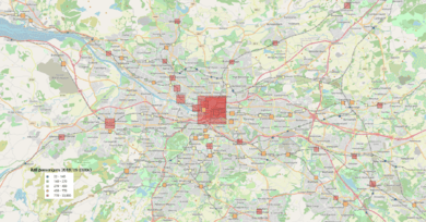
Greater Glasgow has a well-developed transport system. In 1973, the Greater Glasgow Passenger Transport Executive was created. This group took over control of Glasgow's public transport, including the Glasgow Subway. The Glasgow Subway is Scotland's only underground train system.
Later, this group became the Strathclyde Partnership for Transport. It works within Transport Scotland to manage travel in the area.
The region is also served by two international airports. These are Glasgow Prestwick Airport and Glasgow Airport. They connect Glasgow to places all over the world.
The Glasgow City Region: A Wider Look
The Glasgow City Region is a group of local councils that surround Glasgow. It includes eight different local authorities:
- Glasgow
- East Dunbartonshire
- West Dunbartonshire
- North Lanarkshire
- South Lanarkshire
- East Renfrewshire
- Renfrewshire
- Inverclyde
In 2011, this larger area had a population of about 1.79 million people. It's important to know that this city region is not one continuous urban area. Some parts are separated from Greater Glasgow by countryside.
This area is known by several names. These include Metropolitan Glasgow, the metropolitan City-Region of Glasgow, Glasgow and the Clyde Valley, and Clydeside.
The city region doesn't have one single government. However, the eight councils work together. They formed a joint cabinet in 2015 to make decisions for the whole area. The leader of Glasgow City Council leads this cabinet.
Metropolitan Glasgow: What Does it Mean?
Even though the Scottish Government doesn't officially use the term "Metropolitan status," other groups do. For example, Eurostat, the European Union's statistics body, lists Glasgow as a large metropolitan area. It's the 32nd most populated "Larger Urban Zone" in the EU.
Eurostat says this area has over 1.7 million people. It covers about 3,346 square kilometers. This is similar to the population of the Glasgow City Region. This suggests that the two terms might describe the same area.
The planning authority for the Glasgow City Region calls itself the planning authority for the "Glasgow metropolitan area." It also uses the term "metropolitan city-region of Glasgow."
The former local government area of Strathclyde was also seen as a metropolitan area around Greater Glasgow. It covered about 2.3 million people. This was 41% of Scotland's total population.
See also
 In Spanish: Gran Glasgow para niños


