Williamson County, Tennessee facts for kids
Quick facts for kids
Williamson County
|
|||
|---|---|---|---|
|
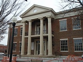
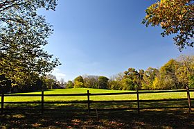
Williamson County Courthouse in Franklin, Old Town Archeological Site on the western side of the Big Harpeth River
|
|||
|
|||

Location within the U.S. state of Tennessee
|
|||
 Tennessee's location within the U.S. |
|||
| Country | |||
| State | |||
| Founded | October 26, 1799 | ||
| Named for | Hugh Williamson | ||
| Seat | Franklin | ||
| Largest city | Franklin | ||
| Area | |||
| • Total | 584 sq mi (1,510 km2) | ||
| • Land | 583 sq mi (1,510 km2) | ||
| • Water | 1.2 sq mi (3 km2) 0.2%% | ||
| Population
(2020)
|
|||
| • Total | 247,726 | ||
| • Estimate
(2023)
|
264,460 |
||
| • Density | 424.2/sq mi (163.78/km2) | ||
| Time zone | UTC−6 (Central) | ||
| • Summer (DST) | UTC−5 (CDT) | ||
| Congressional districts | 7th, 5th | ||
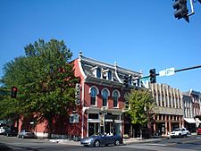
Williamson County is a county in the state of Tennessee. In 2020, about 247,726 people lived here. The main city and county seat is Franklin. The county is in the middle part of Tennessee. It is named after Hugh Williamson, a politician from North Carolina. He was one of the people who signed the U.S. Constitution. Williamson County is part of the larger Nashville-Davidson–Murfreesboro–Franklin city area. Long ago, farmers here grew tobacco and hemp. They also raised animals like horses and cattle.
Contents
History of Williamson County
Early Days Before the Civil War
Williamson County was created on October 26, 1799. It was formed from a part of Davidson County. Before settlers arrived, this area was home to several Native American tribes. These included the Cherokee, Chickasaw, Choctaw, Creek, and Shawnee.
The county also has two very old mound sites. These are the Fewkes site and the Old Town site. They were built by an ancient culture. This culture lived here long before the tribes we know today.
European settlers started moving into the area around 1798. Many came from Virginia and North Carolina. They were part of a big move west after the Revolutionary War. In 1800, Abram Maury planned out Franklin, the county seat. The county was named to honor Dr. Hugh Williamson. He was a colonel in the North Carolina militia. He also served in the Continental Congress.
Many early settlers were soldiers who fought in the Revolutionary War. They were paid with land grants. Some soldiers sold their land to people who wanted to buy and sell land. These buyers then divided the land into smaller pieces. Before the Civil War, Williamson County was very rich. It was the second wealthiest county in Tennessee. The area had lots of trees and good soil. Farmers grew many different crops. These included corn, wheat, tobacco, and hay. This helped the economy stay strong.
The Civil War Years
The Civil War greatly affected Williamson County. Three major battles were fought here. These were the Battle of Brentwood, the Battle of Thompson's Station, and the Battle of Franklin. The Battle of Franklin had many soldiers killed.
The large farms, called plantations, were badly damaged. Many young men from the county died in the war. Many Confederate soldiers who died at the Battle of Franklin are buried nearby. They rest at the McGavock Confederate Cemetery. This cemetery is the largest private Confederate cemetery in America. It holds the bodies of 1,481 soldiers.
After the Civil War
For many years after the war, farming was still the main way people made a living. Most people were farmers. They grew corn, wheat, cotton, and raised animals.
One of the first big factories in the county was Dortch Stove Works. It opened in Franklin. This factory later became the Magic Chef factory. It made electric and gas stoves. The factory buildings were fixed up in the late 1990s. Now, they are used for offices. This project is a great example of how old buildings can be reused.
Since the mid-1900s, Williamson County has grown a lot. This is because of the Interstate Highway System and the growth of Nashville, Tennessee. The county needed to build more roads and schools. Its character changed quickly. Between 1990 and 2000, the population grew by over 56 percent. Most of this growth was in the northern part, especially in Franklin. Franklin is now one of the largest cities in Tennessee. The southern part of the county is still mostly farms and open land. Spring Hill is another city that is growing fast in this area.
Geography of Williamson County
Williamson County covers about 584 square miles. Most of this is land. Only a small part is water. The main rivers are the Harpeth River and its smaller branch, the Little Harpeth River.
Neighboring Counties
Williamson County shares borders with these other counties:
- Davidson County (north)
- Rutherford County (east)
- Marshall County (southeast)
- Maury County (south)
- Hickman County (southwest)
- Dickson County (northwest)
- Cheatham County (north)
Protected Natural Areas
- Natchez Trace Parkway (a national parkway)
State Protected Areas
- Carter House State Historic Site
- Haley-Jaqueth Wildlife Management Area
People of Williamson County
The number of people living in Williamson County went down after 1880 for many years. This was partly because African Americans moved to cities for work. They also left the area because of unfair treatment and less need for farm workers. This movement was part of the Great Migration.
The population in 1880 was not reached again until 1970. Since then, many new people have moved to the county. Now, African Americans make up a smaller part of the population.
Population Changes Over Time
| Historical population | |||
|---|---|---|---|
| Census | Pop. | %± | |
| 1800 | 2,868 | — | |
| 1810 | 13,153 | 358.6% | |
| 1820 | 20,640 | 56.9% | |
| 1830 | 26,638 | 29.1% | |
| 1840 | 27,006 | 1.4% | |
| 1850 | 27,201 | 0.7% | |
| 1860 | 23,827 | −12.4% | |
| 1870 | 25,328 | 6.3% | |
| 1880 | 28,313 | 11.8% | |
| 1890 | 26,321 | −7.0% | |
| 1900 | 26,429 | 0.4% | |
| 1910 | 24,213 | −8.4% | |
| 1920 | 23,409 | −3.3% | |
| 1930 | 22,845 | −2.4% | |
| 1940 | 25,220 | 10.4% | |
| 1950 | 24,307 | −3.6% | |
| 1960 | 25,267 | 3.9% | |
| 1970 | 34,330 | 35.9% | |
| 1980 | 58,108 | 69.3% | |
| 1990 | 81,021 | 39.4% | |
| 2000 | 126,638 | 56.3% | |
| 2010 | 183,182 | 44.7% | |
| 2020 | 247,726 | 35.2% | |
| 2023 (est.) | 264,460 | 44.4% | |
| U.S. Decennial Census 1790-1960 1900-1990 1990-2000 2010-2020 |
|||
What the 2020 Census Shows
In 2020, there were 247,726 people living in Williamson County. There were 84,393 households. The population grew by 64,544 people since 2010. This was the biggest increase in the county's history.
| Race | Number | Percentage |
|---|---|---|
| White (not Hispanic) | 200,408 | 80.9% |
| Black or African American (not Hispanic) | 9,709 | 3.92% |
| Native American | 393 | 0.16% |
| Asian | 12,879 | 5.2% |
| Pacific Islander | 115 | 0.05% |
| Other/Mixed | 9,961 | 4.02% |
| Hispanic or Latino | 14,261 | 5.76% |
Money and Wealth
Williamson County is known as the wealthiest county in Tennessee. It is also one of the wealthiest counties in the whole country. In 2006, it was ranked as the 17th wealthiest county in the U.S. Later, it was even ranked as the 1st wealthiest when the local cost of living was considered. In 2010, Forbes magazine listed it as 17th on its list of the 25 wealthiest counties in America.
The county has grown very fast. The census bureau listed Williamson as one of the 100 fastest-growing counties in the U.S. between 2000 and 2005.
Education in Williamson County
Schools for Kids
Most of the schools in the county are run by Williamson County Schools. This system has 50 schools for students from kindergarten to 12th grade. A part of Franklin has its own school district for K-8 grades, called the Franklin Special School District. After 8th grade, students in this area go to high schools in the Williamson County district.
Colleges and Universities
- Belmont University, Williamson County Campus
- Columbia State Community College, Franklin Campus
- King University, Nashville Campus
- O'More College of Design
- University of Phoenix, Franklin Learning Center
- Williamson College
Communities in Williamson County
Cities in the County
- Brentwood
- Fairview
- Franklin (the main city)
- Spring Hill (partly in Maury County)
Towns in the County
- Nolensville
- Thompson's Station
Smaller Communities (Unincorporated)
These places are not officially cities or towns:
- Allisona (partial)
- Arrington
- Berry's Chapel
- Bethesda
- Bethlehem
- Boston
- Brush Creek
- Burwood
- College Grove
- Clovercroft
- Cool Springs
- Fernvale
- Grassland
- Kirkland
- Leiper's Fork
- Liberty Hill
- Peytonsville
- Primm Springs
- Rudderville
- Southall
- Triune
Images for kids
See also
In Spanish: Condado de Williamson (Tennessee) para niños


