
Yarmouth, Massachusetts facts for kids
Quick facts for kids
Yarmouth, Massachusetts
|
|||
|---|---|---|---|

Yarmouth Town Offices
|
|||
|
|||

Location in Barnstable County and the state of Massachusetts.
|
|||
| Country | United States | ||
| State | Massachusetts | ||
| County | Barnstable | ||
| Settled | 1639 | ||
| Incorporated | September 3, 1639 | ||
| Named After | Great Yarmouth, Norfolk | ||
| Government | |||
| • Type | Open town meeting | ||
| Area | |||
| • Total | 28.2 sq mi (73.1 km2) | ||
| • Land | 24.1 sq mi (62.5 km2) | ||
| • Water | 4.1 sq mi (10.5 km2) | ||
| Elevation | 30 ft (9 m) | ||
| Population
(2010)
|
|||
| • Total | 23,793 | ||
| • Density | 985/sq mi (380.4/km2) | ||
| Time zone | UTC-5 (Eastern) | ||
| • Summer (DST) | UTC-4 (Eastern) | ||
| ZIP code |
02664
02673 02675 |
||
| Area code(s) | 508 / 774 | ||
| FIPS code | 25-82525 | ||
| GNIS feature ID | 0618262 | ||


Yarmouth is a town located in Barnstable County, Massachusetts. It sits right on Cape Cod in the United States. In 2020, about 25,023 people lived here.
The town is made up of three main villages. These are South Yarmouth, West Yarmouth, and Yarmouth Port.
Contents
History of Yarmouth
Early Native American Life
Before European settlers arrived, the Wampanoag lived in the Yarmouth area. They were an Algonquian tribe. In their language, the area was called "Mattacheese." Different Wampanoag groups lived here. These included the Pawkunnawkuts, Hokanums, and Cummaquids.
Settlement by Plymouth Colony
Yarmouth became an official town on September 3, 1639. This happened as part of the Plymouth Colony. John Crowe, Thomas Howes, and Anthony Thacher led the first settlers. Yarmouth is one of the oldest towns on Cape Cod, along with Sandwich.
Originally, Yarmouth included the area that is now the town of Dennis. Dennis became its own separate community in 1793.
Yarmouth got its name from Great Yarmouth. This is a town in England, located on the east coast. Even though the first settlers didn't come from there, the name might have been chosen because of its connection to the Mayflower pilgrims. Some pilgrims lived in the Netherlands before returning to England through Yarmouth's port.
Yarmouth in Early Wars
Yarmouth played a part in early conflicts. In 1642 and 1645, soldiers from Yarmouth helped the Plymouth Colony. They went on trips against the Narragansett tribe.
Later, Yarmouth soldiers also fought in King Philip's War. Fifteen men from Yarmouth joined the Great Swamp Fight. The town lost five men in another battle at Rehoboth. Yarmouth troops also served in the early years of King William's War.
The American Revolution
Yarmouth was home to an active group called the Sons of Liberty. This group supported American independence. The town's local soldiers gathered to help during the Battles of Lexington and Concord. However, they returned home when they heard the rebels had already won.
In March 1776, Yarmouth troops were part of George Washington's forces. They helped during the Fortification of Dorchester Heights. On June 20, 1776, Yarmouth citizens declared their town's independence from Great Britain. Because Yarmouth is on the coast, the Royal Navy blocked its ports during the Revolutionary War.
The War of 1812
After the Revolution, Yarmouth strongly supported the Federalist Party. The town's economy relied on sea industries. Because of this, the people of Yarmouth did not like the Embargo Act of 1807. This act stopped trade with other countries.
On July 8, 1812, Yarmouth citizens voted to protest the war with Great Britain. Starting in 1814, the Royal Navy blocked Yarmouth's coast. Even though Yarmouth people were against the War of 1812, local soldiers tried to stop the blockade.
Early Ways of Making a Living

Yarmouth started as a farming community. People raised pigs, cattle, and sheep. Over time, the original forests disappeared due to farming and shipbuilding. New forests began to grow as farming became less common.
Even with farming, many people in Yarmouth made their living from the ocean. For many years, Yarmouth men worked as whalers. In the early 1800s, Yarmouth captains sailed merchant ships. They traded between New England and China.
Captain Ebenezer Sears of Yarmouth was the first American captain to sail a merchant ship around the Cape of Good Hope. In 1854, Captain Asa Eldridge of Yarmouth set a speed record. He sailed the clipper ship Red Jacket from New York to Liverpool in just 13 days. This record for a commercial sailing ship has never been broken.
In 1856, Captain Eldridge was the captain of the steamship SS Pacific. This ship disappeared at sea while traveling from Liverpool to New York. The house of another Yarmouth sea captain, Captain Bangs Hallet, is now a museum. It is home to the Historical Society of Old Yarmouth.
Modern Yarmouth
Near the end of the 1800s, developers started turning Yarmouth into a summer resort. Many hotels and summer cottages were built in the early 1900s. These were especially popular along what is now Route 28.
After World War II, more people started traveling by car. This led to many motels being built, mostly along Route 28. Later, more houses were built, making Yarmouth look like the suburban town it is today.
The main office for the International Fund for Animal Welfare (IFAW) is in Yarmouth Port. IFAW is a global charity that helps animals. It was started in 1969. In 1970, the national Christmas Tree Shops store chain began in Yarmouth Port.
On August 26, 2003, Colgan Air Flight 9446 crashed into the water near Yarmouth. Both crew members on board died.
Geography of Yarmouth
Yarmouth covers about 73.1 square kilometers (28.2 square miles). About 62.5 square kilometers (24.1 square miles) is land. The rest, about 10.5 square kilometers (4.1 square miles), is water.
Yarmouth is bordered by Cape Cod Bay to the north. To the east is Dennis. To the south is Nantucket Sound. To the west is Barnstable. Yarmouth is about 75 miles southeast of Boston.
The Bass River forms most of the border with Dennis. There are also several smaller ponds in the town. The Cape Cod Bay shore has marshy areas and creeks. The town's southern shore is famous for its beaches. Yarmouth has no large state forests. However, it does have four golf courses, a rod and gun club, and a Boy Scout camp.
Climate in Yarmouth
Yarmouth, Massachusetts, has a humid continental climate. This means it has warm summers and gets rain all year. Winters are cold, with at least one month averaging below 32°F (0°C). Summers are warm, with at least four months averaging above 50°F (10°C).
The average snowfall from November to April is about 30 inches (76 cm). February is usually the snowiest month. This is also when nor'easter storms are most common. The area is suitable for growing plants in USDA plant hardiness zone 7a.
| Climate data for Yarmouth, Barnstable County, Massachusetts (1981–2010 averages) | |||||||||||||
|---|---|---|---|---|---|---|---|---|---|---|---|---|---|
| Month | Jan | Feb | Mar | Apr | May | Jun | Jul | Aug | Sep | Oct | Nov | Dec | Year |
| Mean daily maximum °F (°C) | 37.9 (3.3) |
39.4 (4.1) |
44.5 (6.9) |
52.9 (11.6) |
62.5 (16.9) |
71.7 (22.1) |
77.9 (25.5) |
77.3 (25.2) |
71.0 (21.7) |
61.3 (16.3) |
52.9 (11.6) |
43.4 (6.3) |
57.8 (14.3) |
| Daily mean °F (°C) | 30.6 (−0.8) |
32.0 (0.0) |
37.3 (2.9) |
45.6 (7.6) |
54.9 (12.7) |
64.4 (18.0) |
70.6 (21.4) |
70.1 (21.2) |
63.5 (17.5) |
53.8 (12.1) |
45.6 (7.6) |
36.2 (2.3) |
50.5 (10.3) |
| Mean daily minimum °F (°C) | 23.3 (−4.8) |
24.7 (−4.1) |
30.1 (−1.1) |
38.2 (3.4) |
47.3 (8.5) |
57.0 (13.9) |
63.3 (17.4) |
62.9 (17.2) |
56.1 (13.4) |
46.2 (7.9) |
38.3 (3.5) |
29.0 (−1.7) |
43.1 (6.2) |
| Average precipitation inches (mm) | 3.63 (92) |
3.22 (82) |
4.45 (113) |
4.24 (108) |
3.31 (84) |
3.44 (87) |
3.09 (78) |
3.35 (85) |
3.62 (92) |
3.95 (100) |
3.97 (101) |
4.02 (102) |
44.29 (1,125) |
| Average relative humidity (%) | 70.4 | 69.3 | 67.7 | 70.6 | 73.0 | 75.8 | 78.3 | 78.2 | 77.9 | 74.3 | 71.2 | 70.7 | 73.1 |
| Average dew point °F (°C) | 22.1 (−5.5) |
23.1 (−4.9) |
27.6 (−2.4) |
36.6 (2.6) |
46.4 (8.0) |
56.6 (13.7) |
63.5 (17.5) |
63.0 (17.2) |
56.5 (13.6) |
45.8 (7.7) |
36.8 (2.7) |
27.6 (−2.4) |
42.2 (5.7) |
| Source: PRISM Climate Group | |||||||||||||
Transportation in Yarmouth
Three main roads run through Yarmouth. These are U.S. Route 6, Massachusetts Route 6A, and Massachusetts Route 28. Unlike many towns on Cape Cod, Yarmouth does not have other state roads crossing these three. All crossing roads are local. There are two exits from Route 6 in town.
Freight trains serve Yarmouth. The Massachusetts Coastal Railroad carries trash from a transfer station to a power plant in Rochester. A part of the Hyannis train line also goes through western Yarmouth.
From the nearby Hyannis station, the Cape Cod Central Railroad offers fun train rides. These are for tourists during certain seasons. The MBTA's CapeFLYER service also runs on weekends during the season. It connects Yarmouth to Boston.
There are also several bike paths throughout the town.
The closest airport is the Barnstable Municipal Airport. It is just outside Yarmouth. For national and international flights, the closest major airport is Logan International Airport in Boston.
Population of Yarmouth
| Historical population | ||
|---|---|---|
| Year | Pop. | ±% |
| 1850 | 2,595 | — |
| 1860 | 2,752 | +6.1% |
| 1870 | 2,423 | −12.0% |
| 1880 | 2,173 | −10.3% |
| 1890 | 1,760 | −19.0% |
| 1900 | 1,682 | −4.4% |
| 1910 | 1,420 | −15.6% |
| 1920 | 1,229 | −13.5% |
| 1930 | 1,794 | +46.0% |
| 1940 | 2,286 | +27.4% |
| 1950 | 3,297 | +44.2% |
| 1960 | 5,504 | +66.9% |
| 1970 | 12,033 | +118.6% |
| 1980 | 18,449 | +53.3% |
| 1990 | 21,174 | +14.8% |
| 2000 | 24,807 | +17.2% |
| 2010 | 23,793 | −4.1% |
| 2020 | 25,023 | +5.2% |
| 2022* | 25,244 | +0.9% |
| * = population estimate. Source: United States Census records and Population Estimates Program data. |
||
In 2000, there were 24,807 people living in Yarmouth. There were 11,520 households and 6,900 families. The average household had 2.11 people. The average family had 2.68 people.
About 17.2% of the population was under 18 years old. About 30.1% of the population was 65 years or older. The average age in Yarmouth was 49 years. For every 100 females, there were about 85.6 males.
Education in Yarmouth
Yarmouth schools are part of the Dennis-Yarmouth Regional School District. Yarmouth has two elementary schools: Station Avenue and Marguerite E. Small. These schools serve students from pre-kindergarten to fifth grade.
The Mattacheese Middle School is for students in grades 6 and 7. Students from both Yarmouth and Dennis attend Dennis-Yarmouth Regional High School. This high school serves students from grades 8 through 12. The school colors are green and white, and their mascot is the dolphin.
Students in Yarmouth can also choose to attend other schools. These include Cape Cod Regional Technical High School in Harwich. They can also go to Sturgis Charter Public School in Hyannis. Both of these schools are for grades 9-12. Another option is Saint Pius X School, which serves pre-kindergarten through 8th grade. There are also other private schools in nearby Barnstable.
Sports and Fun in Yarmouth
_(cropped).jpg)
Yarmouth is home to the Yarmouth–Dennis Red Sox. This is a summer baseball team for college players. The team plays at Red Wilson Field. Many players from this team have gone on to play in Major League Baseball. Some famous players include Craig Biggio, Buster Posey, and Chris Sale.
Notable People from Yarmouth

- Asa Eldridge, a famous sea captain
- Edward Gorey, a writer and illustrator
- John Gorham, a decorated colonial soldier
- Lot Hall, a Justice of the Vermont Supreme Court
- Joseph Eldridge Hamblin, a Civil War major general
- Christy Mihos, a businessman and politician
- Snow Parker, a merchant, judge, and politician
- Keith Reed, a Major League Baseball outfielder
- Joe Sherman, a Major League Baseball pitcher
- Thomas Chandler Thacher, a congressman
- George Thatcher, a lawyer and statesman
Images for kids
-
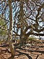
Weeping European Beech

See also
 In Spanish: Yarmouth (Massachusetts) para niños
