
Bairnsdale facts for kids
Quick facts for kids BairnsdaleVictoria |
|||||||||
|---|---|---|---|---|---|---|---|---|---|

Bairnsdale Gardens Main Street
|
|||||||||

Bairnsdale
Location in Shire of East Gippsland
|
|||||||||
| Population | 17,666 (2023 census) | ||||||||
| • Density | 114.0/km2 (295/sq mi) | ||||||||
| Established | 1860 | ||||||||
| Postcode(s) | 3875 | ||||||||
| Elevation | 49 m (161 ft) | ||||||||
| Area | 155 km2 (59.8 sq mi)(2016 urban) | ||||||||
| Location | |||||||||
| LGA(s) | Shire of East Gippsland | ||||||||
| State electorate(s) | Gippsland East | ||||||||
| Federal Division(s) | Gippsland | ||||||||
|
|||||||||
Bairnsdale (pronounced like "bairns-dale") is a city in East Gippsland, Victoria, Australia. It is located in an area that traditionally belongs to the Tatungalung clan of the Gunaikurnai people. In June 2023, about 17,666 people lived in the Bairnsdale urban area.
Bairnsdale is an important regional centre in eastern Victoria, similar to Traralgon and Sale. It is the main place for businesses in the East Gippsland region and where the local government for the Shire of East Gippsland is based. Bairnsdale became a shire (a type of local government area) on July 16, 1868, and was officially made a city on July 14, 1990.
Contents
History
First Peoples' History
Gunaikurnai People The Gunaikurnai people are the traditional owners of Gippsland, which includes the area where Bairnsdale is. There are about 3,000 Gunaikurnai people. Their traditional lands cover both coastal areas and inland regions, reaching up to the southern parts of the Victorian Alps. The Gunaikurnai have five main clans, and the Tatungalung clan are the Traditional Custodians of the Bairnsdale area.
Cultural Meanings The Ganai (or Kurnai) word "Wy-yung" means a type of duck, often linked to the Black Swan. The Bairnsdale backwater area is called Kauan, which means echidna.
European Settlement
Where the Name Came From No one is completely sure how Bairnsdale got its name. One idea is that it came from "Bernis-dale," meaning "Bjorn's dale" or "glen," which suggests Viking connections. Another story says that an early settler, Macleod, saw many children of his stockmen running around and called the place "Bairns-dale," meaning "valley of the children."
How the Town Grew In 1876, the Bairnsdale Shire started to grow a lot. Herman Bredt, a former auditor, helped organize it. He was also the father of Bertha Bredt, who later married the famous Australian poet Henry Lawson. Bertha used to work at the Bairnsdale Hospital. During this time, Bairnsdale's Main Street was created. At first, it was just dirt, which meant it was dusty in summer and muddy in winter. It wasn't paved until 1883. Nicholson Street was built in 1877, and MacLeod Street in 1879.
Geography
Bairnsdale is located on a bend of the Mitchell River. The river flows along the northern edge of the town, then turns south along the eastern edge. Some suburbs, like Wy Yung, Eastwood, and Lucknow, are now found across the river.
Mount Taylor is a mountain just north of Bairnsdale. It is a well-known landmark that can be seen from far away. It is important because of the gold rush that happened in the mid-19th century.

Gold was found in local creeks and rivers in 1857. This led to a lot of gold prospecting around Mount Taylor. The town of Bullumwaal was set up because of this. Its name, "Bullumwaal," comes from an Aboriginal word that might mean 'two spears,' referring to Mount Lookout and Mount Taylor.
Geology Mount Taylor is a key geological feature in the Bairnsdale area and part of the huge Great Dividing Range. Over millions of years, Mount Taylor and its surroundings have changed a lot. This shows the powerful forces that shaped south-eastern Australia's geology.
The area has Devonian granite rocks, which means it is very old. The geological story of eastern Victoria, where Mount Taylor is, goes back over 500 million years. Back then, large parts of the region were under ancient oceans.
Soil and Plants The soils around Mount Taylor are mostly red and brown. These soils support many native plants, including different types of Eucalyptus trees. The types of plants vary from dry forests to wet forests, depending on how much rain the area gets.
Land Use and Changes The land around Mount Taylor is used for conservation, forestry, recreation, and water supply. However, the area can suffer from erosion, especially in places like roads or cleared land. The region gets a lot of rain, between 700-1200 mm per year. This affects the soil and the types of plants that grow there.
Mitchell River
The Mitchell River flows into Lake King and Jones Bay. The Mitchell, Tambo, and Nicholson rivers together bring a lot of water into the lakes system each year. They also carry a lot of sediment (like dirt and sand).
The lower parts of the Latrobe River, Thomson River, and Mitchell River flow into the Gippsland Lakes. These rivers have large floodplains with big wetlands.
The Mitchell River flats often flooded. Big floods happened in 1870 and 1891. The biggest floods were in 1893–94. These floods caused a lot of trouble for the town, including loss of life and damage to buildings and crops. During the 1893–94 floods, two brave men, Patrick Piggott and George Brooks, rescued many people. Sadly, they drowned on their last trip. They are remembered on a marble tablet at the Mechanics' Hall (now the Bairnsdale Library).
The Mitchell Delta is a special type of inland delta. It looks like fingers or toes (called a digitate delta) and extends into Lake King. It is formed by sediment from the river. The Mitchell Delta is considered one of the best examples of this type of landform in the world.
A group of nationally threatened Grey-headed flying foxes live along the river. These native bats help pollinate over 100 types of native trees and plants. They are very important for keeping forests healthy. Their numbers have dropped a lot, so people are working hard to protect them.
Wetlands
Macleod Morass and Jones Bay Wildlife Reserves are areas of wetlands south of Bairnsdale, near Lake King and the Mitchell River. The Tatungoloong clan of the Gunai/Kurnai peoples traditionally cared for these lands and waters. They used the wetlands and surrounding forests for food and shelter.
Macleod Morass formed as the Mitchell River silt jetties grew, eventually separating it from Lake King and Jones Bay. The area has important geological features that show how sea levels used to be higher in Bass Strait.
Macleod Morass was once a 'deep freshwater marsh'. Now, only about 30% of it is still like that. Water flows into the morass from creeks, urban stormwater, and rain. Big floods in the Mitchell River completely fill Macleod Morass and help clean the wetland system.
Since 1939, treated wastewater has been released into Macleod Morass. This has increased nutrient levels, lowered water quality, and changed the types of plants growing there. Both Macleod Morass and Jones Bay Wildlife Reserves are part of the Gippsland Lakes Ramsar Site, which is recognized internationally for its wetlands.
These reserves have many threatened plant types that provide homes for a variety of wildlife, including 23 threatened animal species. Over 100 bird species have been seen here, including 53 waterbird species. Eight migratory bird species found in the reserves are protected by international agreements.
Macleod Morass is an important place for Australian white ibis, straw-necked ibis, and black-winged stilt to breed. Efforts are made to protect important animal sites and bird breeding areas from disturbance. This includes protecting the white-bellied sea eagle, green and golden bell frog, warty bell frog, black-winged stilt, Australian white ibis, and straw-necked ibis.
A total of 141 different fauna species have been found near the reserves. This includes 23 animal species that are threatened in Victoria and three that are vulnerable nationally.
People of Bairnsdale
At the 2021 census, there were 15,684 people living in Bairnsdale.
- Aboriginal and Torres Strait Islander people made up 4.8% of the population.
- Most people (81.2%) were born in Australia. Other common birthplaces included England (2.8%), the Philippines (1.0%), and New Zealand (0.9%).
- English was spoken at home by 87.5% of people.
- The most common religions were No Religion (46.5%), Catholic (16.0%), and Anglican (13.1%).
Climate
Bairnsdale has a temperate climate. This means it has mild to warm summers and cool, wet winters. The hottest temperature ever recorded was 46.2 degrees Celsius on February 7, 2009, during a heatwave. The coldest was −5.4 degrees on July 2, 2017. Winter days in Bairnsdale are a bit warmer than in Melbourne. The town also has more clear days each year than Melbourne.
| Climate data for Bairnsdale (Bairnsdale Airport 1942–2013) | |||||||||||||
|---|---|---|---|---|---|---|---|---|---|---|---|---|---|
| Month | Jan | Feb | Mar | Apr | May | Jun | Jul | Aug | Sep | Oct | Nov | Dec | Year |
| Record high °C (°F) | 44.0 (111.2) |
46.2 (115.2) |
40.8 (105.4) |
37.5 (99.5) |
29.4 (84.9) |
25.0 (77.0) |
22.7 (72.9) |
27.0 (80.6) |
35.4 (95.7) |
34.9 (94.8) |
43.5 (110.3) |
41.6 (106.9) |
46.2 (115.2) |
| Mean daily maximum °C (°F) | 25.9 (78.6) |
25.5 (77.9) |
24.0 (75.2) |
20.7 (69.3) |
17.6 (63.7) |
15.0 (59.0) |
14.6 (58.3) |
15.7 (60.3) |
17.7 (63.9) |
19.9 (67.8) |
21.8 (71.2) |
23.7 (74.7) |
20.2 (68.4) |
| Mean daily minimum °C (°F) | 12.9 (55.2) |
12.9 (55.2) |
11.3 (52.3) |
8.7 (47.7) |
6.7 (44.1) |
4.7 (40.5) |
3.9 (39.0) |
4.5 (40.1) |
5.9 (42.6) |
7.5 (45.5) |
9.6 (49.3) |
11.3 (52.3) |
8.3 (46.9) |
| Record low °C (°F) | 4.2 (39.6) |
3.5 (38.3) |
2.0 (35.6) |
0.5 (32.9) |
−3.0 (26.6) |
−3.2 (26.2) |
−5.4 (22.3) |
−4.5 (23.9) |
−2.2 (28.0) |
−1.0 (30.2) |
1.6 (34.9) |
2.5 (36.5) |
−5.4 (22.3) |
| Average rainfall mm (inches) | 48.0 (1.89) |
47.0 (1.85) |
45.3 (1.78) |
58.2 (2.29) |
44.4 (1.75) |
64.7 (2.55) |
48.0 (1.89) |
36.6 (1.44) |
52.4 (2.06) |
60.9 (2.40) |
78.3 (3.08) |
61.5 (2.42) |
645.3 (25.4) |
| Average rainy days (≥ 0.2mm) | 8.8 | 8.3 | 9.4 | 11.3 | 13.1 | 13.7 | 13.8 | 13.3 | 13.8 | 13.5 | 11.9 | 11.2 | 142.1 |
| Source: Bureau of Meteorology | |||||||||||||
Landmarks

William J. Yates was a well-known architect and builder in Bairnsdale. He built many early buildings, including the school, the old Shire Hall (1860), the Wesleyan Church (1876), St. John's Church, the old Bairnsdale Hospital, and the Mechanic's Hall.
St Mary's Roman Catholic Church
One of Bairnsdale's most famous buildings is St Mary's Roman Catholic Church on Main Street. It has a very tall tower. Building started in 1913, replacing an older brick church from 1883.

Inside, the walls and ceiling of St Mary's are covered with amazing murals (large paintings). These murals show saints, the Trinity, and scenes of hell, purgatory, heaven, and the crucifixion. They are so impressive that they are compared to murals in European churches.
Every year, up to 80,000 visitors come to see the church. The murals were painted by an Italian artist named Francesco Floreani during the Great Depression. They are still a big attraction today.
The new St Mary's Roman Catholic Church building opened on April 29, 1883. A school was also opened in the 1880s and grew quickly. In 1909, plans were made to build a grand new brick church. Work began in August 1913, and the new church, with its tower, was described as being in the Romanesque style, built of brick with a slate roof.
In the 1880s, many churches in Bairnsdale grew, often having full congregations. St Johns Church of England often had over 200 people at its services. A new brick church for St Johns was built and opened in 1884.

Gardens
Bairnsdale's main gardens stretch for about 4 kilometers (2.5 miles) from the Mitchell River to the western edge of town. The central part of the garden is over 500 meters (550 yards) long, running through the main shopping area. It has beds of flowering plants, many old trees, war memorials, and a restored historic band rotunda. The rotunda was built in 1910 and fixed up in 1993.
In 1943, a monument was built at the eastern end of the gardens to celebrate the district's 100th anniversary. This section was then called the Centenary Garden. In 1947, the Country Women's Association (CWA) Younger set took over making the Centenary Garden beautiful. They planted a tree there to celebrate Princess Elizabeth's 21st birthday. Many Australian native trees were planted after the war, making a colorful display, especially in spring and early summer.
From 1964, under the care of the town's head gardeners, the gardens were extended westward with tough trees like desert ash. By 1959, the highway had been extended, and tree planting and lawns created two kilometers of gardens in the center. In 1969, a wishing well was built in the Centre Gardens. A plaque was added in 1984 to celebrate Victoria's 150th anniversary.
To remember those who did not return from the Boer War in 1899, a monument was unveiled in the Main Street Gardens on June 12, 1903.
Cemetery

The Bairnsdale cemetery is now on Forge Creek Road. Its first location was at Punt Flat, which is now the Mitchell Gardens Holiday Park by the river. A plaque marks the original site. After a major flood in 1870, some remains were washed downstream. They were later collected and re-buried at the current cemetery.
In the 1920s, people often complained that the cemetery was messy. In 1990, a community group took over managing the cemetery. The lawn section of the cemetery started in 1969. In 1946, a memorial garden was created for Bairnsdale's war dead. The Imperial War Graves Commission took care of this section, making it beautiful with a gate, cypress hedge, and white headstones. A central memorial Cross of Sacrifice was unveiled in 1950 to remember RAAF personnel who died in the Bairnsdale area during the war.
Frederick Jones was one of the first squatters (early settlers who occupied land) in the Bairnsdale Shire. He arrived at the Mitchell River crossing on June 20, 1842. Jones decided to settle in the area of Lucknow, naming it to reflect his good fortune.
In 1848, John Archer, a retired sea-captain, became the manager of Lucknow Station. Archer's wife, Eliza, died in childbirth in 1847. Her grave's headstone can still be seen by the roadside on Crooke Street, East Bairnsdale. This headstone is thought to be the only remaining proof of an early cemetery in this area.
Infrastructure
Education
Bairnsdale has two high schools. Bairnsdale Secondary College is a government school with about 1,600 students. It was formed in 1993 by combining the Bairnsdale Technical School and Bairnsdale High School. Nagle College, a Catholic school with about 1,000 students, was founded in 1958.
The city also has several primary schools, including the historic Bairnsdale Primary School, Bairnsdale West Primary School, and Lucknow Primary School. The East Gippsland Specialist School helps students from prep to year 12. There are also many kindergartens. For higher education, Bairnsdale has the East Gippsland Institute of TAFE and Federation Training.
Transport

Bairnsdale became a key trading center for East Gippsland. This was helped by good roads, a railway, and some steamer and air services. The 1880s were a "Golden Age" for steamer traffic on the rivers, and Bairnsdale was a major port. The brick Bairnsdale railway station opened in 1890.
Shipping services from Bairnsdale connected with the railway, allowing local farmers and producers to send their goods to markets in Melbourne. With more frequent trains and refrigerated carts by 1890, the last coach service between Sale and Bairnsdale ran in 1889. During World War II, train services were reduced but were restored in 1948. In 1952, diesel trains were first used, and the daily train from Melbourne to Bairnsdale was named The Gippslander.
Today, V/Line provides train services to Bairnsdale railway station, which is the end of the Bairnsdale railway line. Bairnsdale Cabs offers a local taxi service. Bus services are provided by Gillicks Bus Lines, Dysons, and Goodalls Bus Lines.
The East Gippsland Rail Trail is a major recreational path in the city. It starts in East Bairnsdale near Howitt Park. The first part is paved, then it becomes a gravel track. This nearly 100-kilometer (62-mile) trail is great for running, walking, cycling, and horse-riding. It follows the old railway line to Orbost.
Aerodrome
Bairnsdale Airport is on a large area of 280 hectares (690 acres) owned by the East Gippsland Shire Council. It was built during World War II in the 1940s. It was used as an extension to the nearby East Sale R.A.A.F. Base and housed 3,000 men. Its main purpose was for reconnaissance (scouting) missions and training flights over Bass Strait and the Tasman Sea.
The airport became fully operational in May 1942. No. 7 Squadron operated Hudson Aircraft for shipping convoy escort and anti-submarine patrols. New Bristol Beaufort bombers also moved to Bairnsdale in June 1942. The No. 1 Operation Training Unit trained many pilots.
During the war, 53 aircraft crashed, and 71 airmen were killed. In total, 87 people died at Bairnsdale due to crashes or missing aircraft before the war ended.
After the war, several companies tried to establish regular passenger flights from Bairnsdale to Melbourne but without long-term success. Today, the airport supports commercial aviation, including aerial firefighting, corporate flights, aircraft maintenance, and medical services like air ambulances.
Water Supply

Plans for the town's water supply began in 1884. Tanks were put up in Main Street for residents to get water. Later, John H. Grainger designed a reservoir west of town, connected to a pumping plant and an elevated tank in the town. By 1890, the town's water system was ready.
In 1906, the station was upgraded with a new, large concrete tank designed by (Sir) John Monash's company. This tank was a new idea for reinforced concrete construction in the state. A new concrete pump house was also added in 1906, which later used electric pumps.
To provide better water pressure, a reinforced concrete water tower was built in Main Street in 1926–27. It is 100 feet (30 meters) high and can hold 80,000 imperial gallons (360,000 liters) of water. This tower is now a well-known symbol of Bairnsdale. The pumping station continued to work until the 1980s.
With increasing water demand in the 1960s, plans were made for a new water treatment plant and a large basin at Wy Yung. Another storage basin was planned for the Mitchell River at Glenaladale. The basin at Wy Yung opened in 1972. In 1983, the Mitchell Water Board was created to manage water and sewerage for Bairnsdale and nearby communities.
To make sure there is enough drinking water for a long time, a new water storage and treatment plant opened northwest of Bairnsdale at Woodglen in 2010. This plant can process up to 20 megaliters of water a day. It uses a special water treatment process called DAFF. The facility is designed to hold 715 megaliters of water, which is like 715 Olympic-sized swimming pools. About 24,000 people rely on the Mitchell River water supply system.
Media
Newspapers
Bairnsdale has two local newspapers: Bairnsdale Advertiser, sold on Mondays and Fridays, and East Gippsland News, delivered free on Wednesdays. Both are owned by East Gippsland Newspapers. The Bairnsdale Advertiser is special because it has been owned by the same family since the 1880s.
Television
Television came to Bairnsdale in 1956. The area was the first in Australia to get its own regional television station, GLV-10 Gippsland (now Southern Cross 10), which started on December 9, 1961.
Programs from the three main commercial TV networks (Seven, Nine, and Ten) are shown in Bairnsdale by their regional partners. These are broadcast from the Mount Tassie transmitter and local relay transmitters at Mount Taylor. All commercial stations are based in Traralgon and include local commercials.
Local news is available on all three commercial networks:
- WIN broadcasts a half-hour WIN News bulletin each weekday evening.
- Southern Cross Austereo and the Seven Network broadcast short local news and weather updates throughout the day.
The national public broadcasters, ABC (ABC TV) and SBS (SBS TV), are also broadcast in Bairnsdale.
Many extra digital channels are available through Freeview for viewers in Bairnsdale and the Gippsland region. These include HD versions of the main channels, plus channels like ABC TV Plus, ABC Me, ABC News, SBS Viceland, SBS World Movies, 10 Bold, 10 Peach, 10 Shake, 7two, 7mate, 9Gem, 9Go!, 9Life, and Sky News Regional.
Subscription television service Foxtel is available via satellite.
Radio
The local community radio station, R.E.G. FM, broadcasts on 105.5 MHz and 90.7 MHz. It operates from studios in Bairnsdale and Lakes Entrance, with local volunteers as presenters.
Local commercial radio services TRFM (99.9 MHz) and Gold 1242 (98.3 MHz) are operated by Ace Radio. They broadcast to Bairnsdale and most of Gippsland.
Local ABC station, ABC Gippsland, broadcasts into Bairnsdale on 828 kHz AM and 100.7 MHz. National ABC stations Triple J (96.7 MHz) and ABC Classic FM (101.5 MHz) are also available. ABC Radio National (106.3 MHz) and ABC News Radio (107.9 MHz) are re-broadcast locally.
Sport

Australian Rules Football
The town has three Australian rules football clubs. The Bairnsdale Football Club (known as the Redlegs) plays in the Gippsland Football League. Lucknow and Wy Yung play in the local East Gippsland Football League. Football competitions started properly in the 1890s. The first football ground was in Lucknow.
In May 1885, the Bairnsdale team adopted a blue-and-white jersey, blue shorts, red stockings, and a red sash. This gave them the nickname "Red-legs." Bairnsdale won championships in 1893, 1895, 1896, and 1899, and again in 1902, 1903, 1908, 1912, and 1913.
Cricket
Cricket teams were formed in the 1890s, and a women's cricket team started in 1908. In 1892, Lord Sheffield's English Cricket team visited Bairnsdale and played a Gippsland team.
Soccer
Soccer is played by the East Gippsland United Football Club, which competes in the Latrobe Valley Soccer League. Their home ground is Howitt Park in East Bairnsdale.
The Bairnsdale Soccer Club focuses on Futsal, which is a modified version of soccer.
Other Sports
Bairnsdale has a horse racing club, the Bairnsdale Racing Club, which holds about eight race meetings a year. The town has two field hockey clubs. Golfers can play at the Bairnsdale Golf Club or the Goose Gully Golf Greens.
Bairnsdale is a popular place for fishing because it is close to the Gippsland Lakes and Ninety Mile Beach, and has easy access to the Mitchell, Nicholson, and Tambo rivers.
The Bairnsdale Aquatic and Recreation Centre (BARC) is the largest indoor sports complex in country Victoria. It has two swimming pools, three basketball courts, gym rooms, and the Forge theatre. The Riviera triathlon club, based in Bairnsdale, holds events all year.
The Bairnsdale Cycling Club organizes road races most weekends, taking advantage of the scenic terrain. Bairnsdale is also a great place for mountain biking, with trails at Mount Taylor, Colqhoun Park, and Mount Nowa Nowa.
Commercial
According to the 2011 Census, many people in Bairnsdale work in education (6.0%), residential care services (5.4%), bakery product manufacturing (4.3%), and cafes/restaurants (4.0%). There are also jobs in supermarkets and grocery stores. Outside of retail, education, health, and welfare, there are some agricultural jobs.
Goodman's cannery operated for many years until the late 1920s. The Cooperative butter factory was very successful as dairying grew. In 1923, T. N. and W. F. Stephenson started a new butter factory, Lakeland's Butter, known for its prize-winning "Golden Lake" and "Silver Lake" butter.
During and after the war, freezing rabbits became a big local industry. In 1925, a soap-making factory called "Polaso" was set up. It made soap, toilet soap, and polishes. A confectionery factory making sweets like Sno Balls and marshmallows started in 1930. Other factories that opened in the 1920s and 1930s included a plaster sheet factory and Rocla Pipes Ltd, which made reinforced concrete pipes.
Bairnsdale Motors, later called The Big Garage, was founded in 1923. Brodribb Motors started in 1934. A cafe opened in 1932 and was proud to have the town's first neon sign.
Today, businesses like Curtis Australia, a pen-manufacturing company, are based in Bairnsdale. Fennings Timber produces quality hardwood from the Tambo Valley forests. Auswest Timbers Pty Ltd distributes timber worldwide. One of the largest employers in Bairnsdale is Patties Foods, which started as a local bakery in Lakes Entrance in 1966. Many well-known franchise businesses are also popular in Bairnsdale.
Religion
Several Churches serve the Bairnsdale community. These include Catholic, Anglican, Pentecostal, Presbyterian, Uniting, and Seventh-day Adventist churches.
According to the 2021 census, the most common responses for religion in Bairnsdale were no religion (46.2%), Catholic (15.6%), and Anglican (13.2%).
2019–20 Bushfires
During the 2019–20 Australian bushfire season, an evacuation center was set up in Bairnsdale at the Bairnsdale Football pavilion to help people affected by the fires.
Notable People
- Tom Alvin, Carlton footballer
- Jon Ballantyne, AFL footballer
- Terry Bourke, filmmaker and writer
- Callum Chambers, West Coast and Carlton footballer
- Edward Coate, flying ace of the Second World War
- Lock Crowther, multihull sailboat designer
- Kevin Coverdale, Hawthorn football player and coach
- Slim Dusty, country music singer-songwriter
- Leigh Hobbs, children's author and illustrator
- Alfred William Howitt, anthropologist, explorer and naturalist
- Charlotte McShane, triathlete and U23 ITU World Triathlon Champion
- Hal Porter, author
- Brian Royal, Western Bulldogs Footballer
- Kat Stewart, actress
- Will Tomlinson, professional boxer and IBO Super-featherweight World Champion
- Cameron White, Test cricketer
- David Williamson, playwright
Images for kids
-
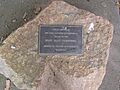
A plaque acknowledging the original cemetery site at Punt Flat.

