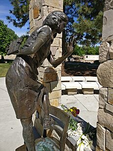
Boise, Idaho facts for kids
Quick facts for kids
Boise, Idaho
|
|||||
|---|---|---|---|---|---|
|
|
|||||
|
|||||
| Nickname(s):
The City of Trees
|
|||||
| Motto(s):
Energy Peril Success
|
|||||
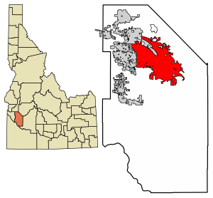
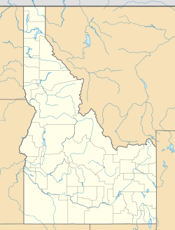
Location within Ada County in Idaho
|
|||||
| Country | United States | ||||
| State | Idaho | ||||
| County | Ada | ||||
| Founded | 1863 | ||||
| Incorporated | 1864 | ||||
| Government | |||||
| • Type | Strong-mayor | ||||
| • Body | Boise City Council | ||||
| Area | |||||
| • State capital city | 85.00 sq mi (219.45 km2) | ||||
| • Land | 84.03 sq mi (216.96 km2) | ||||
| • Water | 0.97 sq mi (2.49 km2) | ||||
| Elevation | 2,704 ft (824 m) | ||||
| Population
(2020)
|
|||||
| • State capital city | 235,684 | ||||
| • Rank | U.S.: 95th ID: 1st | ||||
| • Density | 2,860.54/sq mi (1,055.28/km2) | ||||
| • Urban | 433,180 (US: 94th) | ||||
| • Urban density | 3,111.2/sq mi (1,201.3/km2) | ||||
| • Metro | 764,718 (US: 74th) | ||||
| Demonym(s) | Boisean | ||||
| Time zone | UTC−7 (MST) | ||||
| • Summer (DST) | UTC−6 (MDT) | ||||
| ZIP codes |
83701-83709, 83711-83717, 83719-83720, 83722, 83724-83726, 83728-83729, 83732, 83735, 83756, 83799
|
||||
| Area code(s) | 208, 986 | ||||
| FIPS code | 16-08830 | ||||
| GNIS feature ID | 2409876 | ||||
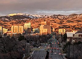
Boise (pronounced BOY-see) is the capital city of Idaho. It is also the largest city in the state. Boise is the main city of Ada County. In 2020, about 235,684 people lived here.
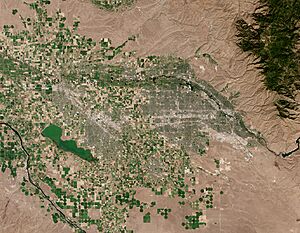
The city is located on the Boise River in southwestern Idaho. It is about 41 miles (66 km) east of the Oregon border. It is also 110 miles (177 km) north of the Nevada border. Downtown Boise is about 2,704 feet (824 m) above sea level.
The Boise area is also called the Treasure Valley. It includes five counties and has a total population of over 749,202 people. This makes it the largest metropolitan area in Idaho. The three biggest cities in Idaho are Boise, Nampa, and Meridian.
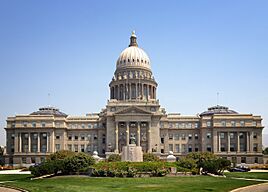
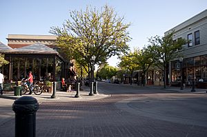
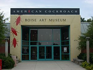
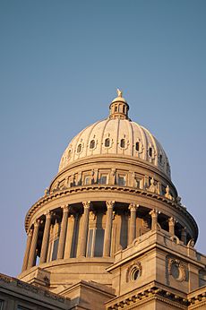
Downtown Boise is a lively place. It has many small businesses, shops, and restaurants. 8th Street is a special area for walking, with outdoor cafes. You can also find the Basque Block here, which celebrates Boise's Basque history. Important places downtown include the Idaho State Capitol, the historic Egyptian Theatre, the Boise Art Museum, and Zoo Boise.
Contents
History of Boise
How Boise Got Its Name
The exact origin of the name "Boise" is not fully known. One story says that Captain B. L. E. Bonneville of the U.S. Army named it. After a long journey through dry land, his group saw the green Boise River Valley. A French-speaking guide supposedly shouted, "Les bois! Les bois!" which means "The woods! The woods!" This name then stuck.
Another idea is that early mountain men gave the river its name. In the 1820s, French Canadian fur trappers worked in the area. The valley of the Boise River was a clear landmark because of its many trees. It was like an oasis in the desert. So, the French trappers called the area "la rivière boisée," meaning "the wooded river."
Most people who live in Boise say "BOY-see." Sometimes, people from other places say "BOY-zee."
Early People and First Encounters
The Boise valley was home to the Shoshone and Bannock tribes. They were part of the "Snake Country" groups. These tribes met in the valley every year to trade and catch salmon. They spent winters in the valley because the weather was milder. They also used the hot springs for bathing and healing. Castle Rock, which they called Eagle Rock, was a sacred place for them.
In 1811, Wilson Price Hunt led an expedition through the Boise valley. This was the first time white Americans entered the region. For many years, the area remained mostly free of settlers.
The British Hudson's Bay Company (HBC) built a fort called Old Fort Boise about 40 miles (64 km) west of modern Boise. The HBC left the fort in 1844, and the United States Army took it over.
The Oregon Trail and Changes
Starting in the 1840s, more settlers began moving to Oregon Country. This led to big changes in the Boise region. The British gave the area to the U.S. in the Oregon Treaty. This meant the Boise valley became part of Oregon Territory.
When gold was found in California in 1848, even more settlers traveled through the area. They used the Oregon Trail. This increased travel upset the Shoshone and Bannock tribes. They felt their lands were being invaded.
Because of this, Native peoples began to attack settler groups. One event was the "Ward Massacre" in 1854. A group of Shoshone and Bannock warriors attacked a wagon train. This led to more conflict with the United States Army. The army eventually had to leave Old Fort Boise. Travel became very dangerous without army protection.
Gold Discovery and City Growth
In 1863, gold was discovered near the Boise valley. This, along with ongoing conflicts, led the U.S. Military to build a new Fort Boise. This new fort was built where Boise is today. It was a good spot because it was near the Oregon Trail and roads to important mining areas.
In 1863, the Idaho Territory was created. Boise became its capital in 1864. This was a debated decision. The city grew quickly because of the gold rush. Many miners settled in Boise after the gold rush slowed down.
By 1864, farming was also growing near the river. The city was officially incorporated in 1868. By this time, Boise had over 400 permanent buildings and many businesses. People also wanted railroad connections to other cities.
The U.S. Assay Office was built in 1871. It allowed gold and silver to be bought in Boise, so miners did not have to send it all the way to San Francisco. The Old Idaho State Penitentiary also opened nearby.
Boise started to be called the "City of Trees" during this time. People planted many trees, especially in downtown Boise. In 1907, Thomas J. Davis donated land for a park, which became Julia Davis Park.
The city also got electricity in 1887. An electric streetcar system was built in 1891. This system helped Boise and nearby towns grow. It ran until 1927.
By the 1890s, Boise had more services. Hot water from natural springs was used to heat many homes. A public swimming center called the Natatorium was built. Churches, schools, a hospital, and a new train station were also built. By 1900, Boise's population had grown to 5,957 people.
20th and 21st Centuries
In 1925, the Boise Union Pacific Depot train station was built. It served passengers until 1997.
In 2019, the city council changed the names of a park and natural preserve. They used names from the Shoshoni language. This was to honor the importance of these places to local Native peoples.
Boise's Location and Areas
Boise is in southwestern Idaho. It is about 41 miles (66 km) east of the Oregon border. It is also 110 miles (177 km) north of the Nevada border. Downtown Boise is about 2,704 feet (824 m) above sea level.
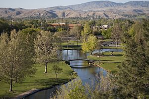
Most of the Boise area is on a flat plain. Mountains rise to the northeast. Locals call these the Boise foothills. They are part of the Rocky Mountains.
Boise covers about 80 square miles (207 square kilometers). Most of this is land, with a small amount of water. The Boise River flows through the city.
Boise's Neighborhoods
Boise has several distinct neighborhoods:
Downtown Boise
Downtown Boise is the city's cultural heart. It has many small businesses and tall buildings. You can find a variety of shops and restaurants here. 8th Street is a special walking area with outdoor cafes. The Basque Block celebrates Boise's Basque heritage. Key attractions include the Idaho State Capitol, Egyptian Theatre, Boise Art Museum, and Zoo Boise.
Boise State University Area
South of downtown is Boise State University (BSU). This area has homes and businesses that serve students. A famous landmark is Albertsons Stadium on the BSU campus. It has a unique blue playing field. This is where the Boise State Broncos football team plays. The campus also has the Velma V. Morrison Center for the Performing Arts and ExtraMile Arena.
The North End
The North End is north of State Street. It has many of Boise's older homes. It is known for its tree-lined streets like Harrison Boulevard. It is a quiet area close to downtown. You can see downtown Boise from Camel's Back Park. Hyde Park on 13th Street has restaurants and shops. The North End is considered one of America's "Great Neighborhoods."
Boise Bench
The Bench is about 60 feet (18 m) higher than downtown Boise. It gets its name because it looks like a step or "bench" in the land. The Bench has older homes and is home to the Boise Union Pacific Depot. The Boise Airport is just south of the Bench.
Southwest Boise
Southwest Boise has neighborhoods built from the 1960s to the 1980s. Many homes have large plots of land. This area is near Interstate 84. It also has the Boise Airport, theaters, and shopping.
Northwest Boise
Northwest Boise is next to the Boise Foothills. It has a mix of old and new homes. Lakeharbor is a neighborhood with a private lake. Downtown is just minutes away. This area also has easy access to the Boise Greenbelt.
Warm Springs and East End
Warm Springs is known for its tree-lined Warm Springs Avenue. It has some of Boise's largest and most expensive homes. These homes are heated by natural hot springs from Boise's fault line. The Natatorium public swim center is also here.
Southeast Boise
Southeast Boise stretches from Boise State University to Micron Technology. It has a mix of older and newer suburban homes. Columbia Village and Oregon Trail Heights are planned communities in this area. Bown Crossing is a newer community with easy access to the Boise Greenbelt.
West Boise
West Boise is home to Boise Towne Square Mall, the largest mall in Idaho. It has many restaurants, shops, and homes. The Ada County jail and Hewlett-Packard's printing division are also located here. West Boise is mostly flat and borders the city of Meridian.
Boise's Climate
| Weather chart for Boise, Idaho | |||||||||||||||||||||||||||||||||||||||||||||||
|---|---|---|---|---|---|---|---|---|---|---|---|---|---|---|---|---|---|---|---|---|---|---|---|---|---|---|---|---|---|---|---|---|---|---|---|---|---|---|---|---|---|---|---|---|---|---|---|
| J | F | M | A | M | J | J | A | S | O | N | D | ||||||||||||||||||||||||||||||||||||
|
1.4
39
26
|
1
46
29
|
1.3
56
35
|
1.2
62
40
|
1.5
72
48
|
0.8
81
54
|
0.2
93
62
|
0.2
91
61
|
0.4
80
53
|
0.8
65
42
|
1.2
49
32
|
1.5
39
25
|
||||||||||||||||||||||||||||||||||||
| temperatures in °F precipitation totals in inches |
|||||||||||||||||||||||||||||||||||||||||||||||
|
Metric conversion
|
|||||||||||||||||||||||||||||||||||||||||||||||
Boise has a climate with four clear seasons. Summers are hot and dry. Temperatures often reach 90°F (32°C) or higher. Winters are moderately cold, with some snow. Spring and fall are mild.
The highest temperature ever recorded was 111°F (44°C). The lowest was -28°F (-33°C). Boise gets about 12 inches (30 cm) of rain each year. Snowfall averages about 18 inches (46 cm).
Tornadoes are very rare in Boise. Since 1950, only a few have been recorded, and none have caused serious damage or injuries.
People of Boise
| Historical population | |||
|---|---|---|---|
| Census | Pop. | %± | |
| 1870 | 995 | — | |
| 1880 | 1,899 | 90.9% | |
| 1890 | 2,311 | 21.7% | |
| 1900 | 5,957 | 157.8% | |
| 1910 | 17,358 | 191.4% | |
| 1920 | 21,393 | 23.2% | |
| 1930 | 21,544 | 0.7% | |
| 1940 | 26,130 | 21.3% | |
| 1950 | 34,393 | 31.6% | |
| 1960 | 34,481 | 0.3% | |
| 1970 | 74,990 | 117.5% | |
| 1980 | 102,249 | 36.4% | |
| 1990 | 125,738 | 23.0% | |
| 2000 | 185,787 | 47.8% | |
| 2010 | 205,671 | 10.7% | |
| 2020 | 235,684 | 14.6% | |
| U.S. Decennial Census | |||
In 2020, Boise had 235,684 people. Most residents were white (81.24%). Other groups included Black or African American (2.27%), Native American (0.7%), and Asian (3.58%). About 9.03% of the population was Hispanic or Latino.
The average age in Boise was 37.1 years. About 20.3% of the population was under 18.
Boise's Economy
Boise is home to many large companies. These include Boise Cascade LLC, Albertsons, and J.R. Simplot Company. The state government is also one of the city's biggest employers.
Micron Technology is the largest private, publicly traded employer based in Boise. The city also has a growing technology industry. Companies like Hewlett-Packard and Cradlepoint have a presence here.
The call center industry is also important. More than 20 call centers employ over 7,000 people in Boise.
Varney Air Lines, which later became United Airlines, was started in Boise in 1926.
Top Employers
Here are some of the top private employers in Boise:
| Employer | Number of Employees |
|---|---|
| St. Luke's Health Systems | 6,000-6,999 |
| Micron Technology | 5,000–5,999 |
| Saint Alphonsus Regional Medical Center | 5,000–5,999 |
| West Ada School District | 4,000-4,999 |
| Boise State University | 3,000-3,999 |
| Walmart | 3,000-3,999 |
| Albertsons Inc. | 3,000-3,999 |
| Idaho Department of Health and Welfare | 3,000-3,999 |
| City of Boise | 3,000-3,999 |
| J.R. Simplot Company | 3,000-3,999 |
Culture and Fun in Boise
Boise is a center for jazz, theater, and indie music. The Gene Harris Jazz Festival happens every spring. There are several theater groups, including the Idaho Shakespeare Festival. The Treefort Music Fest in March features new bands and other art. The Egyptian Theatre hosts concerts and movies.
Boise has one of the largest Basque communities in the United States. Many people of Basque heritage live here. A big Basque festival called Jaialdi is held every five years. Downtown Boise has a special "Basque Block" where you can learn about their culture.
The city has several museums, like the Boise Art Museum, Idaho Historical Museum, and the Basque Museum and Cultural Center. On the first Thursday of each month, art galleries open their doors for a special stroll.
Boise also has a strong performing arts scene. The Boise Philharmonic orchestra and Ballet Idaho perform at the Velma V. Morrison Center for the Performing Arts. Opera Idaho brings grand opera to the city.
The Boise City Department of Arts and History works to promote art, culture, and history in the city. They manage public art, historical walks, and educational programs. Studies show that the arts in Boise contribute a lot to the local economy.
The Boise Centre on the Grove is a large convention center downtown. It hosts many events. The Grove Plaza nearby is a popular spot for outdoor gatherings, like the New Year's Eve celebration. The Morrison-Knudsen Nature Center is a great place to see wildlife.
Boise has many different religious communities. There are synagogues, churches, a Hindu temple, and a Vietnamese temple. The Boise Idaho Temple of The Church of Jesus Christ of Latter-day Saints was dedicated in 1984.
Boise hosted the 2009 Special Olympics World Winter Games. Over 2,500 athletes from more than 85 countries participated.
Boise is also a sister city with Gernika, Spain.
Things to See and Do
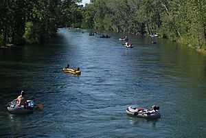
Boise offers many outdoor activities. You can hike and bike in the foothills north of downtown. The Boise River Greenbelt is a long trail along the river. The Boise River is popular for fishing, swimming, and rafting.
Zoo Boise in Julia Davis Park has over 200 animals from around the world. The Aquarium of Boise is a hands-on facility with many marine animals.
Bogus Basin is a ski area about 16 miles (26 km) from the city. It offers skiing, snowboarding, and snow tubing in winter.
Boise is home to the Anne Frank Human Rights Memorial. It is the only human rights memorial in the U.S.
The World Center for Birds of Prey is just outside Boise. It helps bring back birds like the peregrine falcon. They also breed rare California condors.
Magazines like Forbes and Fortune have praised Boise for its great quality of life. In recent years, Boise has been one of the fastest-growing cities in the U.S.
Boise Towne Square Mall is a major shopping spot. It serves Boise and nearby cities.
Sports in Boise
Boise has several professional sports teams. The Boise Hawks play baseball in the Pioneer League. The Idaho Steelheads play minor league hockey in the ECHL. Boise Pro Soccer plans to have professional men's and women's soccer teams soon.
Boise also has a women's roller derby league called the Treasure Valley Rollergirls.
Boise State University is known for its successful football team. Their home is Albertsons Stadium, famous for its blue playing field. ExtraMile Arena is a venue for basketball and other events.

The Famous Idaho Potato Bowl football game is held in Boise every December.
| Club | League | Sport | Venue | Established | Championships |
|---|---|---|---|---|---|
| Boise Hawks | Pioneer League | Baseball | Memorial Stadium | 1987 | 6 |
| Idaho Steelheads | ECHL | Ice hockey | Idaho Central Arena | 1997 | 2 |
Education in Boise
The Boise School District serves most of the city. It has 31 elementary schools, eight junior high schools, and five high schools. Part of the West Ada School District is also in Boise.
Boise's public high schools include Boise, Borah, Capital, Timberline, Frank Church, and Centennial.
Private schools include Bishop Kelly High School, Foothills School of Arts and Sciences, and Riverstone International School. One Stone is a unique student-led school.
For higher education, Boise has Boise State University (BSU). The University of Idaho (UI) and Idaho State University (ISU) also have campuses here. Boise has two law school programs. Boise Bible College trains church leaders and missionaries.
Boiseko Ikastola is the only Basque preschool outside of the Basque Country.
Media in Boise
The Boise area has two daily newspapers: The Idaho Statesman and the Idaho Press. There is also a free weekly newspaper, Boise Weekly.
Boise has many radio stations and five main TV stations. These include KBOI-TV (CBS), KAID (PBS), KIVI-TV (ABC), KTVB (NBC), and KNIN-TV (Fox).
Transportation in Boise
I-84 is the main highway serving Boise. It connects the city to Portland, Oregon, and Salt Lake City, Utah. Interstate 184 (The Connector) links I-84 to downtown Boise.
Boise has many bike paths, like the Boise River Greenbelt. Boise is known for having a high number of people who bike to work.
Public transportation is provided by ValleyRide bus lines. A new public transportation hub was completed in downtown Boise in 2016.
Commercial flights are available at the Boise Airport. The airport has been updated to handle more passengers. It is served by several airlines. The National Interagency Fire Center is located at the airport's east end.
The Amtrak Pioneer passenger train used to stop at the Boise Union Pacific Depot until 1997. A short line railroad, the Boise Valley Railroad, serves local industries.
Notable People from Boise
See also
 In Spanish: Boise para niños
 | Charles R. Drew |
 | Benjamin Banneker |
 | Jane C. Wright |
 | Roger Arliner Young |


