List of neighborhoods in San Francisco facts for kids
San Francisco, a famous city in California, has many different neighborhoods. Some are very well-known, while others are smaller and more specific. Experts often group these neighborhoods into five main areas: Central/Downtown, Richmond, Sunset, Upper Market, and Bernal Heights/Bayview. The city's planning department officially recognizes 36 neighborhoods. Within these, there are even more smaller areas, some with long histories.
Some neighborhoods in San Francisco are also special "cultural districts" because of their unique history and culture.
Alamo Square
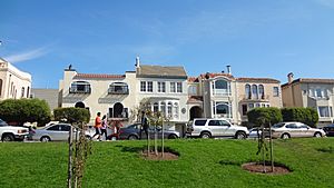
Alamo Square is a part of the Western Addition neighborhood. It's famous for its beautiful Victorian houses that were saved from big city changes. From the park, you can often see the Transamerica Pyramid building and parts of the Golden Gate Bridge and Bay Bridge. A row of colorful Victorian houses called the painted ladies are often seen in pictures of the city.
Anza Vista
Ashbury Heights
Ashbury Heights is a neighborhood on a hill south of the Haight-Ashbury area. It sits at the bottom of Tank Hill and is close to Cole Valley.
Balboa Hollow
Balboa Hollow is a neighborhood inside the Inner Richmond District. It's near the northeast corner of Golden Gate Park. This makes it a great entry point to popular park spots like the Music Concourse, where you'll find the de Young Museum and the California Academy of Sciences. You can also visit the Conservatory of Flowers and the San Francisco Botanical Garden from here.
Balboa Terrace
Balboa Terrace is a small neighborhood in southwestern San Francisco. It's a quiet, residential area next to the fancy St. Francis Wood development.
The Bayview
The Bayview neighborhood stretches along Third Street and is known for its friendly and diverse residents. It has warm weather, nice views, community gardens, and many local businesses. The Bayview has a rich history, especially as an African American and working-class neighborhood. In the 1950s, it was also home to many Italian, Maltese, and French Basque families.
This area was once called "Butcher Town" because of the slaughterhouses on Third Street. Today, the T-Third light rail line serves the area. You can also find the Bayview Opera House and parts of City College here. The neighborhood is growing quickly, with new buildings appearing. Residents often work together to improve their community.
Belden Place
Belden Place is a small neighborhood near the Financial District. It's historically known as San Francisco's French Quarter.
Bernal Heights
Bernal Heights is a neighborhood on a hill between the Mission district, Bayview, and Portola. It's known for its strong community feeling. The main shopping area is Cortland Avenue, with many different shops, cafes, and restaurants. Many of the streets are narrow and winding.
Buena Vista
The Buena Vista neighborhood surrounds Buena Vista Park. It's located south of the Haight-Ashbury neighborhood.
Butchertown (old and new)
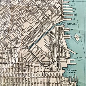
Butchertown (new) is an industrial area in San Francisco that used to have the city's slaughterhouses. It's one of the few industrial areas left in San Francisco. It still has two meat processing plants.
The original Butchertown was along Mission Creek in Mission Bay, an area that is now filled-in land.
The Castro
Cathedral Hill
Cathedral Hill is a small area in the Western Addition neighborhood. It surrounds Saint Mary's Cathedral on Geary Boulevard. The main offices for the Roman Catholic Archdiocese of San Francisco and Sacred Heart Cathedral Preparatory school are located here.
China Basin
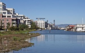
China Basin is a neighborhood built on landfill next to the San Francisco Bay. It's north of Mission Creek and the Mission Bay neighborhood. This area includes Oracle Park, home of the San Francisco Giants baseball team, many restaurants, and the Caltrain train station. The water area itself is also called China Basin. It used to be a busy industrial waterfront, but now it has many homes. The part of the water next to the ballpark is often called McCovey Cove, named after baseball player Willie McCovey.
Chinatown
Civic Center
Clarendon Heights
The Clarendon Heights neighborhood is in the central part of San Francisco. It's located north of Twin Peaks and east of Mount Sutro.
Cole Valley
Cole Valley is a small neighborhood nestled in a u-shaped valley. It's sometimes seen as a part of the Haight district. The main area of Cole Valley is at Cole and Carl streets, where you'll find local shops and cafes. Tank Hill is in the southeast corner, offering views towards the ocean and other parts of the city.
Corona Heights
The Corona Heights neighborhood is a small, wealthy area that surrounds the Corona Heights hill and park. The Randall Museum is located in Corona Heights Park. This community is very close to The Castro neighborhood.
Cow Hollow
Cow Hollow is a wealthy neighborhood located between Russian Hill and the Presidio. It also borders the Marina District and Pacific Heights. The area was once used for grazing cows, which is how it got its name. Union Street is the main shopping street, known for its restaurants, unique shops, and health centers.
Crocker-Amazon
Design District
The Design District is a low-lying area with a mix of industrial buildings, offices, and shops. It has many showrooms and fancy stores. The San Francisco campus of the California College of the Arts is also located here.
Diamond Heights
Dogpatch
The "Dogpatch" is a neighborhood in San Francisco, California, with both industrial and residential areas. It used to be a working-class neighborhood but has changed a lot since the 1990s. Now, it's similar to its neighbor Potrero Hill, with many upper middle-class professionals living there.
Dogpatch has its own neighborhood group but shares other community activities with Potrero Hill.
Dolores Heights
Dolores Heights is a hilly neighborhood named after the hill within it. It borders The Castro to the north and Noe Valley to the south. Some parts are so steep that the Muni Metro J Church train line has to go around them.
Many streets in Dolores Heights are dead ends, connected by steep staircases with great views. It's a wealthy and quiet neighborhood with different types of homes, including Victorian houses and apartment buildings. Because it's high up, Dolores Heights is often warmer and sunnier than other parts of San Francisco, as Twin Peaks blocks the strong winds and fog.
Duboce Triangle
The Embarcadero
Eureka Valley
The "Eureka Heights" area refers to the hill streets above Eureka Valley. Kite Hill park is within Eureka Heights and offers beautiful views of San Francisco. It's also considered the geographic center of the city.
The Excelsior
The Fillmore
The Financial District
The Financial District South
This newer neighborhood stretches from Market to Brannan streets. It will be centered around the new Transbay Transit Center. This area is next to Yerba Buena.
Fisherman's Wharf
Forest Hill
Forest Knolls
Forest Knolls is a neighborhood within the Inner Sunset. It's built on the southwestern side of Mount Sutro, near the main UCSF campus. Most homes here are detached, and many have views of the San Francisco Bay or the Pacific Ocean.
Glen Park
Golden Gate Heights
Golden Gate Heights is a hilly neighborhood south of the Inner Sunset. Grand View Park is on a hill in the northern part of the neighborhood. The 16th Avenue Tiled Steps are a popular local attraction near Grand View Park. Golden Gate Heights has many stairways, with over 2,500 steps in total.
The Haight
Hayes Valley
Hunters Point
India Basin
Ingleside
The Ingleside neighborhood is in the southwestern part of San Francisco, near City College. The Ingleside Library is on Ocean Avenue. The Bay Area Rapid Transit Balboa Park Station is also nearby. The neighborhood is served by several train and bus lines. Ocean Avenue is the main shopping street, with many stores and restaurants.
Ingleside Terraces
Ingleside Terraces is a wealthy neighborhood with about 750 homes. It was built where the Ingleside Racetrack used to be. The main local event is the Annual Sundial Park Picnic. There's a large sundial on Entrada Court, surrounded by the oval-shaped Urbano Drive, which was once a horse race track.
The Inner Sunset
The Inner Sunset is the northeastern part of the Sunset District. Its center is generally around 9th Avenue and Irving Street, where you'll find shops and businesses. The historic Catholic church, St. Anne of the Sunset, has been here for over 100 years.
Irish Hill
Islais Creek
Also called Islais Landing, this area is related to Butchertown.
Jackson Square
Jackson Square is a six-block neighborhood next to North Beach and Chinatown. It's just north of the Transamerica Pyramid.
Japantown
Jordan Park
Jordan Park is a small neighborhood in the northern part of San Francisco. It's often mistaken for being part of Laurel Heights or the Richmond District.
Laguna Honda
Laguna Honda (also known as Forest Hill Extension) is a small neighborhood between Forest Hill and Mount Davidson. The Laguna Honda Hospital and the Muni Metro Forest Hill Station are both located here. Ruth Asawa San Francisco School of the Arts high school is also in this neighborhood.
Lake Street
The Lake Street neighborhood is bordered by the Presidio of San Francisco to the north. It has large, traditional San Franciscan homes, including many grand Edwardian, Victorian, and Queen Anne styles. The neighborhood offers easy access to shopping streets in the Richmond District, the Golden Gate Bridge, and trails in the Presidio.
Its name comes from its closeness to Mountain Lake, one of the few natural lakes left in San Francisco. In 1776, Spanish explorer Juan Bautista de Anza stopped here and found a spot for the Spanish presidio that was built later.
Lakeside
Lakeside is a long, narrow neighborhood between 19th Avenue and Junipero Serra Boulevard. San Francisco State University and the Stonestown Galleria shopping mall are across 19th Avenue from the neighborhood.
Lakeshore
The Lakeshore district is bordered by Sloat Blvd, 26th Avenue, Gellert Drive, and Lake Merced. Lowell High School and Lakeshore Elementary are located in Lakeshore. Lakeshore Plaza is also here.
Laurel Heights
Laurel Heights is a neighborhood south of the Presidio and Presidio Heights. The Laurel Village shopping center is located here, as well as a California Pacific Medical Center and a UCSF campus.
Little Hollywood
Little Hollywood is a small neighborhood in the southeastern part of San Francisco. Little Hollywood Park is located on Lathrop Avenue, and the Bayshore Caltrain station is just south of the neighborhood.
Little Russia
Little Russia is an area in the Richmond District with many Russian-speaking immigrants. It's centered along Geary Boulevard, between the Russian Cathedral of the Holy Virgin and the Russian Renaissance restaurant. This area is the heart of San Francisco's 80,000 Russian-Americans. The neighborhood started in the 1920s, with more people arriving in later decades.
Little Saigon
Lone Mountain
The Lower Haight
Lower Pacific Heights
Lower Pacific Heights is located between Pine Street and Geary Boulevard. It borders Japantown to the east and Pacific Heights to the north.
Lower Nob Hill
Lower Nob Hill is the southern part of Nob Hill. This area was rebuilt after the 1906 earthquake with many multi-story apartment buildings. It's considered part of Nob Hill and is home to California's first high-rise condominium. A part of the neighborhood is listed on the National Register of Historic Places as the Lower Nob Hill Apartment Hotel District.
The Marina
Merced Heights
Merced Heights, also known as Lakeview, is a neighborhood in the southwestern part of the city. It's bordered by Brotherhood Way to the south and Junipero Serra Boulevard to the west. The Oceanview Library is located here, along with two public parks on Shields Street. The Shields Orizaba Rocky Outcrop is the highest point in Merced Heights.
Merced Manor
Merced Manor is a neighborhood in southwestern San Francisco, between Stern Grove and Lake Merced. Lowell High School is located on Eucalyptus Drive. The Stonestown Galleria shopping mall and San Francisco State University are also nearby.
Midtown Terrace
Midtown Terrace is a neighborhood in central San Francisco, on the western slope of Twin Peaks. It was built as a single housing development in the late 1950s. Sutro Tower is on the northern side of Midtown Terrace. The Midtown Terrace Recreation Center is also located here. The neighborhood offers views of the Pacific Ocean, San Francisco, and other hills.
Mid-Market
Miraloma Park
The Miraloma Park neighborhood is in the central part of San Francisco, between Glen Canyon Park and Mount Davidson. Miraloma Playground is located here.
Mission Bay
The Mission Bay neighborhood is built on landfill in San Francisco Bay. The new UCSF research campus at Mission Bay is part of the rapid growth of new office buildings and luxury homes. This area used to be an industrial zone with train yards. The Dogpatch neighborhood is to its south.
The Mission
Mission Dolores
Mission Dolores is the oldest neighborhood in San Francisco and is considered its birthplace. It's named after the Spanish Mission Dolores settlement from 1776. This area is a smaller part of the larger Mission District. The Mission Dolores was built near where the Yelamu people, part of the Ohlone group, lived in villages. These native people helped build the Mission as part of the Spanish colonization.
Mission Terrace
Mission Terrace is a neighborhood in the south-central part of San Francisco. It's bordered by Interstate 280 to the north and west. Balboa Park and the Balboa Park Station are in its southwest corner.
Monterey Heights
Monterey Heights is a small neighborhood on the western slope of Mount Davidson.
Mount Davidson
Mount Davidson is a large hill near the center of San Francisco. It's surrounded by the Miraloma Park neighborhood. Other nearby neighborhoods include Monterey Heights, Sherwood Forest, and Westwood Highlands.
Nob Hill
Noe Valley
North Beach
Oceanview
The Oceanview neighborhood is in southern San Francisco, south of the Ingleside neighborhood and the City College campus. Oceanview Playground and Minnie and Lovie Ward Recreation Center are in the middle of the neighborhood. The Ocean View Branch Library is also located here.
This neighborhood has a rich history, especially for its African American community. Many African Americans moved here in the 1960s. The OMI (Oceanview-Merced-Ingleside) area is now one of San Francisco's most diverse neighborhoods, with many Asian-American, African-American, Latino, and white residents.
After World War II, many African Americans moved to the Bay Area for jobs and settled in homes in Ingleside, Merced Heights, and Oceanview. By 1970, the OMI had become a middle-class area with many single-family homes owned by residents. In recent years, more Asian-American and other groups have moved in, making it even more diverse.
The Outer Mission
The Outer Mission neighborhood is bordered by Geneva Avenue, San Jose Avenue, and Mission Street. Cayuga Park is located in this neighborhood.
The Outer Sunset
Pacific Heights
Parkmerced
The Parkside
Parkside is south of the Sunset District. Abraham Lincoln High School is on 24th Avenue, and the Parkside Library is on Taraval Street. Stern Grove borders the neighborhood to the south.
Parnassus
Parnassus is located south of Cole Valley and Ashbury Heights, north of Clarendon Heights and Forest Knolls, east of Inner Sunset, and west of Corona Heights.
Polk Gulch
Polk Gulch is a section of Polk Street. It's sometimes described as the main shopping area of Polk Street. Local business owners have tried to call the neighborhood "Polk Village."
Portola
Portola is a neighborhood in the southeastern part of San Francisco, northeast of McLaren Park. It's roughly bordered by San Bruno Avenue and the James Lick Freeway (U.S. Route 101) to the east.
Phillip and Sala Burton Academic High School is on Mansell Street, and the Portola Library is at Bacon and Goettingen streets. The large University Mound Reservoir is also located here.
Portola was named after the old Portola School, which was named after the Spanish explorer Gaspar de Portolà. After the 1906 earthquake, Jewish and Italian immigrants first settled here. The area became known for nurserymen and their families who grew many of the city's flowers. San Bruno Avenue, known as "The Road," still has businesses like bakeries and grocery stores. The Asian population in Portola has been growing since the 1990s.
Portola Place
Portola Place is a new development in the Bayview district, built on the site of an old brewery.
Potrero Hill
The Presidio
Presidio Heights
Presidio Heights is a small, wealthy neighborhood between the Presidio and Laurel Heights. It's bordered by Pacific Avenue and the Presidio parklands to the north.
The neighborhood's name was used even before the 1906 San Francisco earthquake. Homes were mostly built in the early 1900s, many in the Edwardian style. There are shopping areas on Sacramento Street and California Street. The Jewish Community Center of San Francisco is on California Street.
The Richmond
Rincon Hill
Rincon Hill is one of San Francisco's hills. It used to be an industrial area but is now becoming a neighborhood with many tall buildings. It's located south of the Financial District and is close to the Bay Bridge. After the Gold Rush, this was San Francisco's first wealthy neighborhood, but it later became mostly industrial. Much of the natural landscape was removed in the 1930s to build the Bay Bridge. Now, it's becoming a popular residential area again with new luxury buildings, close access to the water, and more green spaces.
A newer effort is trying to give Rincon Hill and parts of South Beach a new neighborhood name: The East Cut.
Russian Hill
Saint Francis Wood
Sea Cliff
Sherwood Forest
Sherwood Forest is a small neighborhood on the southwestern slope of Mount Davidson.
Silver Terrace
Silver Terrace is a neighborhood in the southeastern part of San Francisco, between the Bayview and Portola neighborhoods. A tunnel used by Caltrain runs under Silver Terrace.
South Beach
The South Beach neighborhood includes wealthy blocks with a mix of homes and businesses. It borders The Embarcadero and King Street. The most famous spot in South Beach is Oracle Park, where the San Francisco Giants play baseball.
The main buildings for the local Academy of Art University are also found in South Beach.
South End
South End Historic District, San Francisco, California
South of Market
South Park
South Park is a small neighborhood South of Market, dating back to 1852. It's centered around a small, oval-shaped park of the same name.
Sunnydale
Sunnydale is a small neighborhood in Visitacion Valley. It's known for its housing projects on Sunnydale Avenue. It is the center of Visitacion Valley's African American community.
Sunnyside
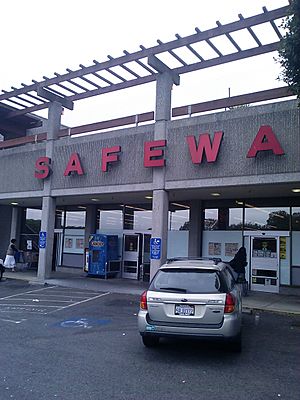
Sunnyside is a medium-sized neighborhood north of Highway 280. City College of San Francisco (CCSF) has its main campus on the border of Sunnyside. CCSF was built on a hillside where the city jail used to be. It has been updated since 2000 and offers good sports facilities and modern buildings. The main shopping street is Monterey Boulevard, with small businesses, restaurants, cafes, and a Safeway.
The neighborhood was first developed in 1891 with lots for single-family houses. An electric streetcar line was added to connect the new neighborhood to downtown San Francisco. This helped the area grow. Houses were built individually or in small groups. Most of the neighborhood was built by 1941.
The Sunnyside Neighborhood Association was started in 1975 to represent the community. The residents are very diverse. It's mostly a middle- to upper-middle-class neighborhood, with many residents owning their homes. Sunnyside Park was updated in 2009 and has a recreation center, a children's play area, and a dog park.
The Sunnyside Conservatory, built in 1902, is a botanical garden and restored greenhouse. It was fully restored in 2006 and is now used for community meetings and events.
The Sunset
The Outer Sunset district includes the area from 46th Avenue to Ocean Beach. Everything east of 19th Avenue is considered the Inner Sunset. 19th Avenue is a major road that connects the Golden Gate Bridge to areas south. Within the Inner Sunset, there's a smaller area called Sunset Heights.
There's a plan called the Ocean Beach Master Plan (OBMP) to develop a long-term vision for Ocean Beach.
Telegraph Hill
The Tenderloin
Treasure Island
Twin Peaks
Twin Peaks refers to the hilltops near the center of San Francisco, south of Mount Sutro. For the neighborhood right next to Twin Peaks, see Midtown Terrace.
Union Square
University Mound
University Mound is a neighborhood north of McLaren Park, part of the Portola district. It's mostly a residential area. Many of its streets are named after universities and famous educators. It contains a large reservoir and Phillip & Sala Burton High School. The neighborhood has a diverse population and varied landscape.
Upper Market
Upper Market is the area between the southern end of Market Street and Twin Peaks.
Visitacion Valley
Vista del Mar
Vista del Mar is a small neighborhood in the Outer Richmond. It's also called Sutro Heights.
West Portal
The Western Addition
Westwood Highlands
Westwood Highlands is a small neighborhood northeast of the intersection of Monterey Boulevard and Plymouth Avenue. The Westwood Park neighborhood is to the south, and Sunnyside is to the east.
Westwood Park
Yerba Buena
This new neighborhood is centered around the Yerba Buena Gardens. It stretches from 2nd to 5th streets and Market to Harrison streets. The Yerba Buena Community Benefit District helps improve this area. Its eastern border is next to the Financial District South.


