
Delaware Basin facts for kids

The Delaware Basin is a special area of land in West Texas and southern New Mexico. It's known for having huge oil fields and a very old, fossilized reef that you can see today. Parts of this basin are protected in Guadalupe Mountains National Park and Carlsbad Caverns National Park. The Delaware Basin is part of an even bigger area called the Permian Basin.
Contents
How the Delaware Basin Formed
Early Times: The Wolfcampian Epoch
About 299 to 290 million years ago, during a time called the Wolfcampian Epoch, the Delaware Basin was a huge, oval-shaped dip in the Earth. It covered over 10,000 square miles (26,000 km²) in what is now Texas and New Mexico. During this time, layers of limestone and dark shale built up, becoming 1600 to 2200 feet (490 to 670 m) thick.
A narrow passage, called the Hovey Channel, allowed new seawater to flow in from the Panthalassa Ocean to the west. The Delaware Basin was one of three basins in the area, along with the smaller Midland Basin and Marfa Basin. All these basins were south of the equator.
These basins formed when a huge southern continent called Gondwana crashed into a northern continent called Laurasia. This collision created the Ouachita Mountains and the supercontinent Pangea. The Ouachita Mountains blocked rain, making the area dry, even though a warm, shallow sea covered the land.
Mid-Permian Changes: Leonardian and Guadalupian Epochs
The Delaware Basin stopped sinking for a while during the Leonardian Epoch. Small banks and reefs started to grow in the shallow waters. The first rock layers formed were the Yeso rocks. These are made of different layers of limestone, gypsum, and sandstone.
Later, the basin started sinking again. By the Guadalupian Epoch, the small reefs had grown much larger. Rocks like the San Andres Formation formed closer to the shore. Further out, quartz sandstone and scattered reefs became the Brushy Canyon Formation.
Rapid Growth of Reefs
When the basin sank quickly in the middle Guadalupian, the reefs grew very fast, mostly upwards. This created the Goat Seep Reef. Different types of sediments formed around it:
- Sediments in a lagoon became the sandstones and dolomites of the Queen and Grayburg Formations.
- Sponge and algae skeletons piled up near the Goat Seep Reef, forming the Getaway Bank.
- Quartz sand deeper in the basin became the Cherry Canyon Formation.
The basin stopped sinking for good in the later part of the Guadalupian. The Capitan Reef, the biggest reef in the basin, grew quickly for 350 miles (560 km) around the basin.
- Fine sand and carbonates near the shore became the dolomites and sandstone of the Carlsbad Group.
- Sand and limey mud deeper in the basin turned into sandstone and limestone of the Bell Canyon Formation.
- The Capitan Formation is the Capitan Reef itself, made of reef limestone.
The Capitan Reef was mostly built by sponges and algae. This is different from most reefs today, which are mainly made of corals.
Filling the Basin: Ochoan Epoch
The sea level dropped as the Earth got colder and more water was trapped in ice caps. Sediment continued to fill the Delaware Basin during the Ochoan Epoch. Sometimes, the basin was completely cut off from the sea. The salty water left behind formed thick layers of evaporites, like the Castile Formation. This formation has thin layers of anhydrite, gypsum, calcite, and halite (rock salt). As the water got saltier, more salt formed, creating the Salado Formation.
By the end of the Ochoan Epoch, the Delaware Basin was mostly filled and covered by dry land. Rivers flowed over the surface, depositing red silt and sand. These became the siltstone and sandstone of the Rustler and Dewey Lake Formations.
How Caves Formed
Later, groundwater flowed through the buried limestone, dissolving it and creating caverns. These caves were later filled in or eroded away.
Mountains and Modern Caves
Millions of years later, during the late Mesozoic and early Cenozoic eras, the Laramide orogeny caused the Guadalupe Mountains to be pushed up. This created a major fault line. The Guadalupe Mountains are the raised part, and the Salt Flat Bolson is the sunken part.
The Capitan Reef limestone was lifted above the ground. El Capitan, a 1000-foot-high (300 m) rock, is the most famous part of this exposed reef. Other parts of the reef can be seen in the Apache Mountains and Glass Mountains.
Streams washed away the softer sediments, lowering the ground. Acidic groundwater carved out caves in the limestone. This acid was likely from hydrogen sulfide and other sulfur-rich brines that mixed with oxygenated groundwater, forming sulfuric acid. This is how Carlsbad Cavern and other nearby caves began to form deep underground. Because the climate is dry, the surface doesn't have many sink holes or pits like other karst areas.
More uplift of the Guadalupe Mountains later enlarged Carlsbad Cavern. Parts of the caves rose out of the water, and new sections were carved out during pauses in this uplift. These pauses created the different levels you see in Carlsbad Caverns today. Water rich in carbon dioxide dripped into the caverns, forming speleothems (cave formations like stalactites and stalagmites). Some speleothems in the "Big Room" of Carlsbad are 500,000 to 600,000 years old, meaning that part of the cave was dry by then.
The soft gypsum of the Castile Formation was eroded away, revealing the Guadalupe Escarpment. More erosion opened up the entrances to Carlsbad Cavern and other caves. As the cave air became drier, the speleothems grew slower, and new formations like "cave popcorn" appeared.
Images for kids
-
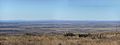
This picture looks south and shows how flat the Delaware Basin is. It was taken from the Walnut Canyon drive in Carlsbad Caverns National Park.
