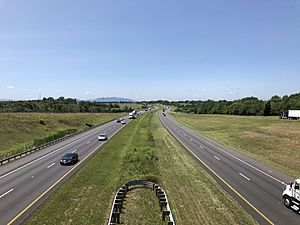
Frederick County, Virginia facts for kids
Quick facts for kids
Frederick County
|
|||
|---|---|---|---|
|
County
|
|||
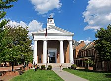
The Old Frederick County Courthouse in Winchester
|
|||
|
|||
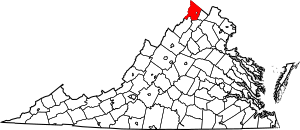
Location within the U.S. state of Virginia
|
|||
 Virginia's location within the U.S. |
|||
| Country | |||
| State | |||
| Founded | 1743 | ||
| Named for | Frederick, Prince of Wales | ||
| Seat | Winchester | ||
| Largest town | Stephens City | ||
| Area | |||
| • Total | 416 sq mi (1,080 km2) | ||
| • Land | 414 sq mi (1,070 km2) | ||
| • Water | 2 sq mi (5 km2) 0.5% | ||
| Population
(2020)
|
|||
| • Total | 91,419 | ||
| • Density | 219.76/sq mi (84.85/km2) | ||
| Time zone | UTC−5 (Eastern) | ||
| • Summer (DST) | UTC−4 (EDT) | ||
| Congressional district | 6th | ||
Frederick County is a county in Virginia, a state in the United States. It is the northernmost county in Virginia. In 2020, about 91,419 people lived there. The main town and county seat is Winchester. Frederick County was created in 1743 from part of Orange County. It is part of the larger Winchester Metropolitan Area. This area also connects to the even bigger Washington-Baltimore-Northern Virginia region.
Contents
History of Frederick County
The land that is now Frederick County was home to many indigenous peoples for thousands of years. They lived and traveled through this area long before Europeans arrived.
Early European Settlement
European settlement in Virginia began with the Virginia Company of London. But more people moved here after Virginia became a royal colony in 1624. To encourage people to move, the "headright system" was used. This system gave land to people who paid for others to travel to the colony.
In 1649, King Charles II gave large amounts of land in Virginia to his supporters. One of these supporters was Lord Fairfax. His family later owned over 5 million acres of land in Virginia. This included much of what became Frederick County.
Frederick County was officially formed in 1743. It was named after Frederick, Prince of Wales, the son of King George II of Great Britain. Back then, "Old Frederick County" was much larger. It included parts of nine other counties that exist today. These are:
- Hampshire (West Virginia), created 1754
- Shenandoah, created 1772
- Berkeley (West Virginia), created 1772
- Hardy (West Virginia), created 1786
- Jefferson (West Virginia), created 1801
- Morgan (West Virginia), created 1820
- Page, created 1831
- Clarke, created 1836
- Warren, created 1836
Frederick County in the Colonial Era
Colonel George Washington was a young military leader in 1754. He set up his headquarters in Winchester during the French and Indian War. He later left the military in 1758.
Washington was elected to represent Frederick County in the House of Burgesses. This was his first elected job. He served there in 1758 and 1761. Later, in 1775, he became the commander-in-chief of the Continental Army. This happened before the American Revolutionary War officially began.
Frederick County During the Civil War
During the American Civil War (1861–1865), Winchester was a very important place. Control of the city often changed between the Confederate and Union armies. Many battles were fought in Frederick County, including:
- First Battle of Kernstown, March 1862
- First Battle of Winchester, May 1862
- Second Battle of Winchester, June 1863
- Second Battle of Kernstown, July 1864
- Third Battle of Winchester, September 1864
- Battle of Cedar Creek, October 1864
Frederick County remained part of Virginia after the war. Some nearby counties became part of the new state of West Virginia. But Frederick County was controlled by the Confederate army, so its residents could not vote on the matter.
Civilian History of the Area
Frederick County is home to natural mineral springs. These springs were once called Capper Springs. In 1856, William Marker bought the land and built a hotel. This was the start of the Rock Enon Springs Resort. People believed that soaking in the spring water had health benefits. This made the springs popular tourist spots in the early 1900s.
By 1944, fewer people visited the springs. There were also more places for tourists to go. The Glaize family sold the property to the Shenandoah Area Council. They turned the resort into a Boy Scout camp called Camp Rock Enon. A lake called Miller Lake was created in 1944. It was made by building a dam across Laurel Run.
Geography of Frederick County
Frederick County covers about 416 square miles (1,077 square kilometers). Most of this area is land, with only a small part being water. It is the northernmost county in Virginia.
Neighboring Counties
Frederick County shares borders with several other counties and one independent city:
|
|
Protected Natural Areas
Parts of two national protected areas are located in Frederick County:
- Cedar Creek and Belle Grove National Historical Park
- George Washington National Forest
Population and People
| Historical population | |||
|---|---|---|---|
| Census | Pop. | %± | |
| 1790 | 19,681 | — | |
| 1800 | 24,744 | 25.7% | |
| 1810 | 22,574 | −8.8% | |
| 1820 | 24,706 | 9.4% | |
| 1830 | 26,046 | 5.4% | |
| 1840 | 14,242 | −45.3% | |
| 1850 | 15,975 | 12.2% | |
| 1860 | 16,546 | 3.6% | |
| 1870 | 16,596 | 0.3% | |
| 1880 | 17,553 | 5.8% | |
| 1890 | 17,880 | 1.9% | |
| 1900 | 13,239 | −26.0% | |
| 1910 | 12,787 | −3.4% | |
| 1920 | 12,461 | −2.5% | |
| 1930 | 13,167 | 5.7% | |
| 1940 | 14,008 | 6.4% | |
| 1950 | 17,537 | 25.2% | |
| 1960 | 21,941 | 25.1% | |
| 1970 | 28,893 | 31.7% | |
| 1980 | 34,150 | 18.2% | |
| 1990 | 45,723 | 33.9% | |
| 2000 | 59,209 | 29.5% | |
| 2010 | 78,305 | 32.3% | |
| 2020 | 91,419 | 16.7% | |
| U.S. Decennial Census 1790–1960 1900–1990 1990–2000 2010 2020 The drop from 1830 to 1840 was because Clarke and Warren counties were split off. |
|||
The population of Frederick County has grown a lot over the years. In 1790, there were about 19,681 people. By 2020, the population had reached 91,419. The table above shows how the population has changed over time. The drop in population between 1830 and 1840 happened because two new counties, Clarke and Warren, were formed from parts of Frederick County.
Population in 2020
The 2020 census collected information about the people living in Frederick County. This table shows the different racial and ethnic groups:
| Race / Ethnicity (NH = Non-Hispanic) | Pop 2010 | Pop 2020 | % 2010 | % 2020 |
|---|---|---|---|---|
| White alone (NH) | 67,590 | 71,739 | 86.32% | 78.47% |
| Black or African American alone (NH) | 3,067 | 3,605 | 3.92% | 3.94% |
| Native American or Alaska Native alone (NH) | 182 | 120 | 0.23% | 0.13% |
| Asian alone (NH) | 959 | 1,661 | 1.22% | 1.82% |
| Pacific Islander alone (NH) | 30 | 39 | 0.04% | 0.04% |
| Some Other Race alone (NH) | 103 | 402 | 0.13% | 0.44% |
| Mixed Race or Multi-Racial (NH) | 1,206 | 3,863 | 1.54% | 4.23% |
| Hispanic or Latino (any race) | 5,168 | 9,990 | 6.60% | 10.93% |
| Total | 78,305 | 91,419 | 100.00% | 100.00% |
Transportation
Winchester Transit provides bus service for the city of Winchester on weekdays.
Major Roads
Many important highways and roads pass through Frederick County. These roads help people travel to and from the county.
 I-66
I-66 I-81
I-81 US 11
US 11 US 17
US 17 US 48
US 48 US 50
US 50 US 340
 US 522
 SR 7
SR 7 SR 37
SR 37 SR 55
SR 55 SR 127
 SR 259
 SR 277
Education
Frederick County has its own school system called Frederick County Public Schools. This system includes many elementary, middle, and high schools. The county also participates in the Mountain Vista Governor's School. This school offers advanced classes for gifted high school students.
Schools
Elementary Schools
|
Middle Schools
- Admiral Richard E. Byrd Middle School
- Frederick County Middle School
- Robert E. Aylor Middle School
High Schools
- James Wood High School
- Millbrook High School
- Sherando High School
Colleges and Universities
- Laurel Ridge Community College
- Shenandoah University
Libraries
- Handley Regional Library
Communities
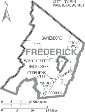
Winchester is the county seat. However, in Virginia, cities like Winchester are "independent cities." This means they are politically separate from any county.
Towns
Census-Designated Places
These are areas that are like towns but are not officially incorporated as towns.
Other Unincorporated Communities
These are smaller communities that are not part of an official town or city.
- Albin
- Armel
- Bartonsville
- Brucetown
- Burnt Factory
- Canterburg
- Cedar Grove
- Cedar Hill
- Clear Brook
- Cross Junction
- De Haven
- Gainesboro
- Good
- Gore
- Gravel Springs
- Greenwood
- Green Spring
- Grimes
- Hayfield
- Indian Hollow
- Jordan Springs
- Kernstown
- Lake Frederick
- Leetown
- Lehew
- Marlboro
- McQuire
- Meadow Mills
- Mill Race Estates
- Mount Pleasant
- Mount Williams
- Mountain Falls
- Mountain Falls Park
- Nain
- Opequon
- Parkins Mills
- Rest
- Reynolds Store
- Ridings Mill
- Rock Enon Springs
- Round Hill
- Shockeysville
- Siler
- Star Tannery
- Stephenson
- Vaucluse
- Welltown
- Whitacre
- White Hall
- Wilde Acres
Notable People
- William McGuire (judge) (1765-1820), a lawyer who became the first chief justice of the Mississippi Territory.
See also
 In Spanish: Condado de Frederick (Virginia) para niños


