List of local nature reserves in Hampshire facts for kids
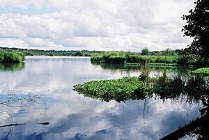
Local Nature Reserves (LNRs) are special places in England where nature is protected. Local councils choose these spots because they have interesting plants, animals, or cool rocks and land features. They make sure these areas are looked after, either by owning them, renting them, or working with the owners. They can even make special rules to keep these places safe for wildlife.
As of April 2020, there are 65 Local Nature Reserves in Hampshire. Many of these are also recognized as other important nature sites:
- 28 are Sites of Special Scientific Interest (SSSI) – these are the best places for wildlife and geology in the UK.
- 15 are Ramsar sites – these are super important wetlands recognized around the world.
- 15 are Special Areas of Conservation (SAC) – these protect rare habitats and species in Europe.
- 16 are Special Protection Areas (SPA) – these protect rare or vulnerable birds and their habitats in Europe.
- One is a National Nature Reserve (NNR) – these are the most important nature sites in the UK.
- One is a Nature Conservation Review site (NCR) – these are top sites for wildlife in Britain.
Two of these sites are looked after by the Hampshire and Isle of Wight Wildlife Trust (HIWWT), a charity that helps protect local wildlife.
Contents
- Special Nature Site Meanings
- Amazing Nature Reserves in Hampshire
- Anton Lakes
- Bishops Waltham Branch
- Boldre Foreshore
- Brook Meadow (Emsworth)
- Broxhead Common, Bordon
- Buriton Chalk Pit
- Calshot Marshes
- Catherington Down
- Chessel Bay
- Claylands
- Crab Wood
- Danebury Hillfort
- Daneshill Park Woods
- Deadwater Valley
- Dundridge Meadows
- Elvetham Heath
- Farlington Marshes
- Fleet Pond
- Gutner Point
- Hackett's Marsh
- Hayling Billy
- Hazleton Common, Horndean
- Herbert Plantation
- Hocombe Mead
- Holly Hill Woodland Park
- Hook with Warsash
- The Kench, Hayling Island
- Liss Riverside Railway Walk North
- Liss Riverside Railway Walk South
- Lymington-Keyhaven Marshes
- Manor Farm
- Mercury Marshes
- Milford on Sea LNR
- The Mill Field, Hampshire
- Miller's Pond
- The Moors, Bishop's Waltham
- Netley Common
- Oxenbourne Down, Clanfield
- Pamber Forest
- Popley Ponds
- Rotherlands
- Shawford Down
- Shortheath Common
- Sturt Pond
- Tadburn Meadows
- Titchfield Haven
- Up Nately LNR
- Valley Park Woodlands
- Wealden Edge Hangers
- West Hayling
- West of the River Alver
- Westwood Woodland Park
- The Wild Grounds
- Yoell's Copse
- Images for kids
- See also
Special Nature Site Meanings
- HIWWT = Hampshire and Isle of Wight Wildlife Trust: A group that helps protect wildlife.
- NCR = Nature Conservation Review site: A very important place for nature in Britain.
- NNR = National Nature Reserve: One of the most important nature spots in the UK.
- Ramsar = Ramsar site: A wetland that's important for wildlife all over the world.
- SAC = Special Area of Conservation: A place that protects rare habitats and animals in Europe.
- SM = Scheduled monument: An old site or building that's protected for its history.
- SPA = Special Protection Area: A special place for rare or at-risk birds in Europe.
- SSSI = Site of Special Scientific Interest: A top site for wildlife or geology in the UK.
Amazing Nature Reserves in Hampshire
Anton Lakes
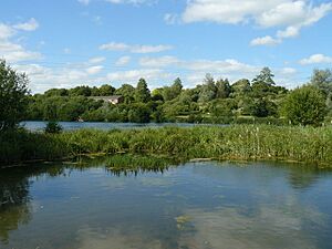
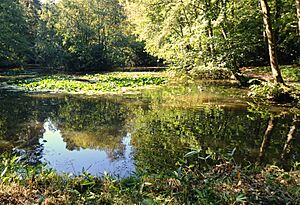
Anton Lakes is near Andover. The River Anton starts here and flows through old watercress farms into the lakes. These lakes were made when gravel was dug out. You can also find chalk grassland here, which is home to beautiful butterflies like the marbled white and gatekeeper. There's also a wet meadow where you might spot otters and water voles!
Bishops Waltham Branch
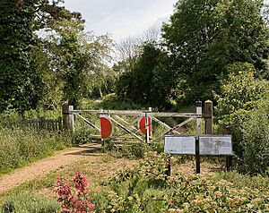
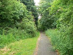
This Local Nature Reserve near Bishop's Waltham is a footpath that follows an old railway line. It's about 1 kilometer (0.6 miles) long. The path is lined with trees like oaks and field maples. You can also see pretty flowering plants such as wood avens and herb robert.
Boldre Foreshore
Boldre Foreshore is a very large nature site near Boldre. It has many different types of natural areas, including salty marshes, shingle beaches, grasslands, and muddy areas. It's a great place for gulls, terns, and wading birds to nest. In winter, many more wading birds and wildfowl come here. This site is so important that it's also a Ramsar site, Special Area of Conservation, Special Protection Area, and a Site of Special Scientific Interest. It's also managed by the Hampshire and Isle of Wight Wildlife Trust.
Brook Meadow (Emsworth)
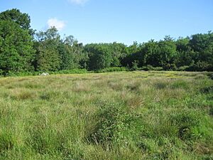
Most of Brook Meadow, located in Emsworth, is covered in grassland. It's surrounded by woods and has two streams flowing nearby. This area is home to lots of different wildlife, including water voles.
Broxhead Common, Bordon
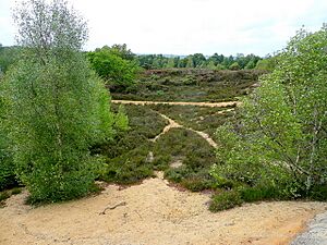
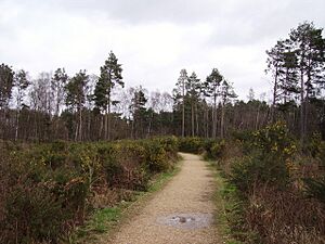
Broxhead Common, near Bordon, has dry heathland and woodlands with birch and oak trees. Rare and protected birds like woodlarks and nightjars breed here. You might also find the nationally rare sand lizard living on the common. This site is a Special Protection Area and a Site of Special Scientific Interest.
Buriton Chalk Pit
This site in Buriton used to be a chalk quarry, where chalk was dug out until the end of World War II. Even though it has big piles of leftover material, it has slowly become a rich home for plants that love chalky soil. Many paths here follow the routes of old narrow railway lines that were used to move chalk.
Calshot Marshes
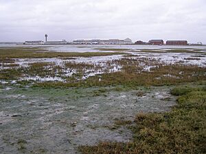
Calshot Marshes, near Southampton, is a saltmarsh that's super important for birds from all over the world. It's especially known for dark-bellied brent geese. Many other birds like wigeon, teal, ringed plover, grey plover, black-tailed godwit, redshank, and dunlin also visit in large numbers. This site is a Ramsar site, Special Area of Conservation, Special Protection Area, and a Site of Special Scientific Interest.
Catherington Down
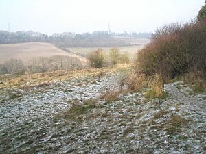
Catherington Down, near Horndean, is a chalk grassland with old lynchet strips. These strips show where people farmed the land way back in the Middle Ages. The site is kept healthy by grazing animals and has many chalk-loving plants like pyramidal orchid, round-headed rampion, and autumn lady's-tresses. There's also a small area of woodland. This site is a Site of Special Scientific Interest.
Chessel Bay
Chessel Bay, in Southampton, is the last part of the lower River Itchen shoreline that hasn't been built on. Most of it is mudflats, which are perfect feeding spots for birds when the tide is out. It also has areas of saltmarsh, woodland, and shingle. This site is a Ramsar site, Special Protection Area, and a Site of Special Scientific Interest.
Claylands
Claylands, near Bishop's Waltham, used to be a place where clay was dug. Now, it's a mix of woodland, ponds, meadows, and scrub. The ponds are home to great crested newts, which are protected amphibians. You can also see butterflies like marbled white, common blue, and green hairstreak here.
Crab Wood
Crab Wood, near Winchester, has been a wooded area since at least the 1500s! It has a layer of hazel trees that have been coppiced (cut back to encourage new growth), along with large oaks, and some beech, ash, and birch trees. It's a fantastic place for butterflies, including the beautiful purple emperor. This site is a Site of Special Scientific Interest.
Danebury Hillfort
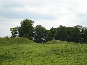
Danebury Hillfort, near Nether Wallop, is an ancient Iron Age hillfort. It was used by people from the 7th to the 1st centuries BC and has been studied a lot by archaeologists. Large beech trees grow around its edges. This site is also a Site of Special Scientific Interest.
Daneshill Park Woods
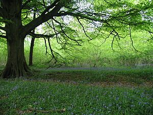
These woods near Basingstoke feature hazel coppice, an old orchard, scrub, and a sunken lane. In spring, the ground is covered with lovely flowers like wood anemone, celandine, and bluebells.
Deadwater Valley
Deadwater Valley, near Bordon, follows the west bank of the River Deadwater. It has a pond, a meadow, wet and dry heathland, alder trees, and both broadleaf and conifer woodlands. You can even find old Civil War earthworks (old defensive mounds) in the southern part of the reserve. This site is a Scheduled monument.
Dundridge Meadows
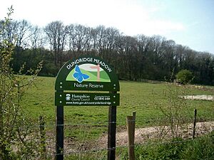
These meadows near Bishop's Waltham are chalk grasslands that are managed for hay. They also have two ponds, very old woodlands, and hedges full of different plant species. You can see pretty flowering plants like cowslips and hayrattle here.
Elvetham Heath
Elvetham Heath, near Fleet, is a heathland where typical heath plants like heather and gorse are growing back naturally. It also has other habitats like reedbeds and wet woodland, where you can find the rare plant called bog myrtle.
Farlington Marshes
Farlington Marshes, near Portsmouth, is a large area of grazing marsh full of flowers. It's incredibly important for its bird population, recognized internationally! In winter, you can see many wildfowl like dark-bellied brent geese, wigeons, avocets, redshanks, and dunlins. In spring and summer, birds like Cetti's, reed, and sedge warblers, skylarks, and lapwings visit. This site is managed by the Hampshire and Isle of Wight Wildlife Trust and is also a Nature Conservation Review site, Ramsar site, Special Area of Conservation, Special Protection Area, and a Site of Special Scientific Interest.
Fleet Pond
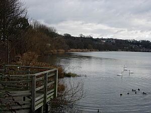
Fleet Pond, near Fleet, is a big, shallow lake surrounded by reed beds, alder carr (a type of wet woodland), and oak and birch woodlands. The lake is full of different water plants and animals. It's also home to many reed warblers and other wetland birds. This site is a Site of Special Scientific Interest.
Gutner Point
Gutner Point, on Hayling Island, is located in Chichester Harbour. It has muddy areas that are covered and uncovered by the tide, grassland, and saltmarsh. You can find plants like sea-lavender here. Many birds come to feed on the small creatures in the mud when the tide is low and rest on the shore when the tide is high. This site is a Ramsar site, Special Area of Conservation, Special Protection Area, and a Site of Special Scientific Interest.
Hackett's Marsh
Hackett's Marsh, near Fareham, has saltmarshes and grasslands full of different plant species. It's home to many kinds of insects, including some that are rare in the UK. These insects are an important food source for wading birds like golden plovers, black-tailed godwits, and curlews. This site is a Ramsar site, Special Area of Conservation, Special Protection Area, and a Site of Special Scientific Interest.
Hayling Billy
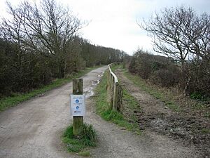
The Hayling Billy is a footpath on Hayling Island. It follows the old Hayling Island railway line along the eastern shore of Langstone Harbour, connecting Havant and South Hayling. This site is a Ramsar site, Special Area of Conservation, Special Protection Area, and a Site of Special Scientific Interest.
Hazleton Common, Horndean
Hazleton Common, near Horndean, is mostly lowland heath, with ponds and areas of woodland. You might see common lizards, adders (a type of snake), grass snakes, slow worms, and dragonflies like the broad-bodied chaser. Birds like green woodpeckers and partridges also live here.
Herbert Plantation
This reserve near Newtown is named after its old owner, Herbert Fox, who died in World War II. It has oak, birch, alder, and pine trees. On the ground, you can find plants typical of very old woodlands, like common solomon's-seal and wood sorrel. It's also home to 22 types of butterflies, including the silver-washed fritillary and white admiral.
Hocombe Mead
Hocombe Mead, near Chandler's Ford, has two meadows full of different plant species. The northern meadow is grazed by cattle and has a large group of ringlet butterflies. The southern meadow is kept healthy by cutting. There are also woods, with some parts being over 400 years old! You can find small areas of bog and heathland too.
Holly Hill Woodland Park
Holly Hill Woodland Park, near Fareham, has lovely landscaped areas with lakes, waterfalls, islands, and woods with both unusual and native trees like oaks. There's also a less formal area of very old, natural woodland.
Hook with Warsash
This large nature reserve near Fareham is on the banks of the River Hamble and Southampton Water. It has many different habitats, including muddy areas that are covered by the tide, saltmarsh, grazing marsh, reedbeds, scrapes (shallow pools), shingle, and woodland. You can find plants like sea kale, yellow horned poppy, slender hare's ear, marsh marigold, English stonecrop, and wild carrot. This site is a Ramsar site, Special Area of Conservation, Special Protection Area, and a Site of Special Scientific Interest.
The Kench, Hayling Island
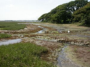
The Kench, on Hayling Island, is on the south shore of Langstone Harbour. It's an area of saltmarsh and muddy areas that are covered and uncovered by the tide. Birds use the mud to feed when the tide is low and rest on a shingle ridge when the tide is high. This site is a Ramsar site, Special Area of Conservation, Special Protection Area, and a Site of Special Scientific Interest.
Liss Riverside Railway Walk North
This footpath near Liss follows part of the old Longmoor Military Railway route from Liss to Liss Forest. The path goes through woodlands with willow and alder trees.
Liss Riverside Railway Walk South
This footpath through woodland is the southern part of the Liss Riverside Railway Walk North. It also follows the route of the old Longmoor Military Railway.
Lymington-Keyhaven Marshes
These coastal marshes near Lymington have saltmarshes and muddy areas that are covered and uncovered by the tide. You can see birds of prey like peregrine falcons, marsh harriers, and merlins. Black-headed gulls and sandwich terns feed on fish in the marshes. Plants like yellow-horned poppies, sea campions, and sea aster grow in the salty mud. This site is managed by the Hampshire and Isle of Wight Wildlife Trust and is also a Ramsar site, Special Area of Conservation, Special Protection Area, and a Site of Special Scientific Interest.
Manor Farm
Manor Farm, near Botley, is a large country park on the north bank of the River Hamble. It has woodlands where you might spot roe deer, and meadows with beautiful wild flowers and skylarks. This site is a Ramsar site, Special Area of Conservation, Special Protection Area, and a Site of Special Scientific Interest.
Mercury Marshes
Mercury Marshes, near Hamble-le-Rice, is on the west bank of the River Hamble. It has muddy areas that are covered and uncovered by the tide, reedbeds, islands, saltmarsh, creeks, and woodland. The saltmarsh and islands are covered with plants like sea purslane, cordgrass, sea aster, and glasswort. This reserve is important for insects and wading birds. This site is a Ramsar site, Special Area of Conservation, Special Protection Area, and a Site of Special Scientific Interest.
Milford on Sea LNR
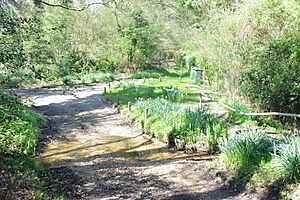
The Danes Stream flows through this nature reserve near Milford on Sea. It features very old woodland, grassland, and winding paths for exploring.
The Mill Field, Hampshire
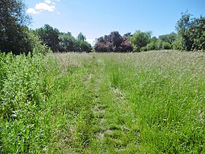
The Mill Field, near Basingstoke, has a large area of grassland along with scrub and hedgerows. It's home to water voles and dormice. You can also find many interesting insects, including different types of moths and marbled white butterflies.
Miller's Pond
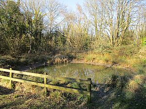
Miller's Pond, in Southampton, is managed for both fishing and wildlife. It also has areas of acid grassland and natural woodland.
The Moors, Bishop's Waltham
These wet meadows near Bishop's Waltham are in their natural state and have alder carr (a type of wet woodland). They drain into Mill Pond, which is in the middle of the site. The meadows have many different kinds of plants, with greater pond sedge in the wetter areas and plants like purple moor-grass and meadow foxtail in drier parts. This site is a Site of Special Scientific Interest.
Netley Common
Netley Common, near Southampton, is a lowland heath site with areas of grassland, woods, scrub, and gorse. You might see reptiles like common lizards and adders. An old Roman road crosses the site, and there's also a Bronze Age burial mound.
Oxenbourne Down, Clanfield
This site near Buriton is part of Queen Elizabeth Country Park. It has natural grassland on poor soils, which is kept healthy by grazing animals. There are also areas of very old, natural woodland. This site is a Special Area of Conservation and a Site of Special Scientific Interest.
Pamber Forest
Pamber Forest, near Tadley, has hazel trees that have been coppiced, with large oak trees standing tall. In the southern part, you can find plants linked to ancient woodlands, such as orpine, wood horsetail, lily of the valley, wild daffodil, and the rare mountain fern. This woodland is home to over forty species that are rare or uncommon in the UK. This site is managed by the Hampshire and Isle of Wight Wildlife Trust and is a Site of Special Scientific Interest.
Popley Ponds
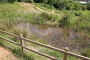
Popley Ponds, near Basingstoke, used to be a quarry. Now, it's a pond with many different amphibians, including great crested newts. There's also an area of woodland.
Rotherlands
The River Rother and its smaller stream, Tilmore Brook, flow through this reserve near Petersfield. It also has natural grassland, wetlands, woodland, and scrub. You might find badgers, otters, and crayfish here.
Shawford Down
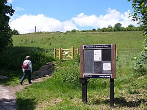
Shawford Down, near Winchester, has strip lynchets, which are old farming terraces from the Middle Ages when the land was shared by the community. The site has various chalk grassland habitats with plants like wild parsnip, red bartsia, cowslip, and common rock-rose. There are also areas of woodland and scrub.
Shortheath Common
Shortheath Common, near Whitehill, has areas of bracken, woodland, heath, and a pond. But its most interesting feature for nature is a large valley mire (a type of wetland). Much of it is covered by Sphagnum mosses, and there are many other plants like velvet bent and the insect-eating round-leaved sundew. The insects here are also very special, with 23 different types of dragonflies breeding on the site. This site is a Special Area of Conservation and a Site of Special Scientific Interest.
Sturt Pond
Sturt Pond, near Milford on Sea, is a tidal pond. The reserve also includes Dane Stream, reedbeds, lagoons, and saltmarsh. These different habitats attract many birds. There's also a grassland area where New Forest ponies graze. This site is a Ramsar site, Special Area of Conservation, Special Protection Area, and a Site of Special Scientific Interest.
Tadburn Meadows
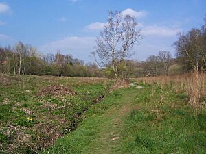
The Tadburn Stream flows through this valley site near Romsey. It has wet willow and alder woodlands in the lower parts and drier habitats higher up. You might see green woodpeckers, kingfishers, and water voles. There's also grassland south of the stream.
Titchfield Haven
Titchfield Haven, near Fareham, used to be a tidal estuary. Now, special valves block the salt water, making it a freshwater river and marshes, wet meadows with ditches, and fen (a type of wetland). It's a very important place for wetland birds that breed here, like bearded reedlings, sedge warblers, and reed warblers. This site is a National Nature Reserve, Ramsar site, Special Protection Area, and a Site of Special Scientific Interest.
Up Nately LNR
This site near Up Nately is a section of the Basingstoke Canal between Up Nately and the Greywell Tunnel. The canal has water, and the towpath (a path alongside the canal) is a public footpath. This site is a Site of Special Scientific Interest.
Valley Park Woodlands
Valley Park Woodlands, near Chandler's Ford, has very old woods, coppice (where trees are cut back for new growth), open areas, woodland paths, rough grassland, and ponds.
Wealden Edge Hangers
Natural England (a government body) says this site near Hawkley is "arguably,... one of the ecologically most interesting and diverse series of chalk woodlands in Britain." It has a rich variety of ground plants, including many rare species. Over 289 types of vascular plants (plants with roots, stems, and leaves) have been found here. It also has more than 111 types of bryophytes (mosses and liverworts) and the second richest collection of lichens in the country, with 74 species! This site is a Special Area of Conservation and a Site of Special Scientific Interest.
West Hayling
West Hayling, near Bedhampton, has large areas of muddy flats that are covered and uncovered by the tide, and lagoons. These areas are home to huge numbers of marine invertebrates (small sea creatures without backbones), which provide food for tens of thousands of birds that spend the winter or breed here. This site is a Ramsar site, Special Area of Conservation, Special Protection Area, and a Site of Special Scientific Interest. It is also managed by the RSPB (Royal Society for the Protection of Birds).
West of the River Alver
This site near Gosport is on the west bank of the River Alver. It has one of the largest reedbeds in England, which is kept healthy by being cut every year. There are also three ponds and areas of grassland, some of which are kept short by rabbits grazing. Seventeen different types of butterflies have been seen here.
Westwood Woodland Park
In the Middle Ages, this park near Southampton was part of the land belonging to Netley Abbey. It has ancient woodland with hazel coppice and oak trees, streams, ponds, marshes, and grassland. You can find several rare beetles here, and birds like barn owls, skylarks, linnets, and meadow pipits.
The Wild Grounds
This site near Gosport was probably shared land until around the year 1600. After that, it grew into a woodland mostly made up of oak trees. While it doesn't have a huge variety of plants, it's very interesting for its natural history and how it's structured. It has old trees of different ages that are allowed to live out their natural lives. This site is a Site of Special Scientific Interest.
Yoell's Copse
Yoell's Copse, near Horndean, is an ancient wood with coppiced mature oak trees and wild service trees. You can find uncommon plants here like butcher's-broom and common cow-wheat.
Images for kids
See also
- List of Sites of Special Scientific Interest in Hampshire
- Hampshire and Isle of Wight Wildlife Trust


