Navarre, Florida facts for kids
Quick facts for kids
Navarre, Florida
|
|
|---|---|
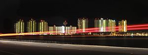
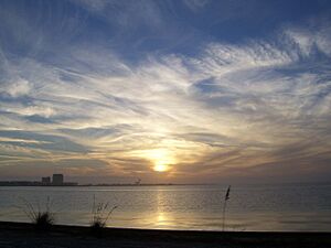
Navarre Beach Skyline
|
|
| Nickname(s):
Florida's Most Relaxing Place
Florida's Best Kept Secret Florida's Playground The South's Quiet Crossroad |
|
|
|
| Country | United States |
| State | Florida |
| County | Santa Rosa |
| First explored | 1693 |
| Settled | 1856 |
| Founded | 1925 |
| Founded by | Guy Wyman |
| Named for | Province in Spain, Navarre |
| Government | |
| • Body | Santa Rosa County |
| Area | |
| • Census-designated place | 29.33 sq mi (75.96 km2) |
| • Land | 23.07 sq mi (59.75 km2) |
| • Water | 6.27 sq mi (16.24 km2) |
| Elevation | 10 ft (3 m) |
| Lowest elevation | 0 ft (0 m) |
| Population
(2020)
|
|
| • Census-designated place | 41,940 (Navarre CDP and Navarre Beach CDP) |
| • Density | 950.89/sq mi (367.14/km2) |
| • Urban
(Navarre–Miramar Beach–Destin, FL)
|
226,213 (US: 173rd) |
| • Urban density | 1,891.1/sq mi (730.2/km2) |
| • Metro | 509,905 (US: 110th) |
| Demonym(s) | Navarreian, Navarrite |
| Time zone | UTC−6 (CST) |
| • Summer (DST) | UTC−5 (CDT) |
| ZIP Code |
32566
|
| Area code(s) | 850/448 |
| FIPS code | 12-48050 |
| Waterways | See List of waterways in Navarre, Florida |
| Website | www.getrelaxing.com |
| Known circa 1693 as "Robledal" Known from 1884-1895 as "Eagen" and "Bilowry" Known circa 1921 as "Hiawatha" |
|
| Historical population | |||
|---|---|---|---|
| Census | Pop. | %± | |
| 1970 | 1,500 | — | |
| 1990 | 8,673 | — | |
| 2000 | 19,255 | 122.0% | |
| 2010 | 31,378 | 63.0% | |
| 2020 | 41,940 | 33.7% | |
| 2022 (est.) | 43,540 | 38.8% | |
| Includes both Navarre and Navarre Beach CDP | |||
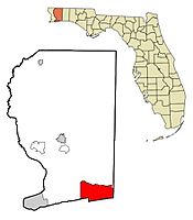
Navarre is a special kind of community in Santa Rosa County, located in the northwest part of the Florida Panhandle. It's a popular place for people to live and travel to work, especially for U.S. military families, government workers, and those who have retired.
Navarre is known for its beautiful Navarre Beach and miles of beachfront along the Gulf of Mexico. It also has beaches within the Navarre Beach Marine Park and the Gulf Islands National Seashore. Because of these natural areas, it's becoming a popular spot for nature lovers and tourists.
Navarre has grown a lot! In 1970, it had about 1,500 people. By 2022, the population was estimated to be around 43,540, including both Navarre and Navarre Beach. This makes it the second largest community in the Pensacola Metro Area and the third largest in the entire Florida Panhandle.
The community is about 25 miles (40 km) east of Pensacola and 15 miles (24 km) west of Fort Walton Beach. It's mainly located where U.S. Route 98 and State Road 87 meet. Navarre is a great place for swimming, picnics, and enjoying the beach.
Contents
Spanish Explorers in 1693
In 1693, Spanish explorers named Carlos de Sigüenza y Góngora and Admiral Andrés de Pez y Malzárraga sailed from Veracruz. Sigüenza was a skilled mapmaker and scientist. His job was to find and map places where Spain could start new settlements in Northwest Florida.
In April 1693, while exploring the East Bay area, the Spanish found what is now called the East Bay River. They named it "The River Jordan" to honor Captain Jordan de Reina.
On April 11, 1693, as they sailed up the East Bay River, the Spanish sailors saw Native Americans watching them from a camp. A group went ashore to greet them, but the Native Americans left quickly. The Spanish found half-cooked buffalo meat over a fire and a dog guarding the camp. Because there were so many oak trees, they named the spot "El Robledal," which means "The Oakgrove" in Spanish. They left gifts and a wooden cross. When they returned later, their gifts were gone, and the Native Americans had left a buffalo hide and their own wooden cross as a peace offering.
The first known map of Robledal is from 1693. It was also noted on a 1698 map by Don Andrés de Arriola y Guzmán, who was the first governor of a Spanish settlement in the Pensacola area.
Early Settlers and the Axelson Family
White settlers have lived in this area since at least 1827. Maps from that time show families like Wyman and Williams living along Santa Rosa Sound. The Wyman family is thought to be related to Guy Wyman, who later named the area "Navarre." The Williams family likely gave their name to William's Creek.
Around 1856, the Axelson family started a homestead at Robledal. They are often seen as Navarre's first settlers because their home was right where Robledal was. Their home was on a small piece of land that is now called Axelson Point.
Soon after settling, the Axelsons built a shipyard on Axelson Point. They fixed ships from nearby ports in Pensacola and Milton, and they also built large ships. The shipyard was busy until about 1890.
Some old maps show the area was also called "Bilowry," possibly a different spelling of "Bill Lowry." There was even a post office here with that name from 1886 to 1891.
People continued to live in this area, though not many. For a short time, it was also known as Hiawatha. A neighborhood in Navarre still has this name today.
The Town of Eagan
Around 1874, a small settlement called Eagan appeared. It had about 40 families and was located near the Santa Rosa Sound, covering part of what is now Navarre. It was named after John Eagan Esq., a lawyer and politician from Pensacola.
The Eagan post office closed in 1884, but families continued to live there. The town even appeared on maps into the 1890s. We don't know exactly what happened to everyone who lived there, but some stayed, and some moved to nearby communities. The land where Eagan was located later became part of Navarre.
The person who officially founded Navarre and gave it its name was Guy Wyman. He was a colonel in the United States Army. During World War I, he met a French nurse named Noelle. To bring her to the United States, he adopted her.
Colonel Wyman brought Noelle to Florida and bought a large amount of land. Noelle named their new home Navarre, after a province in Spain near France. Wyman officially planned the town in 1925, but he didn't start building right away. During the Great Depression, the Wymans couldn't pay the taxes on the land and had to start selling it. Part of that land is now Navarre Park.
Navarre has become one of the fastest-growing communities in Florida. While protecting its natural beauty, the area has added many new things like fancy places to stay, water activities, unique shops, nature trails, and schools.
Hurricanes and Recovery
Navarre has been hit hard by hurricanes, especially Hurricane Ivan in 2004 and Hurricane Dennis in 2005. Before these storms, Navarre was growing quickly. But the hurricanes caused a lot of damage, and many building plans were put on hold or never finished. It took a long time for Navarre to recover, but by the mid-2010s, things started to improve.
Helicopter Crash Memorial
On March 10, 2015, a UH-60 Black Hawk helicopter from the Louisiana National Guard crashed into the Santa Rosa Sound near Navarre. All eleven people on board were believed to have died. To honor them and all who have given their lives for the United States, the Navarre Black Hawk Memorial was built in Navarre Park and unveiled in 2016.
Community Protests
In 2017 and 2018, there were several protests in Navarre.
- In June 2017, people protested when the county changed the town's nickname and welcome sign without asking the community. This made some people want Navarre to become an official city with its own government.
- In 2018, there were protests against the Holley-Navarre Water System. People were concerned about the water board holding "secret" meetings, which might have broken laws about public access to government meetings. A new board was later elected, which helped calm the situation.
- Navarre also saw protests as part of a national school walkout to support gun control.
- On June 3, 2020, about 120 people protested at Navarre Park as part of the George Floyd protests. This was followed by a candlelight vigil.
New Growth and Future Plans
Navarre is growing again, not just in population, but also with new attractions, restaurants, and places for tourists. In the late 2010s, new homes, apartments, a hotel, shops, restaurants, and Santa Rosa County's first microbrewery were built. More development is planned, including new commercial areas.
In 2020, a group called the Navarre Area United PAC started a new effort to make Navarre an official city. This effort was slowed down by the COVID-19 pandemic. In 2021, another group, Preserve Navarre, began studying if becoming a city would be a good idea for Navarre. They have shared a study and a proposed plan for how a city government would work.
In May 2023, a project began to widen Highway 98 in Navarre. This project will improve drainage, add sidewalks, and add three lanes to both eastbound and westbound sides of the highway. It is expected to be finished around 2026 or 2027.
 |
East Bay | Milton Eglin Air Force Base Holley |
Eglin Air Force Base |  |
| Midway Gulf Breeze Pensacola |
Mary Esther Fort Walton Beach Destin |
|||
| Pensacola Beach | Gulf of Mexico | Gulf of Mexico |
Navarre is located at 30°24′04″N 86°51′47″W / 30.401°N 86.863°W. It's in the Florida Panhandle and uses the Central Time Zone. The land is mostly flat, about 10 feet (3.0 m) above sea level.
Navarre has about 12 miles (19 km) of shoreline along the Gulf of Mexico. This doesn't even include the shorelines along both sides of Santa Rosa Sound, East Bay, and the East Bay River.
Land and Water Features
Navarre is part of the Gulf Coastal Plain, meaning it's built on mostly flat, sandy soil, though there are a few small hills. Navarre is mainly located on the Fairpoint Peninsula and Santa Rosa Island.
To the north, Navarre is bordered by the East Bay River, the Yellow River, and several small creeks. To the south, it's bordered by the Santa Rosa Sound. Holley, another community, is north of the Fairpoint Peninsula, across the East Bay River.
Navarre has a humid subtropical climate, which means it has hot, humid summers and mild winters.
| Climate data for Pensacola, Florida normals (Nearest weather station to Navarre) | |||||||||||||
|---|---|---|---|---|---|---|---|---|---|---|---|---|---|
| Month | Jan | Feb | Mar | Apr | May | Jun | Jul | Aug | Sep | Oct | Nov | Dec | Year |
| Record high °F (°C) | 81 (27) |
82 (28) |
88 (31) |
96 (36) |
102 (39) |
102 (39) |
106 (41) |
104 (40) |
102 (39) |
95 (35) |
87 (31) |
81 (27) |
106 (41) |
| Mean daily maximum °F (°C) | 60.5 (15.8) |
63.8 (17.7) |
69.6 (20.9) |
75.7 (24.3) |
83.2 (28.4) |
88.5 (31.4) |
90.0 (32.2) |
89.4 (31.9) |
86.5 (30.3) |
78.9 (26.1) |
70.3 (21.3) |
62.6 (17.0) |
76.6 (24.8) |
| Mean daily minimum °F (°C) | 42.2 (5.7) |
45.5 (7.5) |
51.2 (10.7) |
57.6 (14.2) |
66.0 (18.9) |
72.5 (22.5) |
74.5 (23.6) |
74.2 (23.4) |
70.3 (21.3) |
60.3 (15.7) |
51.2 (10.7) |
44.4 (6.9) |
59.2 (15.1) |
| Record low °F (°C) | 5 (−15) |
7 (−14) |
22 (−6) |
33 (1) |
44 (7) |
55 (13) |
61 (16) |
60 (16) |
43 (6) |
32 (0) |
22 (−6) |
11 (−12) |
5 (−15) |
| Average precipitation inches (mm) | 4.64 (118) |
5.06 (129) |
5.81 (148) |
4.32 (110) |
4.17 (106) |
6.60 (168) |
7.40 (188) |
6.77 (172) |
5.98 (152) |
5.24 (133) |
4.73 (120) |
4.55 (116) |
65.27 (1,658) |
| Average precipitation days (≥ 0.01 in) | 8.9 | 8.6 | 8.1 | 6.5 | 6.7 | 11.1 | 14.0 | 13.6 | 8.8 | 6.1 | 7.2 | 9.0 | 108.6 |
| Source: NOAA | |||||||||||||
Because Navarre is a low-lying community near the Gulf of Mexico, it is often affected by hurricanes. Big storms like Erin and Opal in 1995, Georges in 1998, Ivan in 2004, Dennis in 2005, and Sally in 2020 caused a lot of damage. Many homes and businesses along Santa Rosa Sound were flooded by storm surge. Despite these challenges, the area has recovered and its population has grown quickly.
| Navarre Beach | |
|---|---|
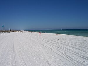
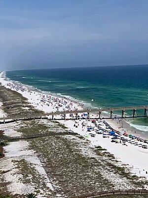
Navarre Beach on a sunny day
|
|
| Location | Navarre, Florida |
| Range | Gulf Coastal Plain |
| Part of | Santa Rosa Island |
| Offshore water bodies | Gulf of Mexico, Santa Rosa Sound |
| Highest point – elevation |
Various sand dunes variably 8–16 feet (2.4–4.9 m) |
| Width | Variable (typically ~1⁄4 mile (0.4 km)) |
| Geology | Beach |
| Age | ~11,700 years (Last Glacial Period) |
Navarre Beach is the beach area of Navarre. It's located on Santa Rosa Island, which is a barrier island in the Gulf of Mexico. In 2020, Navarre Beach had 1,123 people living there.
To the east of Navarre Beach is Navarre Beach Marine Park. To its west is part of the Gulf Islands National Seashore, and further west is Pensacola Beach.
Beach Restoration Efforts
In 2006, a "beach re-nourishment" project began. This project added about 200 feet (61 m) of sand and a 14-foot (4.3 m) high berm (a raised bank) to the Gulf side of Santa Rosa Island. This helped restore sand lost from hurricanes in 2004 and 2005. Another round of beach re-nourishment was finished in 2016.
During the COVID-19 pandemic, Navarre Beach was closed to everyone except people who lived there. Police checked who was allowed on the island at the Navarre Beach Causeway.
Navarre is a large and growing community. In 2020, it had 41,940 people, including both Navarre and Navarre Beach. Some estimates since then suggest the number might be as high as 43,540. If Navarre were to become an official city, it would be the largest city between Pensacola and Tallahassee based on population. This is a huge jump from just 1,500 people 40 years ago!
Here's a look at the different groups of people living in Navarre, based on 2017 estimates:
- White: 75.6%
- African-American: 9.0%
- Hispanic: 9.6%
- Multiracial: 5.2%
- Asian: 3.0%
- Native Hawaiian and other Pacific Islander: 0.2%
- Native American and Alaska Native: 0.2%
Navarre is located near the meeting point of U.S. Highway 98 and State Road 87. It's also close to several large military bases, including Naval Air Station Pensacola to the west, Hurlburt Field and Eglin Air Force Base to the east, and Naval Air Station Whiting Field to the north.
Tourism has grown in Navarre since 2010. The local tourism businesses have even called it "Florida's Best Kept Secret." Navarre has a park on the mainland next to the Navarre Beach bridge. This park has a visitor center, a water splash pad, a playground, picnic areas, a pier, and a small beach.
Many people enjoy boating, surfing, jet skiing, paddle boarding, fishing, and bird watching in Navarre. Exploring scenic trails and walking or jogging are also popular activities. In 2017, Navarre's fourth hotel opened, becoming the first beachfront hotel to operate since 2004.
Navarre is becoming a popular place for ecotourism (tourism focused on nature). This is because it's located near the Gulf of Mexico and important waterways, and it's also next to large, undeveloped woodlands on Eglin Air Force Base.
In the last ten years, several wildlife sanctuaries and conservation centers have opened here. These include:
- Emerald Coast Wildlife Refuge
- Navarre Beach Marine Science Station
- Navarre Beach Sea Turtle Conservation Center
- Sandspur Wildlife Sanctuary
- Navarre Beach Marine Life Sanctuary
The Navarre Beach Fishing Pier was rebuilt in 2010 after being damaged by hurricanes. At 1,545 feet (471 m), it is currently the longest fishing pier on the Gulf of Mexico and in the state of Florida. It's a great spot for fishing and enjoying the views.
Education and Library Services
Education in Navarre is managed by the Santa Rosa County School District. The schools that serve the Navarre community are:
- Navarre High School (for grades 9–12, opened 1996)
- Holley-Navarre Middle School (for grades 6–8, opened 1989)
- Holley-Navarre Intermediate School (for grades 3–5, opened 1971)
- Holley-Navarre Primary School (for grades K–2, opened 2007)
- Woodlawn Beach Middle School (for grades 6–8, opened 2001)
- West Navarre Primary School (for grades K–2)
- West Navarre Intermediate School (for grades 3–5)
- East Bay K-8 School (for grades K-8, opened 2021)
You can find public library services at the Navarre Library, which is part of the Santa Rosa County Library System.
Parks and Recreation
| Navarre Park | |
|---|---|
| Type | County Park |
| Location | Navarre, Florida |
| Area | 7 Acres |
| Operated by | Santa Rosa County Department of Parks and Recreation |
| Visitors | ~150,000 annually |
| Open | Year round |
Navarre has several public parks that are open all year. These parks are managed by the Santa Rosa County Department of Parks and Recreation. The Navarre Sports Complex and Navarre Soccer Complex are also largely managed by the county, but the Navarre Youth Sports Association helps run them.
The biggest parks are the Navarre Beach Marine Park, Navarre Park, and the Navarre Sports Complex.
Navarre Park has a play area for kids, basketball courts, picnic spots, and restrooms. Many big community events are held there each year.
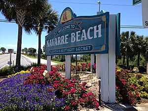
In October 2020, the first phase of park renovations began. These improvements included an interactive splash pad, playgrounds for different age groups, a plaza with shade, new buildings, more parking, and better landscaping. Phase 1 was finished in summer 2022. The original Navarre Beach sign is now on display in the park. More expansions are being planned for Phases 2 and 3.
Navarre mainly relies on roads for transportation. There isn't much public transportation or many sidewalks, which some local residents would like to see improved.
Navarre is centered where U.S. Highway 98 (called "Navarre Parkway" in town) and Florida State Road 87 meet. These are the two main roads in and out of Navarre.
- The Parkway (US 98) goes west to Pensacola and east to Destin and Panama City.
- State Road 87 starts in Navarre and goes north to Interstate 10 and Milton, eventually reaching the Alabama state border.
Navarre also has other important roads like Florida State Road 399 and Santa Rosa County Road 399. These are often called "Gulf Boulevard" and "East Bay Boulevard."
- Gulf Boulevard travels on Santa Rosa Island, going through the Opal Beach section of the Gulf Islands National Seashore and Pensacola Beach.
- East Bay Boulevard runs along East Bay and the East Bay River.
Because of traffic, county leaders and citizens have suggested building a new community access road. Officials are currently studying if this plan is possible.
Navarre doesn't have its own commercial airport. Most people fly into Pensacola International Airport (about 25 miles west in Pensacola) or Destin–Fort Walton Beach Airport (about 30 miles east in Valparaiso, Florida).
Navarre does have a small airport for general aviation called Fort Walton Beach Airport. It has a grass runway and is mainly used by planes that fly advertisements along the beach.
There was also a military airfield nearby called Naval Outlying Landing Field Holley, but it has been turned into one of the largest solar fields in the region.
Public Transportation Options
Navarre has limited public transportation. However, Santa Rosa Transportation offers some on-demand services for people in the town.
Jaws 2 Filming Location
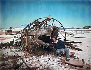
Most of the movie Jaws 2 was filmed in and around Navarre and Navarre Beach in 1977. Making the movie was a big help to the local economy. Many local boaters, extras, and stand-ins were hired. Universal brought in actors, directors, and crew members who needed places to stay, food, and other services.
Navarre's Holiday Inn "Holidome" was used as the movie's main office. The ground floor became production offices, and some rooms were changed for the actors. Universal rented 100 of the hotel's 200 rooms and spent $1 million. The Holiday Inn was destroyed during the 2004 Atlantic hurricane season. A new hotel was built on the same spot and opened in 2017.
Entanglement Book Series
One of the books in the Entanglement science fiction series, Entanglement: The Surface, is set in Navarre. Navarre High School (called Navarre Beach High School in the book) is a main setting in the story.
Entertainment
- Logan Bauer, a finalist on the 29th Season of The Amazing Race
- Anne Rice, a famous writer of gothic fiction
Sports
- Michael Carter, a running back for the Arizona Cardinals
- Matt Cronin, a relief pitcher for the Rochester Red Wings
- Jordan Leggett, a former tight end for the New York Jets
- Michael "Crash" Lockwood, a WWE wrestler
- Akeem Spence, a former defensive tackle for the San Francisco 49ers
- Jeff Van Camp, a former quarterback for the Florida Atlantic Owls
See also
 In Spanish: Navarre (Florida) para niños


