Canadian Prairies facts for kids
Quick facts for kids Canadian Prairies |
|
|---|---|
| Prairies canadiennes (French) | |
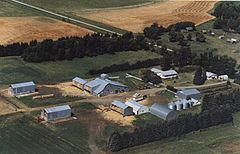
Farm on the prairies near Hartney, Manitoba
|
|
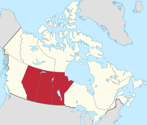
Map of the Prairie Provinces
|
|
| Location | Alberta, Saskatchewan, Manitoba in Canada |
| Area | 1,780,650.6 km2 (687,513.0 sq mi) |
| Geology | Ecoregion |
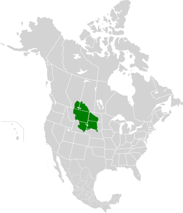
The Canadian Prairies is a large region in Western Canada. When people in Canada say "the Prairies," they usually mean this area. It includes parts of the Great Plains and three provinces: Alberta, Saskatchewan, and Manitoba. These provinces are often called the Prairie provinces.
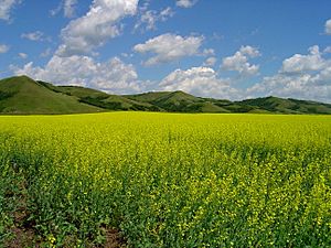
Much of the southern Prairies is covered by grasslands, plains, and low-lying areas. Further north, the land changes, with more forests and hills, and fewer people. The Prairies are a type of temperate grassland and shrubland biome. This means they have a climate that supports grasses and shrubs, not dense forests. The region stretches from north of Edmonton in Alberta, slanting southeast to the border between Manitoba and Minnesota. Alberta has the most prairie land, while Manitoba has the least, as its forests start further south.
Contents
Weather and Climate
The main climate in the Canadian Prairies is often described as semi-arid, meaning it's quite dry. Most of the prairie provinces have snowy, humid continental climates with cool summers. This is known as a Dfc climate type. The very southern parts of the Prairies have similar climates but with warmer summers (Dfb). A small area near the Alberta-Saskatchewan border is even drier and colder, classified as Bsk.
Rain and snow are very important in the Canadian Prairies because this region produces 80% of Canada's farm products. On average, about 454 millimeters (18 inches) of precipitation falls each year. Saskatchewan gets the least amount of precipitation (395 mm), while Manitoba gets the most (486 mm). Most of the rain falls in summer, especially in June and July.
Because of the high humidity in summer, tornadoes can happen. Central Saskatchewan and southern Manitoba are areas where tornadoes are more likely. About 72% of all tornadoes in Canada occur across the Prairies. This is because summer thunderstorms can easily mix with the air over the flat land, creating conditions for tornadoes.
| City | Province | July | January | Annual precipitation | Plant hardiness zone | Average growing season (in days) |
|---|---|---|---|---|---|---|
| Lethbridge | AB | 26 °C/10 °C (79 °F/50 °F) | 0 °C/-12 °C (32 °F/10 °F) | 380 mm (14.9 in) | 4B | 119 |
| Calgary | AB | 23 °C/9 °C (73 °F/48 °F) | -1 °C/-13 °C (30 °F/9 °F) | 419 mm (16.4 in) | 4A | 117 |
| Medicine Hat | AB | 28 °C/12 °C (82 °F/54 °F) | −5 °C/-16 °C (23 °F/3 °F) | 323 mm (12.7 in) | 4B | 134 |
| Edmonton | AB | 23 °C/12 °C (73 °F/54 °F) | −6 °C/-15 °C (21 °F/5 °F) | 456 mm (17.9 in) | 4A | 135 |
| Grande Prairie | AB | 23 °C/10 °C (73 °F/50 °F) | −8 °C/-19 °C (18 °F/-2 °F) | 445 mm (17.5 in) | 3B | 117 |
| Regina | SK | 26 °C/12 °C (79 °F/54 °F) | −9 °C/-20 °C (16 °F/-4 °F) | 390 mm (15.3 in) | 3B | 119 |
| Saskatoon | SK | 25 °C/12 °C (77 °F/54 °F) | −10 °C/-21 °C (14 °F/-9 °F) | 354 mm (13.8 in) | 3B | 117 |
| Prince Albert | SK | 24 °C/12 °C (75 °F/54 °F) | −11 °C/-23 °C (12 °F/-9 °F) | 428 mm (16.8 in) | 3A | 108 |
| Brandon | MB | 25 °C/11 °C (77 °F/54 °F) | −11 °C/-22 °C (12 °F/-11 °F) | 474 mm (18.6 in) | 3B | 119 |
| Winnipeg | MB | 25 °C/12 °C (77 °F/55 °F) | −11 °C/-21 °C (12 °F/-6 °F) | 521 mm (20.5 in) | 4A | 121 |
Land and Landscape
Even though the region is called the "Prairies," its land is quite varied. It includes parts of the Canadian Shield (rocky, forested land), the Western Mountains, and the Canadian Interior Plains. The plains have both grasslands and forests. The Shield is mostly forested, except for freshwater areas near Hudson Bay.

Types of Grasslands
There are three main types of grasslands in the Canadian Prairies:
- Tallgrass prairie: Almost all of this type has been turned into farmland. What's left is mainly in the Red River Valley in Manitoba.
- Mixed grass prairie: This is more common and is part of the dry plains that stretch from Canada down to Texas in the U.S. Over half of the remaining natural grassland in the Canadian Prairies is mixed grass.
- Fescue prairie: This type grows in wetter areas, found in the northern parts of the Prairies in central and southwestern Alberta and west-central Saskatchewan.
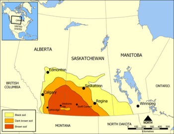
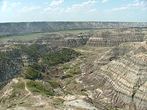
The southwestern Canadian Prairies, especially the area known as Palliser's Triangle, are semi-arid and often experience droughts. The areas around Regina and east of Calgary are also very dry. Most heavy rain clouds lose their moisture before reaching these eastern parts. In southern Saskatchewan, about 30 to 51 centimeters (12 to 20 inches) of precipitation falls each year, mostly from April to June. Frost from October to April limits the time crops can grow.
The eastern Prairies in Manitoba have plenty of water, with large lakes like Lake Winnipeg and many rivers. This area also gets a good amount of rain. The middle parts of Alberta and Saskatchewan are wetter than the south and have better farmland. This is true even though their growing season is shorter. The areas around Edmonton and Saskatoon are known for good farmland. These cities are in the northern part of Palliser's Triangle, in a transition area called aspen parkland.
Further north, it gets too cold for most farming, except for wild rice and sheep. This area is mostly covered by boreal forest. However, the Peace Region in northwestern Alberta is an exception. It's north of 55 degrees latitude but is warm and dry enough for a lot of farming. The long summer daylight hours help crops grow quickly, even with a shorter season. Farming is a big part of the economy in the Peace Region.
People and Cities
The Canadian Prairies are home to many people. In the 2021 Canadian Census, the three prairie provinces had a total population of 6,737,293. This includes 4,262,635 people in Alberta, 1,342,153 in Manitoba, and 1,132,505 in Saskatchewan. This was a 4.6% increase from 2016. The total area of these three provinces is about 1,780,650.6 square kilometers (687,513 square miles).
The Prairies have seen fast population growth, especially due to the oil production boom since the mid-20th century. Between 2011 and 2016, the population grew by 9.5%.
| Rank | Census metropolitan area | Population (2021) | Population (2016) | Province |
|---|---|---|---|---|
| 1 | Calgary | 1,481,806 | 1,392,609 | Alberta |
| 2 | Edmonton | 1,418,118 | 1,321,426 | Alberta |
| 3 | Winnipeg | 834,678 | 778,489 | Manitoba |
| 4 | Saskatoon | 317,480 | 295,095 | Saskatchewan |
| 5 | Regina | 249,217 | 236,481 | Saskatchewan |
Economy
In the mid-20th century, the economy of the Prairies grew very quickly because of a boom in oil production. This created many new jobs. The main industries are agriculture and services. Agriculture includes raising livestock (like cattle and sheep) and growing crops (like oats, canola, wheat, and barley). Oil production also became very important. As oil companies grew, so did the service industry, which provides support for oil workers.
From the 1950s to the 1970s, the rise in oil production made Alberta Canada's "richest province." Canada became one of the top oil exporters in the world. Cities like Edmonton and Calgary attracted more people because of the energy jobs, and other jobs supporting this industry also grew. This steady economic growth helped the Prairies shift from being mostly about farming to having more jobs in services.
In 2014, the global price of oil dropped, which affected the economy a lot. Alberta's economy is still heavily based on oil. Even as older oil wells produce less, new oil sands in the north (like near Fort McMurray) continue to provide jobs for extracting and refining oil.
In the early 20th century, Saskatchewan's economy grew because of a boom in Canadian agriculture, especially wheat farming. It was sometimes called a "one-crop economy" because it relied so much on wheat. But after 1945, new technologies led to the discovery of uranium, more oil, and potash, which diversified the economy.
Culture and Identity
The Prairies have unique cultural and political features that set them apart from the rest of Canada. The oldest influence comes from the First Nations, who have lived here for thousands of years. This region has the highest percentage of Indigenous people in Canada, outside of the northern territories.
The first Europeans to arrive were fur traders and explorers. They came from eastern Canada (mostly present-day Quebec) and Great Britain. These early interactions led to the creation of the Métis, who are known as the "children of the fur trade."
As Europeans settled the Prairies, they often formed communities based on their ethnic backgrounds. This created areas with distinct Ukrainian, German, French, or Scandinavian Canadian cultures. Many families ran farms, growing crops and raising animals. Grain crops were the main cash crop. People of Ukrainian and Polish heritage were often drawn to the forested parkland areas of east-central Alberta.
Southern Alberta is famous for its cowboy culture. This developed when real "open range" ranching was common in the 1880s. Canada's first rodeo, the Raymond Stampede, started in 1902. These influences also shaped the music of Canada's Prairie Provinces. This is partly because many American settlers moved to Alberta (and Saskatchewan) in the late 1880s when land became scarce in the United States.
The Prairie Provinces have also been known for "prairie protest" movements. These are times when people in the region have pushed for big changes in how things are run. Farmer groups and worker groups were active between the World Wars. The One Big Union, a large workers' group, was founded here. The Winnipeg General Strike of 1919 was the biggest general strike in Canadian history. The United Farmers of Alberta formed a government that lasted a long time after World War I. Later, a political idea called Social Credit first formed a government in Alberta in 1932. More recently, Preston Manning's Reform Party, from 1987 to 2000, had its strongest support from Prairie voters.
These political movements often come from a feeling that the Prairies are not always understood or treated fairly by the central parts of Canada. They represent a challenge to the established power in Central Canada.
Today, the Prairies have a wide range of political views. The Conservative Party of Canada is very popular across the region. However, the New Democratic Party (NDP) also holds seats in all three provinces and sometimes forms provincial governments. The NDP also has federal seats in Alberta and Manitoba. The Liberal Party of Canada also holds some federal seats, especially in Winnipeg.
See also
 In Spanish: Praderas canadienses para niños
- Dominion Land Survey
- High Plains (United States)
- List of regions of Canada
- Llano Estacado
- Natural Resources Acts
- Shortgrass prairie
- Ecozones of Canada


