Rabun County, Georgia facts for kids
Quick facts for kids
Rabun County
|
||
|---|---|---|
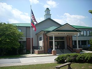
Rabun County courthouse in Clayton
|
||
|
||
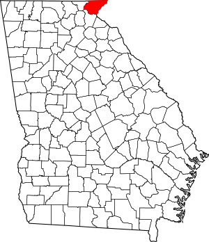
Location within the U.S. state of Georgia
|
||
 Georgia's location within the U.S. |
||
| Country | ||
| State | ||
| Founded | 1819 | |
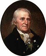
| Named for | William Rabun | |
| Seat | Clayton | |
| Largest city | Clayton | |
| Area | ||
| • Total | 377 sq mi (980 km2) | |
| • Land | 370 sq mi (1,000 km2) | |
| • Water | 6.9 sq mi (18 km2) 1.8% | |
| Population
(2020)
|
||
| • Total | 16,883 | |
| • Density | 44/sq mi (17/km2) | |
| Time zone | UTC−5 (Eastern) | |
| • Summer (DST) | UTC−4 (EDT) | |
| Congressional district | 9th | |
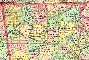
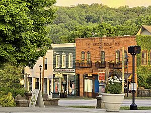
Rabun County is a county in the northeastern part of Georgia, USA. It is the most northeastern county in the state. In 2020, about 16,883 people lived here. The main town and county seat is Clayton.
Rabun County gets a lot of rain! It's known as the rainiest county in Georgia. It's also one of the rainiest places east of the Cascades mountains. In 2018, it had its wettest year ever, with over 116 inches of rain.
Contents
History of Rabun County
People started exploring the area now known as Rabun County as early as 1760.
Early Native American Life
In the 1700s, many Cherokee people lived here. Because of this, some parts of the Appalachian Mountains were called the "Cherokee Mountains." The Cherokee people were divided into groups based on where they lived and how they spoke.
At least four Cherokee villages were once in Rabun County. One village, called Stikayi, was near Stekoa Creek. Another, Tallulah, was on the upper part of the Tallulah River. Two other villages, Chicherohe and Eastertoy, were also in the area. Chicherohe was destroyed during the American Revolutionary War.
Even before the Cherokee, other Native American groups lived here. There is a mound near Dillard that is similar to other mounds in North Georgia. It was likely built by the Mississippian culture, who were known for building mounds. This mound is now a protected historical site.
First Explorers and Settlers
An early visitor to Rabun County was William Bartram, an explorer and naturalist. In May 1775, he wrote in his journal about crossing the Chattooga River into Georgia. He traveled through an area called Dividings, which later became Clayton. He also climbed Rabun Bald. Today, a hiking trail called the Bartram Trail follows some of his paths.
John Dillard and his family were among the first settlers in 1794. They received land for his service in the American Revolution. At first, the Cherokee tolerated the settlers. But soon, tensions grew. The Cherokee saw the settlers as invaders who didn't respect nature. Raids between the groups became common. These fights mostly ended a few years before the Cherokee gave up their land to Georgia in 1817.
Forming the County
The Georgia General Assembly created Rabun County on December 21, 1819. It was Georgia's 47th county. The northern border was set at 35°N latitude, which is the border with North Carolina. However, an early survey made a small mistake. This means Rabun County has Georgia's northernmost point, a little north of the official border.
The county is named after William Rabun. He was the 11th Governor of Georgia and died in 1819. Over the years, parts of other counties were added to Rabun County. Later, in 1856, parts of Rabun County were used to create Towns County.
Civil War and Development
During the U.S. Civil War, Rabun County was one of only five counties in Georgia that did not want to leave the Union. Most people in the county were against secession. Even so, Rabun County did send two groups of soldiers to fight for the Confederate side.
In 1898, the Tallulah Falls Railway was built through the county. A popular stop was Tallulah Gorge. This railway ran for over 60 years and was even featured in a Disney movie called The Great Locomotive Chase.
Starting in the 1920s, many improvements came to the county. This was thanks to the growth of the Chattahoochee National Forest. "Ranger Nick" Nicholson was Georgia's first forest ranger. He helped set up telephone lines and other important services in the county.
Modern Times
The movie Deliverance (1972) was filmed mostly in Rabun County. It was about a group of men on a canoe trip in north Georgia. After the movie came out, tourism in Rabun County greatly increased. By 2012, tourism was the biggest source of money for the county. The population has also doubled since 1970.
Rafting has also become a big industry in the area. Because of the beautiful scenery, many people have built vacation homes around the county's lakes. In 2012, Rabun County held a festival for the Chattooga River to help protect it.
Geography of Rabun County
Rabun County covers about 377 square miles. Most of this is land, with a small part being water. About 60% of the land is part of National Forests and State Parks. Another 20% is owned by Georgia Power, and the rest is private land. Rabun County has the largest part of the Chattahoochee National Forest within its borders.
Most of the county is in the Tugaloo River sub-basin, which is part of the larger Savannah River basin. A northern part of the county is in the Little Tennessee River sub-basin.
Natural Features
Rabun County has three major lakes created by Georgia Power for electricity. Today, these lakes are also popular for fun activities:
- Lake Burton covers about 4.33 square miles and has 100 kilometers of shoreline.
- Lake Rabun covers about 3.38 square kilometers and has 40 kilometers of shoreline.
- Lake Seed covers about 0.97 square kilometers and has 21 kilometers of shoreline.
The county also has many trout streams, like the Tallulah River and its smaller streams.
The Eastern Continental Divide runs through the county. This means that rain falling on one side flows to the Atlantic Ocean, and rain on the other side flows to the Gulf of Mexico. This high elevation gives Rabun County the most snow in Georgia. It also means the county has mild weather in summer, leading to its slogan: Where Spring Spends the Summer. Rabun County is special because it has three state parks: Black Rock Mountain, Moccasin Creek, and Tallulah Gorge.
Mountains
Mountains are a big part of Rabun County's landscape. The Eastern Continental Divide includes the second and third highest peaks in Georgia: Rabun Bald (4,696 feet) and Dick's Knob (4,620 feet). The county has eight peaks over 4,000 feet tall. It also has more than 60 peaks between 3,000 and 4,000 feet tall.
- For more information, see: List of Summits and Ridges in Rabun County, Georgia*
Waterfalls
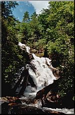
Rabun County has many beautiful waterfalls. Many of them can be reached by short hiking trails. Some popular ones are Dick's Creek Falls, Holcomb Creek Falls, and Minnehaha Falls.
Hiking Trails
The county has many hiking trails. A part of the famous Appalachian Trail goes through Rabun County. The county is also home to a 37-mile section of the Bartram Trail.
Major Roads
US 23 and US 441 run together from south to north through the county. US 76 runs from west to east. State Route 246 starts in Dillard and goes to Sky Valley. State Route 28 runs for a very short distance in the northeastern corner.
Neighboring Counties
- Macon County, North Carolina - north
- Oconee County, South Carolina - east
- Habersham County - south
- Towns County - west
- Clay County, North Carolina - northwest
Animals and Plants
Rabun County is home to several endangered and threatened species. These are animals and plants that are at risk of disappearing.
Animals of Concern
- The bald eagle is no longer endangered in the US, but it is still considered endangered in Georgia.
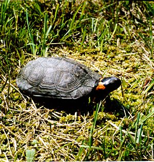
- The bog turtle is a threatened species in both the US and Georgia.
- Three types of fish found in the county are protected in Georgia. These include the fatlips minnow, the highscale shiner, and the olive darter.
Plants of Concern
There are 15 plants that are protected in Rabun County. Two of these are on the Federal endangered species list. They are the persistent trillium, rock gnome lichen, and swamp pink.
Population of Rabun County
| Historical population | |||
|---|---|---|---|
| Census | Pop. | %± | |
| 1820 | 524 | — | |
| 1830 | 2,176 | 315.3% | |
| 1840 | 1,912 | −12.1% | |
| 1850 | 2,448 | 28.0% | |
| 1860 | 3,271 | 33.6% | |
| 1870 | 3,256 | −0.5% | |
| 1880 | 4,634 | 42.3% | |
| 1890 | 5,606 | 21.0% | |
| 1900 | 6,285 | 12.1% | |
| 1910 | 5,562 | −11.5% | |
| 1920 | 5,746 | 3.3% | |
| 1930 | 6,331 | 10.2% | |
| 1940 | 7,821 | 23.5% | |
| 1950 | 7,424 | −5.1% | |
| 1960 | 7,456 | 0.4% | |
| 1970 | 8,327 | 11.7% | |
| 1980 | 10,466 | 25.7% | |
| 1990 | 11,648 | 11.3% | |
| 2000 | 15,050 | 29.2% | |
| 2010 | 16,276 | 8.1% | |
| 2020 | 16,883 | 3.7% | |
| 2023 (est.) | 17,442 | 7.2% | |
| U.S. Decennial Census 1790-1880 1890-1910 1920-1930 1930-1940 1940-1950 1960-1980 1980-2000 2010 2020 |
|||
Recent Population Changes
| Race / Ethnicity (NH = Non-Hispanic) | Pop 2000 | Pop 2010 | Pop 2020 | % 2000 | % 2010 | % 2020 |
|---|---|---|---|---|---|---|
| White alone (NH) | 14,023 | 14,468 | 14,625 | 93.18% | 88.89% | 86.63% |
| Black or African American alone (NH) | 118 | 144 | 107 | 0.78% | 0.88% | 0.63% |
| Native American or Alaska Native alone (NH) | 50 | 53 | 28 | 0.33% | 0.33% | 0.17% |
| Asian alone (NH) | 57 | 114 | 60 | 0.38% | 0.70% | 0.36% |
| Native Hawaiian or Pacific Islander alone (NH) | 0 | 7 | 1 | 0.00% | 0.04% | 0.01% |
| Other race alone (NH) | 5 | 10 | 35 | 0.03% | 0.06% | 0.21% |
| Mixed race or Multiracial (NH) | 114 | 179 | 575 | 0.76% | 1.10% | 3.41% |
| Hispanic or Latino (any race) | 683 | 1,301 | 1,452 | 4.54% | 7.99% | 8.60% |
| Total | 15,050 | 16,276 | 16,883 | 100.00% | 100.00% | 100.00% |
In 2020, there were 16,883 people living in Rabun County. There were 6,662 households and 4,220 families.
In 2010, the county had 16,276 people. Most people (93.3%) were white. About 8.0% of the population was of Hispanic or Latino background. The average age was 45.8 years old. The average income for a family was $50,410. About 18.5% of the people lived below the poverty line.
Economy
In the past, Rabun County's biggest employers were textile factories. However, some of these factories, like Rabun Apparel, closed down in the mid-2000s. This meant many people lost their jobs.
Education
The Rabun County School District serves students from pre-school through 12th grade. It has a primary school, an elementary school, a middle school, and a high school. The district has about 140 full-time teachers and over 2,221 students.
- Rabun County Primary School
- Rabun County Elementary School
- Rabun County Middle School
- Rabun County High School
Rabun Gap-Nacoochee School is a private school in the county. It offers classes for students from pre-kindergarten to 12th grade. It also has boarding options for students in grades 6-12.
Communities
Cities
- Clayton (county seat)
- Dillard
- Sky Valley
Towns
Unincorporated Communities
- Wiley
- Lakemont
- Persimmon
- Pine Mountain
- Rabun Gap
See also
 In Spanish: Condado de Rabun para niños


