
Redding, Connecticut facts for kids
Quick facts for kids
Redding, Connecticut
|
||
|---|---|---|

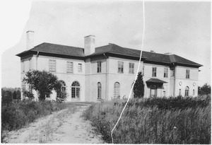
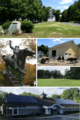
Clockwise from top: Town Center; New Pond Farm; Redding Green; Mark Twain Library; Equestrian statue of Israel Putnam at Putnam Memorial State Park
|
||
|
||
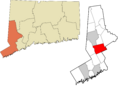
 Fairfield County and Connecticut Fairfield County and Connecticut Western Connecticut Planning Region and Connecticut Western Connecticut Planning Region and Connecticut |
||
| Country | United States | |
| U.S. state | Connecticut | |
| County | Fairfield | |
| Region | Western CT | |
| Incorporated | 1767 | |
| Villages/Sections | Redding Center Diamond Hill Five Points Georgetown (part) Redding Ridge Sanfordtown Topstone West Redding |
|
| Government | ||
| • Type | Selectman-town meeting | |
| Area | ||
| • Total | 32.1 sq mi (83.1 km2) | |
| • Land | 31.5 sq mi (81.6 km2) | |
| • Water | 0.6 sq mi (1.4 km2) | |
| Elevation | 472 ft (144 m) | |
| Population
(2020)
|
||
| • Total | 8,765 | |
| • Density | 278.3/sq mi (107.5/km2) | |
| Time zone | UTC-5 (Eastern) | |
| • Summer (DST) | UTC-4 (Eastern) | |
| ZIP Code |
06896
|
|
| Area code(s) | 203/475 | |
| FIPS code | 09-63480 | |
| GNIS feature ID | 0213495 | |

Redding is a town located in Fairfield County, Connecticut, United States. As of the 2020 census, about 8,765 people live there. Redding is part of the Western Connecticut Planning Region.
Contents
History of Redding
Early Settlement and Town Formation
Long ago, Native American trails crossed through the area that is now Redding. In 1639, Roger Ludlow bought land from local Native Americans to create Fairfield. Later, in 1668, Fairfield bought more land called Northfield, which included parts of modern-day Redding.
Fairfield then divided this new land into "long lots." These lots were narrow (less than a third of a mile wide) but stretched for about 15 miles east to west.
One of the first European settlers in the Redding area might have been Richard Osborn in 1671. Another important person was Nathan Gold, who received a large land grant in 1681. Early settlers lived near a Native American village led by Chickens Warrups.
The town was first named "Reading," like the town in England. However, many believe it was named after John Read, a well-known lawyer and former preacher. He helped set up the town's borders and get it recognized as a parish of Fairfield in 1729. In 1767, the spelling was changed to "Redding" to match how it was pronounced. The U.S. Post Office made this spelling official in 1844.
Redding During the Revolutionary War
Before the Declaration of Independence, there were disagreements in Redding. Some people, called Tories, supported the British, while more people supported the American colonies. Many Tories left to avoid trouble.
About 100 men from Redding joined Captain Zalmon Read's company in the 5th Connecticut Regiment. They fought in the siege of Quebec's Fort Saint-Jean in 1775.
In 1777, the British attacked a supply depot in Danbury, Connecticut. They marched through Redding Ridge, where many residents hid in a rocky area called the Devil's Den.
During the winter of 1778–1779, General George Washington decided to set up winter camps for his army. Major General Israel Putnam chose Redding for about 3,000 soldiers. This camp is now Putnam Memorial State Park. The soldiers guarded supplies in Danbury and supported operations along the coast. They faced harsh conditions, including cold and snow, similar to the famous Valley Forge, Pennsylvania, encampment.
Railroad Comes to Redding
Construction of the Danbury and Norwalk Railroad began in 1850. This railroad connected Danbury and Norwalk, passing through Redding. Regular train service started on March 1, 1852. This led to new train stations in West Redding, Topstone, and Georgetown.
Mining in Redding

In 1876, a man named A.N. Fillow started digging for mica in Branchville, Redding. Scientists from Yale University found new minerals there, including one named reddingite. Over time, the mine produced minerals like quartz, feldspar, beryl, and columbite.
Near the train station, there's also a unique type of rock made almost entirely of garnet.
Gilbert & Bennett Factory
In 1834, the Gilbert & Bennett Co. bought an old mill site in Georgetown. They started making wire mesh cloth for things like sieves and window screens. In 1863, they built a factory to draw metal wire.
During World War I and World War II, the company's products were used by the U.S. military for things like camouflage and gas masks.

In 1985, a group bought the company and moved its operations. In 1987, the Gilbert & Bennett site became part of the Georgetown Historic District on the National Register of Historic Places.
In 1999, the U.S. Environmental Protection Agency (EPA) named the factory pond and land a federal Superfund site. This was done to clean up pollution in the area. There have been plans to build new homes and shops at the site.
Historic Places in Redding
Redding has several places listed on the National Register of Historic Places, which means they are important historical sites:
- Aaron Barlow House
- Daniel and Esther Bartlett House
- Georgetown Historic District
- Putnam Memorial State Park
- Redding Center Historic District
- Umpawaug District School

Major Events and Weather
Redding has faced several challenges, including the COVID-19 pandemic in 2020. Connecticut declared a public health emergency, and schools and many businesses closed.
The town has also experienced severe weather. Hurricane Sandy in October 2012 brought strong winds, knocking down trees and causing widespread power outages. This was one of several major storms, including Hurricane Irene in August 2011 and the ""Halloween nor'easter" that same year. The nor'easter caused heavy snow to fall on trees that still had leaves, leading to many broken branches and power lines. Some areas were without electricity for over a week.
In 1955, heavy rains caused the Flood of 1955. A dam at the Gilbert and Bennett factory broke, flooding the Georgetown neighborhood and causing other damage. The 1938 New England Hurricane, known as "the Long Island Express," also affected Redding, destroying crops. The Great Blizzard of 1888 buried Redding in deep snow.
Geography and Climate
Redding covers about 32.1 square miles (83.1 km2). Most of this is land, with a small amount of water. Redding shares borders with several other towns, including Bethel, Danbury, and Wilton.
The town has nine main areas: Redding Center, Redding Ridge, Poverty Hollow, Sunset Hill, Lonetown, West Redding, Branchville, West Redding River Delta, and Georgetown. Georgetown is located where Redding, Ridgefield, Weston, and Wilton meet.
Redding's Landscape
Redding's landscape has three ridges that run from north to south, with valleys in between. These areas often have steep slopes and rocky cliffs. The highest point in Redding is about 830 feet (253 meters) above sea level on Sunset Hill. The lowest point is about 290 feet (88 meters) at the Saugatuck Reservoir.
Four streams flow south through Redding towards Long Island Sound: the Aspetuck River, the Little River, the Norwalk River, and the Saugatuck River. The Saugatuck River flows into the Saugatuck Reservoir, which is Redding's largest body of water. This reservoir was created in 1938 when part of the Saugatuck River Valley was flooded.
Weather in Redding
Redding has a humid continental climate, which means it has four distinct seasons. Winters are cold and snowy, while summers are hot and humid. The average summer high temperatures are in the low 80s Fahrenheit (upper 20s Celsius).
Population and People
| Historical population | |||
|---|---|---|---|
| Census | Pop. | %± | |
| 1790 | 1,503 | — | |
| 1800 | 1,632 | 8.6% | |
| 1810 | 1,717 | 5.2% | |
| 1820 | 1,678 | −2.3% | |
| 1830 | 1,686 | 0.5% | |
| 1840 | 1,674 | −0.7% | |
| 1850 | 1,754 | 4.8% | |
| 1860 | 1,652 | −5.8% | |
| 1870 | 1,624 | −1.7% | |
| 1880 | 1,540 | −5.2% | |
| 1890 | 1,546 | 0.4% | |
| 1900 | 1,426 | −7.8% | |
| 1910 | 1,617 | 13.4% | |
| 1920 | 1,315 | −18.7% | |
| 1930 | 1,599 | 21.6% | |
| 1940 | 1,758 | 9.9% | |
| 1950 | 2,037 | 15.9% | |
| 1960 | 3,359 | 64.9% | |
| 1970 | 5,590 | 66.4% | |
| 1980 | 7,272 | 30.1% | |
| 1990 | 7,927 | 9.0% | |
| 2000 | 8,270 | 4.3% | |
| 2010 | 9,158 | 10.7% | |
| 2020 | 8,765 | −4.3% | |
| Population 1774–2000 | |||
In 2010, there were 9,158 people living in Redding. The town has one of the lowest population densities in Fairfield County. Between 2000 and 2010, Redding's population grew by about 10.7%.
Most residents (about 94.9%) are White. Other groups include Asian (2.2%), African American (0.7%), and Native American (0.1%). About 2.6% of the population is Hispanic or Latino.
The median age in Redding in 2010 was 46.4 years. About 26% of the population was under 18 years old. In 2000, the average income for a family was $109,250.
Fun Things to Do and See in Redding
Redding has many interesting places to visit and explore:
- Collis P. Huntington State Park: Great for hiking, biking, and horseback riding.
- Devil's Den Preserve: Offers trails and views of the Saugatuck Reservoir.
- Highstead: An arboretum where you can see plants growing naturally.
- Ives Trail: A hiking trail that goes through parts of Redding.
- Lonetown Farm Museum: The home of the Redding Historical Society.
- New Pond Farm: A real working farm started by actress Carmen Mathews. It offers camps for kids.
- Mark Twain Library: Named after the famous author Mark Twain, who lived in Redding.
- Putnam Memorial State Park: The site of a winter camp for soldiers during the American Revolutionary War.
- John Cambria Homestead: One of many historic houses built around the time of the Revolutionary War.
Culture and Arts
Books and Stories
- Mark Twain: A Biography was written by Albert Bigelow Paine, who lived in West Redding. He interviewed Samuel Clemens (Mark Twain) at his home.
- My Brother Sam Is Dead, a popular children's book by James Lincoln Collier and Christopher Collier, is set in Redding during the Revolutionary War.
- Secrets of Redding Glen, a children's book by Jo Polseno, tells about the wildlife along the Saugatuck River.
Movies Filmed in Redding
Several movies have been filmed in Redding or parts of it:
- A Georgetown Story (2005–2008)
- The Last House on the Left (1972)
- Old Dogs (2007–2008)
- Other People's Money (1991)
- Rachel, Rachel (1968)
- Reckless (1995)
- Revolutionary Road
- The Stepford Wives (1975)
- Valley of the Dolls (1967)
Art and Sculptures

You can see many sculptures by Anna Hyatt Huntington in Redding:
- "Mother Bear and Cubs" and "Sculpture of Wolves" are at the entrance to Collis P. Huntington State Park.
- "General Israel Putnam" is at the entrance to Putnam Memorial State Park.
- "Fighting Stallions" is at Redding Elementary School.
- "A Tribute to the Workhorse" is at John Read Middle School.
- A smaller version of "The Torch Bearers" is at the Mark Twain Library.
The Smithsonian Institution has records of several artworks related to Redding, including paintings and photos.
Artists from Redding have also designed stamps for the U.S. Postal Service. The Mark Twain Library holds an annual art show to raise money and displays various artworks throughout the year.
Music and Performances
Composer Charles Ives wrote a piece called "Putnam's Camp, Redding Connecticut." It tries to sound like a child's experience at a parade, using parts of patriotic songs.
Composer Paul Avgerinos won a Grammy Award in 2016.
Redding also hosts free "Concerts on the Green" on Sundays from June to August, featuring different music acts.
Economy and Jobs
Redding Lifecare, which opened a retirement community called Meadow Ridge in 2001, is one of Redding's largest private employers. They had 325 workers in 2013. Other large organizations that pay a lot of property taxes include Eversource Energy (formerly Connecticut Light & Power) and the Redding Country Club.
In 2013, about 260 businesses in Redding employed 1,678 people.
Education in Redding
Public Schools
- Joel Barlow High School: This school, opened in 1959, serves students from both Redding and Easton.
- John Read Middle School: Opened in 1966, this school teaches Redding students from fifth to eighth grade. It was named a National Blue Ribbon School in 2012, which is a special honor.
- Redding Elementary School: Opened in 1948, this school teaches students from pre-kindergarten to fourth grade.
Mark Twain Library
Samuel Clemens, famous as Mark Twain, lived in Redding from 1908 until he passed away in 1910. He donated the first books to what became the Mark Twain Library. The library still has about 200 of the original 3,000 books he gave, along with other items he owned.
Famous People from Redding
Many famous people have lived in Redding, partly because it's close to New York City.
- Actors and Directors: Hope Lange, Barry Levinson, Jessica Tandy and her husband Hume Cronyn, and Christopher Walken.
- Artists: Dan Beard (who illustrated Mark Twain's books), Anna Hyatt Huntington (whose sculptures are in the state park), and photographer Edward Steichen.
- Athletes: Charlie Morton (a baseball pitcher), and Brooklee Han (an Olympic figure skater).
- Authors: Joel Barlow (a poet and diplomat born in Redding), Samuel Clemens (Mark Twain), Howard Fast, Lawrence Kudlow, Dick Morris, Flannery O'Connor, Alvin Toffler, and Stuart Chase.
- Businesspeople: Alfred Winslow Jones, known as one of the "fathers" of the hedge fund industry.
- Composers, Musicians, and Singers: Leonard Bernstein, Daryl Hall, Jascha Heifetz, Charles Ives, Meat Loaf, Andy Powell, and Mary Travers.
Getting Around Redding

The Metro-North Railroad's Danbury Branch has a station in West Redding. This train line connects Redding to Danbury, South Norwalk, Stamford, and Grand Central Terminal in New York City. Local bus service is provided by Housatonic Area Regional Transit.
Images for kids
-
Clockwise from top: Town Center; New Pond Farm; Redding Green; Mark Twain Library; Equestrian statue of Israel Putnam at Putnam Memorial State Park
-
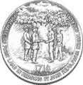
Redding Town Seal
-
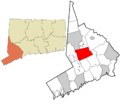
Redding's location within Fairfield County and Connecticut
-
Redding's location within the Western Connecticut Planning Region and the state of Connecticut
See also
 In Spanish: Redding (Connecticut) para niños
