Salmon Falls Creek facts for kids
Quick facts for kids Salmon Falls Creek |
|
|---|---|
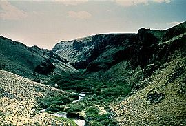
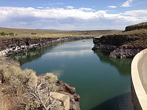
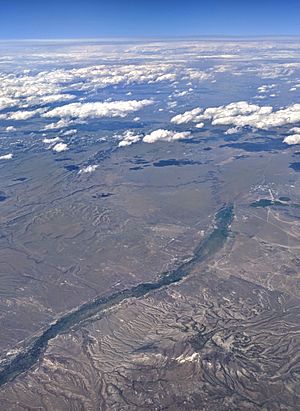
Looking upstream along Salmon Falls Creek Canyon
|
|
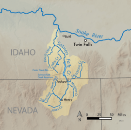
Map of Salmon Falls Creek
|
|
| Country | United States |
| State | Nevada, Idaho |
| Cities | Jackpot, Nevada, Hollister, Idaho |
| Physical characteristics | |
| Main source | Confluence of North and South Forks Salmon Creek Jarbidge Mountains, Nevada 5,643 ft (1,720 m) 41°47′22″N 114°57′43″W / 41.78944°N 114.96194°W |
| River mouth | Snake River Near Hagerman, Snake River Plain, Idaho 3,431 ft (1,046 m) 42°42′55″N 114°51′12″W / 42.71528°N 114.85333°W |
| Length | 121 mi (195 km) |
| Discharge (location 2) |
|
| Basin features | |
| Basin size | 2,103 sq mi (5,450 km2) |
| Tributaries |
|
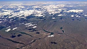
Salmon Falls Creek is a river that flows into the Snake River. It starts in northern Nevada and travels into Idaho in the United States. This creek begins in high mountains at the edge of the Great Basin. It flows north for about 121 miles (195 km) and drains a dry, mountainous area of 2,103 square miles (5,450 km2).
Long ago, the Salmon Falls Creek valley was a trade route. Native American groups from the Snake River Plain and the Great Basin used it. Today, most of the water from the creek is used for irrigation, which means watering crops.
Contents
The Creek's Journey: From Mountains to River
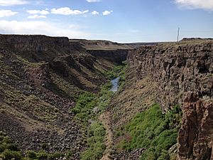
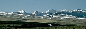
Salmon Falls Creek begins in the dry Jarbidge Mountains of northern Nevada. It forms where its North and South Forks meet. The North Fork is about 24.3 miles (39.1 km) long. The South Fork is about 12.1 miles (19.5 km) long. Many small streams that feed the creek start in the Humboldt National Forest. They come together to form a short canyon.
The creek then flows northeast into the O'Neil Basin. This is a valley along U.S. Highway 93. It flows north for about 40 miles (64 km). Then it passes the town of Jackpot. Here, it meets Shoshone Creek, which is its biggest tributary.
Through Canyons and Reservoirs
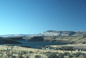
After Shoshone Creek, Salmon Falls Creek enters another canyon. This canyon takes it about 11 miles (18 km) across the Nevada-Idaho state border. It joins Cottonwood Creek and flows into the Salmon Falls Creek Reservoir. This reservoir was made by the Salmon Falls Dam. The dam is made of concrete and was built between 1908 and 1910.
After flowing through this long, narrow lake, the creek cuts into a deep canyon. This is where it enters the Snake River Plain. It meets Cedar Creek and Big Creek near Castleford. Finally, the creek flows into the Snake River. This is about 10 miles (16 km) south of Hagerman.
Water Flow and Use
Before people started using the water for irrigation in the early 1900s, the creek's average flow was about 345 cubic feet per second (9.8 m3/s). After the Salmon Falls Creek Reservoir was built, the flow changed a lot. From 2002 to 2005, the average flow was about 116.5 cubic feet per second (3.30 m3/s).
The water released from the Salmon Falls Creek Reservoir is mostly used for irrigation. So, the lower part of the creek gets its water from four large drains. These drains carry runoff from nearby farms. Work has been done to clean up this runoff. This helps reduce pollutants like excess nitrogen and phosphorus.
The Creek's Surroundings: Its Watershed
The Salmon Falls Creek basin covers about 2,103 square miles (5,450 km2). About 871 square miles (2,260 km2) of this area is in Idaho. This basin includes parts of Elko County in Nevada. It also includes Owyhee and Twin Falls County in Idaho.
The southern part of the watershed is a dry area with mountains and valleys. This is called the Basin and Range Province. The lower part of the watershed is a flat area made of basalt rock. This is part of the Snake River Plain.
Climate and Water Sources
The entire Salmon Falls Creek watershed is very dry. Most of the area gets less than 10 inches (25 cm) of rain each year. However, the mountains can get up to 30 inches (76 cm) of rain. This mountain rainfall provides most of the water for the Salmon Falls Creek Reservoir. Springs from the Snake River Aquifer also add some water.
Several major streams also feed Salmon Falls Creek. The largest is Shoshone Creek. It flows west from the Sawtooth National Forest. It joins the creek just before the town of Jackpot. Other important streams include Cottonwood, China, Big, House, Jakes, and Cedar Creeks.
Geology and Landforms
The Salmon Falls Creek basin has a mix of young geological features. In northern Nevada, you see mountains and valleys that formed from the Earth's crust stretching. This created long valleys along faults. Over time, streams and lakes filled these valleys with sediment.
Lower down the creek, the land is made of basalt rocks from volcanoes. It also has thick layers of loess soil. About 12 million years ago, the North American Plate moved over a volcanic hotspot. This caused many volcanic eruptions on the Snake River Plain. The hotspot is now under Yellowstone National Park.
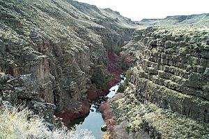
About 14,500 years ago, a huge flood called the Bonneville Flood swept through the Snake River Plain. This flood carved out many canyons, including the lower Salmon Falls Creek Canyon. The flood was so big that the lower Salmon Falls Creek turned into a temporary lake. Wind-blown soil and flood sediments now cover most of the basalt rock. But you can still see the basalt in places like Salmon Falls Creek Canyon.
Environmental Concerns
Pollution from farms and too much water use are big problems in the Salmon Falls Creek watershed. When people take too much groundwater, many springs that feed the lower creek dry up. The Salmon Falls Dam is 220-foot (67 m) high. Since 1984, it has not released any water, except for irrigation. This means the lower creek mostly relies on runoff from farms to keep flowing.
Pollutants in this runoff have harmed the plants along the lower canyon. Some streams flowing from northern Nevada into Idaho have also been diverted. This leaves even less water for the lower creek.
A Look Back: History of Salmon Falls Creek
Salmon Falls Creek likely got its name from Salmon Falls. This was a large waterfall on the Snake River, upstream from where the creek joins it. It was a historic fishing spot for Native Americans. A bit further upstream is Shoshone Falls. This was the natural end point for salmon migrating up the Snake River.
The Snake River below Shoshone Falls used to have huge numbers of salmon. These fish were a very important food source for the local Shoshone and Bannock peoples. But many dams built in the 20th century now stop the salmon from reaching this part of the river. The creek has also been called Holmes Creek, Salmon Creek, Salmon Falls River, and the Salmon River. In the past, it was more like a river, fed by springs and snowmelt from the Jarbidge Mountains.
Early People and Development
The Salmon Falls Creek valley was an important trading route. The Shoshone Indians from the Snake River Plain and the Paiute people from the Great Basin used it to trade. The first Europeans to see the creek were probably fur trappers. They were from the British Hudson's Bay Company and traveled through the area in the early 1800s.
In the early 1900s, a system of canals was built. This was to bring irrigation water to Idaho's Magic Valley. The city of Twin Falls was started in 1905. In 1909, people first suggested building a dam on Salmon Falls Creek for irrigation. They thought it could help grow crops on an extra 130,000 acres (530 km2) of farmland. The Salmon Falls Dam was finished in 1910 and made taller in 1934. However, there was less water than expected. Only about 35,000 acres (140 km2) of land ended up being farmed.
Life in and Around the Creek: Biology and Fish
The Salmon Falls Creek watershed has many different types of habitats. Along the lower part of the creek, there's plenty of water and many springs. This creates a rich riparian environment, like an oasis. It's filled with plants like coyote willow, dogwood, golden currant, cattail, mint, and poison ivy.
The upper part of the creek moves slowly. It supports a small wetland and large meadows. In contrast, most of the upper watershed is a dry shrub-steppe sagebrush grassland. Much of this land is used for grazing animals.
Animals of the Canyon
Many bird species live in the Salmon Falls Creek canyon. These include white-throated swifts, canyon and rock wrens, cliff swallows, violet-green swallows, and barn swallows. You might also see screech owls, long-eared owls, great horned owls, kestrels, red-tailed hawks, golden eagles, and prairie falcons. Mule deer also live in the middle and upper parts of the Salmon Falls Creek basin.
Fish Life
Even though Pacific salmon no longer live in the creek, many other fish do. They live in the main creek and its smaller streams, especially in the Salmon Falls Creek Reservoir. Many fish are put into the reservoir, including brown trout, Chinook salmon, kokanee salmon (which are sockeye that live only in freshwater), yellow perch, black crappie, channel catfish, and smallmouth bass. Walleye are especially common. The Salmon Falls Creek reservoir is known as one of the best fishing spots in southern Idaho.
 | Madam C. J. Walker |
 | Janet Emerson Bashen |
 | Annie Turnbo Malone |
 | Maggie L. Walker |


