Stretford facts for kids
Quick facts for kids Stretford |
|
|---|---|
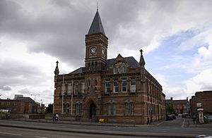
 Trafford Town Hall in Stretford |
|
| Population | 46,910 (2011 Census) |
| • Density | 9,158/sq mi (3,536/km2) |
| OS grid reference | SJ795945 |
| • London | 163 mi (262 km) SSE |
| Metropolitan borough | |
| Metropolitan county | |
| Region | |
| Country | England |
| Sovereign state | United Kingdom |
| Post town | MANCHESTER |
| Postcode district | M15, M16, M17, M32 |
| Dialling code | 0161 |
| Police | Greater Manchester |
| Fire | Greater Manchester |
| Ambulance | North West |
| EU Parliament | North West England |
| UK Parliament |
|
Stretford is a town in Trafford, Greater Manchester, England. It's located on flat land between two important canals: the River Mersey and the Manchester Ship Canal. The Bridgewater Canal also cuts through the town. Stretford is about 4 miles (6.4 km) south of Manchester and 3 miles (4.8 km) south of Salford. In 2011, about 46,910 people lived here.
Long ago, Stretford was a farming village in Lancashire. In the 1800s, it was even called Porkhampton because so many pigs were raised for the Manchester market. It was also famous for growing vegetables, sending over 500 long tons (508 t) of fresh produce to Manchester every week by 1845.
When the Manchester Ship Canal opened in 1894, and the Trafford Park industrial area grew, Stretford became much more industrial. By 2001, very few people in Stretford worked in farming.
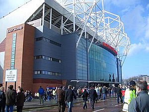
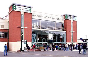
Stretford is famous for being the home of Manchester United Football Club since 1910. It's also where Lancashire County Cricket Club has played since 1864. Many well-known people have lived in Stretford, including the wealthy businessman John Rylands, the suffragette Emmeline Pankhurst, and the painter L. S. Lowry. Musicians like Morrissey from The Smiths, Ian Curtis from Joy Division, pop singer Andy Gibb, and Jay Kay from Jamiroquai also lived here.
Contents
- Stretford's Past: A Quick Look
- How Stretford is Governed
- Stretford's Location and Climate
- Who Lives in Stretford?
- Stretford's Economy
- Cool Places to See in Stretford
- Getting Around Stretford
- News and Media
- Schools in Stretford
- Religion in Stretford
- Sports in Stretford
- Public Services
- Famous People from Stretford
- See also
Stretford's Past: A Quick Look
The name Stretford comes from "street" and "ford," meaning a crossing point over the River Mersey. The main road through Stretford, the A56 Chester Road, follows an old Roman road that went from Chester to Manchester. It crosses the Mersey at Crossford Bridge, which was built where the ancient ford used to be.
The oldest signs of people living in this area are stone axes from about 2000 BC. Stretford was once part of the land of the Celtic Brigantes tribe. By 1212, there were two main land areas, or manors, in Stretford. Eventually, the de Trafford family owned all of Stretford.
From Farms to Factories
Until the early 1900s, Stretford was mostly countryside. One of its main jobs was hand-weaving cotton. At one point, 302 handlooms employed 780 workers. But by 1826, machines in Manchester's cotton mills took over, and only four handlooms were left.
As Manchester grew, it needed food, and Stretford became a huge market garden. It was known as the "garden of Lancashire" by 1836. Stretford was also famous for its pig market and making black puddings, earning it the nickname Porkhampton. A local dish called "Stretford goose" was actually pork stuffed with sage and onions!
In the mid-1800s, Stretford became a popular place to live. Big parks like the Royal Botanical Gardens opened in 1831. These gardens hosted huge events, including the Art Treasures Exhibition in 1857, which was the largest art show ever in the UK. They also held the Royal Jubilee Exhibition in 1887, celebrating Queen Victoria's 50 years as queen. Over 4.75 million people visited this exhibition! The gardens were later used for sports like speedway and greyhound racing. Today, only the entrance gates remain, which are a protected historic building.
The Rise of Industry
The opening of the Manchester Ship Canal in 1894 and the growth of the Trafford Park industrial area changed Stretford a lot. Trafford Park was the world's first planned industrial estate. Stretford's population jumped by 40% between 1891 and 1901, as people moved there for work.
During the Second World War, Trafford Park made many important war supplies, like the Avro Manchester bomber and Rolls-Royce Merlin engines for the Spitfire and Lancaster planes. Because of this, Stretford was heavily bombed, especially during the Manchester Blitz in December 1940. Many buildings were damaged, including Manchester United's Old Trafford football ground. Smoke machines were even used to try and hide Trafford Park from enemy planes. Many children were sent away to safer places. A memorial in Stretford Cemetery remembers those who died in the bombing.
In the 1970s, a place called the Hardrock Theatre and Village Discothèque in Stretford hosted famous bands like Led Zeppelin, David Bowie, and Bob Marley. Today, the Old Trafford Cricket Ground also hosts big concerts.
Travel Through Time
Stretford grew quickly because of new ways to travel. The Bridgewater Canal arrived in 1761, and the railway in 1849. When the Manchester South Junction and Altrincham Railway (MSJAR) opened in 1849, Stretford's population almost doubled in just ten years!
Because Stretford was on the main A56 road between Chester and Manchester, many travelers passed through. Inns were built for them to stop. Horse-drawn buses replaced stagecoaches in 1845. Then, in 1879, horse-drawn trams started running from Manchester to Stretford. These were replaced by electric trams in 1902, and later by buses after the Second World War.
The MSJAR railway line became part of the Manchester Metrolink tram network in 1992. The first Metrolink tram ran through Stretford on June 15, 1992.
How Stretford is Governed
Stretford was once part of the old parish of Manchester in Lancashire. In 1867, the Stretford Local Board of Health was set up to manage local services like sanitation and roads. This board was replaced by the Stretford Urban District Council in 1894.
In 1933, Stretford became the Municipal Borough of Stretford, which meant it had its own special town status. The town council got its own symbol. This symbol includes red roses for Lancashire, a lion for John of Gaunt, 1st Duke of Lancaster, and a scythe to remember the area's farming past. Thunderbolts show the importance of electricity, and a boat represents the Manchester Ship Canal.
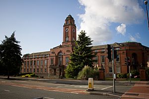
In 1974, Stretford became part of the Metropolitan Borough of Trafford in Greater Manchester. Trafford Town Hall, which used to be Stretford Town Hall, is now the main office for Trafford.
Stretford's Location and Climate
| Weather chart for Stretford | |||||||||||||||||||||||||||||||||||||||||||||||
|---|---|---|---|---|---|---|---|---|---|---|---|---|---|---|---|---|---|---|---|---|---|---|---|---|---|---|---|---|---|---|---|---|---|---|---|---|---|---|---|---|---|---|---|---|---|---|---|
| J | F | M | A | M | J | J | A | S | O | N | D | ||||||||||||||||||||||||||||||||||||
|
70
8
2
|
70
8
2
|
50
10
3
|
63
13
5
|
51
16
8
|
58
19
10
|
54
21
12
|
69
21
12
|
63
18
10
|
88
14
7
|
82
10
4
|
78
7
2
|
||||||||||||||||||||||||||||||||||||
| temperatures in °C precipitation totals in mm source: World Weather Online |
|||||||||||||||||||||||||||||||||||||||||||||||
|
Imperial conversion
|
|||||||||||||||||||||||||||||||||||||||||||||||
Stretford covers about 4.1 square miles (10.6 km2) of land, just north of the River Mersey. It's mostly flat, with a slight slope towards the river. The lowest parts of Stretford are in the Mersey's flood plain, so they used to flood often. Now, a lot of work has been done to control flooding, including making the Mersey river through Stretford straighter and building flood basins like Sale Water Park.
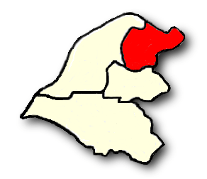
Stretford includes areas like Old Trafford, Firswood, Gorse Hill, and Trafford Park. The weather here is generally mild, without extreme temperatures. The average temperature is a bit higher than the UK average, and rainfall and sunshine are a bit lower.
The town grew along the A56 road in two main parts, which later joined together. The ancient Nico Ditch, an old earthwork, ends just east of Stretford. It was likely used as a boundary long ago.
Who Lives in Stretford?
| Stretford Compared | |||
|---|---|---|---|
| 2011 UK Census | Stretford | Trafford | England |
| Total population | 46,910 | 226,578 | 53,012,456 |
| Foreign born | 22% | 11% | 14% |
| White | 63% | 86% | 85% |
| Asian | 21% | 8% | 8% |
| Black | 8% | 3% | 4% |
| Average age | 36.0 y | 39.3 y | 39.3 y |
| Over 65 years old | 12% | 16% | 16% |
In 2011, the Stretford area had a total population of 46,910 people. The average age of residents was 36 years, which is younger than the average for all of Trafford. About 42% of people were single (never married).
About 22% of Stretford residents were born outside the United Kingdom. Also, 63% of residents were white, while 21% were Asian, and 8% were Black.
In 2011, 23% of people aged 16–74 in Stretford did not have any academic qualifications. The unemployment rate was 5.7%, which was higher than the national rate of 3.2% at the time.
| Population change in Stretford since 1801 | |||||||||||||||||||
|---|---|---|---|---|---|---|---|---|---|---|---|---|---|---|---|---|---|---|---|
| Year | 1801 | 1811 | 1821 | 1831 | 1841 | 1851 | 1861 | 1871 | 1881 | 1891 | 1901 | 1911 | 1921 | 1931 | 1939 | 1951 | 1961 | 1971 | 2001 |
| Population | 1,477 | 1,720 | 2,173 | 2,463 | 3,524 | 4,998 | 8,757 | 11,945 | 19,018 | 21,751 | 30,436 | 42,496 | 46,535 | 56,791 | 51,929 | 61,874 | 60,364 | 54,316 | 37,455 |
| Source: A Vision of Britain through Time | |||||||||||||||||||
Stretford's Economy
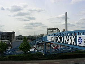
For a long time, Stretford was mainly a farming village. But the growth of the Trafford Park industrial area in the late 1800s changed everything. At its busiest in 1945, Trafford Park employed about 75,000 people! New homes and services had to be built for all these workers. Today, Trafford Park is still a major place for jobs, with about 1,400 companies and 44,000 workers.
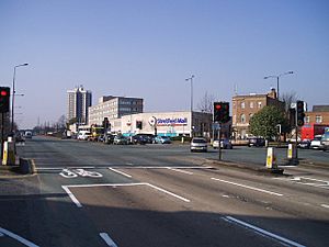
The main shopping area in Stretford is the Stretford Mall, which used to be called Stretford Arndale. It opened in 1969. The huge The Trafford Centre shopping and entertainment complex is also nearby, about 2.5 miles (4.0 km) away.
In 2011, most people in Stretford worked in retail and wholesale (17%), health and social work (11%), or education (11%). Only a very small number (0.06%) worked in agriculture.
Cool Places to See in Stretford
Longford Cinema
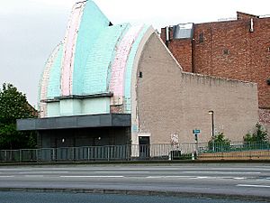
The Longford Cinema is a very striking building in Stretford. It was designed in the popular Art Deco style and opened in 1936. Its unique front, which looks a bit like a cash register, was meant to show that movies are a business.
The cinema had many modern features, like sound-proofing and heating under the seats. It was also the first cinema in Britain to use hidden neon lights. It could seat 1,400 people in the main area and 600 in the balcony. During the Second World War, it hosted concerts, even one by a young Julie Andrews. The Hallé Orchestra also played here after their own hall was bombed.
The cinema closed in 1965 and became a bingo hall until 1995. Since then, the building has been empty. It's now a protected historic building. There are plans to bring it back to life as part of a new university, University Academy 92.
The Great Stone
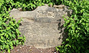
The Great Stone, which gave its name to Great Stone Road, is an easily missed landmark. It's a large, rectangular stone, likely left behind by a glacier. It has two deep slots cut into its top.
People have many ideas about the stone's history. During the Great Plague in 1655–56, people believed that if they passed coins through the holes filled with vinegar or holy water, it would stop the disease. But the holes might be too deep for that to be its original purpose. It could have been a marker on a Roman road or a boundary marker. Some also think it was the base of an Anglo-Saxon cross. A local legend says the stone is slowly sinking, and when it disappears, the world will end!
The stone was moved in 1925 to its current spot outside Gorse Hill Park. It is also a protected historic building.
Stretford Cenotaph
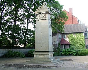
The Stretford Cenotaph is a war memorial opposite Gorse Hill Park. It was built to remember the 580 men from Stretford who died in the First World War. Their names are on a large bronze plaque behind the memorial. It was officially opened in 1923.
The cenotaph is 24 feet (7 m) tall and cost £2,000 to build, raised by public donations. It has the words "They died that we might live" and "In memory of the heroic dead." It is a protected historic building. Each year, a remembrance parade ends here, with local groups gathering around the cenotaph.
Longford Park
For more information, see Longford Park
Stretford Public Hall
Stretford Public Hall was built in 1878 by John Rylands. It was designed by N. Lofthouse. Stretford's first public library opened here in 1883. After Rylands died, his wife let the local council use the building for a very low rent. After she died, the council bought it.
Public baths were built behind the hall. In 1940, a new library opened, and the public hall was no longer needed for that purpose. It reopened in 1949 as the Stretford Civic Theatre. The baths wing was later torn down. The main building started to fall apart, even though it was a protected historic building. But in the 1990s, Trafford Council fixed it up to use as offices. It reopened in 1997 as Stretford Public Hall again.
Stretford Cemetery
Stretford Cemetery was designed by John Shaw and opened in 1885. Its chapel is quite fancy, built in the Decorated style. There's a memorial here for those who died in the Second World War.
Trafford Town Hall
Trafford Town Hall is a large building at the corner of Talbot Road and Warwick Road, right across from the Old Trafford Cricket Ground. Building started in 1931.
The town hall officially opened as Stretford Town Hall in 1933. In 1974, when the new Trafford Metropolitan Borough was formed, it became the main office for the new council and was renamed Trafford Town Hall. It was made a protected historic building in 2007.
Union Church
The Union Church was started in 1862 by John Rylands. He laid the first stone for its building in 1867. Later, the church building was turned into offices. But in 2012, it was bought by the Church of Christ – Iglesia ni Cristo and became a church again.
Getting Around Stretford
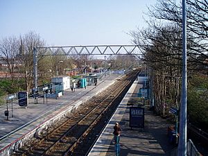
Stretford Metrolink station is part of the Manchester Metrolink tram system. Trams run frequently, connecting Stretford to places like Altrincham and Bury.
The closest train station is Trafford Park. Trains run about every two hours between Liverpool and Manchester.
The Trafford Park Euroterminal is a large rail freight terminal in Stretford. It opened in 1993 and can handle 100,000 containers a year. The large cranes used there can sometimes be noisy for local residents.
Stretford has good access to motorways. Junction 7 of the M60 is just north of Stretford. The A56 road also provides easy access south and to Manchester city centre.
There are also cycle paths in Stretford as part of the Trafford cycle plan.
Manchester Airport, one of the busiest airports outside London, is about nine miles (14 km) south of Stretford. You can get there by bus or tram, though the tram requires a change at Cornbrook.
News and Media
Local news and TV shows for Stretford come from BBC North West and ITV Granada.
You can listen to local radio stations like BBC Radio Manchester (95.1 FM), Heart North West (105.4 FM), and Smooth North West (100.4 FM).
The local newspaper for the town is The Stretford & Urmston Messenger.
Schools in Stretford
Like the rest of Trafford, Stretford has a selective education system. This means students take an 11-plus exam to get into certain schools.
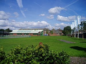
In 2006, 98.3% of students at Stretford Grammar School got five or more good GCSEs. This was much higher than the average for Trafford. Many students at Stretford Grammar and Stretford High School have a first language other than English. Stretford Grammar became a specialist Science College in 2005 and was rated "good" by Ofsted in 2015.
Stretford High School Community Languages College has improved a lot over the years. In 2008, Ofsted rated it "outstanding."
Stretford also has Lostock High School, which is a specialist Arts College.
Plans were announced in 2017 to build a new university in Stretford called University Academy 92. It will be a branch of Lancaster University and hopes to welcome its first students in 2019.
Religion in Stretford
| Stretford Compared | |||
|---|---|---|---|
| 2001 UK Census | Stretford | Trafford | England |
| Total population | 46,910 | 226,578 | 53,012,456 |
| Christian | 51.2% | 63.4% | 59.4% |
| Muslim | 18.4% | 5.7% | 5.0% |
| Sikh | 2.7% | 0.7% | 0.8% |
| Hindu | 0.8% | 1.0% | 1.5% |
| Buddhist | 0.3% | 0.3% | 0.5% |
| Jewish | 0.2% | 1.1% | 0.5% |
| No religion | 19.7% | 21.2% | 24.7% |
We don't know when the first church was built in Stretford, but a document from 1413 mentions land next to a chapel. Many of the churches you see today were built in the late 1800s and early 1900s as Stretford grew.
Methodism was very important in Stretford in the 1800s. Today, there are 17 churches in town, including five Roman Catholic churches.
In 2011, 51% of Stretford residents said they were Christian, 18% were Muslim, and 3% were Sikh. About 20% said they had no religion.
Stretford is part of the Roman Catholic Diocese of Salford and the Anglican Diocese of Manchester.
There are two protected historic churches in Stretford: the Church of St Ann and the Church of St Matthew. St Ann's is a Roman Catholic church built in 1862–67. St Matthew's church was built in 1842 in the Gothic Revival style.
Sports in Stretford
Stretford has been the home of Manchester United Football Club since 1910, when they moved to their Old Trafford ground. The western side of the stadium is still unofficially called the Stretford End.
Old Trafford was originally the home of Manchester Cricket Club. It became the home of Lancashire County Cricket Club in 1864. This ground has hosted international Test cricket matches since 1884. One end of the cricket ground is also called the Stretford End. After a big match in 2005, the club decided to increase the stadium's capacity from 20,000 to 25,000. There are plans to redevelop the ground with new facilities.
Stretford Stadium, next to Longford Park, is where Trafford Athletic Club trains. This club is one of the best in the UK, with many members who have competed internationally.
The Stretford Sports Village has two main centres: the Chester Centre and the Talbot Centre (at Stretford High School). It's located between Manchester United's Old Trafford stadium and Lancashire County Cricket Club's Old Trafford ground. The centres have swimming pools, gyms, badminton courts, five-a-side football courts, and outdoor pitches. The Trafford Water Sports Centre is also nearby.
Public Services
Greater Manchester Police is in charge of policing in Stretford. Their main office for Trafford is also in Stretford.
Local authorities manage waste disposal through the Greater Manchester Waste Disposal Authority.
Healthcare is provided by the NHS, with hospitals in nearby Urmston and Wythenshawe. Ambulance stations are in Urmston and Sale.
The Greater Manchester Fire and Rescue Service (GMFRS) provides fire and rescue services. One of their fire stations is in Stretford, near the Trafford Centre.
Famous People from Stretford
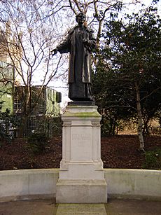
John Holker, one of the world's first industrial spies, was born in Stretford in 1719.
Two very famous residents were the suffragette Emmeline Pankhurst and the painter L. S. Lowry, who was born in Stretford in 1887. The wealthy businessman John Rylands and his wife lived at Longford Hall in Stretford. Herschel Lewis Austin, a socialist politician, was a Member of Parliament for Stretford from 1945 to 1950.
Sir Walter Baldwin Spencer, a British-Australian biologist and anthropologist, was born in Stretford. Other famous people include Martin Fry, the lead singer of ABC, rock climber Derek Hersey, and actor John Comer from Last of the Summer Wine.
Many Manchester United players, including some who died in the Munich air disaster in 1958, lived in a house at 19 Gorse Avenue. A blue plaque was put on the house by former player Sir Bobby Charlton to remember its connection to Manchester United.
The singer and songwriter Jason Kay (Jay Kay), lead vocalist of Jamiroquai, was also born in Stretford.
See also
 In Spanish: Stretford para niños
 | Bayard Rustin |
 | Jeannette Carter |
 | Jeremiah A. Brown |


