Washington County, Utah facts for kids
Quick facts for kids
Washington County
|
|
|---|---|
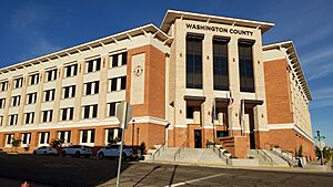
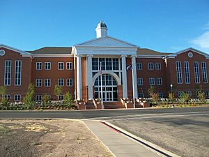
Washington County administration building, November 2023
|
|
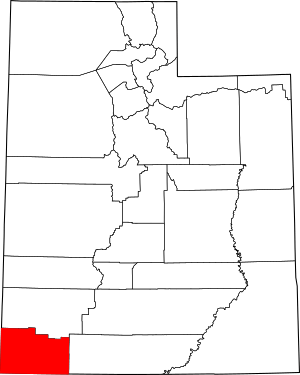
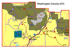
Location within the U.S. state of Utah
|
|
 Utah's location within the U.S. |
|
| Country | |
| State | |
| Founded | March 3, 1852 |
| Named for | George Washington |
| Seat | St. George |
| Largest city | St. George |
| Area | |
| • Total | 2,430 sq mi (6,300 km2) |
| • Land | 2,426 sq mi (6,280 km2) |
| • Water | 3.6 sq mi (9 km2) 0.1% |
| Population
(2020)
|
|
| • Total | 180,279 |
| • Estimate
(2023)
|
202,452 |
| • Density | 74.19/sq mi (28.64/km2) |
| Time zone | UTC−7 (Mountain) |
| • Summer (DST) | UTC−6 (MDT) |
| Congressional district | 2nd |
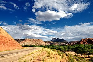
Washington County is a special area, like a big district, located in the very southwest part of Utah, United States. In 2020, about 180,279 people lived here. This makes it the fifth-biggest county in Utah by population. Its main city and biggest town is St. George.
The county was created in 1852 and officially set up in 1856. It is named after George Washington, who was the first President of the United States. Part of the Paiute Indian Reservation is also found in the western part of Washington County. Washington County is also known as the St. George Metropolitan Area, which means it's a busy region with St. George as its center.
Contents
Exploring Washington County's Past
The first settlement in Washington County was Fort Harmony in 1852. Then, Santa Clara was started in 1854. It was a mission to the native people living near the Santa Clara River.
Early Settlements and Cotton Farming
Other towns like Hamblin and Pinto were settled along the Los Angeles - Salt Lake Road in 1856. Gunlock followed in 1857.
Later, more towns were built to grow cotton before the American Civil War (1861-1865). These towns were along the Virgin River in a warm area called "Utah's Dixie". Virgin and Washington were settled in 1857. Other towns like Toquerville and St. George were founded in the years that followed.
Challenges and Changes
A big flood in 1862, after 44 days of rain, damaged many of these early settlements. Some towns, like Fort Harmony, were abandoned. New towns like New Harmony and Springdale were started by people who had to leave their flooded homes.
Shoal Creek, later called Hebron, was a ranching community from 1862. Leeds was settled in 1867. Silver Reef was a mining town that grew in 1875 but was left empty by 1891 when silver prices dropped.
How the County Was Formed
The government of Utah Territory officially created Washington County on March 3, 1852. For the first four years, it was managed by Iron County to the north. On February 23, 1856, Washington County was fully organized. St. George became its main city and the place for its courthouse. The county's borders changed many times but have been the same since 1892.
Understanding Washington County's Landscape
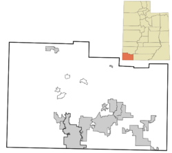
Washington County is in the very southwest corner of Utah. It shares borders with Arizona to the south and Nevada to the west. The land is rugged and dry, with only a small part used for farming. It has a mix of mountains and flat areas.
The land slopes down to the south and west. The lowest point in Utah is in Washington County, in the Beaver Dam Wash. This spot is about 2,178 feet (664 meters) above sea level. The highest point in the county is Signal Peak in the Pine Valley Mountains, which is 10,369 feet (3,160 meters) high. The county covers a total area of about 2,430 square miles.
Washington County has three main types of land:
- The Colorado Plateau in the east and northeast.
- The Great Basin in the northwest.
- The Mojave Desert in the south and southwest.
Exploring the St. George Area
Most people in Washington County live in the south-central part, near the Arizona border, around St. George. You can find many shops, restaurants, and hotels here, along with local businesses. The weather in this area is like the Mojave Desert; it's very hot and dry, getting only about 8 inches of rain each year.
Many homes are in new neighborhoods as the area grows. In Downtown St. George, there are local restaurants and shops that attract both locals and visitors. To help manage growth, new buildings are being planned in the center of St. George. Downtown is also home to Utah Tech University, the only four-year college nearby. Dixie High School is also in the downtown area.
More businesses and factories are in the eastern part of St. George and Washington. This area also has fast-growing neighborhoods, especially in a place called Washington Fields. Large farms have been sold to build more homes and businesses. Pine View High School serves this eastern side. A new high school, Crimson Cliffs High School, has also been built in Washington Fields to help with the growing number of students.
The western part of the urban area includes the towns of Santa Clara and Ivins. It also has neighborhoods like Green Valley and Tonaquint. Because this area is close to Snow Canyon State Park, many fancy resort-style communities have been built here. These often have expensive homes. However, there are still many other neighborhoods with more affordable houses. Snow Canyon High School serves this part of the county.
The southern part of St. George has neighborhoods like Bloomington and SunRiver. Desert Hills High School is in this area. There are fewer new buildings here because of the land. The SR-7 freeway, called Southern Parkway, helps with traffic and connects to St. George Regional Airport. In the future, it will link to Hurricane, making it easier to get to Zion National Park.
The northern part of St. George is mostly undeveloped because of the Red Cliffs National Conservation Area. This area protects endangered wildlife and the desert. The only communities here are The Ledges and Winchester Hills in the west, and Green Springs in the east. The Ledges is a newer development with homes that have amazing views of Snow Canyon State Park. Green Springs is a fancy area with a golf course and many nice homes.
To the east of the main St. George area are the cities of Hurricane and La Verkin. These towns are more rural and have farms, but they are also growing quickly with new businesses and homes. Hurricane High School serves this area.
Areas Outside the Main Cities
Most of Washington County is rural, meaning it's not a big city.
In the middle and north of the county, there are fewer people. The towns of Central and Pine Valley are popular for vacations. They have cabins and parks because they are in Dixie National Forest and the Pine Valley Mountains. Veyo and Dammeron Valley are mostly ranching towns with large plots of land. This central area is wetter and more humid because it's higher up and gets more rain.
The northern part of Washington County is semi-dry. The only official town here is Enterprise, with about 1,700 people. Enterprise has the only high school outside the St. George area, Enterprise High School. It's a quiet, rural town.
Western Washington County has Gunlock, another ranching town. It also has a small Native American reserve called Shivwits, home to the Shivwits Band of Paiutes. This area also holds the lowest point in Utah, Beaver Dam Wash.
Eastern Washington County is also not very populated. However, the towns of Rockville and Springdale have many hotels and resorts. This is because they are very close to Zion National Park, which is one of the most visited national parks in the United States. Tourism is the main source of money for these towns.
The county also includes an area called Mountain Meadows, which is part of the Old Spanish Trail.
Main Roads in Washington County
 Interstate 15
 State Route 7
 State Route 9
 State Route 17
 State Route 18
 State Route 59
 State Route 219
Neighboring Counties
- Iron County - north
- Kane County - east
- Mohave County, Arizona - south
- Lincoln County, Nevada - west
Protected Natural Areas
- Beaver Dam Wash National Conservation Area
- Dixie National Forest (part)
- Quail Creek State Park
- Red Cliffs National Conservation Area
- Sand Hollow State Park
- Snow Canyon State Park
- Zion National Park (part)
There are also 18 official wilderness areas in Washington County. These are special places where nature is protected and kept wild. Many of them are managed by the Bureau of Land Management (BLM).
People and Population
| Historical population | |||
|---|---|---|---|
| Census | Pop. | %± | |
| 1860 | 691 | — | |
| 1870 | 3,064 | 343.4% | |
| 1880 | 4,235 | 38.2% | |
| 1890 | 4,009 | −5.3% | |
| 1900 | 4,612 | 15.0% | |
| 1910 | 5,123 | 11.1% | |
| 1920 | 6,764 | 32.0% | |
| 1930 | 7,420 | 9.7% | |
| 1940 | 9,269 | 24.9% | |
| 1950 | 9,836 | 6.1% | |
| 1960 | 10,271 | 4.4% | |
| 1970 | 13,669 | 33.1% | |
| 1980 | 26,065 | 90.7% | |
| 1990 | 48,560 | 86.3% | |
| 2000 | 90,354 | 86.1% | |
| 2010 | 138,115 | 52.9% | |
| 2020 | 180,279 | 30.5% | |
| 2023 (est.) | 202,452 | 46.6% | |
| US Decennial Census 1790–1960 1900–1990 1990–2000 2010–2018 2019 2020 |
|||
Population Facts from 2020
In 2020, Washington County had 180,279 people. This means there were about 74 people for every square mile. About 81.8% of the people were White. Other groups included African American, Native American, Asian, and Pacific Islander people. About 11.4% of the people were Hispanic or Latino.
There were slightly more females (50.57%) than males (49.43%). About 26.4% of the population was under 18 years old. The average age of people in the county was 37.6 years.
There were 62,416 households, with an average of 2.89 people per household. Most households (74.9%) were families. About 73% of households owned their homes, while 27% rented.
The average income for a household in Washington County was $61,747. For families, it was $72,683. About 10% of the population lived below the poverty line.
Most adults in Washington County have at least a high school diploma. Many have also attended college or earned a degree.
Religious Beliefs
In 2000, most residents (92.5%) were members of The Church of Jesus Christ of Latter-day Saints. Other religions included Catholic (4.1%) and various Protestant faiths.
Learning and Education
Washington County has many schools for kids of all ages, managed by the Washington County School District. The county is also home to Utah Tech University in St. George. This university also has smaller campuses in Hurricane and Hildale.
Utilities and Services
Different companies provide important services in Washington County. These include city departments for water and power, Dixie Power, Rocky Mountain Power, and Dominion Energy for natural gas. The Washington County Water Conservancy District helps manage water resources.
Communities in Washington County
Washington County has several cities, towns, and smaller communities.
Cities
- Enterprise
- Hildale
- Hurricane
- Ivins
- La Verkin
- Santa Clara
- St. George (county seat)
- Toquerville
- Washington
Towns
Census-Designated Places
These are areas that are like towns but are not officially incorporated as cities or towns.
- Central
- Dammeron Valley
- Pine Valley
- Veyo
Unincorporated Communities
These are smaller communities that are not part of any city or town.
Past Communities
Some communities that once existed in Washington County are now abandoned or have been absorbed into larger cities.
- Adventure
- Atkinville (now part of St. George)
- Bloomington (now part of St. George)
- Duncan's Retreat
- Fort Harmony
- Grafton
- Hamblin
- Harrisburg (now part of Hurricane)
- Hebron
- Middleton (now part of St. George)
- Northrop (now part of Springdale)
- Price City (originally Heberville; now part of St. George)
- Shem
- Shunesburg (or Shonesburg)
- Silver Reef (now part of Leeds)
- Tonaquint (now part of St. George)
See also
 In Spanish: Condado de Washington (Utah) para niños
 | Emma Amos |
 | Edward Mitchell Bannister |
 | Larry D. Alexander |
 | Ernie Barnes |


