
Andover, Massachusetts facts for kids
Quick facts for kids
Andover, Massachusetts
Cochichawick
|
|||
|---|---|---|---|

Andover's Old Town Hall, located in downtown Andover
|
|||
|
|||
| Nickname(s):
Massachusett
|
|||
| Motto(s):
"Home of America"
|
|||

Location in Essex County and the state of Massachusetts
|
|||

Andover, Massachusetts
Location in Massachusetts

Andover, Massachusetts
Location in the United States

Andover, Massachusetts
Location in North America
|
|||
| Country | United States | ||
| State | Massachusetts | ||
| County | Essex | ||
| Region | New England | ||
| Settled | 1634 | ||
| Incorporated | 1646 | ||
| Current geography | 1855 | ||
| Government | |||
| • Type | Open town meeting | ||
| Area | |||
| • Total | 32.1 sq mi (83.2 km2) | ||
| • Land | 31.0 sq mi (80.3 km2) | ||
| • Water | 1.1 sq mi (2.9 km2) | ||
| Elevation | 180 ft (55 m) | ||
| Population
(2020)
|
|||
| • Total | 36,569 | ||
| • Density | 1,179.6/sq mi (455.4/km2) | ||
| Time zone | UTC−5 (Eastern) | ||
| • Summer (DST) | UTC−4 (Eastern) | ||
| ZIP Code |
01810
|
||
| Area code(s) | 351/978 | ||
| FIPS code | 25-01465 | ||
| GNIS feature ID | 0619444 | ||
| Website | The Official Website of Andover, Massachusetts: http://www.andoverma.gov/ | ||


Andover is a town in Essex County, Massachusetts, United States. It was settled in 1642 and became an official town in 1646. In 2020, about 36,569 people lived there. Andover is located about 20 miles (32 km) north of Boston. It is also about 4 miles (6 km) south of Lawrence. Andover is connected to a town with the same name in England: Andover, Hampshire.
Contents
History of Andover
Early Native American Life
For thousands of years, Native Americans lived in what is now northeastern Massachusetts. When Europeans arrived, the Massachusett and Naumkeag lived south of the Merrimack River. The Pennacook people lived north of the river.
The Massachusett people called the Andover area Cochichawick. In 1649, the Massachusett leader, Cutshamache, sold this land to English settlers. He sold it to Mr. John Woodbridge for six pounds and a coat. The agreement also allowed the Massachusett people to catch alewives (a type of fish) in the Cochichawick River.
How Andover Was Founded
In 1634, the Massachusetts General Court set aside land in Essex County for a new settlement. This land included parts of what is now Andover. To encourage people to move there, early settlers did not have to pay taxes for three years.
The first permanent settlement in Andover began in 1642. John Woodbridge and other settlers from Newbury and Ipswich started it. They bought land from the Massachusett leader, Cutshamekin. They paid "six pounds of currency and a coat." They also agreed that a local group of Native Americans could plant corn and fish for alewives. A small stream, Roger's Brook, is named after the leader of this group.
In May 1646, the settlement officially became a town and was named Andover. This name likely came from Andover in England. Some of the first settlers were from that English town. The first town meeting happened in 1656.
The Salem Witch Trials and Andover
During the Salem Witch Trials in 1692, Andover had a difficult time. A resident named Joseph Ballard asked for help for his sick wife. Girls from nearby Salem Village were identifying witches. These girls claimed that several Andover people had bewitched Elizabeth Ballard.
More than 40 Andover citizens were accused of witchcraft. Most of them were women and their children. Three Andover residents were found guilty and executed. Their names were Martha Carrier, Mary Parker, and Samuel Wardwell. Five others were found guilty but not executed.
Later, in 1713, the convictions of those found guilty were officially reversed. This happened after families asked for their names to be cleared.
How Andover Divided into Two Towns
By 1705, more people were moving to the southern part of Andover. They wanted a new meeting house there. People in the north, near the original meeting house, did not like this idea.
In 1709, the government divided Andover into two church areas: North and South. The South Parish built its own South Church. Even with this split, the town stayed as one political area.
Andover was once one of the largest towns in Massachusetts. In 1826, a third church area, West Parish, was created.
In 1855, Andover officially split into two separate towns. The West and South parishes became the town of Andover. The North Parish became North Andover. People still debate how the names were chosen.
Andover During the American Revolution
On April 19, 1775, about 350 men from Andover marched towards Lexington. They did not arrive in time for the first battle. However, they fought in the Battle of Bunker Hill two months later. They also fought in other battles during the war.
Samuel Phillips Jr. was an important person from Andover. He founded Phillips Academy in 1778. He also helped write the Massachusetts state constitution.
During the burning of Charlestown in 1775, Andover townspeople climbed Holt Hill to watch. Holt Hill is the highest point in Essex County. It is 420 feet (128 meters) high.
Andover After the Revolution
In 1798, a man named David Brown protested against new laws. He was arrested in Andover. He was fined and sent to prison. His case was important because it was one of the first under the new Sedition Act.
Train Accident in 1853
On January 4, 1853, a sad accident happened in Andover. Benjamin "Bennie" Pierce, the 11-year-old son of President-elect Franklin Pierce, died in a train crash. The train was going 40 miles per hour (64 km/h) when an axle broke. Benjamin was the only person killed.
Andover and the Civil War
Many people in Andover supported the movement against slavery. William Jenkins and others helped runaway slaves on the Underground Railroad. Harriet Beecher Stowe, who wrote Uncle Tom's Cabin, lived in Andover for a long time. Her home is now owned by Phillips Academy.
When the Civil War began in 1861, 79 volunteers from Andover joined the army. By the end of the war in 1865, 600 Andover men had served in the Union Army.

Shawsheen Village: A Model Town
In 1919, the American Woolen Company planned to build a large mill in Frye Village. They renamed the area "Shawsheen." This village was rebuilt as a "model industrial community." It became the company's main office.
The mill opened in 1922. Soon, the village had over 200 houses and many community buildings. Employees rented their homes from the company. Brick houses were for managers, and wooden houses were for other workers.
This "perfect" village did not last long. By the early 1940s, most buildings were privately owned. The mills closed in 1953 because new materials replaced wool. Today, the old mill buildings are used for businesses, homes, and apartments.
Andover's Geography
Andover covers about 32.1 square miles (83.2 km2). Most of this is land, and a small part is water. Important water areas include the Shawsheen River, Fosters Pond, and Haggetts Pond. Haggetts Pond is the town's water supply. Water from the Merrimack River is added to it. The Merrimack River forms half of Andover's northern border.
Andover is also home to parts of the Harold Parker State Forest. The Trustees of Reservations' Charles W. Ward Reservation is also here. The town's Conservation Commission and a group called A.V.I.S. protect about 3000 acres of land.
Andover's town center is about four miles south of Lawrence. It is 22 miles (35 km) north of Boston. Andover borders Lawrence to the north and North Andover to the northeast. It also borders North Reading, Wilmington, and Tewksbury.
Climate in Andover
Andover, Massachusetts, has a typical New England climate. Temperatures usually fall below 50°F (10°C) for about 195 days each year. The town gets about 44.6 inches (113 cm) of rain per year. This is a high amount for the U.S. Snow covers the ground for about 62 days each year.
Getting Around Andover
Andover is where two major highways, Interstate 93 and Interstate 495, meet. Route 28 is the main road that goes through the town from north to south.
Andover has two train stops: Ballardvale and Andover. These stops are on the Haverhill/Reading Line of the MBTA Commuter Rail. This train line goes from Haverhill to Boston's North Station.
For air travel, the closest small airport is Lawrence Municipal Airport. For bigger flights, you can go to Logan International Airport in Boston or Manchester–Boston Regional Airport in New Hampshire. Both are within 30 miles (48 km) of Andover.
People of Andover
| Historical population | ||
|---|---|---|
| Year | Pop. | ±% |
| 1790 | 2,863 | — |
| 1800 | 2,941 | +2.7% |
| 1810 | 3,164 | +7.6% |
| 1820 | 3,889 | +22.9% |
| 1830 | 4,530 | +16.5% |
| 1840 | 5,207 | +14.9% |
| 1850 | 6,945 | +33.4% |
| 1860 | 4,765 | −31.4% |
| 1870 | 4,873 | +2.3% |
| 1880 | 5,169 | +6.1% |
| 1890 | 6,142 | +18.8% |
| 1900 | 6,813 | +10.9% |
| 1910 | 7,301 | +7.2% |
| 1920 | 8,268 | +13.2% |
| 1930 | 9,969 | +20.6% |
| 1940 | 11,122 | +11.6% |
| 1950 | 12,437 | +11.8% |
| 1960 | 17,134 | +37.8% |
| 1970 | 23,695 | +38.3% |
| 1980 | 26,370 | +11.3% |
| 1990 | 29,151 | +10.5% |
| 2000 | 31,247 | +7.2% |
| 2010 | 33,201 | +6.3% |
| 2020 | 36,569 | +10.1% |
| 2022 | 36,363 | −0.6% |
Source: United States Census records and Population Estimates Program data. 1790–1840 |
||
In 2000, there were 31,247 people living in Andover. There were 11,305 households and 8,490 families. About 40.3% of households had children under 18. Most households (65.6%) were married couples.
The population was spread out by age. About 28.8% were under 18. About 12.3% were 65 or older. The average age was 40 years.
Andover's Economy
Several companies have their main offices in Andover. These include Mercury Systems and Vicor Corporation. Many large international companies also have offices here. Some of these are Schneider Electric, Pfizer, and Raytheon Technologies.
The Internal Revenue Service (IRS) has a large office in Andover. This office used to process tax forms from many states. Now, more people file taxes online. The Andover IRS building was updated in 2009 to be more environmentally friendly.
Fun Places to Visit
Points of Interest
- Phillips Academy: This is a famous prep school founded in 1778. Many well-known people have graduated from here.
- Addison Gallery of American Art: This art museum is on the Phillips Academy campus. It is open to the public.
- The Andover Inn: An inn located on the Phillips Academy campus.
- Raytheon: A large factory in Andover that builds the Patriot Missile.
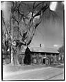
- Chandler-Bigsby-Abbot House: Built in 1673, this is the oldest house in Andover.
- Andover Village Improvement Society (AVIS): This is the second oldest land preservation group in the country. It protects over 1100 acres (4.5 km2) of land in Andover.
- Dundee Park: An old mill area that is now a business park.
- Harold Parker State Forest: A large forest located on the border of Andover, Middleton, and North Reading.
Education in Andover

Public Schools
Andover has public schools for all ages:
- Preschools: Shawsheen Preschool Program
- Elementary Schools (Kindergarten to 5th grade): Bancroft, West Elementary, South, Sanborn, High Plain
- Middle Schools (6th to 8th grade): Doherty, West Middle, Wood Hill
- High Schools (9th to 12th grade): Andover High School
- Greater Lawrence Technical School: This school serves grades 9-12 and offers technical training.
Private Schools
- Saint Augustine's Catholic School: Serves grades K-8.
- The Pike School: Serves grades Pre-K-9.
- Phillips Academy: Serves grades 9-12 (and Post-Grad).
- Andover School of Montessori
Higher Education
- Massachusetts School of Law
Famous People from Andover
- Abiel Abbot, a clergyman and author.
- Robert Abisi, known as DJ Lost Kings.
- Benjamin Abbot, a teacher at Phillips Academy.
- Amos Abbott, a U.S. Congressman.
- John Adams, a teacher at Phillips Academy.
- Ed Anuff, an entrepreneur and author.
- Harriette Newell Woods Baker, an author of many short stories.
- Anne Bradstreet, a 17th-century poet.
- Lorraine Broderick, an Emmy-award winning writer.
- Bill Buckner, a former Red Sox baseball player.
- Steven T. Byington, an American writer.
- Sumner Carruth, a Civil War officer.
- Michael Casey, a poet.
- Michael Chiklis, an actor known for The Shield.
- Andrew Coburn, an author.
- Bill Cunliffe, a Grammy Award-winning composer and jazz pianist.
- S.E. Cupp, a television host and writer.
- Ed Doherty, a football coach.
- Annalisa Drew, a freestyle skier and Olympic athlete.
- Barry Finegold, a former member of the Massachusetts House of Representatives.
- Dudley Fitts, an educator, critic, and poet.
- Abiel Foster, a clergyman and U.S. Congressman.
- Joseph Frye, a brigadier general in the Continental Army.
- Ryan Hanigan, a former Colorado Rockies baseball player.
- Kara Hayward, a teen actress known for Moonrise Kingdom.
- Jon B. Higgins, a Carnatic and Jazz musician.
- Jeremiah Ingalls, an early American folk composer.
- Martin Johnson, lead singer and guitarist for the band Boys Like Girls.
- Howard Koh, a former U.S. Assistant Secretary for Health.
- Priscilla Lane, an actress known for Arsenic and Old Lace.
- Jonathan Leavitt, a founder of a New York City publishing house.
- Jay Leno, an entertainer known for The Tonight Show.
- Jim Loscutoff, a former Boston Celtics basketball player.
- Raphe Malik, an American jazz trumpeter.
- Mary McGarry Morris, a prize-winning author.
- Jimmy McLane, an Olympic swimmer.
- Paul Monette, a prize-winning author.
- Marcus Morton, a Chief Justice of the Massachusetts Supreme Judicial Court.
- Mike Mullen, a United States Navy Admiral.
- Bill O'Brien, an NFL coach.
- Samuel Osgood, the first United States Postmaster General.
- Betty Ong, a flight attendant on American Airlines Flight 11 who reported the September 11, 2001 hijackings.
- E. J. Perry, a college football quarterback.
- Samuel Phillips, the first pastor of the South Church.
- Salem Poor, a freed slave and Revolutionary War soldier.
- Jenny Powers, an actress on Broadway.
- Jim Rice, a former Boston Red Sox player and Hall of Famer.
- Blanchard Ryan, an actress known for Open Water.
- John Smith, a mill owner and abolitionist.
- Samuel Francis Smith, who wrote America while a student in Andover.
- Harriet Beecher Stowe, author of Uncle Tom's Cabin, buried in Andover.
- George L. Street, III, a World War II Medal of Honor recipient.
- Dan Sullivan, a former NFL lineman.
- Susan Tucker, a former Massachusetts politician.
- Robert Urich, an actor known for TV series like "Vega$".
- Elizabeth Stuart Phelps Ward, a 19th-century author.
- Mike Yastrzemski, a professional baseball outfielder.
Images for kids
-
Benjamin Abbott farmhouse, Andover, 1934

