Armenian highlands facts for kids
Quick facts for kids Armenian highlands |
|
|---|---|
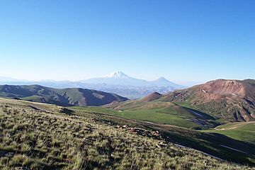
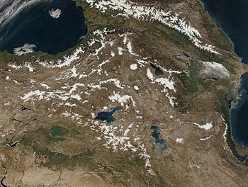
The Armenian highlands near the Iran–Turkey border
|
|
| Highest point | |
| Peak | Mount Ararat (Turkey) |
| Elevation | 5,137 m (16,854 ft) |
| Dimensions | |
| Area | 400,000 km2 (150,000 sq mi) |
| Geography | |
| Countries | Armenia
, Azerbaijan , Iran and Turkey |
| Range coordinates | 39°17′01″N 43°22′19″E / 39.28361°N 43.37194°E |
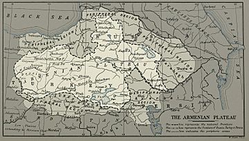
The Armenian Highlands (Armenian: Հայկական լեռնաշխարհ, romanized: Haykakan leṙnašxarh) is a large, high plateau in West Asia. It's often called the Armenian upland or Armenian plateau. This region is one of the highest plateaus in the northern part of West Asia.
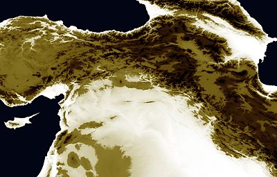
The Armenian Highlands are surrounded by other important areas. To the west is the Anatolian plateau, to the north are the Caucasus mountains, and to the east are the Kura-Aras lowlands and the Iranian Plateau. To the southwest is Mesopotamia. The highlands are split into western and eastern parts by the Ararat Plain, where the famous Mount Ararat stands tall.
In ancient times, during the Iron Age, this region was known by names like Ararat or Urartu. Later, it was called Armenia Major. This area has always been very important to the Armenian people. Today, the Armenian Highlands are divided among several countries: Armenia, Azerbaijan, Iran, and Turkey.
Contents
Exploring the Geography of the Armenian Highlands
The Armenian Highlands are part of a huge mountain system called the Alpide belt. This system stretches across Eurasia. The total area of the Armenian Highlands is about 400,000 square kilometers (about 154,000 square miles).
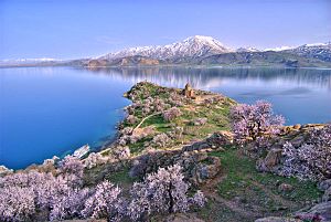
This region has seen a lot of volcanic activity over time. This means there have been many volcanoes erupting here. These eruptions created large volcanic mountains and chains of mountains. Also, movements in the Earth's crust formed three big lakes in the Highlands: Lake Sevan, Lake Van, and Lake Urmia. The Armenian Highlands also have many rivers and other water sources.
A main mountain range, called the Anti-Taurus, runs through the middle of the Armenian plateau from west to east. This range ends near the peaks of Mount Ararat.
To the west, the Anatolian plateau slowly rises and connects with the Armenian Highlands. To the northeast are the Caucasus mountains, with the Kura river forming a boundary. To the southeast is the Iranian plateau, where the land drops quickly. To the southwest lies Mesopotamia, also known as the Fertile Crescent.
According to some experts, the Armenian Highlands cover a large part of what is now Turkey. They also include all of Armenia, parts of southern Georgia, and western Azerbaijan. The northeastern parts are sometimes called the Lesser Caucasus, which is a center of Armenian culture.
A Look at the People of the Highlands
The Armenian Highlands are mainly known for being the home of the Armenian people. They have lived here for a very long time.
Studies show that Armenians have lived in the Armenian Highlands for over 6,000 years. They are considered native to this area. In ancient times, other groups like Assyrians, Georgians, Greeks, Jews, and Iranians also lived here. Later, during the Middle Ages, Arabs, Turkmens, and Kurds moved into the region.
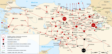
In the early 20th century, there were big changes in the population of the western part of the region. Many Christian Armenians left or were forced to leave during sad events between 1915 and 1917. Today, the eastern part of the Highlands is mostly home to Armenians, Azerbaijanis, and Georgians. The western part is mainly home to Armenians (including hidden Armenians and Hemshins), Kurds, Turks, and Azerbaijanis.
For most of its history, the region was ruled by Armenian nobility and Armenian states. Sometimes they were independent, and sometimes they were part of larger empires. Starting in the 1040s, different Turkic peoples and the Safavid dynasty ruled the highlands. Some Armenian areas, like Artsakh, kept some self-rule.
Much of Eastern Armenia became part of the Russian Empire in 1828. Later, it joined the Soviet Union. Most of Western Armenia was under the Ottoman Empire and is now part of modern Turkey.
History of the Armenian Highlands
Ancient Times and Early Civilizations
From about 4000 to 1000 BC, people in this region were very good at making tools and jewelry from copper, bronze, and iron. They traded these items with nearby lands. Some people also believe this area might be one of the possible locations of the Garden of Eden.
The Armenian Plateau is sometimes called the "epicenter of the Iron Age". This is because iron tools first appeared here around the late 2nd millennium BC. In the early Iron Age, the Kingdom of Van controlled much of the region. Later, it was taken over by the Medes and the Orontid dynasty.
In ancient stories like the Epic of Gilgamesh, a land called Aratta is described. Its location might match the Armenian plateau. In ancient times, many different groups of people lived on the Highlands. But during the Achaemenid Empire (550–330 BC), Armenian-speakers became very important. Recent studies show that Armenians are native to the Armenian Highlands. Their genes show they have lived there for a very long time without much change since 1200 BC.
Middle Ages: New Rulers Arrive
- Further information: Seljuk Empire and Safavid Empire
The Seljuk Turks first came to the Armenian Highlands in the 1040s. They moved westward, taking over lands. Their victory at the Battle of Manzikert made them very powerful in the region. Some Armenians, led by Ruben I, Prince of Armenia, moved away from the Highlands. They went to the mountains of Cilicia and started the Armenian Kingdom of Cilicia.
In the early 1200s, many people moved into the Highlands. They were fleeing from the Mongols. The Mongols reached the Highlands in 1235. Later, the Mongols became Muslims and set up their own rule.
In 1410, the area was ruled by the Kara Koyunlu Turks. Their way of life, focused on raising animals, made farming less common in Armenia. In 1468, the Ak Koyunlu Turks took over. Their rule lasted until 1502, when the Safavids brought Armenia under Iranian rule. The Ottoman Turks took control of the highland region in 1514. This happened after they defeated the Safavids at the Battle of Chalderon. By 1516, the Ottoman Empire had taken over all Armenian lands.
Later History and Modern Divisions
From the early modern period, the region was directly under Safavid Iranian rule. For centuries, the Iranian Safavids and the Ottoman Empire fought many wars over this region. Large parts of the Highlands, known as Western Armenia, were finally taken by the Ottomans in the early 17th century. This happened after the Ottoman–Safavid War (1623–39) and the Treaty of Zuhab.
Eastern Armenia, the other main part of the Highlands, stayed under Iranian control until 1828. Then, after the Treaty of Turkmenchay, it was given to Imperial Russia.
The 20th Century and Today
In the first half of the 19th century, the Ottoman-controlled parts of the Armenian Highlands (Western Armenia) became the border between the Ottoman and Russian empires. This was after Russia had taken over the Caucasus and Eastern Armenia from Qajar Iran.
The Highlands saw a huge change in its population after the fall of the Ottoman Empire and sad events in the early 20th century. Western Armenia was renamed "Eastern Anatolia." Since then, the Highlands have been the border region of Turkey, Iran, and the Soviet Union. After the dissolution of the Soviet Union in 1991, the region became a border area for Armenia, and parts of Georgia and Azerbaijan.
Plants and Animals of the Highlands
The apricot fruit, which Romans called prunus armenicus (the Armenian plum), was first brought to Europe from the Armenian plateau.
Tallest Mountains in the Armenian Highlands
| Rank | Mountain | Elevation | Location |
|---|---|---|---|
| 1 | Mount Ararat | 5,137 m (16,854 ft) | Turkey: Ağrı Province |
| 2 | Mount Cilo | 4,135 m (13,566 ft) | Turkey: Hakkâri Province |
| 3 | Mount Aragats | 4,090 m (13,420 ft) | Armenia: Aragatsotn Province |
| 4 | Mount Sipan | 4,058 m (13,314 ft) | Turkey: Bitlis Province |
| 5 | Mount Kapudzhukh | 3,906 m (12,815 ft) |
|
| 6 | Mount Azhdahak | 3,597 m (11,801 ft) | Armenia: Gegharkunik Province |
| 7 | Mount Trasar | 3,594 m (11,791 ft) | Armenia: Syunik Province |
| 8 | Mount Artos | 3,515 m (11,532 ft) | Turkey: Van Province |
| 9 | Munzur Mountains | 3,463 (11.362 ft) | Turkey: Tunceli Province |
See also
 In Spanish: Altiplano armenio para niños
- Ark of Nuh or Noah
- Geography of Armenia
- Haykakan Par
- History of Armenia
- Mountains of Ararat
- Mount Tendürek
- Durupınar site
- Mount Tendürek
- River system of Mesopotamia
- Zagros Mountains
- Mount Judi
 | Misty Copeland |
 | Raven Wilkinson |
 | Debra Austin |
 | Aesha Ash |


