Logan County, West Virginia facts for kids
Quick facts for kids
Logan County
|
|
|---|---|

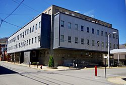
Logan County Courthouse in Logan
|
|

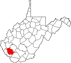
Location within the U.S. state of West Virginia
|
|
 West Virginia's location within the U.S. |
|
| Country | |
| State | |
| Founded | January 12, 1824 |
| Named for | Chief Logan |
| Seat | Logan |
| Largest city | Logan |
| Area | |
| • Total | 456 sq mi (1,180 km2) |
| • Land | 454 sq mi (1,180 km2) |
| • Water | 1.9 sq mi (5 km2) 0.4%% |
| Population
(2020)
|
|
| • Total | 32,567 |
| • Estimate
(2021)
|
31,909 |
| • Density | 71.42/sq mi (27.575/km2) |
| Time zone | UTC−5 (Eastern) |
| • Summer (DST) | UTC−4 (EDT) |
| Congressional district | 1st |
Logan County is a county located in the state of West Virginia in the United States. It's like a smaller region within the state. As of the 2020 census, about 32,567 people live there. The main town and county seat (where the county government is) is Logan. Logan County is part of a larger area that includes nearby cities like Charleston and Huntington.
Contents
History of Logan County
Logan County was created in 1824. It was formed from parts of other counties that were then in Virginia. The county is named after Chief Logan. He was a famous Native American chief of the Mingo tribe.
During the American Civil War, Logan County was part of Virginia. Even though the county had voted to stay with Virginia, it became part of the new state of West Virginia in 1863. This happened because of an order from President Abraham Lincoln.
After West Virginia became a state, its counties were divided into smaller areas. These areas were first called townships. Later, in 1872, they became "magisterial districts." Over time, these districts changed. For example, in 1895, Mingo County was formed from some of Logan County's districts. Today, Logan County is divided into three main districts: Central, Eastern, and Western.
Logan County has seen some important historical events. In 1921, it was the site of the Battle of Blair Mountain. This was a very large conflict in U.S. history. It involved coal miners who were fighting for better working conditions.
Another major event was the Buffalo Creek Flood on February 26, 1972. A dam holding coal waste broke after heavy rains. This released a huge wave of water and waste into the valley. The flood killed 125 people. Many communities were destroyed or badly damaged, including Lorado and Lundale.
Geography of Logan County
Logan County covers about 456 square miles. Most of this area is land, with only a small part being water.
Major Roads
These are the main roads that go through Logan County:
 I‑73 (future road)
 I‑74 (future road)
 U.S. Highway 52
 U.S. Highway 119
 West Virginia Route 10
 West Virginia Route 17
 West Virginia Route 44
 West Virginia Route 73
 West Virginia Route 80
Neighboring Counties
Logan County shares borders with these other counties:
- Lincoln County (to the north)
- Boone County (to the northeast)
- Wyoming County (to the southeast)
- Mingo County (to the southwest)
People of Logan County
| Historical population | |||
|---|---|---|---|
| Census | Pop. | %± | |
| 1830 | 3,680 | — | |
| 1840 | 4,309 | 17.1% | |
| 1850 | 3,620 | −16.0% | |
| 1860 | 4,938 | 36.4% | |
| 1870 | 5,124 | 3.8% | |
| 1880 | 7,329 | 43.0% | |
| 1890 | 11,101 | 51.5% | |
| 1900 | 6,955 | −37.3% | |
| 1910 | 14,476 | 108.1% | |
| 1920 | 41,006 | 183.3% | |
| 1930 | 58,534 | 42.7% | |
| 1940 | 67,768 | 15.8% | |
| 1950 | 77,391 | 14.2% | |
| 1960 | 61,570 | −20.4% | |
| 1970 | 46,269 | −24.9% | |
| 1980 | 50,679 | 9.5% | |
| 1990 | 43,032 | −15.1% | |
| 2000 | 37,710 | −12.4% | |
| 2010 | 36,743 | −2.6% | |
| 2020 | 32,567 | −11.4% | |
| 2021 (est.) | 31,909 | −13.2% | |
| U.S. Decennial Census 1790–1960 1900–1990 1990–2000 2010–2020 |
|||
In 2010, there were 36,743 people living in Logan County. Most people living there were white (96.5%). About 2.1% were black or African American. A small number of people were Asian or American Indian. About 0.7% of the population was of Hispanic or Latino origin.
The average age of people in Logan County was 42.4 years old. The average income for a household was about $35,465 per year. For families, the average income was about $43,475. About 21.8% of the people in the county lived below the poverty line. This included about 32.8% of those under 18 years old.
Towns and Communities
Main Towns
These are the towns that have their own local governments:
- Logan (the county seat)
- Chapmanville
- Man
- Mitchell Heights
- West Logan
Magisterial Districts
These are the three main administrative areas within the county:
- Central
- Eastern
- Western
Census-Designated Places
These are areas that are like towns but don't have their own local governments:
Other Communities
These are smaller communities that are not officially incorporated as towns:
- Argyle
- Baber
- Baisden
- Banco
- Barnabus
- Becco
- Beebe
- Black Bottom
- Blair
- Bradshaw
- Braeholm
- Chambers
- Christian
- Claypool
- Coal Valley
- Cora
- Craneco
- Crites
- Crown
- Crystal Block
- Dabney
- Daisy
- Davin
- Davis
- Dehue
- Diamond
- Dobra
- Dog Patch
- Don
- Emmett
- Ethel
- Fanco
- Five Block
- Fort Branch
- Freeze Fork
- Frogtown
- Gillman Bottom
- Godby Heights
- Guyan Terrace
- Halcyon
- Hedgeview
- Hensley Heights
- Hetzel
- Huff Junction
- Hutchinson
- Isom
- Kelly
- Kitchen
- Lake
- Landville
- Latrobe
- Lintz Addition
- Logan Heights
- Lorado
- Lundale
- Lyburn
- Melville
- Micco
- Mifflin
- Mineral City
- Monclo
- Monitor
- Mountain View
- Oilville
- Orville
- Pardee
- Pecks Mill
- Phico
- Pine Creek
- Ralumco
- Red Campbell
- Ridgeview
- Rita
- Rum Junction
- Saunders
- Sharples
- Shegon
- Shively
- Slagle
- Sodom
- Sovereign
- Spruce Valley
- Stirrat
- Stone Branch
- Stowe
- Sulphur Springs
- Sunbeam
- Sunset Court
- Superior Bottom
- Sycamore
- Taplin
- Thompson Town
- Trace Junction
- Troy Town
- Upper Whitman
- Verner
- Walnut Hill
- Wanda
- Whirlwind
- Whites Addition
- Whitman
- Whitman Junction
- Wilkinson
- Wylo
- Yolyn
School Districts
- Logan County Schools (This is the main school system for the whole county.)
See also
 In Spanish: Condado de Logan (Virginia Occidental) para niños
 | Isaac Myers |
 | D. Hamilton Jackson |
 | A. Philip Randolph |

