Marinette County, Wisconsin facts for kids
Quick facts for kids
Marinette County
|
|
|---|---|
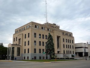
Marinette County Courthouse, Marinette
|
|
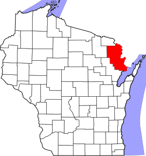
Location within the U.S. state of Wisconsin
|
|
 Wisconsin's location within the U.S. |
|
| Country | |
| State | |
| Founded | 1879 |
| Seat | Marinette |
| Largest city | Marinette |
| Area | |
| • Total | 1,550 sq mi (4,000 km2) |
| • Land | 1,399 sq mi (3,620 km2) |
| • Water | 151 sq mi (390 km2) 9.7%% |
| Population
(2020)
|
|
| • Total | 41,872 |
| • Estimate
(2023)
|
42,106 |
| • Density | 29.9/sq mi (11.5/km2) |
| Time zone | UTC−6 (Central) |
| • Summer (DST) | UTC−5 (CDT) |
| Congressional district | 8th |
Marinette County is a special area called a county in the state of Wisconsin, USA. In 2020, about 41,872 people lived here. The main city, which is also where the county government is located, is called Marinette. Marinette County is also part of a larger economic area that includes Marinette, Wisconsin, and parts of Michigan.
Contents
Exploring Marinette County's Geography
Marinette County covers a total area of about 1,550 square miles (4,015 square kilometers). Most of this area, about 1,399 square miles (3,623 square kilometers), is land. The rest, about 151 square miles (391 square kilometers), is water, making up about 9.7% of the county. It is the third-largest county in Wisconsin by land area.
Part of Marinette County is next to Lake Michigan. This area is special because it has unique plants that only grow there. These are called endemic plants.
Neighboring Counties Around Marinette
Marinette County shares its borders with several other counties:
- Dickinson County, Michigan - to the north
- Menominee County, Michigan - to the northeast
- Door County - to the east and southeast, across Green Bay
- Oconto County - to the southwest
- Forest County - to the west
- Florence County - to the northwest
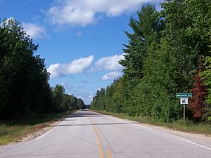
Main Roads in Marinette County
Several important highways run through Marinette County, helping people travel around:
Railroads Serving the County
Trains also play a role in Marinette County, with lines operated by:
- Canadian National
- Escanaba and Lake Superior Railroad
- Watco
Local Airport
The Crivitz Municipal Airport helps connect Marinette County to other places. It serves the county and nearby towns.
People of Marinette County
| Historical population | |||
|---|---|---|---|
| Census | Pop. | %± | |
| 1880 | 8,929 | — | |
| 1890 | 20,304 | 127.4% | |
| 1900 | 30,822 | 51.8% | |
| 1910 | 33,812 | 9.7% | |
| 1920 | 34,361 | 1.6% | |
| 1930 | 33,530 | −2.4% | |
| 1940 | 36,225 | 8.0% | |
| 1950 | 35,748 | −1.3% | |
| 1960 | 34,660 | −3.0% | |
| 1970 | 35,810 | 3.3% | |
| 1980 | 39,314 | 9.8% | |
| 1990 | 40,548 | 3.1% | |
| 2000 | 43,384 | 7.0% | |
| 2010 | 41,749 | −3.8% | |
| 2020 | 41,872 | 0.3% | |
| U.S. Decennial Census 1790–1960 1900–1990 1990–2000 2010 2020 |
|||
Marinette County's Population in 2020
In 2020, the population of Marinette County was 41,872 people. This means there were about 29.9 people living in each square mile. There were also many homes, with about 29,189 housing units.
Most people in the county, about 93.4%, identified as White. Other groups included 0.6% Native American, 0.5% Black or African American, and 0.4% Asian. About 1.1% were from other races, and 4.0% were from two or more races. About 2.6% of the population identified as Hispanic or Latino.
Fun Things to Do: Tourism in Marinette County
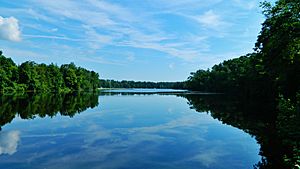
Tourism is a big part of life in many Marinette County communities. The county has two main rivers, the Peshtigo and Menominee, along with many lakes, streams, and forests. This makes it a great place for outdoor adventures!
In winter, Snowmobiling is very popular. There are many trails for snowmobilers to enjoy.
You can also visit Dave's Falls, a beautiful waterfall located near the community of Amberg in Marinette County.
Communities in Marinette County
Marinette County is home to several cities, villages, and smaller communities.
Cities in Marinette County
- Marinette (This is the county seat, meaning it's the main city for county government)
- Niagara
- Peshtigo
Villages in Marinette County
Towns in Marinette County
Census-Designated Places (CDPs)
These are areas that are like towns but are not officially incorporated as cities or villages.
Other Unincorporated Communities
These are smaller communities that are not officially part of a city, village, or CDP.
See also
 In Spanish: Condado de Marinette para niños
 | Emma Amos |
 | Edward Mitchell Bannister |
 | Larry D. Alexander |
 | Ernie Barnes |


