Port Arthur, Texas facts for kids
Quick facts for kids
Port Arthur
|
|
|---|---|
Port Arthur
|
|
| Nickname(s):
PA, PAT
|
|
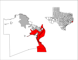
Location of Port Arthur, Texas - U.S. Census Map
|
|
| Country | United States |
| State | Texas |
| County | Jefferson, Orange |
| Settled | 1895 |
| Incorporation | 1898 |
| Government | |
| • Type | Council-Manager |
| Area | |
| • Total | 144.17 sq mi (373.41 km2) |
| • Land | 77.15 sq mi (199.82 km2) |
| • Water | 67.02 sq mi (173.58 km2) |
| Elevation | 0 ft (0 m) |
| Population
(2020)
|
|
| • Total | 56,039 |
| • Density | 703.55/sq mi (271.64/km2) |
| Time zone | UTC−6 (Central (CST)) |
| • Summer (DST) | UTC−5 (CDT) |
| ZIP codes |
77640-77642
|
| Area code(s) | 409 |
| FIPS code | 48-58820 |
| GNIS feature ID | 2411461 |
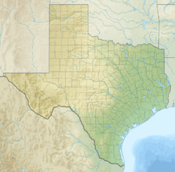
Port Arthur is a city in Texas, a state in the United States. It is about 90 miles (145 km) east of Houston. Port Arthur is part of the larger Beaumont–Port Arthur metropolitan area. Most of the city is in Jefferson County, with a small part in Orange County.
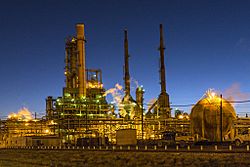
The Motiva Refinery is located here. It is the largest oil refinery in the United States. In 2020, about 56,039 people lived in Port Arthur. The city was founded in 1895 by Arthur Stilwell. It became an official city in 1898 and quickly grew into an important seaport. It also became a major center for oil refining. The Rainbow Bridge connects Port Arthur to Bridge City across the Neches River.
Port Arthur is often hit by strong storms called tropical cyclones. These storms have caused a lot of damage to the city many times.
Contents
History of Port Arthur
An early settlement called Aurora was started in 1837. It was near Sabine Lake, a large saltwater area. This lake connects to the Gulf of Mexico through Sabine Pass. People tried to sell land there, but not many settlers came.
Later, the area was known as "Sparks." This was named after John Sparks, who moved his family to Sabine Lake. A railroad was built nearby, but it was removed during the American Civil War. In 1886, a big hurricane hit the coast. The remaining residents moved away, and by 1895, Aurora was a ghost town (an empty town).
Arthur Stilwell helped restart the area. He planned to build a city as the end point for his railroad, the Kansas City, Pittsburg and Gulf Railroad. Stilwell named the city Port Arthur after himself. The city officially opened its port in 1899.
Pleasure Island is a man-made island that now separates the city from the Gulf Intracoastal Waterway. It was built between 1899 and 1908 to help develop the port.
When oil was found at Spindletop in 1901, companies like J.M. Guffey Petroleum (later Gulf Oil) built pipelines to Port Arthur. They also built an oil refinery there. The first oil tanker left Port Arthur in November 1901. The refinery grew, and another company, The Texas Company (later Texaco), also built a refinery in 1902. By 1916, the Port Arthur refinery was one of the biggest in the U.S.
In 2021, Governor Abbott announced that Port Arthur was named a "film friendly city" by the Texas Film Commission. This means it's a good place for movies and TV shows to film.
Geography of Port Arthur
Port Arthur is on the eastern side of Jefferson County, next to Sabine Lake. To the northeast is Orange County, Texas, and across Sabine Lake to the southeast is Cameron Parish, Louisiana. The city stretches south along Sabine Pass all the way to the Gulf of Mexico. To the north, the city limits cross the Neches River into Orange County. Nearby cities include Nederland, Groves, Port Neches, and Bridge City.
The city covers about 144.17 square miles (373.1 square kilometers). About 77.15 square miles (199.2 square kilometers) is land, and 67.02 square miles (173.9 square kilometers) is water.
Communities in Port Arthur
Some neighborhoods and communities in Port Arthur are:
- El Vista
- Griffing Park
- Lakeview
- Pear Ridge
- Port Acres
- Sabine Pass
- West Side
Tropical cyclones and Port Arthur

Port Arthur is often affected by tropical cyclones (hurricanes and tropical storms).
Hurricane of September 12, 1897
A big hurricane hit Port Arthur on September 12, 1897. Water was five feet deep in the streets. A railroad building collapsed, killing four people. In total, 13 people died, and many homes were destroyed.
Hurricane Audrey
In June 1957, Hurricane Audrey hit just east of Port Arthur. It was a strong Category 3 hurricane. The storm caused a lot of wind damage in the city. There was also significant flooding nearby.
Hurricane Rita
Hurricane Rita hit near Port Arthur on September 24, 2005. It was a Category 3 hurricane. Winds reached 116 miles per hour (187 km/h) in Port Arthur. The storm caused widespread damage and power outages that lasted for weeks. Some areas of the city also flooded.
Hurricane Humberto
On September 13, 2007, Hurricane Humberto hit west of Port Arthur. It was a Category 1 hurricane. It caused wind damage across the area, but most of it was minor.
Tropical Storm Edouard
Tropical Storm Edouard hit just west of Port Arthur on August 5, 2008. The city felt only light effects from this storm.
Hurricane Ike
Hurricane Ike hit Galveston Island on September 13, 2008. It was a Category 2 hurricane, but it was very large. Port Arthur had a lot of wind damage, and many people lost power. The city's seawall helped protect it from major flooding that other nearby cities experienced.
Hurricane Harvey
On August 29, 2017, Harvey brought a huge amount of rain to Port Arthur. About 26 inches (66 cm) of rain fell in one day at the airport. This caused widespread flash flooding. The mayor said that 20,000 homes were flooded with up to 6 feet (1.8 m) of water. He posted on Facebook, "Our whole city is underwater right now."
Hurricane Laura
Hurricane Laura was expected to hit Port Arthur as a major hurricane, and the city was evacuated. However, the storm turned north and made landfall near Cameron, Louisiana, instead.
Climate
Port Arthur is known for being one of the most humid cities in the United States. The air is often very moist.
| Climate data for Port Arthur, Texas (Jack Brooks Airport) 1991–2020 normals, extremes 1901–present | |||||||||||||
|---|---|---|---|---|---|---|---|---|---|---|---|---|---|
| Month | Jan | Feb | Mar | Apr | May | Jun | Jul | Aug | Sep | Oct | Nov | Dec | Year |
| Record high °F (°C) | 86 (30) |
90 (32) |
95 (35) |
94 (34) |
101 (38) |
106 (41) |
108 (42) |
108 (42) |
105 (41) |
99 (37) |
94 (34) |
86 (30) |
108 (42) |
| Mean maximum °F (°C) | 77.4 (25.2) |
79.3 (26.3) |
83.0 (28.3) |
86.9 (30.5) |
91.7 (33.2) |
95.7 (35.4) |
97.0 (36.1) |
98.4 (36.9) |
95.8 (35.4) |
90.7 (32.6) |
83.9 (28.8) |
79.2 (26.2) |
99.3 (37.4) |
| Mean daily maximum °F (°C) | 63.5 (17.5) |
67.3 (19.6) |
73.2 (22.9) |
79.0 (26.1) |
85.7 (29.8) |
90.9 (32.7) |
92.6 (33.7) |
93.1 (33.9) |
89.5 (31.9) |
82.1 (27.8) |
72.3 (22.4) |
65.5 (18.6) |
79.6 (26.4) |
| Daily mean °F (°C) | 53.7 (12.1) |
57.5 (14.2) |
63.3 (17.4) |
69.3 (20.7) |
76.5 (24.7) |
82.0 (27.8) |
83.6 (28.7) |
83.8 (28.8) |
80.0 (26.7) |
71.6 (22.0) |
61.9 (16.6) |
55.6 (13.1) |
69.9 (21.1) |
| Mean daily minimum °F (°C) | 43.8 (6.6) |
47.8 (8.8) |
53.4 (11.9) |
59.6 (15.3) |
67.3 (19.6) |
73.1 (22.8) |
74.6 (23.7) |
74.4 (23.6) |
70.6 (21.4) |
61.1 (16.2) |
51.5 (10.8) |
45.8 (7.7) |
60.2 (15.7) |
| Mean minimum °F (°C) | 28.0 (−2.2) |
31.9 (−0.1) |
35.6 (2.0) |
43.3 (6.3) |
53.9 (12.2) |
66.3 (19.1) |
70.3 (21.3) |
69.7 (20.9) |
58.4 (14.7) |
44.1 (6.7) |
34.3 (1.3) |
30.6 (−0.8) |
26.2 (−3.2) |
| Record low °F (°C) | 11 (−12) |
10 (−12) |
20 (−7) |
32 (0) |
42 (6) |
53 (12) |
61 (16) |
58 (14) |
45 (7) |
30 (−1) |
22 (−6) |
12 (−11) |
10 (−12) |
| Average precipitation inches (mm) | 5.32 (135) |
3.09 (78) |
3.63 (92) |
3.92 (100) |
4.70 (119) |
6.70 (170) |
6.85 (174) |
6.89 (175) |
6.69 (170) |
5.47 (139) |
3.89 (99) |
4.98 (126) |
62.13 (1,578) |
| Average precipitation days (≥ 0.01 in) | 9.6 | 8.6 | 7.6 | 7.2 | 7.2 | 10.7 | 11.8 | 11.3 | 8.9 | 7.5 | 7.6 | 9.7 | 107.7 |
| Average relative humidity (%) | 79.0 | 76.6 | 76.2 | 77.1 | 78.7 | 79.0 | 80.7 | 80.3 | 79.3 | 76.9 | 78.0 | 79.6 | 78.4 |
| Mean monthly sunshine hours | 135.5 | 168.5 | 188.1 | 203.2 | 262.9 | 284.6 | 281.7 | 258.6 | 231.9 | 241.3 | 184.8 | 148.9 | 2,590 |
| Percent possible sunshine | 42 | 54 | 51 | 53 | 62 | 68 | 66 | 63 | 63 | 68 | 58 | 47 | 58 |
| Source: NOAA (relative humidity and sun 1961–1990) | |||||||||||||
People in Port Arthur
| Historical population | |||
|---|---|---|---|
| Census | Pop. | %± | |
| 1900 | 900 | — | |
| 1910 | 7,663 | 751.4% | |
| 1920 | 22,251 | 190.4% | |
| 1930 | 50,902 | 128.8% | |
| 1940 | 46,140 | −9.4% | |
| 1950 | 57,530 | 24.7% | |
| 1960 | 66,676 | 15.9% | |
| 1970 | 57,371 | −14.0% | |
| 1980 | 61,251 | 6.8% | |
| 1990 | 58,724 | −4.1% | |
| 2000 | 57,755 | −1.7% | |
| 2010 | 53,818 | −6.8% | |
| 2020 | 56,039 | 4.1% | |
| U.S. Decennial Census | |||
| Race | Number | Percentage |
|---|---|---|
| White (NH) | 9,259 | 16.52% |
| Black or African American (NH) | 21,046 | 37.56% |
| Native American or Alaska Native (NH) | 105 | 0.19% |
| Asian (NH) | 3,272 | 5.84% |
| Pacific Islander (NH) | 14 | 0.02% |
| Some Other Race (NH) | 191 | 0.34% |
| Mixed/Multi-Racial (NH) | 987 | 1.76% |
| Hispanic or Latino | 21,165 | 37.77% |
| Total | 56,039 |
In 2010, about 53,818 people lived in Port Arthur. By 2020, the population grew to 56,039. The city has a diverse population. In 2019, about 38.1% of the people were Black or African American. About 34.5% were Hispanic or Latino American.
In 2010, about 30.2% of households had children under 18. The average household had 2.63 people. The median age in the city was 35.3 years old.
From 2014 to 2019, the average household income was $36,557. About 27.2% of the people lived below the poverty line.
Economy of Port Arthur
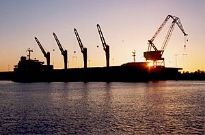
Port Arthur is a major center for oil refining in the United States. Many large oil companies have invested in the city. For example, Motiva Enterprises expanded its refinery to process 600,000 barrels of oil per day. This was a huge project, costing $10 billion. Other companies like Valero and BASF/Fina have also expanded their plants. These businesses are supported by the Port of Port Arthur, which is one of Texas's busiest seaports.
In 2010, there was an oil spill in the Sabine/Neches waterway. An oil tanker and a barge crashed, causing 450,000 gallons of oil to spill.
Downtown changes
The downtown area of Port Arthur was very busy in the early 1900s. Over time, people moved to new homes outside the city center. This caused businesses to move too. From 1960 to 1974, economic problems also hurt the town. Today, many buildings in the old downtown are empty.
The Hotel Sabine opened in 1929. It was the tallest building in Port Arthur, with 10 stories. It closed in the mid-1980s. There have been talks about renovating or tearing down the old hotel.
Hurricane Rita in 2005 damaged many downtown businesses and homes. Now, the main shopping area is Central Mall, which opened in 1982 outside the downtown area.
Arts and culture
The Museum of the Gulf Coast in Port Arthur has many items and exhibits about famous people from the area.
UGK, a very important hip-hop group from Texas, started in Port Arthur.
Education in Port Arthur
Colleges
Lamar State College-Port Arthur
Lamar State College-Port Arthur is in downtown Port Arthur. It celebrated its 100th birthday in 2009. The college offers many basic classes that can be transferred to other Texas public universities. It is also known for programs in music, nursing, and legal assistant studies. The college has sports teams for men's basketball and women's softball.
Galveston College (for some areas)
Some parts of Port Arthur are assigned to Galveston College in Galveston.
Career and Technical Education Center
This school used to be called Stilwell Technical Center. It helps students learn job skills. In 2012, the school moved to a new building next to Memorial High School.
Primary and secondary schools
Most students in Port Arthur go to schools in the Port Arthur Independent School District. The district has one high school, Memorial High School. This school was formed in 2002 when three other high schools joined together.
Other parts of the city are served by different school districts, including Nederland Independent School District, Port Neches-Groves Independent School District, Sabine Pass Independent School District, Beaumont ISD, Hamshire-Fannett ISD, and Bridge City Independent School District.
The Bob Hope Charter School is also located in Port Arthur.
Public libraries
The Port Arthur Public Library is located at 4615 9th Avenue. It serves as the main library for the city.
Media
Newspapers
The Port Arthur News is the only daily newspaper in Port Arthur. It has been operating since 1897, making it one of the oldest businesses in the city.
Television
- KBTV (Dabl) channel 4
Radio
| Frequency | Call letters / licensed to (if not Beaumont) | Format | Owner | Notes |
|---|---|---|---|---|
| 560 | KLVI | News, Talk radio | iHeartMedia | |
| 1250 | KDEI (Port Arthur) | Catholic radio | Radio Maria | |
| 1340 | KOLE (Port Arthur) | Various | Birach Broadcasting | |
| 92.5 | KCOL (Groves) | Oldies "Cool 92.5" | iHeartMedia | |
| 93.3 (Port Arthur) | KQBU | Regional Mexican "Que Buena 93.3" | Univision | |
| 94.1 | KQXY | CHR "Q94" | Cumulus Broadcasting | |
| 95.1 | KYKR | Country "Kicker 95.1" | iHeartMedia | |
| 98.5 | KTJM (Port Arthur) | Regional Mexican "La Raza 98.5/103.3" | Liberman Broadcasting-Houston | |
| 102.5 | KTCX (Beaumont) | Urban contemporary "Magic 102.5" | Cumulus Broadcasting | |
| 103.3 | K277AG (Beaumont) | Hip-Hop, R&B "The Beat 103.3" | iHeartMedia | Simulcast of KKMY-HD2 |
| 104.5 (Orange) | KKMY | Rhythmic CHR "104.5 Kiss FM" | iHeartMedia | |
| 105.3 | KLTW (Winnie) | Contemporary Christian | Educational Media Foundation | |
| 106.1 | KIOC (Orange) | Rock "Big Dog 106" | iHeartMedia | |
| 107.9 | KQQK | Regional Mexican "107.9 El Norte" | Liberman Broadcasting-Houston |
Transportation
Air travel
The Jack Brooks Regional Airport is located in the northwest part of Port Arthur. It serves both Beaumont and Port Arthur.
Bus service
Local bus service in Port Arthur is provided by Port Arthur Transit.
Train travel
The closest train station to Port Arthur is Beaumont station in nearby Beaumont. This station is served by Amtrak's Sunset Limited line. Trains arrive three times a week in each direction.
Notable people
- Lucian Adams, a brave soldier who received the Medal of Honor
- Jonathan Babineaux, former professional football player
- Jordan Babineaux, former professional football player
- G.W. Bailey, actor
- Zachary Breaux, jazz musician
- Aaron Brown, professional football player
- J'Covan Brown (born 1990), basketball player
- Jamaal Charles, professional football player
- C. J. Chenier, musician
- Babe Didrikson Zaharias, an amazing athlete who was great at golf, basketball, baseball, and track and field
- Todd Dodge, American football coach
- Ted Dunbar, jazz musician
- Earl Evans, college and professional basketball player
- Kevin Everett, professional football player
- Mitch Gaspard, college baseball coach
- John Warne Gates, a wealthy businessman in steel, railroads, and oil
- Danny Gorrer, professional football player
- Jason Halbert, musical director for Kelly Clarkson
- Kree Harrison, a singer who was runner-up on American Idol
- Lee Hazlewood, musician, grew up in Port Arthur
- Tom Hicks, former owner of sports teams and companies
- Jim Hurtubise, race car driver
- Stephen Jackson, former professional basketball player
- Jimmy Johnson, football coach and broadcaster
- Janis Joplin, famous singer/songwriter
- Evelyn Keyes, film actress
- Bobby Leopold, professional football player
- Kenneth Lofton Jr., college and Team USA basketball player
- Inika McPherson, track and field athlete
- Donald Narcisse, player in Canadian Football League
- Johnny Preston, pop singer
- Robert Rauschenberg, painter and graphic artist
- Leah Rhodes, Hollywood costume designer
- J.P. Richardson aka "The Big Bopper", singer and songwriter
- Elandon Roberts, professional football player
- Amber Chardae Robinson, actress
- Raymond Strother, political consultant
- Tad Tadlock, choreographer
- Joe Washington, college and professional football player
- Ken Webster, actor and director
See also
 In Spanish: Port Arthur (Texas) para niños
 | Sharif Bey |
 | Hale Woodruff |
 | Richmond Barthé |
 | Purvis Young |


