Słupsk facts for kids
Quick facts for kids
Słupsk
|
|||||
|---|---|---|---|---|---|
|
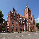
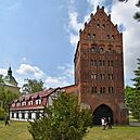
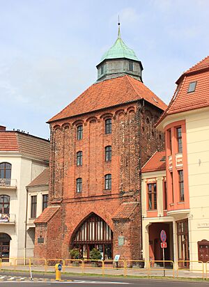
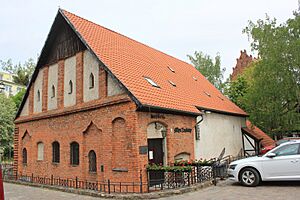
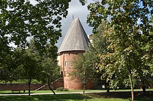
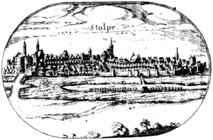
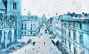
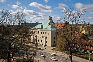
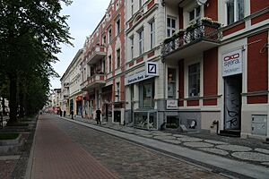
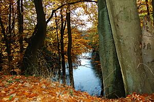
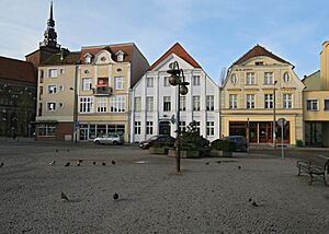
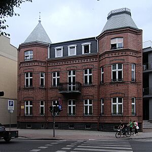
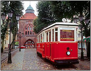
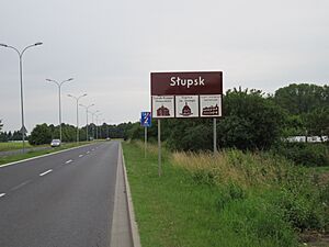
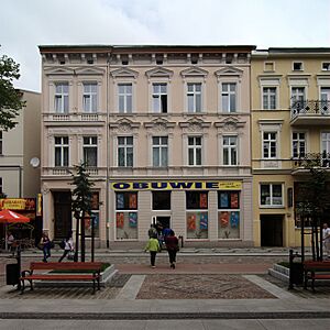
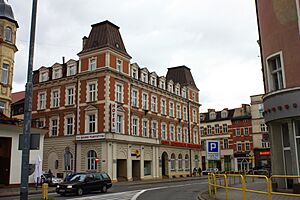
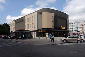
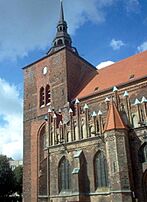
From top, left to right: City Hall, Mill Gate, Pomeranian Dukes' Castle, Słupsk County Office
|
|||||
|
|||||
| Country | |||||
| Voivodeship | |||||
| County | city county | ||||
| Established | 10th century | ||||
| City rights | 1265 | ||||
| Area | |||||
| • Total | 52.7 km2 (20.3 sq mi) | ||||
| Elevation | 22 m (72 ft) | ||||
| Population
(31 December 2021)
|
|||||
| • Total | 88,835 |
||||
| Time zone | UTC+1 (CET) | ||||
| • Summer (DST) | UTC+2 (CEST) | ||||
| Postal code |
76-200 to 76-210, 76-215, 76-216, 76-218, 76-280
|
||||
| Area code(s) | +48 059 | ||||
| Car plates | GS | ||||
| Website | www.slupsk.pl | ||||
Słupsk is a city in northern Poland. It is located on the Słupia River in the Pomeranian Voivodeship. This area is part of a larger historical region called Pomerania. Słupsk is home to about 88,835 people, making it one of Poland's most populated cities for its size. It is also the main administrative center for Słupsk County.
Słupsk started as a small settlement in the early Middle Ages. It was granted city rights in 1265. By the 1300s, it became an important center for trade and local government. It was even connected to the Hanseatic League, a powerful group of trading cities. For many years, from 1368 to 1478, it was home to the Dukes of Słupsk. After World War II, Słupsk became part of Poland again.
Contents
History of Słupsk
Early Beginnings
Słupsk grew from several small settlements along the Słupia River. This river had a special crossing point that connected important trade routes. Because of this, a grod (a fortified Slavic settlement) was built on an island in the river. This fortress was well protected by swamps and the river itself.
Archaeological digs show that the grod was on an artificial hill. It had a natural moat from the river and was protected by a palisade (a fence of strong wooden stakes). Records suggest that Słupsk was part of Poland as early as the 10th century.
Becoming a City
Some historians believe Słupsk was first mentioned in 1015, when the Polish king Boleslaus I the Brave took control of the town. In the 12th century, it became one of the most important areas in Pomerania.
The city likely received its city rights in 1265. These rights were later confirmed and expanded in 1310 and 1313. In 1337, the leaders of Słupsk bought the village of Stolpmünde (now Ustka). They then built a port there, which helped the city's economy grow through sea trade.
From 1368, Słupsk became the center of its own small state, the Duchy of Słupsk. Its dukes were connected to the Kings of Poland. Słupsk remained under Polish influence until 1474.
Later Years and Changes
In the 1500s, the Protestant Reformation came to Słupsk. Many people in the town started to follow Lutheranism. In 1637, the ruling family of Pomerania ended. After some wars, Słupsk came under the control of Brandenburg-Prussia in 1653.
After the Thirty Years' War, Słupsk lost some of its importance. However, its economy grew steadily. In the 19th century, it became the second-largest city in the province in terms of people and industry.
In 1807, during the Napoleonic Wars, Polish soldiers briefly took control of the city. In 1815, Słupsk became part of the Province of Pomerania (1815–1945). A railway line reached Słupsk in 1869, connecting it to Gdańsk.
The city grew a lot in the 19th century. A new city hall was finished in 1901, and a tram line opened in 1910. Before World War I, Słupsk had about 34,340 people.
World War II and After
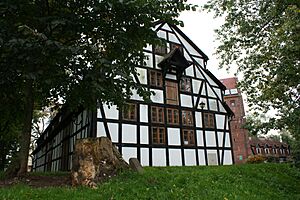
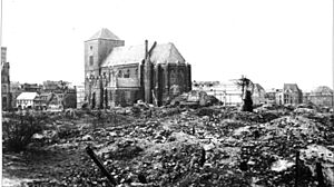
During World War II, the city's growth stopped. After the war, Słupsk became part of Poland again. Most of the German people living there either left or were moved out. Poles, many of whom had been moved from eastern Polish territories, settled in the city.
Life in Słupsk began anew. In 1945, schools and workshops opened. Trams and trains started running again. The city became a cultural hub. In the 1950s, new theaters and a college were started. Słupsk even had one of the first cinerama cinemas in Poland. The first Polish pizzeria opened in Słupsk in 1975.
Modern Słupsk
After 1989, many street names in Słupsk were changed. Many old buildings were also renovated. In 1999, Słupsk Voivodeship (a type of province) was dissolved. Słupsk became part of the larger Pomeranian Voivodeship.
In 2014, Słupsk elected Robert Biedroń as its mayor. He was the first openly gay mayor in Poland.
Geography
City Layout
Słupsk is a city and also a city county. Its borders are mostly man-made. Only small parts follow natural features like the Słupia River. The city's boundaries have not changed since 1949.
Słupsk shares most of its borders with the rural district called Gmina Słupsk. Słupsk is the main office for this district, but it is not part of it. The city has an irregular shape. Its center is at Plac Zwycięstwa (Victory Square).
Land and Water
Słupsk is located in a river valley of the Słupia River. The city center is lower than the areas to its west and east. The river divides Słupsk into two almost equal parts. The city has more hills than other cities in the region. About 5 square kilometers (2 square miles) of the city are covered by forests. Another 17 square kilometers (6.6 square miles) are used for farming.
Słupsk has many natural water areas. There are over twenty ponds within the city. Most of these are old bends of the Słupia River. There are also several streams and old irrigation canals.
Climate
Słupsk has a mild marine climate, similar to other coastal areas in Poland. The warmest month is July, with temperatures usually between 11 and 21 degrees Celsius (52 to 70 degrees Fahrenheit). The coldest month is February, with temperatures averaging -5 to 0 degrees Celsius (23 to 32 degrees Fahrenheit). August is the wettest month, while March is the driest. Snow can fall between December and April.
| Climate data for Słupsk (1951–1980 normals, extremes 1951–1965 and 1987–1992) | |||||||||||||
|---|---|---|---|---|---|---|---|---|---|---|---|---|---|
| Month | Jan | Feb | Mar | Apr | May | Jun | Jul | Aug | Sep | Oct | Nov | Dec | Year |
| Record high °C (°F) | 12.3 (54.1) |
18.1 (64.6) |
21.3 (70.3) |
26.7 (80.1) |
30.6 (87.1) |
33.9 (93.0) |
36.0 (96.8) |
34.9 (94.8) |
29.8 (85.6) |
22.7 (72.9) |
17.3 (63.1) |
13.7 (56.7) |
36.0 (96.8) |
| Mean maximum °C (°F) | 7.0 (44.6) |
7.8 (46.0) |
12.9 (55.2) |
21.1 (70.0) |
25.1 (77.2) |
29.2 (84.6) |
30.0 (86.0) |
28.9 (84.0) |
26.6 (79.9) |
19.7 (67.5) |
12.6 (54.7) |
9.7 (49.5) |
31.3 (88.3) |
| Mean daily maximum °C (°F) | 1.4 (34.5) |
1.2 (34.2) |
4.9 (40.8) |
11.5 (52.7) |
16.2 (61.2) |
20.7 (69.3) |
21.6 (70.9) |
21.3 (70.3) |
18.2 (64.8) |
12.9 (55.2) |
6.6 (43.9) |
3.0 (37.4) |
11.6 (52.9) |
| Daily mean °C (°F) | −1.1 (30.0) |
−1.8 (28.8) |
1.0 (33.8) |
6.4 (43.5) |
11.0 (51.8) |
15.6 (60.1) |
16.8 (62.2) |
16.3 (61.3) |
12.9 (55.2) |
8.6 (47.5) |
3.9 (39.0) |
0.7 (33.3) |
7.5 (45.5) |
| Mean daily minimum °C (°F) | −4.1 (24.6) |
−5.1 (22.8) |
−2.7 (27.1) |
1.9 (35.4) |
5.7 (42.3) |
9.8 (49.6) |
12.0 (53.6) |
11.9 (53.4) |
8.5 (47.3) |
4.9 (40.8) |
1.3 (34.3) |
−1.8 (28.8) |
3.5 (38.3) |
| Mean minimum °C (°F) | −15.9 (3.4) |
−15.4 (4.3) |
−11.7 (10.9) |
−3.7 (25.3) |
−0.6 (30.9) |
3.4 (38.1) |
6.5 (43.7) |
6.5 (43.7) |
1.7 (35.1) |
−1.2 (29.8) |
−5.7 (21.7) |
−11.4 (11.5) |
−19.2 (−2.6) |
| Record low °C (°F) | −31.2 (−24.2) |
−28.6 (−19.5) |
−19.8 (−3.6) |
−6.8 (19.8) |
−2.8 (27.0) |
−0.6 (30.9) |
4.5 (40.1) |
2.8 (37.0) |
−0.6 (30.9) |
−7.3 (18.9) |
−13.7 (7.3) |
−19.6 (−3.3) |
−31.2 (−24.2) |
| Average precipitation mm (inches) | 53.4 (2.10) |
43.9 (1.73) |
39.1 (1.54) |
46.8 (1.84) |
57.7 (2.27) |
58.6 (2.31) |
98.7 (3.89) |
85.1 (3.35) |
77.2 (3.04) |
74.5 (2.93) |
72.1 (2.84) |
64.0 (2.52) |
771.2 (30.36) |
| Average precipitation days (≥ 0.1 mm) | 18.1 | 15.2 | 12.9 | 13.0 | 13.1 | 10.9 | 14.7 | 13.6 | 14.8 | 15.1 | 17.3 | 17.8 | 176.5 |
| Average relative humidity (%) | 85.3 | 84.1 | 80.8 | 79.4 | 76.6 | 75.9 | 81.0 | 82.5 | 83.7 | 85.7 | 87.2 | 86.5 | 82.4 |
| Average dew point °C (°F) | −3 (27) |
−2 (28) |
0 (32) |
3 (37) |
7 (45) |
11 (52) |
14 (57) |
14 (57) |
11 (52) |
6 (43) |
4 (39) |
0 (32) |
5 (42) |
| Mean monthly sunshine hours | 86.8 | 90.4 | 164.3 | 270.0 | 279.0 | 291.0 | 285.2 | 306.9 | 243.0 | 145.7 | 111.0 | 86.8 | 2,360.1 |
| Average ultraviolet index | 2 | 2 | 2 | 4 | 4 | 5 | 5 | 5 | 4 | 3 | 1 | 1 | 3 |
| Source 1: Meteomodel.pl | |||||||||||||
| Source 2: Weather Atlas (UV), Time and Date (dewpoints, 2005-2015) | |||||||||||||
Neighbourhoods to Explore
Słupsk has many neighborhoods, each with its own feel. Their names are used for signs and maps. Here are some of them:
- Nadrzecze ("Riverside") is in the south. It is a big industrial area.
- Osiedle Akademickie ("Academic Neighbourhood") has many houses. It is near the Pomeranian Academy and its student dorms.
- Osiedle Bałtyckie ("Baltic Neighbourhood") is in the north. A large part of it is a special economic zone.
- Osiedle Niepodległości ("Independence Neighbourhood") and Osiedle Piastów ("Piast Neighbourhood") are the largest residential areas. About 40,000 people live here.
- Osiedle Słowińskie ("Slovincian Neighbourhood") is in the east. It is next to the Northern Wood.
- Ryczewo became part of the city in 1949. It used to be a villa district and still feels a bit like a village.
- Stare Miasto ("Old Town") is the city center. It has historic buildings like the city hall and the Pomeranian Dukes' Castle.
- Westerplatte is a growing area in the southeast. It has the city's highest point. Both houses and apartment blocks are being built here.
- Zatorze is the second-largest residential area, with 10,000 people.
Parks and Green Spaces
Słupsk has lots of green areas. The most important ones are the Park of Culture and Leisure (Park Kultury i Wypoczynku), the Northern Wood (Lasek Północny), and the Southern Wood (Lasek Południowy). There are also many smaller parks and squares.
Transport
Trains
Słupsk is an important railway hub. Four train lines run north, west, east, and south from the city. The main station serves the whole city. Słupsk has train connections to most major cities in Poland. These include Gdańsk, Warsaw, and Kraków. It also connects to local towns like Ustka.
The first railway reached Słupsk in 1869. After World War II, the first train connection to be fixed was to Lębork in 1945. Most of the train lines in the city were electrified between 1988 and 1989.
Roads
Słupsk used to have a main road, National route 6, running through it. Now, a bypass road goes around the south of the city. This bypass is part of Expressway S6. When finished, it will connect Słupsk to Szczecin and Gdańsk with a fast road. Other roads connect Słupsk to nearby towns and villages.
The city's streets are well developed. Słupsk is investing money to improve its roads.
Air Travel
The Słupsk-Redzikowo Airport is no longer used for regular passenger flights. Plans to reopen it have not worked out due to a lack of money. This airport was chosen to be a site for a US missile defense system. This system became active in December 2023. The closest active airports are in Gdańsk and Szczecin.
Monuments
Słupsk has many interesting historical buildings and places to see:
- Słupsk Town Hall (Victory Square 3)
- The new Town Hall (Victory Square 1)
- County Office (Victory Szeregów 14)
- Pomeranian Dukes Castle (Dominikańska Street 5 - 9)
- Municipal Public Library (Grodzka Street 3)
- The Castle Mill (Dominikańska Street 5 - 9) - the oldest industrial building in Poland
- Post-Dominican church of St. Jack (Dominikańska Street 5–9)
- Church of Virgin Mary (Nowobramska Street)
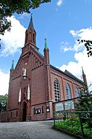
- The Church of the Holiest Heart of Jesus (Armii Krajowej Street 22)
- The Church of the Holy Cross (Słowacki Street 42)
- Monastery Church under the invocation of St. Otto (Henryk Pobożny Street 7)
- New Gate (Victory Square 12)
- The Mill Gate (Dominikańska Street 5–9)
- Richter's granary (Dominikańska Street 5–9)
- Former Jewish funeral home (dr Max Joseph Street)
- Old Brewery in Słupsk (Kiliński Street 26–28)
- Defensive walls
- 'Słowiniec' Department Store, with the oldest wooden lift in Europe (Victory Square 11)
- Witches' Tower (Nullo Street 13)
- Main Post Office (Łukasiewicz Street 3)
Culture
Słupsk hosts several festivals throughout the year:
- The "Solidarity" International Contract Bridge Festival
- The Komeda Jazz Festival
- The "Performance" International Art Festival
- An International Piano Festival
The museum in Słupsk has the world's largest collection of works by the artist Witkacy.
Theatres
Słupsk has three theaters:
- The Tęcza ("Rainbow") Theatre
- The Rondo ("Roundabout") Theatre
- The New Theatre, which reopened after 13 years.
Cinemas
Słupsk once had five cinemas. Today, only one major cinema, part of the Multikino chain, is open. It is located in the Jantar Shopping Centre. There is also a smaller, special cinema called "Rejs".
Economy
Słupsk has a growing economy with several large factories. The footwear industry is very successful here. It exports shoes to many countries.
The Scania factory, which makes commercial vehicles like buses, is also very important to Słupsk's economy. It brings in the most money of all companies in the city. Most of the buses made there are sent to Western Europe.
Demographics
Before World War II, most people in Słupsk were Protestants.
- Number of people living in Słupsk over the years

Sports Clubs
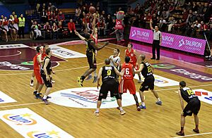
Słupsk has several sports clubs. The most famous is the basketball team Czarni Słupsk. They play in Poland's top league and have finished 3rd four times.
Other sports clubs in Słupsk include:
- Akademia Tenisa Oxford: tennis
- Gryf Słupsk: football
- Słupia Słupsk: handball
- Słupski Klub Sportowy Piast-B: badminton
- SKB Czarni Słupsk: boxing
- TPS Czarni Słupsk: women's volleyball
- Towarzystwo Pływackie Skalar Słupsk: swimming
- AML Słupsk: athletics
- LKS Fenix: athletics
- STS Gryf 3 Słupsk : judo
US Missile Defense Complex
A US missile defense system was planned for Redzikowo, a place near Słupsk. This system was meant to help protect NATO countries from missile threats. It was supposed to have up to 10 interceptor missiles.
Many local people protested against the missile base. In March 2008, about 300 protesters marched to the planned site. The plan for the missile base was later changed in 2009. However, in 2016, a contract was given to build part of the Aegis Ashore missile defense system in Redzikowo. This site became operational in December 2023.
Notable People

Many interesting people have come from or lived in Słupsk. Here are a few:
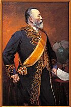
- Heinrich von Stephan (1831–1897), a German official who helped create the Universal Postal Union.
- George Grosz (1893–1959), a German artist known for his satirical drawings.
- Mieczysław Kościelniak (1912–1993), a Polish painter and graphic designer.
- Ulrich Beck (1944–2015), a German sociologist.
- Grażyna Auguścik (born 1955), a Polish jazz singer and composer.
- Tomasz Malinowski (born 1965), a Polish-American diplomat and politician.
- Sarsa Markiewicz (born 1989), a Polish singer and songwriter.
Sports Stars
- Heinz Radzikowski (1925–2017), a German field hockey player who competed in the 1956 Summer Olympics.
- Harry Klugmann (born 1940), a German equestrian who won an Olympic medal in 1972.
- Halina Aszkiełowicz-Wojno (1947–2018), a Polish volleyball player who won a bronze medal in the 1968 Summer Olympics.
- Tomasz Iwan (born 1971), a Polish football player.
- Milena Rosner (born 1980), a volleyball player who played in the 2008 Summer Olympics.
- Kamila Augustyn (born 1982), a Polish badminton player who competed in the Olympics.
- Miłosz Bernatajtys (born 1982), a Polish rower who won a silver medal in the 2008 Summer Olympics.
Twin Towns and Cities
Słupsk is twinned with several cities around the world. This means they have special friendly relationships.
 Bari, Italy
 Bukhara, Uzbekistan
 Carlisle, United Kingdom
 Cartaxo, Portugal
 Flensburg, Germany
 Ustka, Poland
 Vantaa, Finland
 Vordingborg, Denmark
Słupsk used to be twinned with:
 Arkhangelsk, Russia (ended in 2022)
 Grodno, Belarus (ended in 2022)
See also
 In Spanish: Słupsk para niños
 | Sharif Bey |
 | Hale Woodruff |
 | Richmond Barthé |
 | Purvis Young |


