
Saw Kill (Hudson River tributary) facts for kids
Quick facts for kids Saw Kill |
|
|---|---|

Saw Kill from U.S. Route 9 in Red Hook
|
|
| Native name | Metambesem |
| Other name(s) | Sawkill Creek |
| Country | United States |
| State | New York |
| Region | Hudson Valley |
| County | Dutchess |
| Towns | Milan, Red Hook |
| Physical characteristics | |
| Main source | W slope of unnamed hill near Broadview Lane Milan 690 ft (210 m) 41°59′10″N 73°46′33″W / 41.98622°N 73.77592°W |
| River mouth | Hudson River at South Tivoli Bay Red Hook 0 ft (0 m) 42°01′02″N 73°55′03″W / 42.017261°N 73.917367°W |
| Length | 14.3 mi (23.0 km), E-W |
| Basin features | |
| Basin size | 22 sq mi (57 km2) |
| Tributaries |
|
The Saw Kill is a 14.3-mile-long (23.0 km) tributary of the Hudson River. Local Algonquin people once called it the Metambesem. Today, some people also call it Sawkill Creek.
This river starts in the town of Milan. It flows through a 22-square-mile (57 km2) area in northwestern Dutchess County, New York. This area includes most of Red Hook and part of Rhinebeck.
The Saw Kill mostly flows through forests and farms. Near its end, it drops quickly over waterfalls into South Tivoli Bay. This bay is located between the Montgomery Place estate and Bard College. Bard College uses the stream for its water supply and for treated water disposal. In the 1840s, the owners of these lands agreed to protect the stream. This was one of the first conservation efforts in American history.
Contents
Journey of the Saw Kill River
The Saw Kill starts in the hills of Milan and eastern Red Hook. It flows downhill quickly at first. Then, as the land flattens, it winds slowly through more developed areas near the village of Red Hook. Finally, at Annandale-on-Hudson, it drops fast again to reach the Hudson River.
Where Does the Saw Kill Begin?
The Saw Kill begins on a hill near Broadview Lane in Milan. It starts about 690 feet (210 m) above sea level. For its first half-mile, it flows southwest through woods, dropping 140 feet (43 m). It then reaches a small farm pond and turns northwest.
Over the next mile, it crosses fields and slowly bends southwest. It flows under a farm road and into a larger farm pond. By this point, it has dropped another 50 feet (15 m).
How the Upper Stream Flows
From the pond, the Saw Kill flows west, then sharply south-southwest. It enters a wooded valley next to Milan Hill Road. By the time it flows under New York State Route 199 (NY 199), it is 400 feet (120 m) above sea level. After the highway, it turns west and flows roughly parallel to it.
For the next mile, the Saw Kill flows into another small farm pond. It passes an auto-body shop and a fire station. It crosses under two more farm roads. After one of these, a covered bridge, it flows into another farm pond. This pond is about 300 feet long.
The stream then turns north and flows under Old Mill Road and NY 199 again. This happens through a long tunnel at Rock City. North of Rock City, it flows into a small lake, 330 feet (100 m) above sea level. Here, it gets water from an unnamed smaller stream.
It leaves the lake flowing west-southwest. It crosses under Sawmill Road and then NY 199 again. At this point, it enters the town of Red Hook.
After this, the Saw Kill flows west through swampy areas near the Rhinebeck town line. This is a wooded area south of a golf course. It receives water from the Sepasco Lake outlet stream. Then it bends northwest into a small lake. At the end of this lake, it drops 90 feet (27 m) to 240 feet (73 m) in elevation. It does this through waterfalls next to Oriole Mills Road, near Camp Rising Sun.
The Lower Stream's Journey
The Saw Kill then flows generally north through flat land for about a mile. It starts to meander (curve) as it passes Sky Park Airport. Just before NY 199, it receives its only named tributary, the Lakes Kill, from the north. It then turns west, following the highway for 600 feet. It crosses under NY 199 for the last time. From there, it moves away from the road, heading northwest.
The land around it stays flat, but more fields appear along the stream. It turns more to the north and crosses under Echo Valley Road. It stays on a mostly northerly path for half a mile. It flows through a narrow wooded area between fields, to where U.S. Route 9 crosses. The Saw Kill bends northwest past this bridge. About 2,000 feet from US 9, it turns west and then southwest. It is still in a forested area through farmland.

As it reaches the Mill Road bridge, the Saw Kill widens into a lake. This lake is 200 feet (61 m) high and was made by a dam. The lake extends 1,500 feet to the northwest. Past the dam, the river is wider. It continues to flow southwest through a wooded area. It passes a Red Hook town park, just outside the Red Hook village line. Then it flows under Linden Avenue. West of Linden, it winds again as it flows west for a mile. It stays inside a large wooded area next to farms. Then it turns northwest to cross under Aspinwall Road.
Over the next thousand feet, the Saw Kill turns west. It gets another unnamed tributary from the north. Then it turns southwest to cross under Aspinwall Road again. The area stays flat and heavily wooded. Large homes are now on either side of the stream. The Saw Kill follows the back of these homes along West Bard Avenue. It flows west and then briefly north to Kelly Road. Here, it bends southeast again to cross under New York State Route 9G. It has dropped 50 feet (15 m) from the lake at Mill Road to 150 feet (46 m) above sea level.
The Saw Kill first flows next to Route 9G. Then it quickly bends northeast. Here, it is dammed again in the hamlet of Annandale-on-Hudson. This area is part of the Hudson River Historic District. It then flows under its last crossing at River Road. It flows north, parallel to the road, until turning northwest at Cedar Hill Road. This is part of the Bard College campus. At this point, it starts to drop rapidly over waterfalls. It reaches 100 feet (30 m) in elevation in just 150 feet.

In the woods, with the historic Montgomery Place estate on its south side, the stream turns north for 500 feet. Then it turns west-northwest where it drops over Zabriskie's Falls. This brings it down to 50 feet (15 m) in elevation. Walking trails are on both sides as it drops through more waterfalls. Finally, it empties into the Hudson River.
Saw Kill's Water Basin
The Saw Kill watershed covers 22 square miles (57 km2). The main stream and its smaller streams total 54.8 miles (88.2 km) in length. This area includes more of the town of Red Hook than any other river basin. It stretches from its mouth west to include almost all of the village and most of the town west of it.
In Milan, the watershed covers a half-circle shape in the eastern part of town. The Rhinebeck part is the smallest. It includes areas around Sepasco Lake and a swamp near the Old Rhinebeck Aerodrome. A small stream starts from this swamp.
The land in the watershed is hilly and wooded at its eastern end. The highest point is an unnamed 880-foot (270 m) hill in Milan. Just east of the Red Hook–Milan town line, the hills become gently rolling land. Much of this land is used for farming. As the stream gets closer to the Hudson River, the land becomes wooded and slightly hillier. This is because it reaches the sloping land next to the river.
What Kinds of Land Are in the Watershed?
A study from 1991 showed how the land in the watershed is used:
- 51.1% is forest. This includes 31% second-growth deciduous (trees that lose leaves), 14% coniferous (evergreen trees), and 4% mixed trees.
- 25.8% is farmland, mostly hayfields or row crops.
- 7.5% is low-density housing.
- 5.4% is medium- and high-density housing. Most of this is in the village of Red Hook or neighborhoods north of it.
- Farms make up 13.6% of all residential use.
- Businesses use only 2.8% of the land, mostly in Red Hook village.
- Lakes and wetlands cover 2% of the area.
Protecting the Saw Kill's Land
There are no large protected areas in the watershed. However, several groups have agreements to prevent building on big pieces of land. Scenic Hudson has the largest agreement. It covers much of the Lakes Kill area northeast of Red Hook village. It also protects a smaller area west of the village. Scenic Hudson also protects the Montgomery Place and Bard College properties. These are next to the lowest part of the stream.
The Dutchess Land Conservancy protects a large area next to the Scenic Hudson land. Some of this land also goes into the Stony Creek watershed to the north. A part of the stream from the Old Rhinebeck Aerodrome is protected by the Winakee Land Trust.
History of the Saw Kill
How the Saw Kill Was Formed
The Saw Kill formed from streams that fed Lake Albany. This was a huge lake that filled most of the Hudson Valley during the last Ice age, about 12,000 to 15,000 years ago. The lake covered the valley up to about 250-foot (76 m) above sea level. This is roughly where the Saw Kill now drops over waterfalls near Camp Rising Sun. When the lake melted and became the Hudson River, it left behind the flat land (called an outwash plain) that the Saw Kill flows through today.
Early Human Use of the River
As the glaciers melted, animals and plants returned to the region. They found streams like the Saw Kill good places to live. Native American tribes later settled here. They used the streams as paths between their villages. They also hunted and fished for food. Old studies at Montgomery Place show that people used the land for hunting 5,000 years ago.
Development and Mills (1620s–1803)

The Dutch began settling the area in the 1620s. They also used the streams for travel and food. But as more Dutch settlers arrived, they saw the Saw Kill as a good place to build mills. Especially sawmills, which gave the river its name. People bought the rights to use the river's water even before mills were built.
Colonel Pieter Schuyler bought the Saw Kill and most of the land north of it in 1688. His land rights for Rhinebeck lasted until 1840. The legal papers for the sale call the Saw Kill the Metambesem. This was its Algonquin name, which is not used much today.
Schuyler's land ownership slowed down farming growth along the Saw Kill. But sawmills and gristmills (for grinding grain) were still built. By 1777, mills were near the river's mouth. They were also upstream at Red Hook Mills and Rock City. Mills were common along the river by the late 1700s. But milling became less profitable and died down by the late 1800s.
More pressure for factories on the Saw Kill grew in the mid-1800s. Some people, like Louise Livingston of Montgomery Place, worried about this. Her estate was built in 1803 on a hill south of the river's mouth. She saw factories as a threat to the river's peace and natural beauty. Her sister-in-law, Janet Livingston Montgomery, had bought the land after her husband, General Richard Montgomery, died in the Battle of Quebec. Janet built the house and created a beautiful farm on the property.
Protecting the River in the 1800s

In the 1820s, the Saw Kill's lower gorge was painted by famous artists. Jacques-Gérard Milbert made a lithograph (a type of print). Alexander Jackson Davis painted Janet Livingston enjoying the view. The Marquis de Lafayette visited it when he came back to America in 1825.
Louise Livingston and Robert Donaldson bought land on the Saw Kill in 1841. They wanted to stop factories from being built there. An old mill at the river's mouth was torn down.
They were afraid of losing the river's natural beauty. They worried about noise, losing the landscape, and factory workers coming onto their land. Hunting was also seen as a problem for wealthy landowners. But hunting continued into the 1900s.
Livingston and Donaldson built trails and footbridges over the stream. They also built small wooden shelters. Visitors could use these to enjoy the river's beauty. Their legal agreement is one of the earliest land-protection agreements in American history.

In the 1860s, Theodore Roosevelt's family rented an estate near Montgomery Place. They spent summers there. He often explored the lower Saw Kill. He canoed around its mouth and the nearby bay. He found it beautiful and interesting for science. His letters show this. Some people say this experience led to his lifelong interest in conservation.
The Saw Kill in the 1900s
In 1921, the Delafield family, who were descendants of Livingston, moved into Montgomery Place. They used the Saw Kill for industry again. They built a power station on one of the lakes made by earlier mills. It was finished two years later. It provided electricity for the estate and all of Annandale.
The Delafields often hiked in the woods. They also boated and swam in the lakes. Violetta Delafield, a botanist, continued the conservation efforts. She wrote notes and painted watercolors of the mushroom species she found.
In 1951, the Blithewood estate, north of the Saw Kill, was given to Bard College. The college kept it mostly natural. Annandale and Montgomery Place got local electricity in 1965. But the Delafields' power station stayed on as a backup until 1983. In 1985, the Delafields sold the estate to Historic Hudson Valley. This group opened it to the public for tours. They also kept up the trails along the Saw Kill.
Between 1975 and 1982, two local conservation groups and Bard College tested the river's water quality. They checked 14 spots from the mouth to Rock City. They also tested water from treatment plants at Bard and Camp Rising Sun. A local newspaper said in 1977 that the Saw Kill was in good shape. "There is little in the way of man-made pollution," a member said.
The Saw Kill in the 2000s
Bard uses the Saw Kill for drinking water. Further downstream, it releases its treated wastewater into the river. Bard started checking the river's health in the early 2000s. In 2006, it built an eel ladder below one of the dams. This helps American eels reach their breeding areas upstream. Later, the college looked into making power at the dams. This would help reduce greenhouse gases.

In 2009, Historic Hudson Valley thought about selling Montgomery Place. They said it cost too much to keep. After some criticism, they decided not to sell. In 2016, they sold the property to Bard for $17 million. This meant Bard College owned both sides of the lower Saw Kill for the first time.
Geology of the Saw Kill Area
The Saw Kill and its watershed have two different types of geology. This shows how they were formed. In the west, below 250 feet (76 m) in elevation, the stream flows over silt, sand, and gravel. These are left over from the old lake bed and glacial plains. In the east, where the land rises above the old Lake Albany, glacial till covers shale bedrock. The soil is mostly silt loams over bedrock, 2.6–7.5 feet (0.8–2.3 m) deep. This covers 45% of the watershed.

A 1998 study compared soil erosion in the Saw Kill watershed with Stony Creek. Both streams flow into similar bays. The North Bay, where Stony Creek flows, has become a marsh with cattails. But the South Bay, fed by the Saw Kill, has stayed open water. Researchers wanted to know why.
They looked at how people settled and developed the land over time. They focused on farming, which clears land and can cause erosion. They found that the Saw Kill had twice as much soil erosion each year, even with more development and farming. They thought that where the clearing happened might affect erosion more. More research was needed.
Water Quality of the Saw Kill
The Saw Kill's water flow is not measured regularly. But data from 1968 shows its flow ranges from 4.6–68 cubic feet (0.13–1.93 m3) per second. The average flow is 32.9 cubic feet (0.93 m3) per second. The area gets 35 to 43 inches (900 to 1,100 mm) of rain each year. This rain is spread evenly throughout the year. The average temperature in January is 25 °F (−4 °C) and in July is 73 °F (23 °C).
The 1975–82 water testing project found the Saw Kill to be generally healthy. Sometimes there were increases of coliform bacteria near the Bard water treatment plant. But this was not a regular problem. Dissolved oxygen levels, important for water life, stayed normal.
In 2004, Dutchess County tested water resources. The Saw Kill had the second highest nitrate and highest phosphate levels in the county. The report suggested this might be because testing sites were below water treatment plants.
Three years later, New York's Department of Environmental Conservation (DEC) called the Saw Kill a Class B stream. This means it is safe for swimming, boating, and fishing. It can also be used for drinking water with proper treatment. A 1998 study found the Saw Kill to be "slightly impacted." This might be from insecticides and fertilizers used on farms. But it was still healthy and could support aquatic life.
Bard started a new water testing project in 2016. Volunteers test the stream at 13 different places. They test for Enterococcus bacteria. The results are posted online for everyone to see.
Animals and Plants in the Saw Kill
In 1998, a Bard student studied how land use affected insects in the Saw Kill. She compared insects that cannot handle pollution, like mayflies and caddisflies. She also looked at insects that can handle pollution, like some flies, leeches, and snails. Her results showed that homes had a greater negative effect on the water than farming.
The DEC adds brown trout and some brook trout to the Saw Kill every year. This is for people who like to fish. Fishing is allowed near bridges along the stream. The trout fishing season in the Saw Kill ends in mid-October. This is earlier than in most other state waterways.
Protecting the Saw Kill River
In 2015, Bard College and other groups formed the Saw Kill Watershed Community (SKWC). Their goal is to protect the river's quality. One of their first projects was to restart the water testing program. So far, the river is as clean as it was in the 1970s and 1980s. The SKWC also cleans up the riverbanks. They talk to residents and local government. They also create educational programs.
The SKWC's work goes beyond the local area. In early 2017, a group traveled to Astrakhan State University in Russia. They worked with student groups there. They created a guide to help young people protect rivers. The SKWC made this guide available in English and Russian on its website.
Images for kids
-
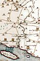
A 1798 map showing the lower Saw Kill and the estates around it
-
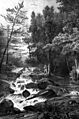
Lower Falls, Montgomery Place, by Milbert
-
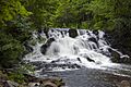
Donaldson and Livingston preserved the stream's picturesque lower portion between their estates
-
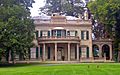
Bard bought Montgomery Place in 2016.
-
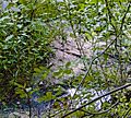
Shale bedrock in the Saw Kill at Rock City
