Sheffield, Massachusetts facts for kids
Quick facts for kids
Sheffield, Massachusetts
|
||
|---|---|---|
| Town of Sheffield | ||

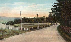
Dewey Memorial Hall
|
||
|
||
| Motto(s):
"He Who Plants a Tree Plants Hope"
|
||
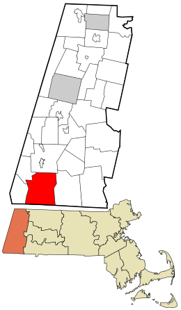
Location in Berkshire County and the state of Massachusetts.
|
||
| Country | United States | |
| State | Massachusetts | |
| County | Berkshire | |
| Settled | 1725 | |
| Incorporated | 1733 | |
| Government | ||
| • Type | Open town meeting | |
| Area | ||
| • Total | 48.6 sq mi (125.8 km2) | |
| • Land | 47.5 sq mi (122.9 km2) | |
| • Water | 1.1 sq mi (2.9 km2) | |
| Elevation | 675 ft (206 m) | |
| Population
(2020)
|
||
| • Total | 3,327 | |
| • Density | 68.50/sq mi (26.447/km2) | |
| Time zone | UTC-5 (Eastern) | |
| • Summer (DST) | UTC-4 (Eastern) | |
| ZIP code |
01257
|
|
| Area code(s) | 413 | |
| FIPS code | 25-61065 | |
| GNIS feature ID | 0619428 | |
Sheffield is a town located in Berkshire County, Massachusetts, United States. It is part of the larger Pittsfield area. In 2020, about 3,327 people lived here.
Sheffield is home to Berkshire School, which is a private school that prepares students for college. The town also includes the village of Ashley Falls. Sheffield shares borders with other towns like Egremont and Great Barrington. Its southern edge touches the state line of Connecticut.
Contents
History of Sheffield
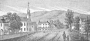
The land where Sheffield is now was bought on April 25, 1724. It was purchased from Chief Konkapot and 20 other Native American leaders from the Stockbridge Mahican tribe. The price was 460 pounds (an old form of money), 3 barrels of cider, and 30 quarts of rum. The first European settler, Matthew Noble from Westfield, arrived in 1725. He settled in the area known as Housatonic.
At that time, New York claimed the land west of the Housatonic River. They said that Massachusetts was building on their land. One early settler was even arrested and held in Albany for trespassing. But Sheffield, Massachusetts, officially became a town on June 22, 1733. It was the first town to be incorporated in what is now Berkshire County. In 1761, the northern part of Sheffield became its own town, called Great Barrington. Because Sheffield is in the rich floodplain of the Housatonic River valley, farming was the main business.
Sheffield's Role in American Independence
The Sheffield Resolves, also known as the Sheffield Declaration, was an important document created in Sheffield. It was a petition against British rule and a statement about individual rights. The town approved these resolves on January 12, 1773. They were then printed in a newspaper called The Massachusetts Spy on February 18, 1773.
Sheffield was also the place of the last and most violent battle of Shays' Rebellion. This battle happened on February 27, 1787. Shays' Rebellion was an uprising by farmers in Massachusetts who were upset about high taxes and debt.
Geography and Nature
Sheffield covers a total area of about 48.6 square miles (125.8 km2). About 47.5 square miles (122.9 km2) of this is land, and 1.1 square miles (2.9 km2) (or 2.33%) is water. Sheffield is located along the southern border of Berkshire County and Massachusetts. It is north of Litchfield County, Connecticut.
Neighboring Towns and Location
Sheffield is bordered by:
- Great Barrington to the north
- New Marlborough to the east
- North Canaan and Salisbury, Connecticut to the south
- Mount Washington to the west
- Egremont to the northwest
Sheffield is about 27 miles (43 km) south of Pittsfield. It is also about 47 miles (76 km) west of Springfield and 134 miles (216 km) west of Boston. The very southern part of Sheffield, on Route 41, is less than 100 miles (160 km) from the northern edge of Central Park in New York City.
Rivers and Mountains
The town is in the valley of the Housatonic River. Several smaller streams and the Konkapot River flow into the Housatonic River within Sheffield. There are also several waterfalls along these rivers, including Ashley Falls near the state border.
To the northeast, East Mountain is just over the Great Barrington border. Part of its southern slope and a state forest are within Sheffield. Several hills are also found south of this, along the New Marlborough town line. To the west, Mount Everett, which is part of the Taconic Range, reaches its highest point in Mount Washington. Its eastern slopes extend into Sheffield. Parts of the Mount Everett State Reservation and Mount Washington State Forest are also in town. The famous Appalachian Trail crosses the northern part of Sheffield as it goes north from Mount Everett to East Mountain.
Transportation in Sheffield
U.S. Route 7 runs through Sheffield, dividing the town roughly in half. The southernmost part of Massachusetts Route 7A is also in town. It starts between the town center and Ashley Falls and continues into Connecticut as an unnumbered road before rejoining the main highway. Massachusetts Route 41 also ends at Sheffield's southern border. It comes from Egremont along the western part of town and becomes Connecticut Route 41 in Connecticut.
The closest major highway, Interstate 90 (the Massachusetts Turnpike), is to the north. The nearest entrance to this highway is in Lee, about 18 miles (29 km) north-northeast of Sheffield. The town is also on the Housatonic Railroad line. This line offers train service between New York and Great Barrington in the autumn. For other train travel, Amtrak service is available in Pittsfield. Bus service can be found in Great Barrington. The closest small airport is in Great Barrington. For national flights, the nearest major airport is Bradley International Airport in Windsor Locks, Connecticut.
Population and People
| Historical population | ||
|---|---|---|
| Year | Pop. | ±% |
| 1850 | 2,769 | — |
| 1860 | 2,621 | −5.3% |
| 1870 | 2,535 | −3.3% |
| 1880 | 2,204 | −13.1% |
| 1890 | 1,954 | −11.3% |
| 1900 | 1,804 | −7.7% |
| 1910 | 1,817 | +0.7% |
| 1920 | 1,435 | −21.0% |
| 1930 | 1,650 | +15.0% |
| 1940 | 1,709 | +3.6% |
| 1950 | 2,150 | +25.8% |
| 1960 | 2,138 | −0.6% |
| 1970 | 2,374 | +11.0% |
| 1980 | 2,743 | +15.5% |
| 1990 | 2,910 | +6.1% |
| 2000 | 3,335 | +14.6% |
| 2010 | 3,257 | −2.3% |
| 2020 | 3,327 | +2.1% |
| 2022* | 3,329 | +0.1% |
| * = population estimate. Source: United States Census records and Population Estimates Program data. |
||
In 2010, there were 3,257 people living in Sheffield. There were 1,424 households and 879 families. Sheffield was the tenth most populated town out of 32 in Berkshire County. It was also the 269th most populated out of 351 cities and towns in Massachusetts.
The population density was about 67.2 inhabitants per square mile (25.9/km2). This means there were about 67 people per square mile. There were 1,751 housing units, with an average of about 36.1 per square mile (13.9/km2) per square mile.
Diversity in Sheffield
Most of the people in Sheffield are White (95.8%). Other groups include:
- African American: 1.1%
- Native American: 0.2%
- Asian: 0.3%
- People from other races: 1.3%
- People from two or more races: 1.3%
About 3.2% of the population identified as Hispanic or Latino.
Age and Households
In 2010, about 24.8% of households had children under 18 living with them. About 49.8% were married couples living together. About 7.7% had a female head of household with no husband present. And 38.3% were not families.
About 31.1% of all households were made up of single individuals. About 13.3% had someone living alone who was 65 years old or older. The average household had 2.28 people, and the average family had 2.87 people.
The population was spread out by age:
- Under 18: 18.9%
- 18 to 24: 6.1%
- 25 to 44: 19.7%
- 45 to 64: 35.9%
- 65 or older: 19.4%
The average age was 48 years. For every 100 females, there were about 94.8 males. For every 100 females aged 18 and over, there were about 96.2 males.
Education in Sheffield
Sheffield is part of the Mount Everett Regional School District. This district also includes students from Alford, Egremont, Monterey, Mount Washington, and New Marlborough.
Local Schools
- South Egremont School: For Pre-K students.
- New Marlborough Central School: For Pre-K through grade 3.
- Undermountain Elementary School: Located in Sheffield, for Pre-K through grade 5.
- Mount Everett Regional High School: Also in Sheffield, this school serves grades 7–12. Its sports teams are called the Eagles, and the school colors are blue and gold.
Sheffield is also home to the Berkshire School. This is a private, co-educational boarding school for students in grades nine through twelve. There are other private schools in nearby Great Barrington.
Higher Education Options
- The closest community college is the South County Center of Berkshire Community College in Great Barrington.
- The nearest state college is Westfield State University.
- The closest private college is Bard College at Simon's Rock in Great Barrington.
Places to Visit in Sheffield
Sheffield has several interesting places to see:
- Bartholomew's Cobble
- Berkshire School
- Colonel John Ashley House
- Dewey Memorial Hall
- Old Covered Bridge
- Sheffield Historical Society & Museum
- Shays Rebellion Memorial Monument
- Our Lady of the Valley Church
Notable People from Sheffield
Many interesting people have connections to Sheffield:
- Ethan Allen: A famous leader during the American Revolution.
- Andy Bachetti: A racing driver.
- Daniel D. Barnard: A US congressman.
- Frederick Augustus Porter Barnard: A scientist and educator.
- John G. Barnard: An army engineering officer.
- Emma Curtiss Bascom: An educator, a supporter of women's right to vote, and a reformer.
- John C. Crosby: A politician.
- Sidney Curtiss: A politician.
- Charles Dewey: A Justice of the Indiana Supreme Court.
- Orville Dewey: A minister.
- Grandison Fairchild: A college founder.
- Elizabeth Freeman: An enslaved woman, also known as "Mum Bett," who successfully sued for her freedom in 1781.
- John Z. Goodrich: A politician.
- Sophia Curtiss Hoffman: A person known for her charitable giving.
- Wanda Toscanini Horowitz: Daughter of famous conductor Arturo Toscanini and wife of pianist Vladimir Horowitz.
- Stephen Jacob: A Justice of the Vermont Supreme Court.
- Ahmad Jamal: A jazz pianist.
- Nadia Milleron: An advocate for aviation safety and consumers.
- George Frederick Root: A songwriter.
- Luella Dowd Smith: A writer (1847–1941).
See also
 In Spanish: Sheffield (Massachusetts) para niños
 | Calvin Brent |
 | Walter T. Bailey |
 | Martha Cassell Thompson |
 | Alberta Jeannette Cassell |


